

Wandelkaart 171 - Chiltern Hills West & Henley-on-Thames OSI
Omvat the Chilterns AONB & North Wessex Downs

Korte omschrijving
Wandelkaarten Oxfordshire west England, Buckinghamshire, England, Bedfordshire, England en Herefordshire, England van Ordnance Survey. Ideaal voor tochten in England.
Wandelkaart Chiltern Hills West - Henley-on-Thames - Oxfordshire Omvat ook: Henley-on-Thames & Wallingford. Productbeschrijving: Kaart nummer 171 in de OS Explorer reeks omvat Henley-on-...

Specificaties
- Uitgever: Ordnance Survey
- ISBN-13: 9780319470435
- HOOFDCATEGORIEËN: Wandelkaart
- Activiteiten: Wandelen, Hiking & Trekking
- Regio: Bedfordshire, England, Buckinghamshire, England, Herefordshire, England, Oxfordshire west England
- Land: England
- Waterafstotende kaart: Ordnance Survey ACTIVE Explorer Weatherproof Maps
- TOPO's & Stafkaarten: Topografisch wandelen
- AONB - Area of Outstanding Beauty/National Landscape: Chiltern Hills AONB
- Schaal: 1:25000
- Taal: Engels
- Reeks/Serie: Explorer ACTIVE Series OSI
Volledige omschrijving
Wandelkaart Chiltern Hills West - Henley-on-Thames - Oxfordshire
Omvat ook: Henley-on-Thames & Wallingford.
Productbeschrijving: Kaart nummer 171 in de OS Explorer reeks omvat Henley-on-Thames, Wallingford, Purley-on-Thames, Barrow-in-Furness, Caversham. Hoogtepunten van het gebied zijn the Chilterns AONB en North Wessex Downs AONB, de Chiltern Way, Thames path, rivier de Theems en een deel van de Ridgeway. De OS Explorer kaart voor Chiltern Hills AONB West is beschikbaar in zowel de standaard papieren versie als de weerbestendige 'Actief' versie.
Productdiscription: Map sheet number 171 in the OS Explorer series covers Henley-on-Thames, Wallingford, Purley-on-Thames, Watlington, Caversham. Highlights of the area include: the Chilterns and North Wessex Downs AONB, the Chiltern Way, Thames Path, River Thames and a section of the Ridgeway. The OS Explorer map for Chiltern Hills West is available in both the standard paper version and weatherproof 'Active' version.
Locatie op kaart
Gekoppelde artikelen

Wandelkaart 171 Chiltern Hills West AONB - Wycombe - OSI • 9780319243640
standaard versieWandelkaart Chiltern Hills West AONB - Wycombe England Productbeschrijving: - Henley-on-Thames & Wallingford. 171 / Chiltern Hills West, Wycombe, England - Kaart nummer 171 in de OS Explorer reeks omvat Henley-on-Thames, Wallingford, Purley-on-Thames, Barrow-in-Furness, Caversham. Hoogtepunten van het gebied: the Chilterns AONB en North Wessex Downs AONB, de Chiltern Way, Thames pad, r…

Wandelkaart 171 - Chiltern Hills West & Henley-on-Thames OSI • 9780319470435
weatherproof versieWandelkaart Chiltern Hills West - Henley-on-Thames - Oxfordshire Omvat ook: Henley-on-Thames & Wallingford. Productbeschrijving: Kaart nummer 171 in de OS Explorer reeks omvat Henley-on-Thames, Wallingford, Purley-on-Thames, Barrow-in-Furness, Caversham. Hoogtepunten van het gebied zijn the Chilterns AONB en North Wessex Downs AONB, de Chiltern Way, Thames path, rivier de Theems en een…
Overzichtskaarten

Area's of Outstanding Natural Beauty - AONB's UK
Area's of Outstanding Natural Beauty - AONB's UK

Producten op de overzichtskaart
Klik op een product om naar de detailpagina te gaan.
- Wandelgids - Guide to the Cotswolds AONB - AA
- Wandelkaart 24 - Chilterns AONB - AA
- Wandelgids - Cotswold classic walks guidebook - Goldeneye
- Wandelgids - Cotswold Classic Walks - Goldeneye
- Wandelgids - The Cotswold Way 30 classic routes - Cicerone
- Wandelgids - North Downs Way Nat. trail - Cicerone
- Wandelgids - Chilterns walking guide - Cicerone
- Wandelgids - Suffolk coast & Heaths walks - Cicerone
- Wandelgids - North Downs Way - Map Booklet - Cicerone
- Wandelgids - North Pennines AONB walking guide - Cicerone
- Wandelgids - Forest of Bowland & Pendle - Cicerone
- Wandelgids - Hampshire's Test Way walking guide - Cicerone
- Wandelgids & Fietsgids - The Cotswold AONB - Cicerone
- Wandelgids - North Wessex Downs - Cicerone Press
- Wandelgids - Walking on the North Wessex Downs - Cicerone
- Wandelgids - Silverdale & Arnside AONB - Cicerone
- Wandelkaart OL2 - Yorkshire Dales- Southern & Western Areas - OSI
- Wandelkaart OL19 - Howgill Fells and Upper Eden Valley - OSI
- Wandelkaart OL21 - South Pennines - Yorkshire - OSI
- Wandelkaart OL31 - North Pennines- Teesdale & Weardale - OSI
- Wandelkaart OL40 - The Broads - OSI
- Wandelkaart OL41 - Forest of Bowland & Ribblesdale - OSI
- Wandelkaart OL45 - The Cotswolds AONB- Gloucestershire - OSI
- Wandelkaart 108 - Lower Tamer Valley & Plymouth- Cornwall- OSI
- Wandelkaart 115 - Exmouth & Sidmouth- Devon - OSI
- Wandelkaart 137 - Ashford- Kent downs AONB- England - OSI
- Wandelkaart 140 - Quantock Hills AONB- Somerset - OSI
- Wandelkaart 140 - Quantock Hills AONB & Bridgwater- Devon - OSI
- Wandelkaart 147 - Sevenoaks & Tonbridge- Kent - OSI
- Wandelkaart 164 - Gower AONB & Gwyr- South Wales - OSI
- Wandelkaart 164 - Gower AONB & Gwyr- Wales - OSI
- Wandelkaart 171 - Chiltern Hills West & Henley-on-Thames OSI
- Wandelkaart 171 - Chiltern Hills West AONB- Wycombe - OSI
- Wandelkaart 172 - Chiltern Hills East AONB- Wycombe - OSI
- Wandelkaart 181 - Chiltern Hills AONB North- England - OSI
- Wandelkaart 181 - Chiltern Hills North AONB- Wycombe - OSI
- Wandelkaart 190 - Malvern Hills & Bredon Hill - OSI
- Wandelkaart 190 - Malvern Hills AONB & Bredon Hill - OSI
- Wandelkaart 203 - Ludlow- Shropshire Hills AONB - OSI
- Wandelkaart 217 - Long Mynd & Wenlock Edge- Schropshire- OSI
- Wandelkaart 254 - Lleyn Peninsular East- North Wales - OSI
- Wandelkaart 261 - Boston- Lincolnshire AONB - OSI
- Wandelkaart 262 - Anglesey West- Wales AONB - OSI
- Wandelkaart 263 - Anglesey East AONB- Wales - OSI
- Wandelkaart 273 - Lincolnshire Wolds South AONB - OSI
- Wandelkaart 282 - Lincolnshire Wolds North AONB - OSI
- Wandelkaart 298 - Nidderdale AONB- Yorkshire - OSI
- Wandelkaart 298 - Nidderdale AONB North Yorkshire - OSI
- Wandelkaart 300 - Howardian Hills AONB - OSI
- Wandelkaart 300 - Howardian Hills AONB & Malton - OSI
- Wandelkaart - Mourne Mountains N. Ireland - Harvey maps
- Wandelkaart - Fietskaart Forest of Bowland - Harvey maps
- Wandelkaart XT40 - Anglesey Coastal Path N. Wales - Harvey Maps
- Wandelkaart XT40 - Pennine Way Noord - Harvey Maps
- Wandelkaart XT40 - Pennine Way Zuid - Harvey Maps
- Wandelgids Cotswold - Way Two-way trekking guide - Knife Edge
- Reisgids Cotswolds England - Rough Guides
Artikelen uit dezelfde regio

Wandelgids 084 Pathfinder Berkshire- Buckinghamshire- Oxfordshire • 9780319092279
Wandelgids Berkshire- Buckinghamshire- Oxfordshire Productomschrijving: This all-new Pathfinder® Guide covering the ceremonial counties of Berkshire, Buckinghamshire and Oxfordshire features 28 outstanding circular walks across all three counties, offering more wonderful Pathfinder® routes in the south-central Midlands between the Cotswolds (PF 6 Cotswolds) and the Chilterns (PF 25 Thames…

Wandelgids Lea Valley walk - Cicerone Press • 9781786312877
Wandelgids Lea Valley walk - Cicerone Productomschrijving: Guidebook to the Lea Valley Walk, a 53 mile path from Luton to the Thames. The walk traces the River Lea from Leagrave, near Luton to East India Dock opposite Greenwich where it joins the Thames Path. Features an alternative finish at Limehouse and an optional tour of the Olympic Park. Split into 9 stages, the walk is suitable for …

Landkaart Wegenkaart Planning map Oxford & The Cotswolds • 9781788688499
Wegenkaart Planning map Oxford & The Cotswolds Productomschrijving: From Lonely Planet, the world's leading travel guide publisher Durable and waterproof, with a handy slipcase and an easy-fold format, Lonely Planet's Oxford & the Cotswolds Planning Map helps you get around with ease. Get more from your map and your trip with images and information about top attractions. - Durable and …

Wandelkaart 164 Oxford & Chipping Norton - OSI • 9780319474877
Wandelkaart Oxford- Chipping Norton & Bicester Productbeschrijving: Oxford is voorzien van een cultureel uitje als gevolg van het wereld beroemde hogescholen, rijke geschiedenis en familie dagjes uit. OS Landranger kaart 164 heeft betrekking op de 'stad van de droom torens' en het omliggende gebied. Neem een bootje langs de rivier Cherwell en de botanische tuinen of de Bodleian Library of …
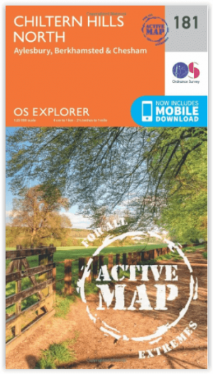
Wandelkaart 181 - Chiltern Hills AONB North- England - OSI • 9780319470534
Wandelkaart Chiltern Hills AONB North - Oxfordshire Omvat ook: Aylesbury, Berkhamsted & Chesham. Productbeschrijving: Kaart nummer 181 in de OS Explorer reeks omvat Aylesbury, Wendover, Berkhamstead, Chesham, Princes Risborough en Tring. Hoogtepunten van het gebied zijn The Chiltern Hills, rivier Thame, The Chilterns AONB, Aylesbury Ring, de Ridgeway en de Chiltern way. De OS Explorer …