

Wandelkaart OL31 - North Pennines- Teesdale & Weardale - OSI
Hamsterley Forest- Middleton- Milburn Forest & Cow green

Korte omschrijving
Wandelkaarten Yorkshire, England van Ordnance Survey. Ideaal voor tochten in England.
Wandelkaart North Pennines- Teesdale & Weardale - England Omvat ook: Teesdale & Weardale Productbeschrijving: Kaart nummer OL31 in de OS Explorer kaarten reeks, omvat de North Pennines A...

Specificaties
- Uitgever: Ordnance Survey
- ISBN-13: 9780319469491
- HOOFDCATEGORIEËN: Wandelkaart
- Activiteiten: Wandelen, Hiking & Trekking
- Regio: Yorkshire, England
- Land: England
- Waterafstotende kaart: Ordnance Survey ACTIVE Explorer Weatherproof Maps
- TOPO's & Stafkaarten: Topografisch wandelen
- AONB - Area of Outstanding Beauty/National Landscape: Western Pennines AONB
- Schaal: 1:25000
- Taal: Engels
- Reeks/Serie: Explorer ACTIVE Series OSI
Volledige omschrijving
Wandelkaart North Pennines- Teesdale & Weardale - England
Omvat ook: Teesdale & Weardale
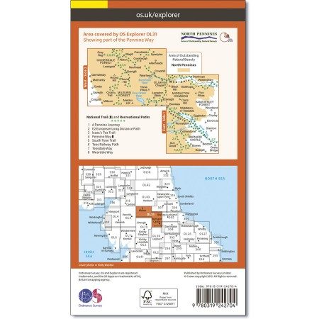
Productbeschrijving: Kaart nummer OL31 in de OS Explorer kaarten reeks, omvat de North Pennines AONB, Barnard Castle, Alton en Allenheads. Hoogtepunten van het gebied zijn onder andere: Hamsterley community Forest, Middleton, Milburn Forest, Cow green en Burnhope Reservoirs, Weardale en een deel van de Pennine Way. De OS Explorer kaart voor North Pennines is beschikbaar in zowel de standaard papieren versie en weerbestendige 'Actief' versie
Kaart nummer OL31 is een all purpose kaart vol gepakt met informatie om u het gebied te helpen leren kennen. De kaarten bestrijken het land. Elke kaart heeft een oppervlakte van 40 km door 40 km (25 mijl door 25 mijl) en zoals andere kaarten van Ordnance Survey, National Grid-vierkanten worden verstrekt zodat elke functie een unieke referentienummer kan worden gegeven.
Productdiscription: Map sheet number OL31 in the OS Explorer series covers an area of the North Pennines AONB, Barnard Castle, Alton, and Allenheads. Highlights of the area include: Hamsterley Forest, Middleton Common, Milburn Forest, Cow Green and Burnhope Reservoirs, River Tees, Teesdale, River Wear, Weardale and a section of the Pennine Way. The OS Explorer map for North Pennines is available in both the standard paper version and weatherproof 'Active' version
Locatie op kaart
Gekoppelde artikelen

Wandelkaart OL31 - North Pennines- Teesdale & Weardale - OSI • 9780319469491
weatherproof versieWandelkaart North Pennines- Teesdale & Weardale - England Omvat ook: Teesdale & Weardale Productbeschrijving: Kaart nummer OL31 in de OS Explorer kaarten reeks, omvat de North Pennines AONB, Barnard Castle, Alton en Allenheads. Hoogtepunten van het gebied zijn onder andere: Hamsterley community Forest, Middleton, Milburn Forest, Cow green en Burnhope Reservoirs, Weardale en een deel va…
Overzichtskaarten

Area's of Outstanding Natural Beauty - AONB's UK
Area's of Outstanding Natural Beauty - AONB's UK

Producten op de overzichtskaart
Klik op een product om naar de detailpagina te gaan.
- Wandelgids - Guide to the Cotswolds AONB - AA
- Wandelkaart 24 - Chilterns AONB - AA
- Wandelgids - Cotswold classic walks guidebook - Goldeneye
- Wandelgids - Cotswold Classic Walks - Goldeneye
- Wandelgids - The Cotswold Way 30 classic routes - Cicerone
- Wandelgids - North Downs Way Nat. trail - Cicerone
- Wandelgids - Chilterns walking guide - Cicerone
- Wandelgids - Suffolk coast & Heaths walks - Cicerone
- Wandelgids - North Downs Way - Map Booklet - Cicerone
- Wandelgids - North Pennines AONB walking guide - Cicerone
- Wandelgids - Forest of Bowland & Pendle - Cicerone
- Wandelgids - Hampshire's Test Way walking guide - Cicerone
- Wandelgids & Fietsgids - The Cotswold AONB - Cicerone
- Wandelgids - North Wessex Downs - Cicerone Press
- Wandelgids - Walking on the North Wessex Downs - Cicerone
- Wandelgids - Silverdale & Arnside AONB - Cicerone
- Wandelkaart OL2 - Yorkshire Dales- Southern & Western Areas - OSI
- Wandelkaart OL19 - Howgill Fells and Upper Eden Valley - OSI
- Wandelkaart OL21 - South Pennines - Yorkshire - OSI
- Wandelkaart OL31 - North Pennines- Teesdale & Weardale - OSI
- Wandelkaart OL40 - The Broads - OSI
- Wandelkaart OL41 - Forest of Bowland & Ribblesdale - OSI
- Wandelkaart OL45 - The Cotswolds AONB- Gloucestershire - OSI
- Wandelkaart 108 - Lower Tamer Valley & Plymouth- Cornwall- OSI
- Wandelkaart 115 - Exmouth & Sidmouth- Devon - OSI
- Wandelkaart 137 - Ashford- Kent downs AONB- England - OSI
- Wandelkaart 140 - Quantock Hills AONB- Somerset - OSI
- Wandelkaart 140 - Quantock Hills AONB & Bridgwater- Devon - OSI
- Wandelkaart 147 - Sevenoaks & Tonbridge- Kent - OSI
- Wandelkaart 164 - Gower AONB & Gwyr- South Wales - OSI
- Wandelkaart 164 - Gower AONB & Gwyr- Wales - OSI
- Wandelkaart 171 - Chiltern Hills West & Henley-on-Thames OSI
- Wandelkaart 171 - Chiltern Hills West AONB- Wycombe - OSI
- Wandelkaart 172 - Chiltern Hills East AONB- Wycombe - OSI
- Wandelkaart 181 - Chiltern Hills AONB North- England - OSI
- Wandelkaart 181 - Chiltern Hills North AONB- Wycombe - OSI
- Wandelkaart 190 - Malvern Hills & Bredon Hill - OSI
- Wandelkaart 190 - Malvern Hills AONB & Bredon Hill - OSI
- Wandelkaart 203 - Ludlow- Shropshire Hills AONB - OSI
- Wandelkaart 217 - Long Mynd & Wenlock Edge- Schropshire- OSI
- Wandelkaart 254 - Lleyn Peninsular East- North Wales - OSI
- Wandelkaart 261 - Boston- Lincolnshire AONB - OSI
- Wandelkaart 262 - Anglesey West- Wales AONB - OSI
- Wandelkaart 263 - Anglesey East AONB- Wales - OSI
- Wandelkaart 273 - Lincolnshire Wolds South AONB - OSI
- Wandelkaart 282 - Lincolnshire Wolds North AONB - OSI
- Wandelkaart 298 - Nidderdale AONB- Yorkshire - OSI
- Wandelkaart 298 - Nidderdale AONB North Yorkshire - OSI
- Wandelkaart 300 - Howardian Hills AONB - OSI
- Wandelkaart 300 - Howardian Hills AONB & Malton - OSI
- Wandelkaart - Mourne Mountains N. Ireland - Harvey maps
- Wandelkaart - Fietskaart Forest of Bowland - Harvey maps
- Wandelkaart XT40 - Anglesey Coastal Path N. Wales - Harvey Maps
- Wandelkaart XT40 - Pennine Way Noord - Harvey Maps
- Wandelkaart XT40 - Pennine Way Zuid - Harvey Maps
- Wandelgids Cotswold - Way Two-way trekking guide - Knife Edge
- Reisgids Cotswolds England - Rough Guides
Artikelen uit dezelfde regio

Wandelkaart OL30 Yorkshire Dales - Northern & Central areas - OS • 9780319263358
Wandelkaart Yorkshire Dales - Northern & Central areas - OS Productomschrijving: Een topografische wandelkaart van het Noordelijke & centrale gedeelte van het Yorkshire Dales Nationaal Park. Omvat: Wensleydale & Swaledale, northern & Central areas of Yorkshire Dales National Park, with The Nidderdale & Northern Pennines AONB area's, A Pennine Journey, the Dales Way, E2 European Long di…
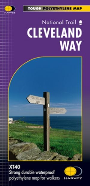
Wandelkaart Cleveland Way - Across North York NP - Harvey maps • 9781851374892
Wandelkaart Cleveland Way - Across North York NP - Harvey maps Productomschrijving: 174km (109 mijl) van Helmsley over het North York Moors National Park naar Saltburn en langs de kust via Scarborough eindigend met Filey. Informatie over het vinden van accommodatie, camping, voedsel. Routebeschrijving naar het begin. Ook Ranger Service contacten met nummers en uitbreidingen van steden/dorp…
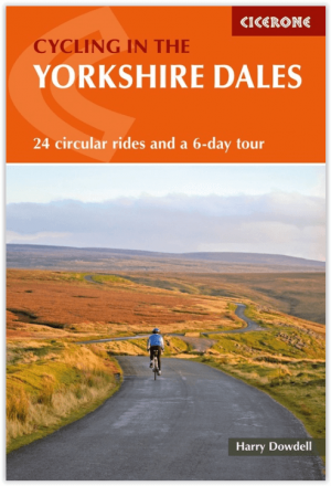
Fietsgids Cycling The Yorkshire Dales - Cicerone • 9781786310170
Fietsgids - Cycling The Yorkshire Dales - Cicerone Productomschrijving: Deze gids beschrijft 23-dagroutes, gesorteerd op afstand, klimgradatie en algehele helling, allemaal geschikt voor racefietsen en geïllustreerd met gedetailleerde kaarten en profielen. Bovendien neemt een route van zes etappes alle hoogtepunten in beslag, waaronder Grassington, Leyburn, Hawes, Kirkby Stephen, Ingleton …

Mountainbikegids North York Moors Mountain Biking - Vertebrate • 9781839811920
North York Moors Mountain Biking - Vertebrate Productomschrijving: North York Moors Mountain Biking – Moorland Trails is the fully updated second edition of the bestselling guide to some of the finest mountain biking in the North of England. Featured are over 20 of the best mountain bike rides in the North York Moors, between 10 and 76 Km in length, suitable for all levels of mountain bik…

Wandelgids Guide to Yorkshire - AA • 9780749579470
Wandelgids - Guide to Yorkshire - AA Productomschrijving: Yorkshire, een regio's waar prachtige heuvelachtige plaatsen van komen, en een plaats waar de rust zelf tot rust komt. Een locatie in bezit van ondermeer "The Yorkshire Dales" en locatie langs de kust die elke old timer de welverdiende rust geeft die hij zoekt. Een gids, die u de natuur toont, als ook de fauna, de Flora, de keuken v…