

Wandelgids - Guide to the Cotswolds AONB - AA
The Cotswolds zijn een regio van uitmuntend natuurlijk schoon

Korte omschrijving
Wandelgidsen Somerset South West England, Warwickshire, West Midlands, Wiltshire, West England, Oxfordshire West England en Worcestershire, West England van AA Publishing. Ideaal voor tochten in United Kingdom, Great Britain.
Wandelgids - Guide to the Cotswolds AONB - AA Productomschrijving: The Cotswolds zijn een regio van uitmuntend natuurlijk schoon, of in andere woorden, "Area of Outstanding Natural Beauty". ...

Specificaties
- Uitgever: AA Publishing
- ISBN-13: 9780749579418
- HOOFDCATEGORIEËN: Wandelgids
- Regio: Oxfordshire West England, Somerset South West England, Warwickshire, West Midlands, Wiltshire, West England, Worcestershire, West England
- Land: United Kingdom, Great Britain
- AONB - Area of Outstanding Beauty/National Landscape: Cotswolds AONB
- Taal: Engels
Volledige omschrijving
Wandelgids - Guide to the Cotswolds AONB - AA
Productomschrijving: The Cotswolds zijn een regio van uitmuntend natuurlijk schoon, of in andere woorden, "Area of Outstanding Natural Beauty". Zo noemen de britten hun meest geliefde regio's. WIj spreken oven nationale parken or regionale parken, terwijl de britten er eveneens over beschikken, maar de AONB's gaan voor op de rest. Talloze routes door deze plaatsen, laten u kennis maken met sommige van de prachtigste gebieden op het Engelse platte land, en dat van noord naar zuid, verldeeld over het ganse land.
Omschrijving van de uitgever zelf: The UK's second-largest protected landscape and the largest Area of Outstanding Natural Beauty in England and Wales, the Cotswolds is what novelist J B Priestley once described as 'the most English of all our countrysides'. The AA Guide to The Cotswolds gives you all you need to know to get the most out of your visit to this wonderful region. From the panoramic views at the top of Broadway Tower to the stunning autumn colours of Westonbirt Arboretum, each entry is packed with the very best sites to see, things to do, recommendations for eating and drinking, and places to explore nearby. With everything from local legends to must-see festivals and events, this authoritative and practical guide ensures you will never be lost for something to do.
Locatie op kaart
Overzichtskaarten

Area's of Outstanding Natural Beauty - AONB's UK
Area's of Outstanding Natural Beauty - AONB's UK

Producten op de overzichtskaart
Klik op een product om naar de detailpagina te gaan.
- Wandelgids - Guide to the Cotswolds AONB - AA
- Wandelkaart 24 - Chilterns AONB - AA
- Wandelgids - Cotswold classic walks guidebook - Goldeneye
- Wandelgids - Cotswold Classic Walks - Goldeneye
- Wandelgids - The Cotswold Way 30 classic routes - Cicerone
- Wandelgids - North Downs Way Nat. trail - Cicerone
- Wandelgids - Chilterns walking guide - Cicerone
- Wandelgids - Suffolk coast & Heaths walks - Cicerone
- Wandelgids - North Downs Way - Map Booklet - Cicerone
- Wandelgids - North Pennines AONB walking guide - Cicerone
- Wandelgids - Forest of Bowland & Pendle - Cicerone
- Wandelgids - Hampshire's Test Way walking guide - Cicerone
- Wandelgids & Fietsgids - The Cotswold AONB - Cicerone
- Wandelgids - North Wessex Downs - Cicerone Press
- Wandelgids - Walking on the North Wessex Downs - Cicerone
- Wandelgids - Silverdale & Arnside AONB - Cicerone
- Wandelkaart OL2 - Yorkshire Dales- Southern & Western Areas - OSI
- Wandelkaart OL19 - Howgill Fells and Upper Eden Valley - OSI
- Wandelkaart OL21 - South Pennines - Yorkshire - OSI
- Wandelkaart OL31 - North Pennines- Teesdale & Weardale - OSI
- Wandelkaart OL40 - The Broads - OSI
- Wandelkaart OL41 - Forest of Bowland & Ribblesdale - OSI
- Wandelkaart OL45 - The Cotswolds AONB- Gloucestershire - OSI
- Wandelkaart 108 - Lower Tamer Valley & Plymouth- Cornwall- OSI
- Wandelkaart 115 - Exmouth & Sidmouth- Devon - OSI
- Wandelkaart 137 - Ashford- Kent downs AONB- England - OSI
- Wandelkaart 140 - Quantock Hills AONB- Somerset - OSI
- Wandelkaart 140 - Quantock Hills AONB & Bridgwater- Devon - OSI
- Wandelkaart 147 - Sevenoaks & Tonbridge- Kent - OSI
- Wandelkaart 164 - Gower AONB & Gwyr- South Wales - OSI
- Wandelkaart 164 - Gower AONB & Gwyr- Wales - OSI
- Wandelkaart 171 - Chiltern Hills West & Henley-on-Thames OSI
- Wandelkaart 171 - Chiltern Hills West AONB- Wycombe - OSI
- Wandelkaart 172 - Chiltern Hills East AONB- Wycombe - OSI
- Wandelkaart 181 - Chiltern Hills AONB North- England - OSI
- Wandelkaart 181 - Chiltern Hills North AONB- Wycombe - OSI
- Wandelkaart 190 - Malvern Hills & Bredon Hill - OSI
- Wandelkaart 190 - Malvern Hills AONB & Bredon Hill - OSI
- Wandelkaart 203 - Ludlow- Shropshire Hills AONB - OSI
- Wandelkaart 217 - Long Mynd & Wenlock Edge- Schropshire- OSI
- Wandelkaart 254 - Lleyn Peninsular East- North Wales - OSI
- Wandelkaart 261 - Boston- Lincolnshire AONB - OSI
- Wandelkaart 262 - Anglesey West- Wales AONB - OSI
- Wandelkaart 263 - Anglesey East AONB- Wales - OSI
- Wandelkaart 273 - Lincolnshire Wolds South AONB - OSI
- Wandelkaart 282 - Lincolnshire Wolds North AONB - OSI
- Wandelkaart 298 - Nidderdale AONB- Yorkshire - OSI
- Wandelkaart 298 - Nidderdale AONB North Yorkshire - OSI
- Wandelkaart 300 - Howardian Hills AONB - OSI
- Wandelkaart 300 - Howardian Hills AONB & Malton - OSI
- Wandelkaart - Mourne Mountains N. Ireland - Harvey maps
- Wandelkaart - Fietskaart Forest of Bowland - Harvey maps
- Wandelkaart XT40 - Anglesey Coastal Path N. Wales - Harvey Maps
- Wandelkaart XT40 - Pennine Way Noord - Harvey Maps
- Wandelkaart XT40 - Pennine Way Zuid - Harvey Maps
- Wandelgids Cotswold - Way Two-way trekking guide - Knife Edge
- Reisgids Cotswolds England - Rough Guides
Artikelen uit dezelfde regio
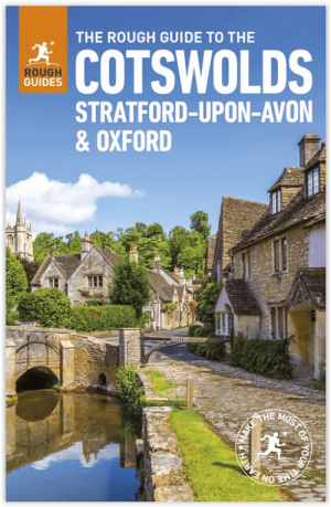
Reisgids Cotswolds England - Rough Guides • 9780241308752
Reisgids Cotswolds England - Rough Guides Productomschrijving: The Rough Guide to the Cotswolds AONB is your definitive handbook to one of the most beautiful and diverse holiday destinations in the UK. From stately homes and wildlife parks to modern art galleries, country walks and adventure sports, there is a section that introduces all of the regions’ highlights. For every town and v…

Wandelkaart 184 Salisbury & The Plain- Wiltshire England - OSI • 9780319262825
Wandelkaart Salisbury & The Plain - Wiltshire England Productbeschrijving: Kaart nummer 184 in de OS Landranger kaarten reeks, is ideaal voor het plannen van uitstapjes in- en rond het gebied van Salisbury. Grote open ruimten zijn in overvloed in dit gebied, zodat bezoekers van het gebied zullen genieten van spectaculaire uitzichten. Hoogtepunten van het gebied zijn onder andere: Stoneheng…
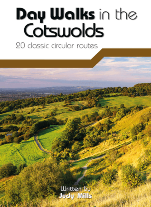
Wandelgids Day Walks in the Cotswolds AONB - Vertebrate Publ. • 9781910240991
Day Walks in the Cotswolds AONB - Vertebrate Productomschrijving: Day Walks in the Cotswolds by Judy Mills features 20 circular routes suitable for hillwalkers of all abilities. Together with stunning photography, each route features Ordnance Survey 1:25,000 maps, easy-to-follow directions, distance and navigation information, refreshment stops and local information. Split across thre…

Wandelgids The Kennet and Avon Canal walk - Cicerone • 9781786312303
The Kennet and Avon Canal walk - Cicerone Productomschrijving: Wandelgids langs het Kennet & Avon kanaal. De 151 Km lange route van Reading naar Bristol is verdeeld in 7 etappes van redelijk gemakkelijke wandelingen en omvat het UNESCO werelderfgoed Bath en de drijvende haven van Bristol. Er zijn ook 20 rondwandelingen opgenomen, variërend van 4¼ tot 9 mijl, waarbij de beste delen van het …
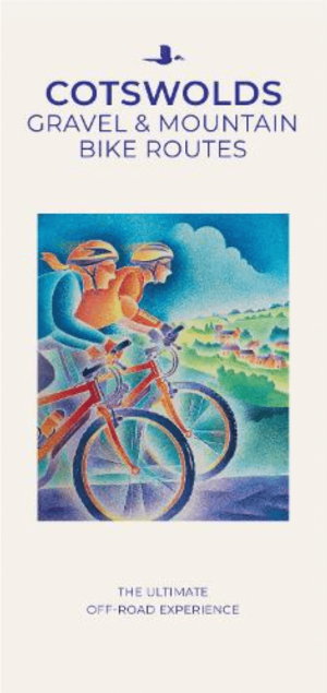
Moutainbike Cotswold Gravel & Mountain AONB - Goldeneye • 9781859653135
Moutainbike map Cotswold - Goldeneye Productomschrijving: Cotswold Gravel & Mountain Bike Routes: The Ultimate Off-Road Experience - Gravel & Mountain Bike Routes 18 (Paperback) When mountainbiking in the Cotswolds, in an Area of Outstanding Natural Beauty of AONB area, a lot of sportsfanatics & MTB fanatics are very interested, and cannot go wrong with this new Goldeneye mountainbiki…