

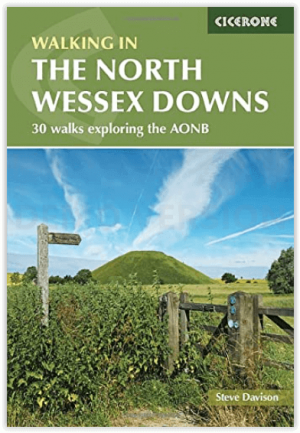
Wandelgids - Walking on the North Wessex Downs - Cicerone
De North Wessex Downs in Berkshire- Hampshire & Wiltshire


Korte omschrijving
Wandelgidsen Wiltshire, West England en Wessex, England van CICERONE Press. Ideaal voor tochten in England.
Wandelgids - Walking on the North Wessex Downs - Cicerone Productomschrijving: 30 wandelroutes verkennen de North Wessex Downs, Area of Outstanding Natural Beauty (AONB). De routes zijn tuss...

Specificaties
- Uitgever: CICERONE Press
- ISBN-13: 9781852847289
- HOOFDCATEGORIEËN: Wandelgids
- Activiteiten: Wandelen, Hiking & Trekking
- Auteur: Steve Davison
- Regio: Wessex, England, Wiltshire, West England
- Land: England
- AONB - Area of Outstanding Beauty/National Landscape: North Wessex Downs AONB
- Editie: 1
- Taal: Engels
- De Engelse Graafschappen: Essex
Volledige omschrijving
Wandelgids - Walking on the North Wessex Downs - Cicerone
Productomschrijving: 30 wandelroutes verkennen de North Wessex Downs, Area of Outstanding Natural Beauty (AONB). De routes zijn tussen de 7 tot 20 kilometer door dit rustige glooiende krijtlandschap die deel uitmaakt van vier provincies: Berkshire, Hampshire, Wiltshire en Oxfordshire, met beschrijving van de hoogste punten en hoe ze te bereiken.
Product description: 30 walking routes exploring the North Wessex Downs Area of Outstanding Natural Beauty (AONB). The routes are between 7 and 20km through this peaceful rolling chalk landscape covering parts of four counties: Berkshire, Hampshire, Wiltshire and Oxfordshire, with descriptions to reach the highest points in each one.
Seasons:
All year round. Spring and early summer are best for wild flowers, butterflies and birds; in autumn the trees are splashed in golden-brown autumnal colours, while a frosty winter's day can give impressive clear views
Centres:
Marlborough, Lambourn, Great Bedwyn, Dorchester on Thames, Hungerford, Pewsey, Kingsclere The walks are accessible from the following towns outside of the area: Didcot, Wantage, Swindon, Calne, Devizes, Andover, Basingstoke, Newbury and Reading.
Difficulty:
Walks to suit most ages and abilities; no difficulties apart from some short steep uphill and downhill sections; can be muddy in winter.
Must See:
Panoramic views, the highest points in Berkshire, Hampshire, Wiltshire and Oxfordshire; the rivers Thames, Kennet, Pang and Lambourn; picturesque villages with thatched cottages, historic churches and cosy pubs. Prehistoric sites; Avebury, the Uffington White Horse, Neolithic and Bronze Age long barrows and Iron Age hill forts.

Locatie op kaart
Overzichtskaarten

Area's of Outstanding Natural Beauty - AONB's UK
Area's of Outstanding Natural Beauty - AONB's UK

Producten op de overzichtskaart
Klik op een product om naar de detailpagina te gaan.
- Wandelgids - Guide to the Cotswolds AONB - AA
- Wandelkaart 24 - Chilterns AONB - AA
- Wandelgids - Cotswold classic walks guidebook - Goldeneye
- Wandelgids - Cotswold Classic Walks - Goldeneye
- Wandelgids - The Cotswold Way 30 classic routes - Cicerone
- Wandelgids - North Downs Way Nat. trail - Cicerone
- Wandelgids - Chilterns walking guide - Cicerone
- Wandelgids - Suffolk coast & Heaths walks - Cicerone
- Wandelgids - North Downs Way - Map Booklet - Cicerone
- Wandelgids - North Pennines AONB walking guide - Cicerone
- Wandelgids - Forest of Bowland & Pendle - Cicerone
- Wandelgids - Hampshire's Test Way walking guide - Cicerone
- Wandelgids & Fietsgids - The Cotswold AONB - Cicerone
- Wandelgids - North Wessex Downs - Cicerone Press
- Wandelgids - Walking on the North Wessex Downs - Cicerone
- Wandelgids - Silverdale & Arnside AONB - Cicerone
- Wandelkaart OL2 - Yorkshire Dales- Southern & Western Areas - OSI
- Wandelkaart OL19 - Howgill Fells and Upper Eden Valley - OSI
- Wandelkaart OL21 - South Pennines - Yorkshire - OSI
- Wandelkaart OL31 - North Pennines- Teesdale & Weardale - OSI
- Wandelkaart OL40 - The Broads - OSI
- Wandelkaart OL41 - Forest of Bowland & Ribblesdale - OSI
- Wandelkaart OL45 - The Cotswolds AONB- Gloucestershire - OSI
- Wandelkaart 108 - Lower Tamer Valley & Plymouth- Cornwall- OSI
- Wandelkaart 115 - Exmouth & Sidmouth- Devon - OSI
- Wandelkaart 137 - Ashford- Kent downs AONB- England - OSI
- Wandelkaart 140 - Quantock Hills AONB- Somerset - OSI
- Wandelkaart 140 - Quantock Hills AONB & Bridgwater- Devon - OSI
- Wandelkaart 147 - Sevenoaks & Tonbridge- Kent - OSI
- Wandelkaart 164 - Gower AONB & Gwyr- South Wales - OSI
- Wandelkaart 164 - Gower AONB & Gwyr- Wales - OSI
- Wandelkaart 171 - Chiltern Hills West & Henley-on-Thames OSI
- Wandelkaart 171 - Chiltern Hills West AONB- Wycombe - OSI
- Wandelkaart 172 - Chiltern Hills East AONB- Wycombe - OSI
- Wandelkaart 181 - Chiltern Hills AONB North- England - OSI
- Wandelkaart 181 - Chiltern Hills North AONB- Wycombe - OSI
- Wandelkaart 190 - Malvern Hills & Bredon Hill - OSI
- Wandelkaart 190 - Malvern Hills AONB & Bredon Hill - OSI
- Wandelkaart 203 - Ludlow- Shropshire Hills AONB - OSI
- Wandelkaart 217 - Long Mynd & Wenlock Edge- Schropshire- OSI
- Wandelkaart 254 - Lleyn Peninsular East- North Wales - OSI
- Wandelkaart 261 - Boston- Lincolnshire AONB - OSI
- Wandelkaart 262 - Anglesey West- Wales AONB - OSI
- Wandelkaart 263 - Anglesey East AONB- Wales - OSI
- Wandelkaart 273 - Lincolnshire Wolds South AONB - OSI
- Wandelkaart 282 - Lincolnshire Wolds North AONB - OSI
- Wandelkaart 298 - Nidderdale AONB- Yorkshire - OSI
- Wandelkaart 298 - Nidderdale AONB North Yorkshire - OSI
- Wandelkaart 300 - Howardian Hills AONB - OSI
- Wandelkaart 300 - Howardian Hills AONB & Malton - OSI
- Wandelkaart - Mourne Mountains N. Ireland - Harvey maps
- Wandelkaart - Fietskaart Forest of Bowland - Harvey maps
- Wandelkaart XT40 - Anglesey Coastal Path N. Wales - Harvey Maps
- Wandelkaart XT40 - Pennine Way Noord - Harvey Maps
- Wandelkaart XT40 - Pennine Way Zuid - Harvey Maps
- Wandelgids Cotswold - Way Two-way trekking guide - Knife Edge
- Reisgids Cotswolds England - Rough Guides
Artikelen uit dezelfde regio

Wandelkaart 143 Warminster & Trowbridge- Wiltshire - OSI • 9780319470152
Wandelkaart Warminster & Trowbridge - Wiltshire England Productbeschrijving: Kaart nummer 143 in de OS Explorer kaarten reeks heeft betrekking op het westen van Wiltshire, alsook Cranbone Chase & West Wiltshire Downs. Hoogtepunten van het gebied zijn onder andere: Mid Wilts Way, Wessex Ridgeway, Monarch Way en Imber Range Perimeter Path. De OS Explorer kaart voor Warminster & Trowbridge is…

Cotswolds Mountain Biking - Vertebrate Publ. • 9781906148140
Cotswolds AONB Mountain Biking - Vertebrate Productomschrijving: 20 Classic Rides - Cotwolds Mountain Biking by Tom Fenton features 20 classic MTB routes in the Cotswold Hills across the counties of Gloucestershire and Oxfordshire, and extending into parts of Wiltshire, Somerset, Worcestershire and Warwickshire. With Ordnance Survey mapping and easy-to-follow directions. The Cotswold H…
Wandelgids - North Wessex Downs - Cicerone Press • 9781786311108
Wandelgids North Wessex Downs - Cicerone Productomschrijving: 30 wandelroutes die het North Wessex Downs Area of Outstanding Natural Beauty (AONB) verkennen. De routes zijn tussen de 7 en 20 km lang door dit vredige glooiende krijtlandschap en bestrijken delen van vier graafschappen: Berkshire, Hampshire, Wiltshire en Oxfordshire, met beschrijvingen om de hoogste punten in elk van hen te b…
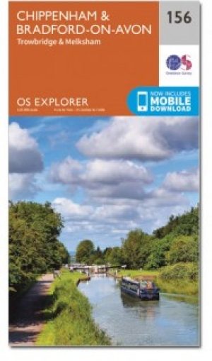
Wandelkaart 156 Chippenham & Bradford-on-Avon- Wiltshire - OSI • 9780319470282
Wandelkaart Chippenham & Bradford-on-Avon - Wiltshire Omvat ook: Trowbridge & Melksham. Productbeschrijving: Kaart nummer 156 in de OS Explorer reeks heeft betrekking op een gedeelte van de North Wessex Downs AONB en Cotswolds rond Melksham en Bradford-on-Avon. Hoogtepunten van het gebied zijn de steden Chippenham en Trowbridge samen met de Macmillan way en White Horse Trail. De OS Exp…

Wandelgids Sarsen Way Guidebook - Cicerone • 9781786311269
Wandelgids Sarsen Way Guidebook - Cicerone Productomschrijving: Gids over de Sarsen Way (79 km) van Coate Water Park naar Salisbury en de Cranborne Droves Way (28 km) die Salisbury verbindt met de Wessex Ridgeway bij Win Green. Deze langeafstandspaden maken deel uit van de Great Chalk Way. Beide kunnen in een week gelopen worden en zijn geschikt voor alle niveaus. De routes worden gep…