

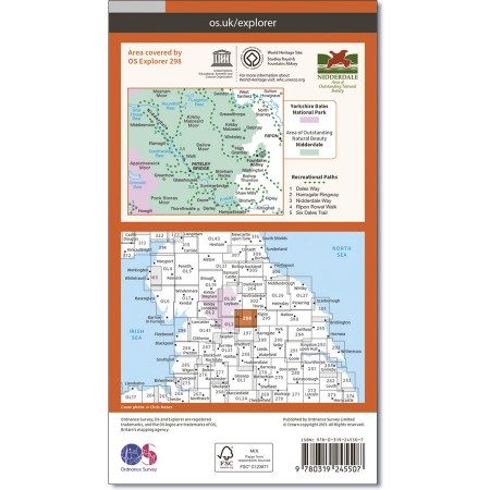
Wandelkaart 298 Nidderdale AONB- Yorkshire - OSI
North Yorkshire rond Nidderdale AONB

Korte omschrijving
Wandelkaarten Yorkshire, England van Ordnance Survey. Ideaal voor tochten in England.
Wandelkaart Nidderdale AONB - Yorkshire England Omvat ook: Fountains Abbey, Ripon & Pateley Bridge Productomschrijving: Kaart nummer 298 in de OS Explorer kaarten serie heeft een oppervl...

Specificaties
- Uitgever: Ordnance Survey
- ISBN-13: 9780319245507
- HOOFDCATEGORIEËN: Wandelkaart
- Activiteiten: Wandelen, Hiking & Trekking
- Regio: Yorkshire, England
- Land: England
- Nationale parken: Yorkshire Dales NP, England
- TOPO's & Stafkaarten: Topografisch wandelen
- AONB - Area of Outstanding Beauty/National Landscape: Nidderdale AONB
- Schaal: 1:25000
- Taal: Engels
- Reeks/Serie: Explorer Series OS
- De Engelse Graafschappen: Yorkshire
Volledige omschrijving
Wandelkaart Nidderdale AONB - Yorkshire England
Omvat ook: Fountains Abbey, Ripon & Pateley Bridge
Productomschrijving: Kaart nummer 298 in de OS Explorer kaarten serie heeft een oppervlakte van North Yorkshire rond Nidderdale. De Nidderdale way en Ripon Rowel lopen door dit pittoreske gebied, die ook een deel van het Yorkshire Dales National Park heeft. Hoogtepunten van het gebied zijn onder andere: Ripon, Pateley Bridge en Fountains Abbey. De OS Explorer kaart voor Nidderdale is beschikbaar in zowel de standaard papieren versie en weerbestendige 'Actief' versie
Kaart nummer 298 is een all purpose kaart vol gepakt met informatie om u het gebied te helpen leren kennen. De kaarten bestrijken het land. Elke kaart heeft een oppervlakte van 40 km door 40 km (25 mijl door 25 mijl) en zoals andere kaarten van Ordnance Survey, National Grid-vierkanten worden verstrekt zodat elke functie een unieke referentienummer kan worden gegeven.
Productdiscription: Map sheet number 298 in the OS Explorer series covers an area of North Yorkshire around Nidderdale. The Nidderdale Way and Ripon Rowel Walk run through this picturesque area, which also has a section of the Yorkshire Dales National Park. Highlights of the area include: Ripon, Pateley Bridge and Fountains Abbey. The OS Explorer map for Nidderdale is available in both the standard paper version and weatherproof 'Active' version
Locatie op kaart
Gekoppelde artikelen

Wandelkaart 298 Nidderdale AONB- Yorkshire - OSI • 9780319245507
standaard versieWandelkaart Nidderdale AONB - Yorkshire England Omvat ook: Fountains Abbey, Ripon & Pateley Bridge Productomschrijving: Kaart nummer 298 in de OS Explorer kaarten serie heeft een oppervlakte van North Yorkshire rond Nidderdale. De Nidderdale way en Ripon Rowel lopen door dit pittoreske gebied, die ook een deel van het Yorkshire Dales National Park heeft. Hoogtepunten van het gebied zij…

Wandelkaart 298 - Nidderdale AONB North Yorkshire - OSI • 9780319471708
weatherproof versieWandelkaart Nidderdale AONB - North Yorkshire England Omvat ook: Fountains Abbey, Ripon & Pateley Bridge. Productbeschrijving: Kaart nummer 298 in de OS Explorer kaarten reeks beslaat een gebied van Noord-Yorkshire rond Nidderdale. De Nidderdale Way en Ripon Rowel pad, voeren uit door dit schilderachtige gebied, die ook een deel van de Yorkshire Dales National Park heeft. Hoogtepunten …
Overzichtskaarten

Area's of Outstanding Natural Beauty - AONB's UK
Area's of Outstanding Natural Beauty - AONB's UK

Producten op de overzichtskaart
Klik op een product om naar de detailpagina te gaan.
- Wandelgids - Guide to the Cotswolds AONB - AA
- Wandelkaart 24 - Chilterns AONB - AA
- Wandelgids - Cotswold classic walks guidebook - Goldeneye
- Wandelgids - Cotswold Classic Walks - Goldeneye
- Wandelgids - The Cotswold Way 30 classic routes - Cicerone
- Wandelgids - North Downs Way Nat. trail - Cicerone
- Wandelgids - Chilterns walking guide - Cicerone
- Wandelgids - Suffolk coast & Heaths walks - Cicerone
- Wandelgids - North Downs Way - Map Booklet - Cicerone
- Wandelgids - North Pennines AONB walking guide - Cicerone
- Wandelgids - Forest of Bowland & Pendle - Cicerone
- Wandelgids - Hampshire's Test Way walking guide - Cicerone
- Wandelgids & Fietsgids - The Cotswold AONB - Cicerone
- Wandelgids - North Wessex Downs - Cicerone Press
- Wandelgids - Walking on the North Wessex Downs - Cicerone
- Wandelgids - Silverdale & Arnside AONB - Cicerone
- Wandelkaart OL2 - Yorkshire Dales- Southern & Western Areas - OSI
- Wandelkaart OL19 - Howgill Fells and Upper Eden Valley - OSI
- Wandelkaart OL21 - South Pennines - Yorkshire - OSI
- Wandelkaart OL31 - North Pennines- Teesdale & Weardale - OSI
- Wandelkaart OL40 - The Broads - OSI
- Wandelkaart OL41 - Forest of Bowland & Ribblesdale - OSI
- Wandelkaart OL45 - The Cotswolds AONB- Gloucestershire - OSI
- Wandelkaart 108 - Lower Tamer Valley & Plymouth- Cornwall- OSI
- Wandelkaart 115 - Exmouth & Sidmouth- Devon - OSI
- Wandelkaart 137 - Ashford- Kent downs AONB- England - OSI
- Wandelkaart 140 - Quantock Hills AONB- Somerset - OSI
- Wandelkaart 140 - Quantock Hills AONB & Bridgwater- Devon - OSI
- Wandelkaart 147 - Sevenoaks & Tonbridge- Kent - OSI
- Wandelkaart 164 - Gower AONB & Gwyr- South Wales - OSI
- Wandelkaart 164 - Gower AONB & Gwyr- Wales - OSI
- Wandelkaart 171 - Chiltern Hills West & Henley-on-Thames OSI
- Wandelkaart 171 - Chiltern Hills West AONB- Wycombe - OSI
- Wandelkaart 172 - Chiltern Hills East AONB- Wycombe - OSI
- Wandelkaart 181 - Chiltern Hills AONB North- England - OSI
- Wandelkaart 181 - Chiltern Hills North AONB- Wycombe - OSI
- Wandelkaart 190 - Malvern Hills & Bredon Hill - OSI
- Wandelkaart 190 - Malvern Hills AONB & Bredon Hill - OSI
- Wandelkaart 203 - Ludlow- Shropshire Hills AONB - OSI
- Wandelkaart 217 - Long Mynd & Wenlock Edge- Schropshire- OSI
- Wandelkaart 254 - Lleyn Peninsular East- North Wales - OSI
- Wandelkaart 261 - Boston- Lincolnshire AONB - OSI
- Wandelkaart 262 - Anglesey West- Wales AONB - OSI
- Wandelkaart 263 - Anglesey East AONB- Wales - OSI
- Wandelkaart 273 - Lincolnshire Wolds South AONB - OSI
- Wandelkaart 282 - Lincolnshire Wolds North AONB - OSI
- Wandelkaart 298 - Nidderdale AONB- Yorkshire - OSI
- Wandelkaart 298 - Nidderdale AONB North Yorkshire - OSI
- Wandelkaart 300 - Howardian Hills AONB - OSI
- Wandelkaart 300 - Howardian Hills AONB & Malton - OSI
- Wandelkaart - Mourne Mountains N. Ireland - Harvey maps
- Wandelkaart - Fietskaart Forest of Bowland - Harvey maps
- Wandelkaart XT40 - Anglesey Coastal Path N. Wales - Harvey Maps
- Wandelkaart XT40 - Pennine Way Noord - Harvey Maps
- Wandelkaart XT40 - Pennine Way Zuid - Harvey Maps
- Wandelgids Cotswold - Way Two-way trekking guide - Knife Edge
- Reisgids Cotswolds England - Rough Guides

OSI Explorer & Explorer Active - Noord Engeland - Lake District
OSI Explorer & Explorer Active - Noord Engeland - Lake District

Producten op de overzichtskaart
Klik op een product om naar de detailpagina te gaan.
- Wandelkaart 275 Liverpool- South West England - OSI
- Wandelkaart 276 Bolton- Wigan & Warrington- Machester - OSI
- Wandelkaart 277 Manchester & Salford - OSI
- Wandelkaart 278 Sheffield & Barnsley- South Yorkshire - OSI
- Wandelkaart 279 Doncaster- South Yorkshire - OSI
- Wandelkaart 280 Isle of Axholme- Lincolnshire - OSI
- Wandelkaart 281 Ancholme Valley- Lincolnshire - OSI
- Wandelkaart 283 Louth & Mablethorpe- Lincolnshire - OSI
- Wandelkaart 284 Grimsby- Cleethorpes & Immingham - OSI
- Wandelkaart 285 Southport & Chorley- Merseyside - OSI
- Wandelkaart 286 Blackpool & Preston- Lancashire - OSI
- Wandelkaart 287 West Pennine Moors- Lankashire - OSI
- Wandelkaart 288 Bradford & Huddersfield- West Yorkshire - OSI
- Wandelkaart 289 Leeds- Harrogate- Wetherby & Pontefract - OSI
- Wandelkaart 290 York- Selby & Tadcaster- North Yorkshire - OSI
- Wandelkaart 291 Goole & Gilberdyke- Yorkshire - OSI
- Wandelkaart 292 Withernsea & Spurn Head- East Riding - OSI
- Wandelkaart 293 Kingston upon Hull & Beverley - OSI
- Wandelkaart 294 Market Weighton & central Yorkshire Wolds - OSI
- Wandelkaart 295 Bridlington- Driffield & Hornsea - OSI
- Wandelkaart 296 Lancaster- Morecambe & Fleetwood - OSI
- Wandelkaart 297 Lower Wharfedale & Washburn Valley - OSI
- Wandelkaart 298 Nidderdale AONB- Yorkshire - OSI
- Wandelkaart 299 Ripon & Boroughbridge- North Yorkshire - OSI
- Wandelkaart 300 Howardian Hills AONB & Malton - OSI
- Wandelkaart 301 Scarborough- Bridlington & Flamborough
- Wandelkaart 302 Northallerton & Thirsk- North Yorkshire
- Wandelkaart 303 Whitehaven & Workington - OSI
- Wandelkaart 304 Darlington & Richmond- North Cleveland
- Wandelkaart 305 Bishop Auckland & Durham - OSI
- Wandelkaart 306 Middlesbrough & Hartlepool - OSI
- Wandelkaart 307 Consett & Derwent reservoir - OSI
- Wandelkaart 308 Durham & Sunderland- England - OSI
- Wandelkaart 314 Solway Firth- Wigton & Silloth - OSI
- Wandelkaart 315 Carlisle- Brampton- Longtown - OSI
- Wandelkaart OL01 Peak District NP & Dark Peak area - OS
- Wandelkaart OL02 Yorkshire Dales - South& Western areas - OS
- Wandelkaart OL04 English Lakes - North Western area - OS
- Wandelkaart OL05 English Lakes - North Eastern area - OS
- Wandelkaart OL06 English Lakes - South Western area - OS
- Wandelkaart OL07 English Lakes - South Eastern area - OS
- Wandelkaart OL19 Howgill Fells & Upper Eden Valley - OS
- Wandelkaart OL21 South Pennines - OS
- Wandelkaart OL26 North York Moors Western area - OS
- Wandelkaart OL27 North York Moors, Eastern area - OS
- Wandelkaart OL30 Yorkshire Dales - Northern & Central areas - OS
- Wandelkaart OL31 Northern Pennines AONB, Teesdale & Weardale - OS
- Wandelkaart OL41 Forest of Bowland & Ribblesdale - OS
- Wandelkaart OL43 Hadrian's Wall- Haltwhistle & Hexham - OS
Artikelen uit dezelfde regio
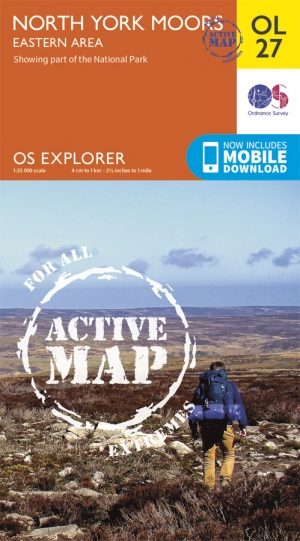
Wandelkaart OL27 North York Moors- Eastern area - OSI • 9780319469453
Wandelkaart North York Moors - Yorkshire England Omvat de: "Eastern area" Productbeschrijving: OS Explorer kaart OL27 omvat het North York Moors National Park, met inbegrip van de Cleveland Hills en The Hambleton Hills. Ook zijn op deze kaart de Celeveland way National Trail & de Tabular Hills way, Cleveland Street, Esk Valley Walk en het noordelijke uiteinde van Ebor way beschreven. D…

Wandelgids Day Walks in the North York Moors - Vertebrate Publ. • 9781906148324
Day Walks in the North York Moors - Vertebrate Productomschrijving: 20 circular routes in North Yorkshire Day Walks on the North York Moors showcases 20 circular walks, between 5 and 13.7 miles (8 and 22 kilometres) in length, suitable for hillwalkers of all abilities. The routes are split into three areas – The Cleveland Hills and Hambleton Hills, Central Moors and Coastal Walks – an…
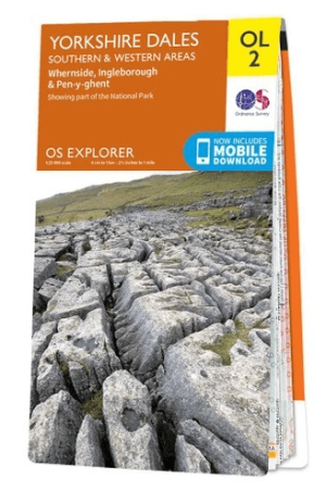
Wandelkaart OL02 Yorkshire Dales - South& Western areas - OS • 9780319263310
Wandelkaart OL2 Yorkshire Dales - South& Western areas - OS Productomschrijving: Yorkshire Dales Nationale Park - South& Western areas, Whernside, Ingleborough & Pen-y-ghent, The AONB Area's of Forest of Bowland & Nidderdale AONB. Yorkshire three peaks, The Devils Bridge at Kirkby Lonsdale, Leeds to Liverpool Canal at Skipton, The Pennine Way, Settle, and Old Town. Omvat: Whernside, I…
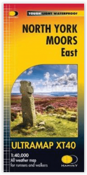
Wandelkaart North York Moors Oost XT40 - Harvey Maps • 9781851376230
Wandelkaart North York Moors Oost - Harvey Maps Productomschrijving: Omvat een groot gebied maar is praktisch en compact, zakformaat. Gedetailleerde kaart voor lopers en wandelaars van het oostelijk gedeelte van het Nationaal Park North York Moors. Omvat: Robin Hood's Bay, Flyingdales Moor en het populaire Rosedale Abbey. - De North Yorkshire Steam spoorweg en de Lyke Wake Walk zij…
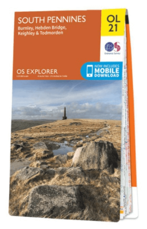
Wandelkaart OL21 South Pennines - OS • 9780319242605
Wandelkaart South Pennines - Ordnance Survey Productomschrijving: Parts of the Peak District National Park, South Pennines, Brontë Way, Burnley Way, Calder / Aire Link, Calderdale Way, Colne Valley Circular Walk, Dales High Way, E2 European long distance Path, Irwell Sculpture trail, Kirklees Way, Meltham Way, Millenium Way, Oldhan Way & Crompton Circuit, Pendle Way, Pennine Bridleway, Pen…