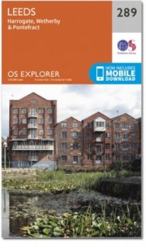
Wandelkaart 289 Leeds- Harrogate- Wetherby & Pontefract - OSI
Omvat Harrogate tot Pontefract met inbegrip van Leeds
Korte omschrijving
Wandelkaart Leeds- Harrogate- Wetherby & Pontefract England Productbeschrijving: OS Explorer kaart 289 dekt Harrogate tot Pontefract, met inbegrip van Leeds en de rivieren Nidd, rivier, Aire...

Specificaties
- Uitgever: Ordnance Survey
- ISBN-13: 9780319244869
- HOOFDCATEGORIEËN: Wandelkaart
- Activiteiten: Wandelen, Hiking & Trekking
- Regio: Yorkshire, England
- Land: England
- TOPO's & Stafkaarten: Topografisch wandelen
- Schaal: 1:25000
- Taal: Engels
- Reeks/Serie:: Explorer Series OS
Volledige omschrijving
Wandelkaart Leeds- Harrogate- Wetherby & Pontefract England
Productbeschrijving: OS Explorer kaart 289 dekt Harrogate tot Pontefract, met inbegrip van Leeds en de rivieren Nidd, rivier, Aire en Calder. Hoogtepunten omvatten de Dales Way en de Trans Pennine Trail. De OS Explorer kaart voor Leeds is beschikbaar in zowel de standaard papieren versie en weerbestendige 'Actief' versie.
Product description: OS Explorer Map sheet 289 covers Harrogate to Pontefract, including Leeds and the Rivers Nidd, Wharfe, Aire and Calder. Highlights includes the Dales Way and the Trans Pennine Trail. The OS Explorer map for Leeds is available in both the standard paper version and weatherproof 'Active' version.
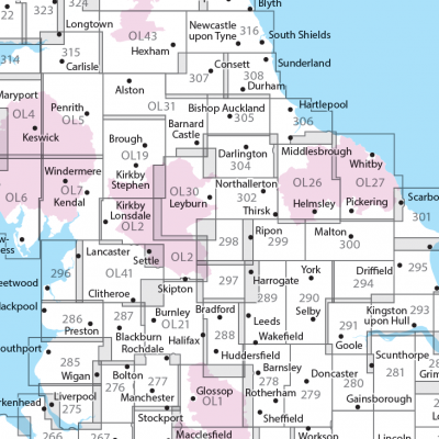
Locatie op kaart
Gekoppelde artikelen

Wandelkaart 289 Leeds- Harrogate- Wetherby & Pontefract - OSI • 9780319244869
standaard versieWandelkaart Leeds- Harrogate- Wetherby & Pontefract England Productbeschrijving: OS Explorer kaart 289 dekt Harrogate tot Pontefract, met inbegrip van Leeds en de rivieren Nidd, rivier, Aire en Calder. Hoogtepunten omvatten de Dales Way en de Trans Pennine Trail. De OS Explorer kaart voor Leeds is beschikbaar in zowel de standaard papieren versie en weerbestendige 'Actief' versie. Prod…

Wandelkaart 289 Leeds- Harrogate & Wetherby - OSI • 9780319471616
weatherproof versieWandelkaart Leeds- Harrogate- Wetherby & Pontefract - Yorkshire Productbeschrijving: OS Explorer kaart 289 dekt Harrogate aan Pontefract, met inbegrip van Leeds en de rivieren Nidd, rivier, Aire en Calder. Hoogtepunten omvat de Dales Way en de Trans Pennine Trail. De OS Explorer kaart voor Leeds is beschikbaar in zowel de standaard papieren versie als de weerbestendige 'Actief' versie. …
Overzichtskaarten

OSI Explorer & Explorer Active - Noord Engeland - Lake District
OSI Explorer & Explorer Active - Noord Engeland - Lake District

Producten op de overzichtskaart
Klik op een product om naar de detailpagina te gaan.
- Wandelkaart 275 Liverpool- South West England - OSI
- Wandelkaart 276 Bolton- Wigan & Warrington- Machester - OSI
- Wandelkaart 277 Manchester & Salford - OSI
- Wandelkaart 278 Sheffield & Barnsley- South Yorkshire - OSI
- Wandelkaart 279 Doncaster- South Yorkshire - OSI
- Wandelkaart 280 Isle of Axholme- Lincolnshire - OSI
- Wandelkaart 281 Ancholme Valley- Lincolnshire - OSI
- Wandelkaart 283 Louth & Mablethorpe- Lincolnshire - OSI
- Wandelkaart 284 Grimsby- Cleethorpes & Immingham - OSI
- Wandelkaart 285 Southport & Chorley- Merseyside - OSI
- Wandelkaart 286 Blackpool & Preston- Lancashire - OSI
- Wandelkaart 287 West Pennine Moors- Lankashire - OSI
- Wandelkaart 288 Bradford & Huddersfield- West Yorkshire - OSI
- Wandelkaart 289 Leeds- Harrogate- Wetherby & Pontefract - OSI
- Wandelkaart 290 York- Selby & Tadcaster- North Yorkshire - OSI
- Wandelkaart 291 Goole & Gilberdyke- Yorkshire - OSI
- Wandelkaart 292 Withernsea & Spurn Head- East Riding - OSI
- Wandelkaart 293 Kingston upon Hull & Beverley - OSI
- Wandelkaart 294 Market Weighton & central Yorkshire Wolds - OSI
- Wandelkaart 295 Bridlington- Driffield & Hornsea - OSI
- Wandelkaart 296 Lancaster- Morecambe & Fleetwood - OSI
- Wandelkaart 297 Lower Wharfedale & Washburn Valley - OSI
- Wandelkaart 298 Nidderdale AONB- Yorkshire - OSI
- Wandelkaart 299 Ripon & Boroughbridge- North Yorkshire - OSI
- Wandelkaart 300 Howardian Hills AONB & Malton - OSI
- Wandelkaart 301 Scarborough- Bridlington & Flamborough
- Wandelkaart 302 Northallerton & Thirsk- North Yorkshire
- Wandelkaart 303 Whitehaven & Workington - OSI
- Wandelkaart 304 Darlington & Richmond- North Cleveland
- Wandelkaart 305 Bishop Auckland & Durham - OSI
- Wandelkaart 306 Middlesbrough & Hartlepool - OSI
- Wandelkaart 307 Consett & Derwent reservoir - OSI
- Wandelkaart 308 Durham & Sunderland- England - OSI
- Wandelkaart 314 Solway Firth- Wigton & Silloth - OSI
- Wandelkaart 315 Carlisle- Brampton- Longtown - OSI
- Wandelkaart OL01 Peak District NP & Dark Peak area - OS
- Wandelkaart OL02 Yorkshire Dales - South& Western areas - OS
- Wandelkaart OL04 English Lakes - North Western area - OS
- Wandelkaart OL05 English Lakes - North Eastern area - OS
- Wandelkaart OL06 English Lakes - South Western area - OS
- Wandelkaart OL07 English Lakes - South Eastern area - OS
- Wandelkaart OL19 Howgill Fells & Upper Eden Valley - OS
- Wandelkaart OL21 South Pennines - OS
- Wandelkaart OL26 North York Moors Western area - OS
- Wandelkaart OL27 North York Moors, Eastern area - OS
- Wandelkaart OL30 Yorkshire Dales - Northern & Central areas - OS
- Wandelkaart OL31 Northern Pennines AONB, Teesdale & Weardale - OS
- Wandelkaart OL41 Forest of Bowland & Ribblesdale - OS
- Wandelkaart OL43 Hadrian's Wall- Haltwhistle & Hexham - OS
Artikelen uit dezelfde regio

Wandelkaart OL30 Yorkshire Dales - Northern & Central areas - OS • 9780319263358
Wandelkaart Yorkshire Dales - Northern & Central areas - OS Productomschrijving: Een topografische wandelkaart van het Noordelijke & centrale gedeelte van het Yorkshire Dales Nationaal Park. Omvat: Wensleydale & Swaledale, northern & Central areas of Yorkshire Dales National Park, with The Nidderdale & Northern Pennines AONB area's, A Pennine Journey, the Dales Way, E2 European Long di…

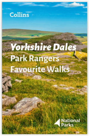
Wandelgids Park Rangers Favourite Walks Yorkshire Dales - Collins • 9780008462659
Park Rangers Favourite Walks Yorkshire Dales - Collins Productomschrijving: Wandelgids voor het Yorkshire Dales National Park, met 20 beste routes uitgekozen door de parkwachters. Elke wandeling varieert in lengte van 2 tot 10 km en kan in minder dan 4 uur worden afgelegd. Engelse omschrijving: Walking guide to the Yorkshire Dales National Park, with 20 best routes chosen by the park r…

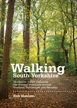
Wandelgids Walking South Yorkshire 30 circular walks - Vertebrate • 9781906148218
Walking South Yorkshire 30 circular walks - Vertebrate Productomschrijving: 30 circular walks exploring the ancient woodland around Sheffield, Rotherham and Barnsley. Walking South Yorkshire by Rob Haslam is a collection of 30 circular walks of South Yorkshire, between 2 and 8 miles (3 and 13 km) in length, that explore the ancient woodland and rural visitor attractions around Sheffiel…

Wandelkaart XT40 Yorkshire Wolds Way Yorkshire - Harvey Maps • 9781851375929
Wandelkaart XT40 - Yorkshire Wolds Way Yorkshire - Harvey Maps Productomschrijving: De Yorkshire Wolds Way, (127km) is een National Trail in Yorkshire, Engeland. De route loopt van Hessle naar Filey, rond de Yorkshire Wolds. Bij Filey Brigg verbindt hij met de Cleveland Way, een ander National Trail. In 2007 vierde de Yorkshire Wolds Way de 25ste verjaardag van de officiële opening die pla…

Wandelgids Atlas Yorkshire Dales NP - Harvey maps • 9781851374953
Wandelgids - Atlas Yorkshire Dales NP - Harvey maps Productomschrijving: Deze spiraal gebonden gids/Atlas combineert in één volume, de gedetailleerde kaarten van de Yorkshire Dales, die betrekking hebben op het geheel van het nationaal park en het gebied Midden Dale. De atlas is ontworpen voor gebruik buitenshuis en de pagina's, hoewel niet scheur-proof, worden afgedrukt op waterdichte pap…


