

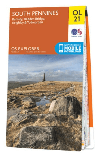
Wandelkaart OL21 South Pennines - OS
Burnley- Hebden Bridge- Keighley & Todmorden
Korte omschrijving
Wandelkaarten Yorkshire, England van Ordnance Survey. Ideaal voor tochten in England.
Wandelkaart South Pennines - Ordnance Survey Productomschrijving: Parts of the Peak District National Park, South Pennines, Brontë Way, Burnley Way, Calder / Aire Link, Calderdale Way, Colne...

Specificaties
- Uitgever: Ordnance Survey
- ISBN-13: 9780319242605
- HOOFDCATEGORIEËN: Wandelkaart
- Activiteiten: Wandelen, Hiking & Trekking
- Auteur: Ordnance Survey
- Regio: Yorkshire, England
- Land: England
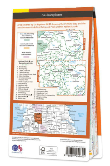
- Lange afstand wandelroutes: Pennine Bridleway, England (330 km), Pennine Way (420 km), Ribble way (113 km)
- Nationale parken: Peak District NP, Derbyshire UK
- TOPO's & Stafkaarten: Topografisch wandelen
- AONB - Area of Outstanding Beauty/National Landscape: Forest of Bowland AONB
- Schaal: 1:25000
- Taal: Engels
- Reeks/Serie: Explorer Series OS
Volledige omschrijving
Wandelkaart South Pennines - Ordnance Survey
Productomschrijving: Parts of the Peak District National Park, South Pennines, Brontë Way, Burnley Way, Calder / Aire Link, Calderdale Way, Colne Valley Circular Walk, Dales High Way, E2 European long distance Path, Irwell Sculpture trail, Kirklees Way, Meltham Way, Millenium Way, Oldhan Way & Crompton Circuit, Pendle Way, Pennine Bridleway, Pennine Way, Ribble Way, Rochdale Way, Rosse,dale Way, Standedge Trail, Todmorden Centenery Way, Weighver's Way & Worth Way.
Omvat: Burnley- Hebden Bridge- Keighley & Todmorden.
Ontdek de OL-serie van Ordnance Survey:
De OL-serie (Outdoor Leisure) van Ordnance Survey is dé referentie voor wie gaat wandelen op de Britse eilanden. Deze topografische kaarten maken deel uit van de Explorer-reeks en bieden ongeëvenaarde nauwkeurigheid en detail op een schaal van 1:25.000. Perfect voor wandelaars, hikers en outdoorliefhebbers.
Waarom kiezen voor de OL Explorer-kaarten?
Gedetailleerde topografie: Elk hekje, pad, beekje en hoogteverschil staat erop.
Ingetekende National Trails: Bekende wandelroutes zoals de South West Coast Path, Hadrian’s Wall Path en Pennine Way zijn duidelijk gemarkeerd.
Betrouwbaarheid: Ordnance Survey is al decennialang de standaard voor kaarten in het VK.
Weerbestendige versies beschikbaar – ideaal voor gebruik in weer en wind.
De beste keuze voor wandelaars
Vergeet generieke wandelkaarten. Met de OL-serie krijg je precieze, actuele informatie, zodat je zonder zorgen op pad kunt.
KOOP NU UW TOPOGRAFISCHE WANDELKAART
Bekijk ons aanbod en kies de OL-kaart die past bij jouw volgende wandelroute. Wandel slim, wandel met Ordnance Survey. wandelroute. Wandel slim, wandel met Ordnance Survey.

Overzichtskaarten

OSI Explorer & Explorer Active - Noord Engeland - Lake District
OSI Explorer & Explorer Active - Noord Engeland - Lake District

Producten op de overzichtskaart
Klik op een product om naar de detailpagina te gaan.
- Wandelkaart 275 Liverpool- South West England - OSI
- Wandelkaart 276 Bolton- Wigan & Warrington- Machester - OSI
- Wandelkaart 277 Manchester & Salford - OSI
- Wandelkaart 278 Sheffield & Barnsley- South Yorkshire - OSI
- Wandelkaart 279 Doncaster- South Yorkshire - OSI
- Wandelkaart 280 Isle of Axholme- Lincolnshire - OSI
- Wandelkaart 281 Ancholme Valley- Lincolnshire - OSI
- Wandelkaart 283 Louth & Mablethorpe- Lincolnshire - OSI
- Wandelkaart 284 Grimsby- Cleethorpes & Immingham - OSI
- Wandelkaart 285 Southport & Chorley- Merseyside - OSI
- Wandelkaart 286 Blackpool & Preston- Lancashire - OSI
- Wandelkaart 287 West Pennine Moors- Lankashire - OSI
- Wandelkaart 288 Bradford & Huddersfield- West Yorkshire - OSI
- Wandelkaart 289 Leeds- Harrogate- Wetherby & Pontefract - OSI
- Wandelkaart 290 York- Selby & Tadcaster- North Yorkshire - OSI
- Wandelkaart 291 Goole & Gilberdyke- Yorkshire - OSI
- Wandelkaart 292 Withernsea & Spurn Head- East Riding - OSI
- Wandelkaart 293 Kingston upon Hull & Beverley - OSI
- Wandelkaart 294 Market Weighton & central Yorkshire Wolds - OSI
- Wandelkaart 295 Bridlington- Driffield & Hornsea - OSI
- Wandelkaart 296 Lancaster- Morecambe & Fleetwood - OSI
- Wandelkaart 297 Lower Wharfedale & Washburn Valley - OSI
- Wandelkaart 298 Nidderdale AONB- Yorkshire - OSI
- Wandelkaart 299 Ripon & Boroughbridge- North Yorkshire - OSI
- Wandelkaart 300 Howardian Hills AONB & Malton - OSI
- Wandelkaart 301 Scarborough- Bridlington & Flamborough
- Wandelkaart 302 Northallerton & Thirsk- North Yorkshire
- Wandelkaart 303 Whitehaven & Workington - OSI
- Wandelkaart 304 Darlington & Richmond- North Cleveland
- Wandelkaart 305 Bishop Auckland & Durham - OSI
- Wandelkaart 306 Middlesbrough & Hartlepool - OSI
- Wandelkaart 307 Consett & Derwent reservoir - OSI
- Wandelkaart 308 Durham & Sunderland- England - OSI
- Wandelkaart 314 Solway Firth- Wigton & Silloth - OSI
- Wandelkaart 315 Carlisle- Brampton- Longtown - OSI
- Wandelkaart OL01 Peak District NP & Dark Peak area - OS
- Wandelkaart OL02 Yorkshire Dales - South& Western areas - OS
- Wandelkaart OL04 English Lakes - North Western area - OS
- Wandelkaart OL05 English Lakes - North Eastern area - OS
- Wandelkaart OL06 English Lakes - South Western area - OS
- Wandelkaart OL07 English Lakes - South Eastern area - OS
- Wandelkaart OL19 Howgill Fells & Upper Eden Valley - OS
- Wandelkaart OL21 South Pennines - OS
- Wandelkaart OL26 North York Moors Western area - OS
- Wandelkaart OL27 North York Moors, Eastern area - OS
- Wandelkaart OL30 Yorkshire Dales - Northern & Central areas - OS
- Wandelkaart OL31 Northern Pennines AONB, Teesdale & Weardale - OS
- Wandelkaart OL41 Forest of Bowland & Ribblesdale - OS
- Wandelkaart OL43 Hadrian's Wall- Haltwhistle & Hexham - OS
Artikelen uit dezelfde regio

Reisgids Yorkshire - Rough Guides • 9781835290583
Reisgids Yorkshire - Rough Guides Productomschrijving: The Rough Guide to Yorkshire was the first comprehensive guidebook to England’s largest county. Detailed coverage of the ruggedly beautiful Dales and Moors, the magnificent North Sea coast and historic York rubs shoulders with penetrating insights into the multi-cultural cities of Leeds and Sheffield, the resurgent port of Hull, and th…
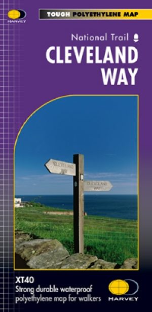
Wandelkaart Cleveland Way - Across North York NP - Harvey maps • 9781851374892
Wandelkaart Cleveland Way - Across North York NP - Harvey maps Productomschrijving: 174km (109 mijl) van Helmsley over het North York Moors National Park naar Saltburn en langs de kust via Scarborough eindigend met Filey. Informatie over het vinden van accommodatie, camping, voedsel. Routebeschrijving naar het begin. Ook Ranger Service contacten met nummers en uitbreidingen van steden/dorp…

Fietsgids Yorkshire Dales Mountain Biking - Vertebrate Publ. • 9781912560066
Yorkshire Dales Mountain Biking - Vertebrate Productomschrijving: Classic Pennine Trails Yorkshire Dales Mountain Biking by Nick Cotton features 26 rides in one of the UK’s most MTB-friendly national parks. Includes rides around Swaledale, Ingleborough, Whernside and Pen-y-ghent. Each ride is described with easy-to-follow directions and is plotted on clear and easy to use Ordnance Sur…

Wandelgids North Yorkshire historic walks - Cicerone • 9781852843892
Wandelgids - North Yorkshire historic walks - Cicerone Productomschrijving: Een gids over historische wandelingen in North Yorkshire, in 20 meestal circulaire routes. Zij brengen u van open heidegebied en blootgestelde delen van heuvel en kliffen naar de meer beschutte dales en de straten van York. Wandelingen bevatten Skipton Castle, Ripon en Fountains Abbey, Ripley Castle, Castle Howard,…

Reisgids Noord-Engeland - Lannoo • 9789020955644
Reisgids Noord-Engeland - Lannoo Productomschrijving: Maak kennis met Yorkshire, het grootste graafschap van Groot-Brittannië, niet voor niets God's own Country genoemd. En met het Lake District, het spectaculaire land van meren (de diepste van Engeland) en bergen (de hoogste van Engeland). Reis naar het land van veearts James Herriot, naar de decors die je kent van tv-series en fi…