

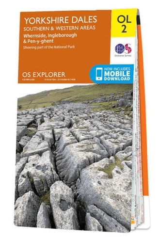
Wandelkaart OL02 Yorkshire Dales - South& Western areas - OS
Whernside, Ingleborough & Pen-y-ghent
Korte omschrijving
Wandelkaarten Yorkshire Dales, Yorkshire, England, Cumbria, England en Lanacshire, England van Ordnance Survey. Ideaal voor tochten in England.
Wandelkaart OL2 Yorkshire Dales - South& Western areas - OS Productomschrijving: Yorkshire Dales Nationale Park - South& Western areas, Whernside, Ingleborough & Pen-y-ghent, The AONB Area's...

Specificaties
- Uitgever: Ordnance Survey
- ISBN-13: 9780319263310
- HOOFDCATEGORIEËN: Wandelkaart
- Activiteiten: Wandelen, Hiking & Trekking
- Auteur: Ordnance Survey
- Regio: Cumbria, England, Lanacshire, England, Yorkshire Dales, Yorkshire, England
- Land: England
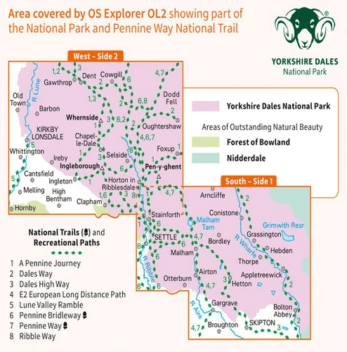
- Lange afstand wandelroutes: Pennine Bridleway, England (330 km), Pennine Way (420 km), Ribble way (113 km)
- Nationale parken: Yorkshire Dales NP, England
- Regionale parken: Forest of Bowland, England
- TOPO's & Stafkaarten: Topografisch wandelen
- AONB - Area of Outstanding Beauty/National Landscape: Forest of Bowland AONB, Nidderdale AONB
- Schaal: 1:25000
- Taal: Engels
- Reeks/Serie: Explorer Series OS
- De Engelse Graafschappen: South Yorkshire, West Yorkshire, Yorkshire
Volledige omschrijving
Wandelkaart OL2 Yorkshire Dales - South& Western areas - OS
Productomschrijving: Yorkshire Dales Nationale Park - South& Western areas, Whernside, Ingleborough & Pen-y-ghent, The AONB Area's of Forest of Bowland & Nidderdale AONB. Yorkshire three peaks, The Devils Bridge at Kirkby Lonsdale, Leeds to Liverpool Canal at Skipton, The Pennine Way, Settle, and Old Town.
Omvat: Whernside, Ingleborough & Pen-y-ghent
Ontdek de OL-serie van Ordnance Survey:
De OL-serie (Outdoor Leisure) van Ordnance Survey is dé referentie voor wie gaat wandelen op de Britse eilanden. Deze topografische kaarten maken deel uit van de Explorer-reeks en bieden ongeëvenaarde nauwkeurigheid en detail op een schaal van 1:25.000. Perfect voor wandelaars, hikers en outdoorliefhebbers.
Waarom kiezen voor de OL Explorer-kaarten?
Gedetailleerde topografie: Elk hekje, pad, beekje en hoogteverschil staat erop.
Ingetekende National Trails: Bekende wandelroutes zoals de South West Coast Path, Hadrian’s Wall Path en Pennine Way zijn duidelijk gemarkeerd.
Betrouwbaarheid: Ordnance Survey is al decennialang de standaard voor kaarten in het VK.
Weerbestendige versies beschikbaar – ideaal voor gebruik in weer en wind.
De beste keuze voor wandelaars
Vergeet generieke wandelkaarten. Met de OL-serie krijg je precieze, actuele informatie, zodat je zonder zorgen op pad kunt.
KOOP NU UW TOPOGRAFISCHE WANDELKAART
Bekijk ons aanbod en kies de OL-kaart die past bij jouw volgende wandelroute. Wandel slim, wandel met Ordnance Survey. wandelroute. Wandel slim, wandel met Ordnance Survey.
Overzichtskaarten

OSI Explorer & Explorer Active - Noord Engeland - Lake District
OSI Explorer & Explorer Active - Noord Engeland - Lake District

Producten op de overzichtskaart
Klik op een product om naar de detailpagina te gaan.
- Wandelkaart 275 Liverpool- South West England - OSI
- Wandelkaart 276 Bolton- Wigan & Warrington- Machester - OSI
- Wandelkaart 277 Manchester & Salford - OSI
- Wandelkaart 278 Sheffield & Barnsley- South Yorkshire - OSI
- Wandelkaart 279 Doncaster- South Yorkshire - OSI
- Wandelkaart 280 Isle of Axholme- Lincolnshire - OSI
- Wandelkaart 281 Ancholme Valley- Lincolnshire - OSI
- Wandelkaart 283 Louth & Mablethorpe- Lincolnshire - OSI
- Wandelkaart 284 Grimsby- Cleethorpes & Immingham - OSI
- Wandelkaart 285 Southport & Chorley- Merseyside - OSI
- Wandelkaart 286 Blackpool & Preston- Lancashire - OSI
- Wandelkaart 287 West Pennine Moors- Lankashire - OSI
- Wandelkaart 288 Bradford & Huddersfield- West Yorkshire - OSI
- Wandelkaart 289 Leeds- Harrogate- Wetherby & Pontefract - OSI
- Wandelkaart 290 York- Selby & Tadcaster- North Yorkshire - OSI
- Wandelkaart 291 Goole & Gilberdyke- Yorkshire - OSI
- Wandelkaart 292 Withernsea & Spurn Head- East Riding - OSI
- Wandelkaart 293 Kingston upon Hull & Beverley - OSI
- Wandelkaart 294 Market Weighton & central Yorkshire Wolds - OSI
- Wandelkaart 295 Bridlington- Driffield & Hornsea - OSI
- Wandelkaart 296 Lancaster- Morecambe & Fleetwood - OSI
- Wandelkaart 297 Lower Wharfedale & Washburn Valley - OSI
- Wandelkaart 298 Nidderdale AONB- Yorkshire - OSI
- Wandelkaart 299 Ripon & Boroughbridge- North Yorkshire - OSI
- Wandelkaart 300 Howardian Hills AONB & Malton - OSI
- Wandelkaart 301 Scarborough- Bridlington & Flamborough
- Wandelkaart 302 Northallerton & Thirsk- North Yorkshire
- Wandelkaart 303 Whitehaven & Workington - OSI
- Wandelkaart 304 Darlington & Richmond- North Cleveland
- Wandelkaart 305 Bishop Auckland & Durham - OSI
- Wandelkaart 306 Middlesbrough & Hartlepool - OSI
- Wandelkaart 307 Consett & Derwent reservoir - OSI
- Wandelkaart 308 Durham & Sunderland- England - OSI
- Wandelkaart 314 Solway Firth- Wigton & Silloth - OSI
- Wandelkaart 315 Carlisle- Brampton- Longtown - OSI
- Wandelkaart OL01 Peak District NP & Dark Peak area - OS
- Wandelkaart OL02 Yorkshire Dales - South& Western areas - OS
- Wandelkaart OL04 English Lakes - North Western area - OS
- Wandelkaart OL05 English Lakes - North Eastern area - OS
- Wandelkaart OL06 English Lakes - South Western area - OS
- Wandelkaart OL07 English Lakes - South Eastern area - OS
- Wandelkaart OL19 Howgill Fells & Upper Eden Valley - OS
- Wandelkaart OL21 South Pennines - OS
- Wandelkaart OL26 North York Moors Western area - OS
- Wandelkaart OL27 North York Moors, Eastern area - OS
- Wandelkaart OL30 Yorkshire Dales - Northern & Central areas - OS
- Wandelkaart OL31 Northern Pennines AONB, Teesdale & Weardale - OS
- Wandelkaart OL41 Forest of Bowland & Ribblesdale - OS
- Wandelkaart OL43 Hadrian's Wall- Haltwhistle & Hexham - OS
Artikelen uit dezelfde regio

Wandelkaart Coast to Coast (west) St Bees to Keld - Harvey maps • 978185137618
Wandelkaart Coast to Coast (west) St Bees to Keld - Harvey maps Productomschrijving: Toont de gehele westelijke helft van de route op één deel van de kaart. Heeft betrekking op het gedeelte van St Bees naar Keld. Omvat alle alternatieve routes. Gedetailleerde kaart met aanvullende informatie en handige telefoonnummers, schaal van 1: 40.000. Nieuwe generatie HARVEY Superwalker, XT25 wat…
Wandelkaart Hadrian's Wall Path - Harvey maps • 9781851374380
Wandelkaart Hadrian's Wall Path - Harvey maps Productomschrijving: Kaart van de gehele Hadrians Way op één kaart. 130km (81 mijl) van de Solway Coast naar Newcastle. Met de gelegenheid voor een bezoek aan een groot aantal historische plekken langs de weg. Informatie over het vinden van accommodatie, camping, voedsel. Met routebeschrijving naar de start van de route. Nieuwe generatie H…
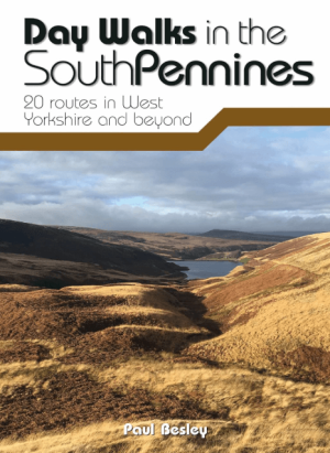
Wandelgids Day Walks in the Southern Pennines - Vertebrate Publ. • 9781912560653
Day Walks in the Southern Pennines - Vertebrate Productomschrijving: 20 routes in West Yorkshire and beyond Day Walks in the South Pennines features 20 circular walks between 5 and 18 miles (8km and 29 km) in length, spread across West Yorkshire, Lancashire and Greater Manchester. Researched and written by knowledgeable and experienced author Paul Besley, the walks range from gentle r…

Wandelkaart 89 West Cumbria England - OSI • 9780319474129
Wandelkaart West Cumbria - England Productbeschrijving: West Cumbria staat bekend om zijn aantrekkelijke landschap en het Lake District National Park & Wast Water Lake, die zich uitstrekt over 3 mijl langs de Wasdale vallei. OS Landranger kaart 89 van West Cumbria, omvat ook Cockermouth, Workington, Maryport, Dovenby, Uldale, Ennerdale Bridge, Egermont, Gosforth, Keswick, Scafell Pike, Col…
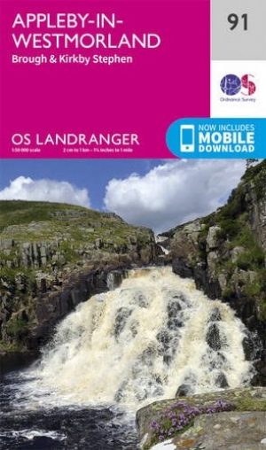
Wandelkaart 91 Appleby-in-Westmorland - OSI • 9780319263389
Wandelkaart Appleby-in-Westmorland - Cumbria England Productomschrijving: De Pennine Way E2 Europese Long Distance pad samen met het nabijgelegen Yorkshire Dales National Park op OS Landranger kaart 91 is er voor wandelaars van lange trekkingsroutes om te genieten van het prachtige omringende landschap. Appleby-in-Westmorland zelf ligt in het hart van Cumbria en is een van Engelands meest …