

Wandelgids Lune Valley & Howgills Lancashire - Cicerone
Gelegen pal tussen 3 natuurgebieden
Korte omschrijving
Wandelgidsen North West England en Lanacshire, England van CICERONE Press. Ideaal voor tochten in England.
Wandelgids - Lune Valley & Howgills Lancashire - Cicerone Productomschrijving: Gelegen pal tussen 3 natuurgebieden, en bijgevolg ook de perfecte uitvalsbasis voor wie van de natuur houd. Aan...

Specificaties
- Uitgever: CICERONE Press
- ISBN-13: 9781852849160
- HOOFDCATEGORIEËN: Wandelgids
- Activiteiten: Wandelen, Hiking & Trekking
- Regio: Lanacshire, England, North West England
- Land: England
- Editie: 2
- Taal: Engels
- De Engelse Graafschappen: Lancashire
Volledige omschrijving
Wandelgids - Lune Valley & Howgills Lancashire - Cicerone
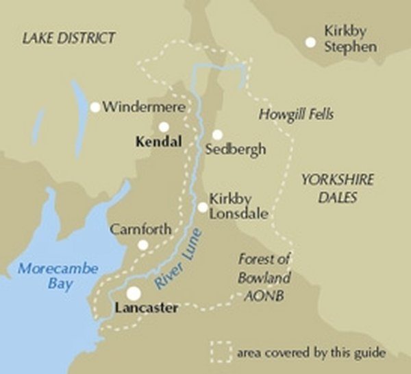
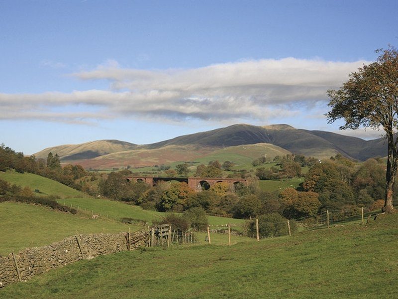
Productomschrijving: Gelegen pal tussen 3 natuurgebieden, en bijgevolg ook de perfecte uitvalsbasis voor wie van de natuur houd. Aan de ene zijde ligt het wereldbekende "Lake District National Park", daar rechts onder het beroemde "Yorkshire Dales National Park", en links onder "The forest of Bowland AONB". Voor wie niet thuis is in het Engelse landschap, AONB's zijn Regio's van uitmuntend natuurschoon, of beter "Area's of Oustanding Natural Beauty. De Lune valley staat bekend voor zijn centraal gelegen uitvalsbasis. duizenden trekken er jaarlijks naartoe, aangezien men van daaruit alle 2 de Nationale parken binnen treedt.
Product description: Guidebook to 40 walks, from 3 to 11 miles, exploring the Lune Valley and Howgill Fells, some of the most unspoilt countryside in north west England. Set mainly within the Yorkshire Dales National Park, and the AONBs of Bowland and Arnside and Silverdale, the walking is hugely rewarding, near the centres of Sedbergh, Kendal and Lancaster.
The Ordnance Survey Explorer maps for the walks in this guide are listed below.
OL19 (Howgill Fells and Upper Eden Valley)
OL7 (The English Lakes, South Eastern area)
OL2 (Yorkshire Dales, Southern and Western areas)
OL41 (Forest of Bowland and Ribblesdale)
296 (Lancaster, Morecambe and Fleetwood
Seasons:
Come spring and early summer, the woodlands, meadows and hedgerows are at their most colourful, and you'll likely get the best weather too. As summer fades, autumnal hues paint another magical time. Crisp winter days can open wonderful distant views, but the weather can sometimes create challenging conditions, even for experienced walkers.
Centres:
Useful facilities exist at the few small towns and larger villages covered by the area, the main centres being Tebay, Sedbergh, Dent, Kirkby Lonsdale and Lancaster.
Difficulty:
The lowland walks are generally without difficulty, but venture onto the higher moors and hills of the Howgill Fells and Bowland fringe, and competent navigation skills and stamina become necessary, particularly in winter. Good footwear, wind and waterproofs underlie basic equipment requirements. Non of the routes demand climbing skills, although some steep gradients may be involved.
Must See:
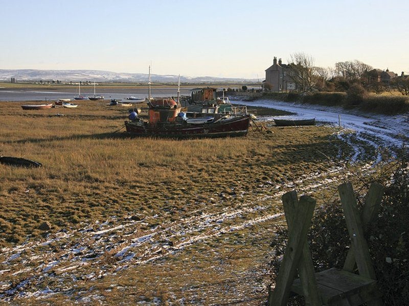
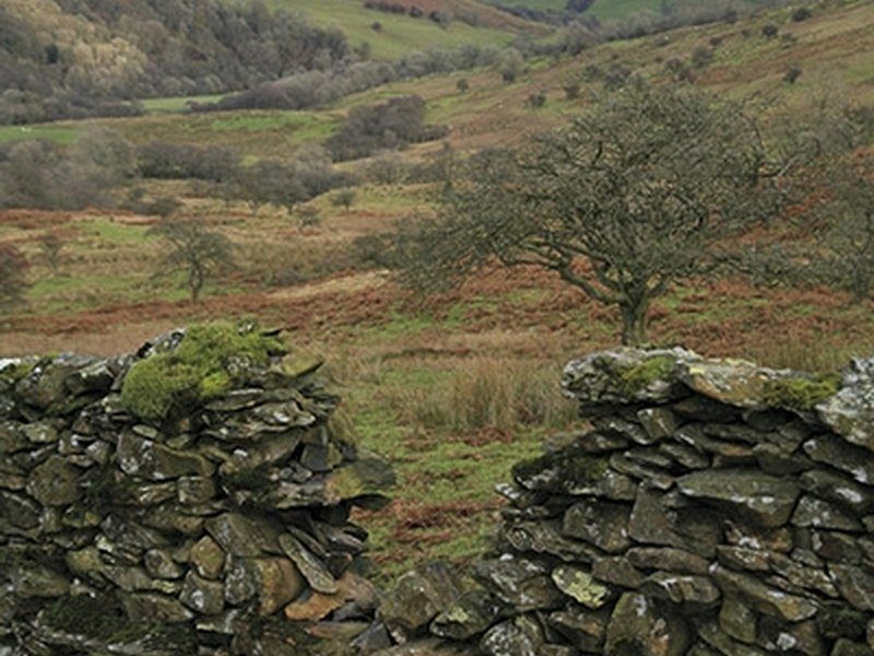
The Howgill Fells are the main area of high ground covered within the book, the highest point of which is The Calf at 672m. Several of the other summits are also included such as Randygill Top, Green Bell and Docker Knott, with walks routed through the long valleys and along the broad ridges that are such a dominant feature of the area. Other satisfying heights include neighbouring Borrowdale, Middleton Fell and Clougha Pike. Elsewhere, the focus is on the River Lune and its immediate tributaries, exploring its changing character as it winds to the sea.
Locatie op kaart
Artikelen uit dezelfde regio

Wandelkaart Coast to Coast (west) St Bees to Keld - Harvey maps • 978185137618
Wandelkaart Coast to Coast (west) St Bees to Keld - Harvey maps Productomschrijving: Toont de gehele westelijke helft van de route op één deel van de kaart. Heeft betrekking op het gedeelte van St Bees naar Keld. Omvat alle alternatieve routes. Gedetailleerde kaart met aanvullende informatie en handige telefoonnummers, schaal van 1: 40.000. Nieuwe generatie HARVEY Superwalker, XT25 wat…

Wandelkaart 102 Preston & Blackpool- Lytham - OSI • 9780319474259
Wandelkaart Preston & Blackpool- Lytham - Lancashire Productbeschrijving: Kaart OS Landranger 102 bestrijkt het gebied rond Preston & Blackpool. De bruisende badplaats Blackpool's eigenzinnige vibes heeft zijn sporen nagelaten sinds vele jaren. Attracties zoals het pleasure beach, Blackpool Tower en de wereld beroemde illuminations maken Blackpool onderscheiden van andere bestemmingen in d…

Fietsgids Pennine Bridleway cycling - Cicerone • 9781852846558
Fietsgids Pennine Bridleway cycling - Cicerone Productomschrijving: Handige gids voor iedereen die de Walliser Bridleway National Trail wenst te fietsen. Meer dan 140km van berg fietsen die door Lancashire en de Yorkshire Dales lopen, samen met een linksom route rond de helft van de Mary Towneley Loop. 11 circulaire dag MTB routes in de Yorkshire Dales met behulp van de Bridleway zijn ook …

Wandelkaart 102 Preston & Blackpool- Lancashire - OSI • 9780319262009
Wandelkaart Preston & Blackpool- Lancashire - OSI Productbeschrijving: OS Landranger kaart 102 bestrijkt het gebied rond Preston & Blackpool. De bruisende badplaats & Blackpool's eigenzinnige vibes heeft zijn sporen nagelaten, sindsdien komen de toeristen als sinds vele jaren. Attracties zoals het pleasure beach, Blackpool Tower en de wereld beroemde illuminations onderscheiden Blackpool v…

Wandelkaart OL41 - Forest of Bowland & Ribblesdale - OSI • 9780319469590
Wandelkaart Forest of Bowland & Ribblesdale - North Yorkshire Omvat ook: Pendle Hill, Clitheroe & Settle Productbeschrijving: Kaart nummer OL41 in de OS Explorer kaarten reeks omvat de Forest of Bowland en Yorkshire Dales National Park in de buurt van Clitheroe. Hoogtepunten van het gebied zijn onder andere: Ribble way & Wyre way, Lune Valley walkway en Pendle way, samen met de steden …