

Wandelkaart 297 Lower Wharfedale & Washburn Valley - OSI
Nidderdale AONB en het Yorkshire Dales National Park
Korte omschrijving
Wandelkaarten North Yorkshire, Engeland van Ordnance Survey. Ideaal voor tochten in England.
Wandelkaart Lower Wharfedale & Washburn Valley - North Yorkshire Omvat ook: Harrogate & Ilkley Moor Productomschrijving: Kaart nummer 297 in de OS Explorer kaarten reeks heeft betrekking...

Specificaties
- Uitgever: Ordnance Survey
- ISBN-13: 9780319245491
- HOOFDCATEGORIEËN: Wandelkaart
- Activiteiten: Wandelen, Hiking & Trekking
- Regio: North Yorkshire, Engeland
- Land: England
- Nationale parken: Yorkshire Dales NP, England
- TOPO's & Stafkaarten: Topografisch wandelen
- AONB - Area of Outstanding Beauty/National Landscape: Nidderdale AONB
- Schaal: 1:25000
- Taal: Engels
- Reeks/Serie: Explorer Series OS
Volledige omschrijving
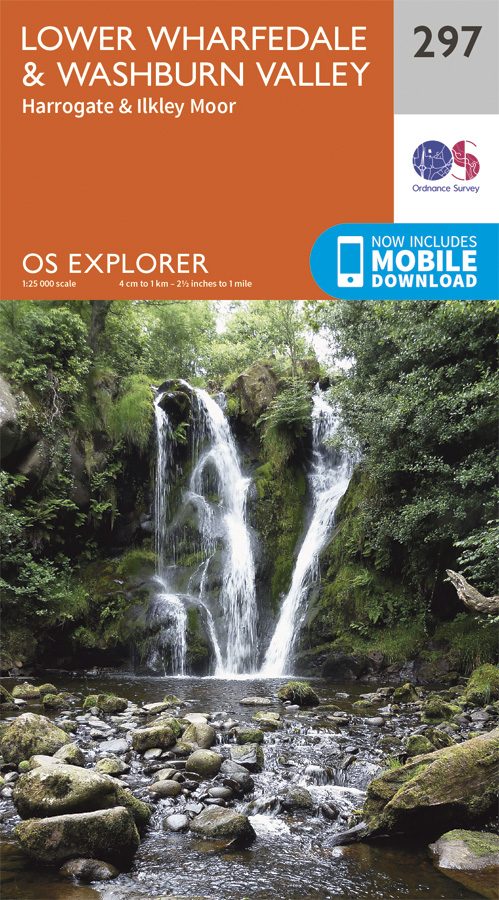
Wandelkaart Lower Wharfedale & Washburn Valley - North Yorkshire
Omvat ook: Harrogate & Ilkley Moor
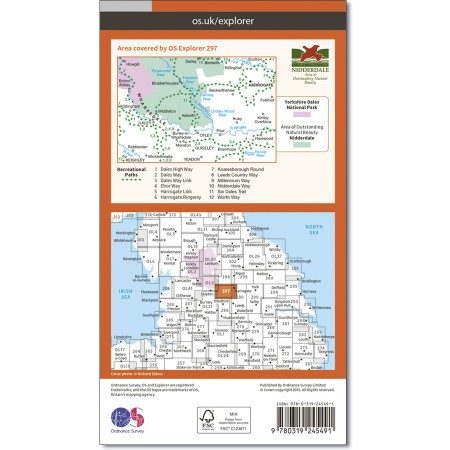
Productomschrijving: Kaart nummer 297 in de OS Explorer kaarten reeks heeft betrekking op het Nidderdale AONB en het Yorkshire Dales National Park. De stad van Harrogate is omgeven door het Harrogate Ringway recreatief pad, terwijl de Dales Way loopt langs Ilkley, Otley en Guisely. Andere hoogtepunten van het gebied zijn: Yeadon, Keighley en Eccup Reservoir. De OS Explorer kaart voor Lower Wharfedale & Washburn Valley is beschikbaar in zowel de standaard papieren versie als de weerbestendige 'Actief' versie.
Kaart nummer 297 is een all purpose kaart vol gepakt met informatie om u het gebied te helpen leren kennen. De 204 Landranger-kaarten bestrijken het land. Elke kaart heeft een oppervlakte van 40 km door 40 km (25 mijl door 25 mijl) en zoals andere kaarten van Ordnance Survey, National Grid-vierkanten worden verstrekt zodat elke functie een unieke referentienummer kan worden gegeven.
Productdiscription: Map sheet number 297 in the OS Explorer series covers the Nidderdale Area of Outstanding Natural beauty and the Yorkshire Dales National Park. The town of Harrogate is surrounded by the Harrogate Ringway Recreational Path, whilst the Dales Way runs past Ilkley, Otley and Guisely. Other highlights of the area include: Yeadon, Keighley and Eccup Reservoir. The OS Explorer map for Lower Wharfedale & Washburn Valley is available in both the standard paper version and weatherproof 'Active' version.
Locatie op kaart
Gekoppelde artikelen

Wandelkaart 297 Lower Wharfedale & Washburn Valley - OSI • 9780319245491
standaard versieWandelkaart Lower Wharfedale & Washburn Valley - North Yorkshire Omvat ook: Harrogate & Ilkley Moor Productomschrijving: Kaart nummer 297 in de OS Explorer kaarten reeks heeft betrekking op het Nidderdale AONB en het Yorkshire Dales National Park. De stad van Harrogate is omgeven door het Harrogate Ringway recreatief pad, terwijl de Dales Way loopt langs Ilkley, Otley en Guisely. Ander…

Wandelkaart 297 Lower Wharefedale & Washburn Valley- OSI • 9780319471692
weatherproof versieWandelkaart Lower Wharefedale & Washburn Valley - North Yorkshire Omvat ook: Harrogate & Ilkley Moor. Productbeschrijving: Kaart nummer 297 in de OS Explorer reeks heeft betrekking op het Nidderdale gebied van buitengewone natuurlijke schoonheid AONB en het Yorkshire Dales National Park. De stad van Harrogate is omgeven door het Harrogate Ringway recreatieve pad, terwijl de Dales Way l…
Overzichtskaarten

OSI Explorer & Explorer Active - Noord Engeland - Lake District
OSI Explorer & Explorer Active - Noord Engeland - Lake District

Producten op de overzichtskaart
Klik op een product om naar de detailpagina te gaan.
- Wandelkaart 275 Liverpool- South West England - OSI
- Wandelkaart 276 Bolton- Wigan & Warrington- Machester - OSI
- Wandelkaart 277 Manchester & Salford - OSI
- Wandelkaart 278 Sheffield & Barnsley- South Yorkshire - OSI
- Wandelkaart 279 Doncaster- South Yorkshire - OSI
- Wandelkaart 280 Isle of Axholme- Lincolnshire - OSI
- Wandelkaart 281 Ancholme Valley- Lincolnshire - OSI
- Wandelkaart 283 Louth & Mablethorpe- Lincolnshire - OSI
- Wandelkaart 284 Grimsby- Cleethorpes & Immingham - OSI
- Wandelkaart 285 Southport & Chorley- Merseyside - OSI
- Wandelkaart 286 Blackpool & Preston- Lancashire - OSI
- Wandelkaart 287 West Pennine Moors- Lankashire - OSI
- Wandelkaart 288 Bradford & Huddersfield- West Yorkshire - OSI
- Wandelkaart 289 Leeds- Harrogate- Wetherby & Pontefract - OSI
- Wandelkaart 290 York- Selby & Tadcaster- North Yorkshire - OSI
- Wandelkaart 291 Goole & Gilberdyke- Yorkshire - OSI
- Wandelkaart 292 Withernsea & Spurn Head- East Riding - OSI
- Wandelkaart 293 Kingston upon Hull & Beverley - OSI
- Wandelkaart 294 Market Weighton & central Yorkshire Wolds - OSI
- Wandelkaart 295 Bridlington- Driffield & Hornsea - OSI
- Wandelkaart 296 Lancaster- Morecambe & Fleetwood - OSI
- Wandelkaart 297 Lower Wharfedale & Washburn Valley - OSI
- Wandelkaart 298 Nidderdale AONB- Yorkshire - OSI
- Wandelkaart 299 Ripon & Boroughbridge- North Yorkshire - OSI
- Wandelkaart 300 Howardian Hills AONB & Malton - OSI
- Wandelkaart 301 Scarborough- Bridlington & Flamborough
- Wandelkaart 302 Northallerton & Thirsk- North Yorkshire
- Wandelkaart 303 Whitehaven & Workington - OSI
- Wandelkaart 304 Darlington & Richmond- North Cleveland
- Wandelkaart 305 Bishop Auckland & Durham - OSI
- Wandelkaart 306 Middlesbrough & Hartlepool - OSI
- Wandelkaart 307 Consett & Derwent reservoir - OSI
- Wandelkaart 308 Durham & Sunderland- England - OSI
- Wandelkaart 314 Solway Firth- Wigton & Silloth - OSI
- Wandelkaart 315 Carlisle- Brampton- Longtown - OSI
- Wandelkaart OL01 Peak District NP & Dark Peak area - OS
- Wandelkaart OL02 Yorkshire Dales - South& Western areas - OS
- Wandelkaart OL04 English Lakes - North Western area - OS
- Wandelkaart OL05 English Lakes - North Eastern area - OS
- Wandelkaart OL06 English Lakes - South Western area - OS
- Wandelkaart OL07 English Lakes - South Eastern area - OS
- Wandelkaart OL19 Howgill Fells & Upper Eden Valley - OS
- Wandelkaart OL21 South Pennines - OS
- Wandelkaart OL26 North York Moors Western area - OS
- Wandelkaart OL27 North York Moors, Eastern area - OS
- Wandelkaart OL30 Yorkshire Dales - Northern & Central areas - OS
- Wandelkaart OL31 Northern Pennines AONB, Teesdale & Weardale - OS
- Wandelkaart OL41 Forest of Bowland & Ribblesdale - OS
- Wandelkaart OL43 Hadrian's Wall- Haltwhistle & Hexham - OS
Artikelen uit dezelfde regio

Wandelkaart 94 Whitby & Esk Dale- North Yorkshire - OSI • 9780319261927
Wandelkaart Whitby & Esk Dale - North Yorkshire England Productbeschrijving: OS Landranger kaart 94 toont van het meeste van het North York Moors National Park, en omvat Robin Hoods Bay, Whitby en Saltburn-by-the-Sea. De Esk Dale is een schilderachtige vallei - Volg de Esk Valley Walk (56km) om het beste van dit gebied te zien De OS Landranger kaarten reeks heeft betrekking op Groot-Br…

Wandelkaart 299 Ripon & Boroughbridge - England - OSI • 9780319471715
Wandelkaart Ripon & Boroughbridge - North Yorkshire England Omvat ook: Easingwold. Productbeschrijving: Kaart nummer 299 in de OS Explorer kaarten reeks is ideaal voor ontdekken van North Yorkshire rond Ripon en Boroughbridge. Bezoek de kathedraal stad van Ripon en de Ripon markt, of de Ripon Hornblower, een traditie van de Middeleeuwen. Andere hoogtepunten van het gebied zijn: Easingw…

Wandelgids 15 short walks in the Yorkshire Dales NP - Cicerone • 9781786312488
15 short walks in the Yorkshire Dales - Cicerone Productomschrijving: Would you like to explore the best of the Sedbergh, Kirkby Lonsdale and Ingleton? This guidebook covers 15 of the best short walks in the area (all under three hours), including Cautley Spout, Pendragon Castle, Wild Boar Fell, the Lune Valley and Ingleton Waterfalls Trail. Why choose this guidebook? - Easy to mo…

Wandelkaart 101 Scarborough- North Yorkshire - OSI • 9780319261996
Wandelkaart Scarborough- North Yorkshire - Ordnance Survey Productbeschrijving: OS Landranger kaart 101 beslaat de kust stad van Scarborough, evenals de zuidoostelijke hoek van het North York Moors National Park. De OS Landranger kaarten reeks heeft betrekking op Groot-Brittannië met 204 gedetailleerde kaarten, perfect voor dagtochten en korte pauzes. Elke kaart bevat alle informatie die u…

Wandelkaart 99 Northallerton & Ripon- N. Yorkshire - OSI • 9780319261972
Wandelkaart Northallerton & Ripon - North Yorkshire England Productbeschrijving: Ligt tussen de Yorkshire Dales en de North York Moors, het gebied gedekt door OS Landranger kaart 99 wordt vaak vergeten, maar omvat de oude kathedraal stad van Ripon, Northallerton en andere kleinere steden. De OS Landranger kaarten reeks heeft betrekking op Groot-Brittannië met 204 gedetailleerde kaarten…