

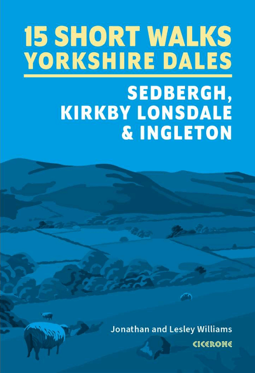
Wandelgids 15 short walks in the Yorkshire Dales NP - Cicerone
Sedbergh, Kirkby Lonsdale and Ingleton

Korte omschrijving
Wandelgidsen North Yorkshire, Engeland van CICERONE Press. Ideaal voor tochten in England.
15 short walks in the Yorkshire Dales - Cicerone Productomschrijving: Would you like to explore the best of the Sedbergh, Kirkby Lonsdale and Ingleton? This guidebook covers 15 of the best ...

Specificaties
- Uitgever: CICERONE Press
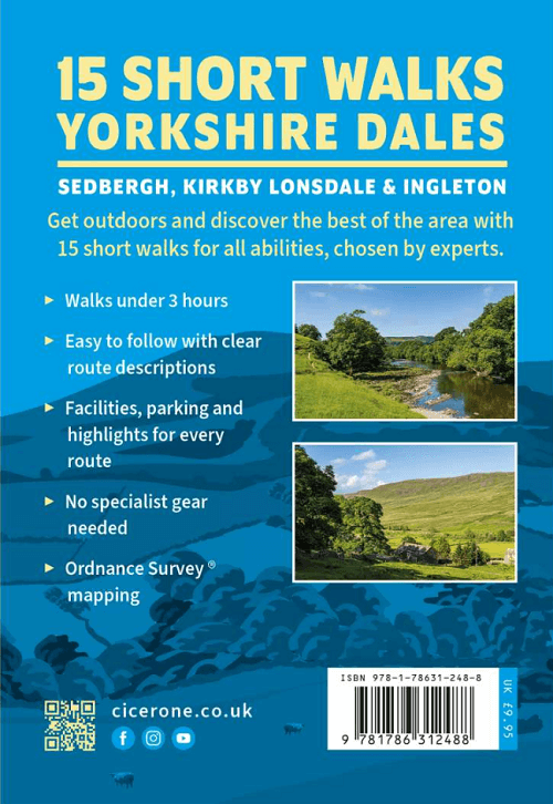
- ISBN-13: 9781786312488
- HOOFDCATEGORIEËN: Wandelgids
- Activiteiten: Wandelen, Hiking & Trekking
- Auteur: Jonathan Williams, Lesley Williams
- Regio: North Yorkshire, Engeland
- Land: England
- Nationale parken: Yorkshire Dales NP, England
- Editie: 1
- Taal: Engels
- De Engelse Graafschappen: North Yorkshire, Yorkshire
Volledige omschrijving
15 short walks in the Yorkshire Dales - Cicerone
Productomschrijving: Would you like to explore the best of the Sedbergh, Kirkby Lonsdale and Ingleton? This guidebook covers 15 of the best short walks in the area (all under three hours), including Cautley Spout, Pendragon Castle, Wild Boar Fell, the Lune Valley and Ingleton Waterfalls Trail.
Why choose this guidebook?
- Easy to moderate walks suitable for almost everyone
- Short climbs but no challenging terrain
- Numbered points which tie OS maps to clear route description
- Facilities, parking and highlights for every route
- Route Summary Table to help you choose your walk
Cicerone’s Short Walks guidebooks contain everything you need to get outdoors and discover the best of an area. The routes are perfect if you’re new to walking or looking for something you can enjoy with the whole family. Let the adventures begin!.
Seasons:
These routes are suitable for walking at all times of the year, although in winter and extremely wet weather, extra care will be needed on steep slopes and near rivers and waterfalls.
Centres:
Sedbergh and Kirkby Lonsdale are the main centres. The villages of Dent and Barbon also provide a range of more limited facilities.
Difficulty:
The Yorkshire Dales comprise dales (valleys) but also steep hillsides from where extensive views can be enjoyed. Stoney tracks and paths tend to be the norm, rivers and streams are crossed on footbridges, and narrow ‘squeeze’ stiles pass through drystone walls.
Must See:
Sedbergh, Kirkby Lonsdale, Dent, Barbon, Barbondale, Dentdale, Howgill fells, Winder, Calf, Calders, River Lune, River Rawthey, River Dee. Ingleton waterfalls, Cautley Spout, Ingleborough, Pendragon Castle, Sedbergh school, Ruskin’s View, Farfield Mill, Dent Station, Coal Road, viaducts.

Artikelen uit dezelfde regio
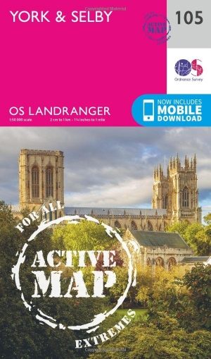
Wandelkaart 105 York & Selby- North Yorkshire - OSI • 9780319474280
Wandelkaart York & Selby - North Yorkshire - OSI Productbeschrijving: OS Landranger kaart 105 toont York, een bruisende en levendige stad boordevol culturele attracties om te bezoeken. Hoogtepunten zijn de York Minster, York Museum en het nemen van een boottocht van York langs de prachtige rivier de Ouse. De markt stad van Selby ligt ten zuiden van York samen met de andere omliggende dorpe…

Wandelkaart 300 Howardian Hills AONB & Malton - OSI • 9780319245521
Wandelkaart Howardian Hills AONB & Malton - North Yorkshire 300 / Howardian Hills AONB & Malton, North Torkshire, England - Kaart nummer 300 is een all purpose kaart vol gepakt met informatie om u het gebied te helpen leren kennen. De 204 Landranger-kaarten bestrijken het land. Elke kaart heeft een oppervlakte van 40 km door 40 km (25 mijl door 25 mijl) en zoals andere kaarten van Ordnance…

Wandelkaart 297 Lower Wharefedale & Washburn Valley- OSI • 9780319471692
Wandelkaart Lower Wharefedale & Washburn Valley - North Yorkshire Omvat ook: Harrogate & Ilkley Moor. Productbeschrijving: Kaart nummer 297 in de OS Explorer reeks heeft betrekking op het Nidderdale gebied van buitengewone natuurlijke schoonheid AONB en het Yorkshire Dales National Park. De stad van Harrogate is omgeven door het Harrogate Ringway recreatieve pad, terwijl de Dales Way l…

Fietskaart Yorkshire Dales National Park - Goldeneye • 9781859651421
Fietskaart Yorkshire Dales National Park - Goldeneye Productomschrijving: De Yorkshire Dales is een heuvellandschap in Noord-Engeland dat voornamelijk ten oosten van de waterscheiding van het Penninisch gebergte is gelegen in Noord-Yorkshire. Het maakt voornamelijk deel uit van het graafschap North Yorkshire, een klein gedeelte is gelegen in Cumbria. Het beeld dat men in deze omgeving aant…

Wandelkaart 299 Ripon & Boroughbridge- North Yorkshire - OSI • 9780319245514
Wandelkaart Ripon & Boroughbridge - North Yorkshire England Omvat ook: Easingwold Productbeschrijving: Kaart nummer 299 in de OS Explorer kaarten reeks is ideaal voor het ontdekken van North Yorkshire rond Ripon en Boroughbridge. Bezoek de kathedraal stad van Ripon en bewonder de Ripon markt, of de Ripon Hornblower, een traditie van de Middeleeuwen. Andere hoogtepunten van het gebied z…