

HOOFDCATEGORIEËN
De Australische Regio's
Reeks/Serie:
Land
Regio
Nationale parken
Regionale parken
Uitgever


 Beste Wegenkaarten Australië
Beste Wegenkaarten Australië, Ontdek Sydney, the Great Barrier Reef & Melbourne.
Een avontuurlijke roadtrip door Australië vraagt om uitstekende wegenkaarten van gerenommeerde uitgevers als Hema Maps en ITMB. Hema Maps levert uiterst gedetailleerde kaarten voor de populaire oostkust van Australië. Hiermee navigeer je eenvoudig naar iconische steden zoals Sydney, beroemd om het Sydney Opera House, Harbour Bridge en het nabijgelegen Bondi Beach. Ook routes naar spectaculaire natuurgebieden zoals de Blue Mountains zijn duidelijk gemarkeerd.
Deze uitgevers bieden praktische kaarten voor Queensland, de thuisbasis van het wereldberoemde Great Barrier Reef en tropische steden zoals Cairns en Townsville. Ontdek met gemak de prachtige stranden, kleurrijke koraalriffen en het regenwoudgebied van Daintree National Park.
ITMB-kaarten zijn ideaal voor reizen naar Melbourne en omgeving. Deze kaarten helpen je probleemloos om de beroemde Great Ocean Road te ontdekken, met spectaculaire bezienswaardigheden zoals de Twelve Apostles en charmante dorpjes zoals Lorne en Apollo Bay. Praktische informatie over parkeergelegenheden, rustplaatsen en toeristische hotspots maken jouw Australische reis comfortabel en plezierig.
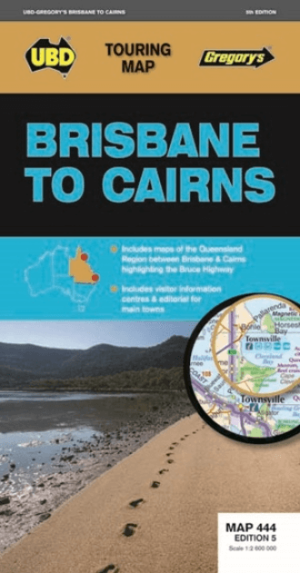
Landkaart Wegenkaart 444 Brisbane to Cairns Region - Gregory's • 9780731931156
Wegenkaart Brisbane to Cairns Region, Northern Queensland Productomschrijving: The 5th Edition of the Brisbane to Cairns touring map will help you with your travels along the Queensland coast. It includes a Queensland state map highlighting the Bruce Highway from Brisbane to Cairns, strip maps featuring the best of the Bruce Highway, and visitor and touring information.

Landkaart Wegenkaart Queensland state handy - Hema • 9781922668776
Wegenkaart Queensland state handy - Hema Productomschrijving: A compact map of Queensland (QLD) at a scale of 1:2,500,000 for touring throughout the state which features highways, major roads and minor roads. Marked on the map are national parks, camping areas, caravan parks, rest areas, points of interest and 24-hour fuel accompanied by a distance grid and an index.

Landkaart Wegenkaart Melbourne tot Adelaide - Hema Maps • 9781865007311
Wegenkaart Melbourne tot Adelaide - Hema Productomschrijving: A city to city map from Melbourne to Adelaide (1:900,000) that features the Great Ocean Road (1:450,000). The Great Ocean Road map has significant locations pinpointed with brief tourist information attached, accompanied by general tourist information for the journey from Melbourne to Adelaide. Also included are throughroad map…
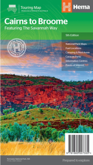
Landkaart Wegenkaart Savannah Way Cairns to Broome - Hema Maps • 9781865007335
Wegenkaart Savannah Way, Cairns to Broome - Hema Productomschrijving: A touring map for the trip along the Savannah Way between Cairns and Broome at a scale of 1:2,200,000. The maps show 24-hour fuel, outback fuel and LPG as well as caravan parks, camping areas and rest areas. Popular national parks along the route are featured with detailed inset maps of Judbarra/Gregory, Purnululu, …

Landkaart Wegenkaart Brisbane tot Cairns Region - Hema Maps • 9781865008714
Wegenkaart Brisbane tot Cairns Region - Hema Productomschrijving: City to City Map - via the Bruce Highway A Brisbane to the Cairns Region map at a scale of 1:1,500,000 with tourist drives map (1:3,000,000). Drive between Brisbane to Cairns with relevant touring points of interest and detailed mapping for the trip with 24-hour fuel, camping areas and caravan parks, rest areas and attra…

Landkaart Wegenkaart South Australia state handy map - Hema • 9781865008707
Wegenkaart South Australia state handy map - Hema Productomschrijving: A map of South Australia (SA) that has camping areas, caravan parks, points of interest, rest areas and fuel marked on the map for touring throughout the state. Accompanying the mapping is an index of towns and localities and a distance chart.

Landkaart Victoria state NSW - Hema Maps • 9781865009773
Wegenkaart Landkaart Victoria state - Hema Productomschrijving: A compact map of Victoria for touring throughout the state with a distance grid and index for planning and reference. Marked on the mapping are highways, major and minor roads, points of interest, information centres, picnic areas, caravan parks and lookouts. Great for using in the car, Hema's Victoria Handy Map clearly shows …

Landkaart Wegenkaart Victoria state map - Hema Maps • 9781865009834
Wegenkaart Victoria state map - Hema Productomschrijving: A comprehensive map of Victoria for touring throughout the state that has camping and rest areas, 24-hour fuel and points of interest marked on the mapping. On the reverse are CBD, the surrounding region and through road maps of Melbourne in addition to maps of the Great Ocean Road and East Gippsland. Also included is a national pa…

Landkaart Wegenkaart Zuid-Australië state map - Hema Maps • 9781865009865
Wegenkaart Zuid-Australië state map - Hema Productomschrijving: A map of South Australia (SA) for touring throughout the state that has camping and rest areas, 24-hour fuel and points of interest marked on the mapping. On the reverse are CBD, surrounding region and through road maps of Adelaide in addition to maps of Flinders Ranges National Park and the Barossa Valley. Also included are …
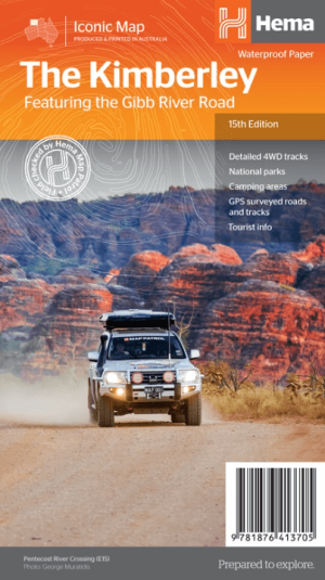
Landkaart Wegnkaart Kimberley Iconic Map, Gibb River road - Hema • 9781876413705
Wegnkaart Kimberley Iconic Map, The Gibb River road Productomschrijving: Een 660 km lange prachtige avontuurlijke route genaamd, The Kimberley Gibb River road. Engelse omschrijving: A regional map of the Kimberley that features the iconic Gibb River Road. On the reverse are inset maps for Purnululu National Park, the Dampier Peninsula and the Parry Creek area. There is also extensive …
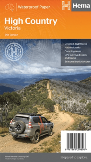
Landkaart Wegenkaart Iconic Map The High Country - Hema • 9781876413125
Iconic Map The High Country - Hema Productomschrijving: This brand new edition of Hema’s best-selling High Country map, on durable waterproof paper, features our latest mapping and points of interest in a stunning new cartographic style. Featuring roads and 4WD tracks field-checked by the Hema Map Patrol for superior accuracy. It combines Hema’s entire database of roads and 4WD tracks…

Landkaart Gold Coast Queensland & omgeving - Hema Maps • 9781925625059
Landkaart Gold Coast & omgeving - Hema Productomschrijving: Map of Gold Coast: CBD, City, Suburbs & Hinterland This map of the Gold Coast includes detailed mapping of the city (1:15,000) and suburbs (1:50,000), as well as a comprehensive overview of the surrounding Gold Coast Hinterland (1:100,000). There’s plenty of useful visitor information marked on the mapping for staying in …
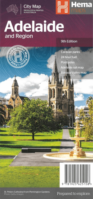
Landkaart Adelaide & omgeving - Hema Maps • 9781925625158
Wegenkaart Landkaart Adelaide & omgeving - Hema Productomschrijving: A map of Greater Adelaide (1:80,000) that features highways, major roads, local streets and suburbs in addition to 24-hour fuel, parks and caravan parks marked on the mapping. On the reverse is an Adelaide City map that has accommodation, shopping, theatres, places of interest and more highlighted, accompanied by an Adela…

Landkaart Wegenkaart New South Wales handy map - Hema • 9781925625608
Wegenkaart New South Wales handy map - Hema Productomschrijving: A fully indexed state map of New South Wales (NSW) at a scale of 1:1,400,000. Marked on the map are national parks, camping areas, caravan parks, rest areas, points of interest and 24-hour fuel accompanied by a distance grid.

Landkaart Wegenkaart New South Wales state map - Hema Maps • 9781925625615
Wegenkaart New South Wales state map - Hema Productomschrijving: A state map of New South Wales (NSW) at a scale of 1:1,500,000. Marked on the map are national parks, points of interest, 24-hour fuel in addition to camping and rest areas. On the reverse side are CBD maps of Sydney and Canberra, as well as a Sydney regional map, a Sydney throughroads map, and maps of Blue Mountains Na…
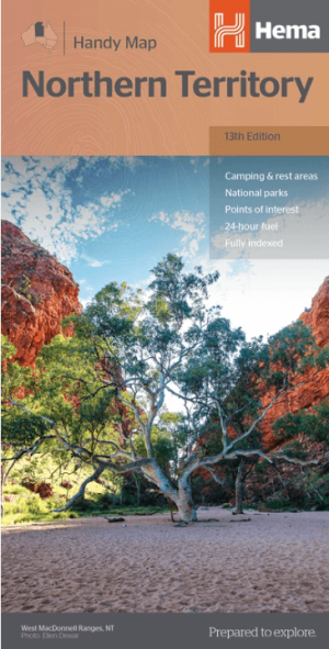
Landkaart Wegenkaart Northern Territory handy map - Hema • 9781925625684
Wegenkaart Northern Territory handy map - Hema Productomschrijving: A fully indexed map of the Northern Territory (NT) at a scale of 1:1,750,000. Marked on the map are national parks, camping areas, rest areas, caravan parks, points of interest and 24-hour fuel accompanied by a distance grid.
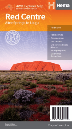
Landkaart Wegenkaart Iconic Map Red Centre - Hema Maps • 9781925625745
Iconic Map Red Centre - Hema Productomschrijving: A regional map of the Red Centre (1:750,000), covering from Alice Springs to Uluru. Extensive travel and background information on specific regions including Alice Springs and surrounds, Larapinta Drive, West MacDonnell Ranges, East MacDonnell Ranges, the Old Ghan Route, Kings Canyon and Watarrka National Park and Uluru-Kata Tjuta National…
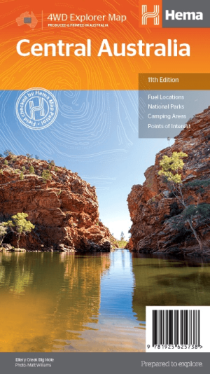
Landkaart Australië Centraal - Hema Maps • 9781925625738
Wegenkaart Landkaart Centraal Australië - Hema Productomschrijving: Discover Australia's ancient heartland This map of the Central Australia region is ideal for discovering some of Australia's most iconic landscapes. The main map covers the area around Alice Springs, including Uluru, Kata Tjuta, West MacDonnell Range, as well as the Simpson Desert, and popular tracks such as the Hay R…
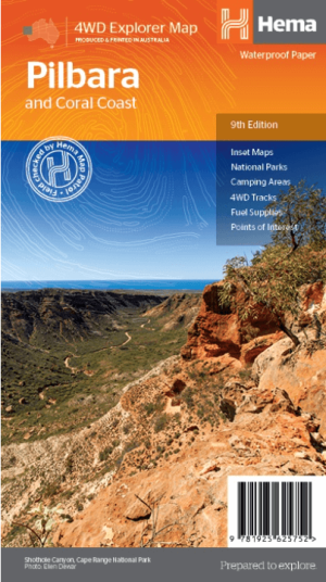
Landkaart Wegenkaart Pilbara & Coral Coast - Hema Maps • 9781925625752
Wegenkaart Pilbara & Coral Coast - Hema Productomschrijving: This regional waterproof map of the Pilbara and Coral Coast is ideal for discovering the northern reaches of Western Australia. The main map covers the diverse marine attractions around Shark Bay, François Peron National Park and the Ningaloo Reef. It also stretches to the gorges of Karijini, lush habitats of Millstream Chichest…
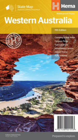
Landkaart Wegenkaart West-Australië state map - Hema Maps • 9321438001553
Wegenkaart West-Australië state map - Hema Productomschrijving: A map of Western Australia (WA) for touring throughout the state that has camping and rest areas, 24-hour fuel and points of interest marked on the mapping. On the reverse are CBD and through road maps of Perth in addition to inset maps of Leeuwin-Naturaliste National Park, Cape Range National Park, Nambung National Park, …
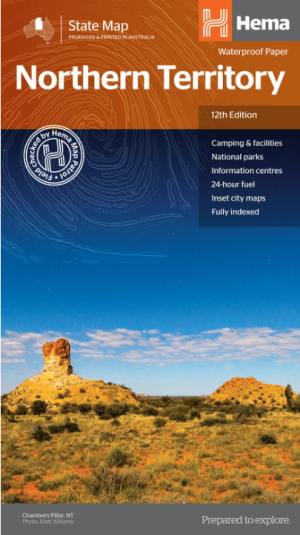
Landkaart Wegenkaart Northern Territory state map - Hema Maps • 9321438001508
Wegenkaart Northern Territory state map - Hema Productomschrijving: A touring map of the Northern Territory (NT) that features 24-hour fuel, camping areas and rest areas. Marked on the map are highways, major roads and minor roads, national parks and Aboriginal land and various points of interest. The map is fully indexed, and includes a handy list of accredited visitor information c…

Landkaart Wegenkaart Western Australia state handy map - Hema • 9321438001560
Wegenkaart Western Australia state handy map - Hema Productomschrijving: A compact map of Western Australia (WA) for touring throughout the state with a distance grid and index for planning and reference. Marked on the mapping are highways, major and minor roads, camping and rest areas, 24-hour fuel, information centres, picnic areas, caravan parks and lookouts.
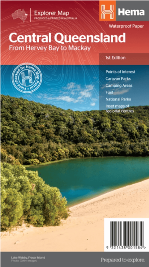
Landkaart Wegenkaart Explorer Map Centraal Queensland - Hema Maps • 9321438001584
Explorer Map Centraal Queensland - Hema Productomschrijving: A regional map of central Queensland (1:1,000,000) that stretches inland past Jericho and from Maryborough in the south to Mackay in the north. On the opposite side is tourist information on the region, as well as inset maps of Mackay, the Capricorn Coast, Gladstone, Bundaberg, Rockhampton, and the Gemfields. Accompanying e…
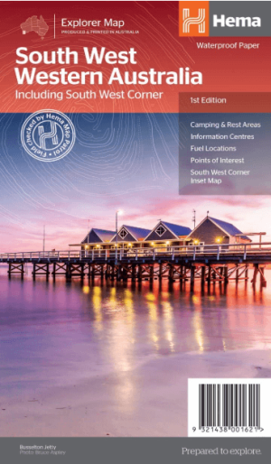
Landkaart Wegenkaart West & Zuidwest-Australië NP's - Hema • 9321438001621
Landkaart West & Zuidwest-Australië - Hema Productomschrijving: A regional map for discovering South West & Western Australia (WA). On the reverse side of the map are detailed inset maps of Nambung National Park, Avon Valley National Park, Lane Poole Reservation, the South West Corner, Stirling Range National Park, D'Entrecastreaux National Park and Albany Coast. Also included is tourist …
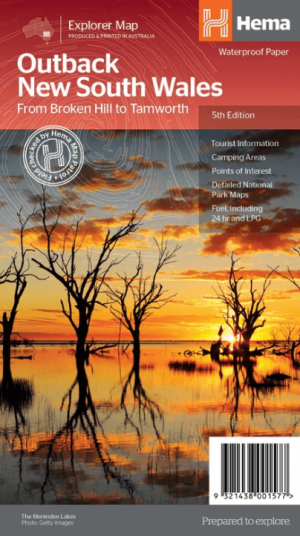
Landkaart Wegenkaart Explorer Map Outback New South Wales - Hema • 9321438001577
Explorer Map Outback New South Wales - Hema Productomschrijving: A regional map of the outback NSW (1:1,100,000) that ranges from Tamworth in the east to Broken Hill in the west, as well as from Wagga Wagga in the south to past the Queensland border in the north. On the opposite side is extensive information on numerous regions, including visitor, historical and background information. …
Complete Wegenkaarten voor West-Australië
Complete Wegenkaarten voor West-Australië, Ontdek Perth, Broome en Kimberley.
Wanneer je West-Australië wilt verkennen, zijn betrouwbare wegenkaarten essentieel. Uitgevers zoals UBD Gregory’s, National Geographic en Hema Maps bieden uitstekende kaarten speciaal voor dit fascinerende gebied. UBD Gregory’s levert gedetailleerde kaarten voor de stad Perth, bekend om Kings Park, Fremantle en nabijgelegen stranden zoals Cottesloe Beach. De praktische weergave maakt het eenvoudig om de stad en haar omgeving grondig te ontdekken.
National Geographic biedt uitgebreide routekaarten voor de regio Kimberley, beroemd om zijn wilde natuur en spectaculaire locaties zoals de Bungle Bungle Range en Gibb River Road. Deze kaarten zijn ideaal voor avonturiers die deze afgelegen regio probleemloos willen verkennen.
Hema Maps is perfect voor reizen naar de kustplaats Broome, bekend om Cable Beach met haar iconische zonsondergangen en historische locaties zoals de Japanse begraafplaats. Dankzij duidelijke schaalverhoudingen, informatie over voorzieningen, en lokale highlights, geniet je optimaal van je roadtrip door het spectaculaire West-Australië.
Praktische Wegenkaarten Australië
Praktische Wegenkaarten Australië, Vind gemakkelijk Adelaide, Tasmanië & het Rode Centrum!
Om de diversiteit van Australië volledig te ervaren, zijn gedetailleerde wegenkaarten van uitgevers als Michelin, Explore Australia en Lonely Planet ideaal. Michelin biedt duidelijke kaarten voor Zuid-Australië, waaronder Adelaide, bekend om haar festivals, wijngebieden zoals Barossa Valley en natuurgebieden zoals Kangaroo Island. Dankzij praktische symbolen en duidelijke routes ontdek je deze regio comfortabel.
Explore Australia biedt uitstekende kaarten voor reizigers die het Rode Centrum (Northern Territory) willen bezoeken. Bereik moeiteloos Uluru (Ayers Rock), Alice Springs en Kings Canyon. De kaarten bevatten nuttige informatie over wandelroutes, kampeerplaatsen en lokale bezienswaardigheden, perfect voor avonturiers.
Lonely Planet-kaarten zijn uitstekend voor reizen door Tasmanië, Australië’s eilandstaat. Hiermee verken je eenvoudig steden als Hobart, bekend om Salamanca Market en historische havenwijken. Ook natuurschatten zoals Cradle Mountain-Lake & St Clair National Park zijn duidelijk aangegeven. Door heldere weergave van voorzieningen en toeristische attracties maak je je Australische avontuur zorgeloos en onvergetelijk.