
Landkaart Wegenkaart West & Zuidwest-Australië NP's - Hema
Nambung NP - Avon Valley NP - Lane Poole Reservation
Korte omschrijving
Wandelkaarten Western Australia en South-west Autralia van Hema Maps. Ideaal voor tochten in Australië.
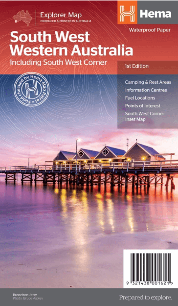
Landkaart West & Zuidwest-Australië - Hema Productomschrijving: A regional map for discovering South West & Western Australia (WA). On the reverse side of the map are detailed inset maps of...

Specificaties
- Uitgever: Hema Maps
- ISBN-13: 9321438001621
- HOOFDCATEGORIEËN: Wegenkaart - Landkaart
- Activiteiten: Wandelen, Hiking & Trekking
- Regio: South-west Autralia, Western Australia
- Land: Australië
- Schaal: 1:750000
- Editie: 1
- Taal: Engels
- De Australische Regio's: Western Australia
Volledige omschrijving
Landkaart West & Zuidwest-Australië - Hema
Productomschrijving: A regional map for discovering South West & Western Australia (WA). On the reverse side of the map are detailed inset maps of Nambung National Park, Avon Valley National Park, Lane Poole Reservation, the South West Corner, Stirling Range National Park, D'Entrecastreaux National Park and Albany Coast. Also included is tourist information for the Coral Coast, Perth, Avon Valley, the Great Southern Region, Peel, Blackwood River Valley, the Southern Forests, the Margaret River region and the Southern Coast.
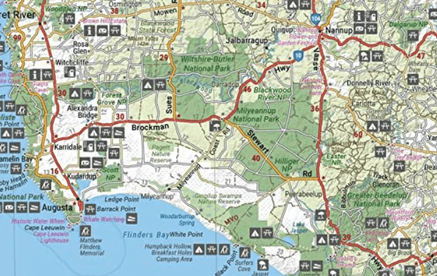
The southwestern portion of Western Australia has spectacular coastline, great surfing beaches, flowing rivers, tall forests, wineries, farms, quaint towns, bustling cities and numerous other attractions. While forest communities remain quiet, the coastal area from Bunbury to Margaret River and Augusta bursts at the seams on long weekends.
The Southern Forests feature many opportunities for memorable encounters of the tree kind, and the region also has stunning coastline. Almost the entire coast is within national parks and there are many great opportunities for four-wheel driving. To get a real taste for the vast wilderness protected by D’Entrecasteaux National Park, your best bet is by 4WD.
Lake Jasper via Black Point is one of the favourite 4WD routes in the South West. The Great Southern area stretches from Denmark across to Albany and up to Mt Barker, taking in the Porongurup and Stirling ranges. Between Denmark and Albany is West Cape Howe National Park which offers challenging 4WD tracks, fantastic camping at Shelley Beach, remnant karri forest and Western Australia’s most southerly point at Torbay Head.
Blessed with milder summer temperatures than Perth, the South West corner is popular in spring for the wildflowers. The winter months are often wet and windy, especially along the southern coast. Visitors should also be aware that total fire bans apply in many areas throughout the summer months.
Locatie op kaart
Artikelen uit dezelfde regio

Kampinggids Perth & The South West 4WD + Camping escapes - Hema • 9781865006215
Wegenatlas Kampinggids Perth & The South West Productomschrijving: 4WD + Camping Escapes – Perth & the South West is a guide to the best four-wheel driving and camping locations in South West Western Australia. Each regional section outlines the area’s 4WD Tracks and Featured Camping Areas, with a Camping Directory at the end to provide comprehensive coverage of other camping areas. T…
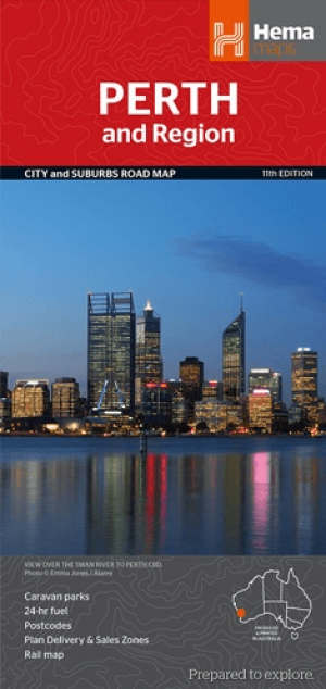
Stadskaart plattegrond Perth & omgeving - Hema Maps • 9781925195163
Stadskaart Perth & omgeving - Hema Productomschrijving: Perth CBD, City & Suburbs Map A map that has the Perth suburbs (1:80,000) and Perth city (1:15,000) maps on one side and the Perth region (1:750,000) and Fremantle (1:20,000) maps on the other. Included is a rail network map of Perth as well as points of interest and accommodation for both Fremantle and Perth. Perth is one of …

Landkaart Wegenkaart Western Australia state handy map - Hema • 9321438001560
Wegenkaart Western Australia state handy map - Hema Productomschrijving: A compact map of Western Australia (WA) for touring throughout the state with a distance grid and index for planning and reference. Marked on the mapping are highways, major and minor roads, camping and rest areas, 24-hour fuel, information centres, picnic areas, caravan parks and lookouts.

Landkaart Wegenkaart West Australia Planning map - Lonely Planet • 9781788688994
Wegenkaart Western Australia Planning map - Lonely Planet Productomschrijving: With this easy-to-use, full-colour map in your back pocket, you can truly get to the heart of Western Australia - so begin your journey now! - Durable and waterproof - Easy-fold format and convenient size Handy slipcase - Full colour and easy to use Before-you-go info - Beautiful imagery Tailored itin…
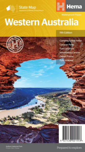
Landkaart Wegenkaart West-Australië state map - Hema Maps • 9321438001553
Wegenkaart West-Australië state map - Hema Productomschrijving: A map of Western Australia (WA) for touring throughout the state that has camping and rest areas, 24-hour fuel and points of interest marked on the mapping. On the reverse are CBD and through road maps of Perth in addition to inset maps of Leeuwin-Naturaliste National Park, Cape Range National Park, Nambung National Park, …