

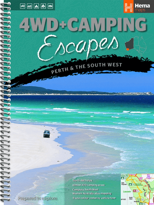
Kampinggids Perth & The South West 4WD + Camping escapes - Hema
Camping Escapes – Perth & the South West
Korte omschrijving
Wegenatlas Kampinggids Perth & The South West Productomschrijving: 4WD + Camping Escapes – Perth & the South West is a guide to the best four-wheel driving and camping locations in South We...

Specificaties
- Uitgever: Hema Maps
- ISBN-13: 9781865006215
- HOOFDCATEGORIEËN: Kampeergids
- Activiteiten: Toerisme
- Regio: Perth, South-west Autralia, Western Australia
- Land: Australië
- Schaal: 1:700000
- Editie: 1
- Taal: Engels
Volledige omschrijving
Wegenatlas Kampinggids Perth & The South West
Productomschrijving: 4WD + Camping Escapes – Perth & the South West is a guide to the best four-wheel driving and camping locations in South West Western Australia. Each regional section outlines the area’s 4WD Tracks and Featured Camping Areas, with a Camping Directory at the end to provide comprehensive coverage of other camping areas.
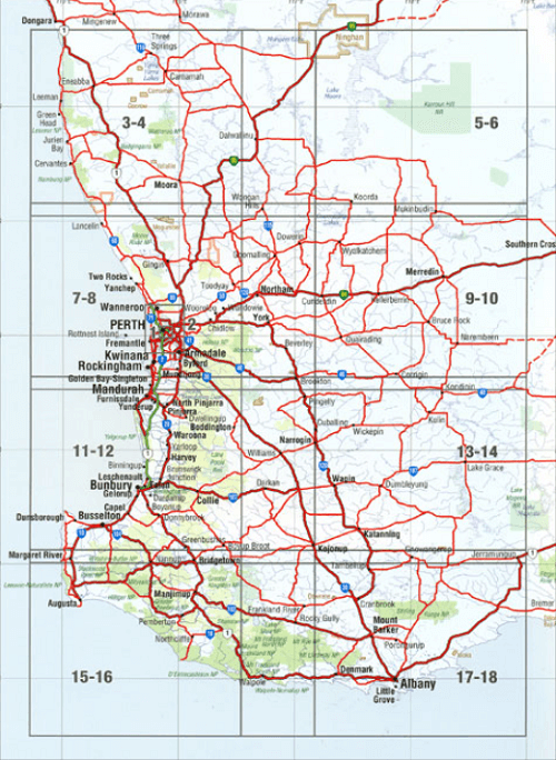
The complete atlas contains Hema’s new South West Western Australia map, featuring 24hr fuel, information centres, rest areas and points of interest.
The guide features 15 4WD tracks, each with its own detailed inset map showing the route taken. The range of trips includes some suitable for first-timers as well as others for the more experienced looking for something new to tackle. All of the tracks are colour-coded to make it simple to find the tracks that suit your type of vehicle and handy symbols show towing suitability too.
The featured camping area descriptions help you find a site to suit your requirements, whether you want a 2WD-accessible spot with toilets and a shower that’s suitable for your caravan, or a 4WD-only bush camp with no facilities but where your pet is allowed.The book is written by Michael and Jane Pelusey, who are both keen outdoor enthusiasts and experienced travel writers. There’s also plenty of essential pre-trip reading on terrain, permits, environmental issues, fishing and bushwalking.
What's included in this guide:
Introduction:
Using this book: Vehicle capability, Terrain, National parks permits & fees, Environmental issues, Fishing & Bushwalking.
CHAPTER 1: Experience Perth
Touring Highlights
City parks
Perth Hills
Fremantle
Swan River
The coast
Rottnest Island
Tourist Drives
Adevnture Directory
4WD Tracks
1. Lancelin Off Road Vehicle Area
2. Lane Poole Reserve
3. Mundaring
4. Avondale
5. Footsteps of a bush ranger
6. Beach and bush
Featured Camping Areas
1. Avon Valley National Park
2. Beelu National Park
3. Dryandra Woodland
4. Lane Poole Reserve
Camping Directory, Camping areas 5 to 130
CHAPTER 2: South West Corner
Touring Highlights
Bunbury
Ferguson Valley
Collie
Balingup Nannup Bridgetown Drive
Busselton
Dunsborough
Yallingup
Margret River
Augusta
Pemberton
Northcliffe
Walpoole
Mount Frankland National Park
Tourist Drives
Adventure Directory
4WD Tracks
7. Collie River
8. Cape Naturalise
9. Boranup Forest
10. Lake Jasper
11. West Cliff Point
12. Warren River
Featured Camping Areas
131. Blackwood River National Park
132. D'Entrecasteaux National Park
133. Leeuwin-Natraliste National Park
134. Leschenault Peninsula Conversation Park
135. Shannon National Park
136. Warren National Park
137. Wellington National Park
138. Yalgorup National Park
Camping Directory, Camping areas 139 to 212
CHAPTER 3: Great Southern
Touring highlights
Denmark
Albany region
Mount Barker
Porongurup National Park
Tourist Drives
Adventure Directory
4WD Tracks
13. Cheyne Beach
14. West Cape Howe
15. Parry Beach
Featured Camping Areas
213. Stirling Range National Park
214. Waychinicup National Park
215. West Cape Howe National Park
Camping Directory, Camping areas 216 to 247

Artikelen uit dezelfde regio
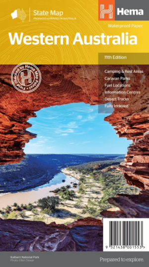
Landkaart Wegenkaart West-Australië state map - Hema Maps • 9321438001553
Wegenkaart West-Australië state map - Hema Productomschrijving: A map of Western Australia (WA) for touring throughout the state that has camping and rest areas, 24-hour fuel and points of interest marked on the mapping. On the reverse are CBD and through road maps of Perth in addition to inset maps of Leeuwin-Naturaliste National Park, Cape Range National Park, Nambung National Park, …
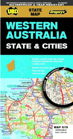

Landkaart Wegenkaart 619 Western Australia State & Cities - UBD • 9780731933198
Wegenkaart Western Australia State & Cities - Gregory's Productomschrijving: The latest edition of the Western Australia State and Cities map has been fully revised and updated. It includes a comprehensive state map with an index to the towns and localities at a scale of 1: 2.900.000 plus more detailed coverage of South West Western Australia at a scale of 1 : 1.870.000 on one side. …
Landkaart Wegenkaart Australië West - Reise Know How • 9783831774739
Wegenkaart West Australië - Reise Know How Productomschrijving: Reis Know-How-kaarten (wereldkaart-projectreeks) zijn gemakkelijk te lezen, waterdichte en zeer duurzame reiskaarten die speciaal zijn ontworpen voor dagelijks gebruik op de weg. Omvat: The Northern Territories, Western Australia & Southern Australia. Onze kaarten combineren state-of-the-art, GPS-compatibele cartograf…
Reisgids Western Australia - Bradt guides • 9781784777531
Western Australia - Bradt Productomschrijving: Bradt's Western Australia is de eerste gids gericht op de lange landwegen, inspirerende nationale parken en wijngaarden van wereldklasse van Australië's grootste staat. Inwoner Scott Dareff heeft de afgelopen vijf jaar bijna alle 137 administratieve gebieden van de staat bezocht, waardoor hij een buitengewoon inzicht in en kennis van een van '…

Landkaart Australië Great Desert Tracks (West) - Hema Maps • 9781922668059
Australië Great Desert Tracks (West) - Hema Productomschrijving: Great Desert Tracks Western Sheet (9th edition) - covering from beyond Derby in the north to Norseman in the south, and from Halls Creek in the east to Marble Bar in the west, the Great Desert Tracks Western Sheet is essential for anyone travelling to this remote part of the Australian outback. Hema's Great Desert Tracks …