

Landkaart Wegenkaart Explorer Map Nullarbor Plain - Western Map
from Kalgoorlie to Border Village and its surrounds


Korte omschrijving
Explorer Map Nullarbor Plain Western Map - Hema Productomschrijving: This map is part of Hema's new Nullarbor Plain Map Series and covers the area from Kalgoorlie to Border Village and its ...

Specificaties
- Uitgever: Hema Maps
- ISBN-13: 9781925625981
- HOOFDCATEGORIEËN: Wegenkaart - Landkaart
- Activiteiten: Street/Road maps & city plans
- Regio: Western Australia
- Land: Australië
- Schaal: 1:550000
- Editie: 1
- Taal: Engels
- Reeks/Serie: Explorer Map reeks, Hema maps, Nullarbor Plain Region, Australia
Volledige omschrijving
Explorer Map Nullarbor Plain Western Map - Hema
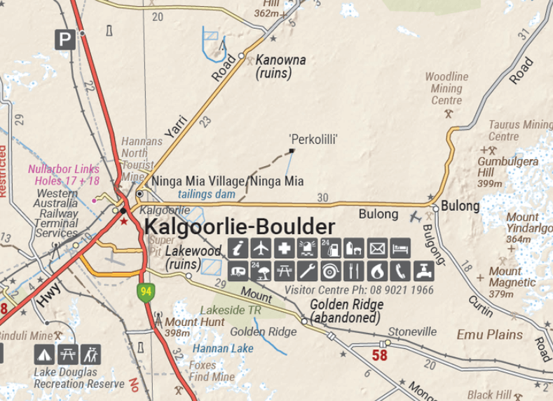
Productomschrijving: This map is part of Hema's new Nullarbor Plain Map Series and covers the area from Kalgoorlie to Border Village and its surrounds.
Truly one of the worlds great adventure drives, Australia's semi-arid Nullarbor Plain stretches some 1,256 kilometres (781 miles) via the Eyre Highway and links the cities of Adelaide and Perth (or vice versa depending on your direction). The length of this journey is so large we needed to stretch it over two maps; East from Port Pirie to Border Village in South Australia and the Western sheet from Border Village to Kalgoorlie.
While all the key sites and facilities along the Eyre Highway are listed this map allows you to broaden your horizon and consider some of the other attractions off the Highway, including; the various Nullarbor caves, iconic beaches across the Great Australian Bight and thousands of kilometres of 4WD tracks (including Old Coach Road (by permit)), all field-checked by the Hema Map Patrol for superior accuracy.
This map combines Hema’s entire database of roads and 4WD tracks with touring points of interest and topographic information. Also included are camping & rest areas, fuel locations, accommodation, distances and history of the region.
Key Features:
• 4WD tracks (including Googs Track)
• Camping & rest areas
• Fuel Locations
• Road distances
• Accommodation
• Caves and Beaches
• History of the area
Gekoppelde artikelen

Landkaart Wegenkaart Explorer Map Nullarbor Plain - Eastern Map • 9781925625998
standaard versieExplorer Map Nullarbor Plain - Eastern Map - Hema Productomschrijving: This map is part of Hema's new Nullarbor Plain Map Series (East and West) and covers Border Village to Port Pirie including the Eyre Peninsula. Truly one of the worlds great adventure drives, Australia's semi-arid Nullarbor Plain stretches some 1,256 kilometres (781 miles) via the Eyre Highway and links the cities …
Artikelen uit dezelfde regio
Landkaart Wegnkaart Kimberley Iconic Map, Gibb River road - Hema • 9781876413705
Wegnkaart Kimberley Iconic Map, The Gibb River road Productomschrijving: Een 660 km lange prachtige avontuurlijke route genaamd, The Kimberley Gibb River road. Engelse omschrijving: A regional map of the Kimberley that features the iconic Gibb River Road. On the reverse are inset maps for Purnululu National Park, the Dampier Peninsula and the Parry Creek area. There is also extensive …

Landkaart Wegenkaart 619 Western Australia State & Cities - UBD • 9780731933198
Wegenkaart Western Australia State & Cities - Gregory's Productomschrijving: The latest edition of the Western Australia State and Cities map has been fully revised and updated. It includes a comprehensive state map with an index to the towns and localities at a scale of 1: 2.900.000 plus more detailed coverage of South West Western Australia at a scale of 1 : 1.870.000 on one side. …
Landkaart Wegenkaart West-Australië state map - Hema Maps • 9321438001553
Wegenkaart West-Australië state map - Hema Productomschrijving: A map of Western Australia (WA) for touring throughout the state that has camping and rest areas, 24-hour fuel and points of interest marked on the mapping. On the reverse are CBD and through road maps of Perth in addition to inset maps of Leeuwin-Naturaliste National Park, Cape Range National Park, Nambung National Park, …
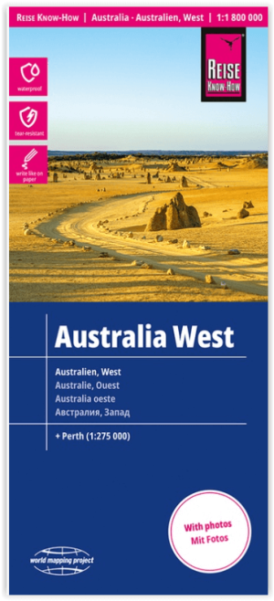
Landkaart Wegenkaart Australië West - Reise Know How • 9783831774739
Wegenkaart West Australië - Reise Know How Productomschrijving: Reis Know-How-kaarten (wereldkaart-projectreeks) zijn gemakkelijk te lezen, waterdichte en zeer duurzame reiskaarten die speciaal zijn ontworpen voor dagelijks gebruik op de weg. Omvat: The Northern Territories, Western Australia & Southern Australia. Onze kaarten combineren state-of-the-art, GPS-compatibele cartograf…

Wegenatlas The Kimberley atlas & guide - Hema Maps • 9781876413644
The Kimberley atlas & guide - Hema Productomschrijving: TOP 10 4WD Trips explored by RON And VIV MOON. This brand new edition of Hema’s best-selling outdoor guidebook for discovering the Kimberley now features 20 atlas pages in a stunning new cartographic style. The book features 10 4WD trips, explored and revised by well-known travel writers Ron and Viv Moon. This edition also no…