

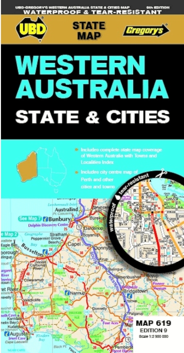
Landkaart Wegenkaart 619 Western Australia State & Cities - UBD
Mandurah- Busselton- Carnarvon- Broome- Albany- Geraldton
Korte omschrijving
Wegenkaart Western Australia State & Cities - Gregory's Productomschrijving: The latest edition of the Western Australia State and Cities map has been fully revised and updated. It incl...

Specificaties
- Uitgever: UBD Gregory's Universal Publishers
- ISBN-13: 9780731933198
- HOOFDCATEGORIEËN: Wegenkaart - Landkaart
- Activiteiten: Street/Road maps & city plans
- Regio: West Australië, Western Australia
- Land: Australië
- Schaal: 1:2900000
- Editie: 9
- Taal: Engels
- De Australische Regio's: Western Australia

Volledige omschrijving
Wegenkaart Western Australia State & Cities - Gregory's
Productomschrijving: The latest edition of the Western Australia State and Cities map has been fully revised and updated.
It includes a comprehensive state map with an index to the towns and localities at a scale of 1: 2.900.000 plus more detailed coverage of South West Western Australia at a scale of 1 : 1.870.000 on one side.
On the other side there are street level maps for Perth city at a scale of 1:5.000, a Fremantle map at a scale of 1:15.000, and town maps for Mandurah, Busselton, Carnarvon, Broome, Albany, Geraldton, Esperance, Bunbury and Kalgoorlie–Boulder at a scale of 1 : 25 000.
There is also touring information included for the state.
With all this information contained in this handy fold out map it is an essential tool to keep by your side when travelling Western Australia.
Artikelen uit dezelfde regio

Reisgids Australië - een reis door Zuid en West - Edicola • 9789492920997
Reisgids Australië - een reis door Zuid en West - Edicola Productomschrijving: Na het succes van Australië - Een rondreis door het zuiden van Lisanna Weston heeft zij nu samen met Sanne de Groot een tweede reisgids geschreven: Een reis door Zuid- en West. Lisanna Weston, succesvol reisorganisatie-onderneemster in Australië en Sanne de Groot, onderdeel van Dutchies Travel en veelvoudig Aust…
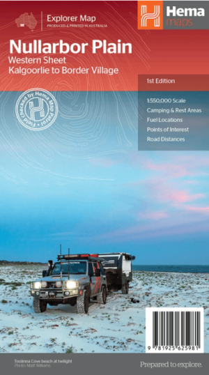
Landkaart Wegenkaart Explorer Map Nullarbor Plain - Western Map • 9781925625981
Explorer Map Nullarbor Plain Western Map - Hema Productomschrijving: This map is part of Hema's new Nullarbor Plain Map Series and covers the area from Kalgoorlie to Border Village and its surrounds. Truly one of the worlds great adventure drives, Australia's semi-arid Nullarbor Plain stretches some 1,256 kilometres (781 miles) via the Eyre Highway and links the cities of Adelaide and…

Wegenatlas The Kimberley atlas & guide - Hema Maps • 9781876413644
The Kimberley atlas & guide - Hema Productomschrijving: TOP 10 4WD Trips explored by RON And VIV MOON. This brand new edition of Hema’s best-selling outdoor guidebook for discovering the Kimberley now features 20 atlas pages in a stunning new cartographic style. The book features 10 4WD trips, explored and revised by well-known travel writers Ron and Viv Moon. This edition also no…
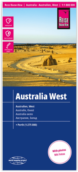
Landkaart Wegenkaart Australië West - Reise Know How • 9783831774739
Wegenkaart West Australië - Reise Know How Productomschrijving: Reis Know-How-kaarten (wereldkaart-projectreeks) zijn gemakkelijk te lezen, waterdichte en zeer duurzame reiskaarten die speciaal zijn ontworpen voor dagelijks gebruik op de weg. Omvat: The Northern Territories, Western Australia & Southern Australia. Onze kaarten combineren state-of-the-art, GPS-compatibele cartograf…

Kampinggids Perth & The South West 4WD + Camping escapes - Hema • 9781865006215
Wegenatlas Kampinggids Perth & The South West Productomschrijving: 4WD + Camping Escapes – Perth & the South West is a guide to the best four-wheel driving and camping locations in South West Western Australia. Each regional section outlines the area’s 4WD Tracks and Featured Camping Areas, with a Camping Directory at the end to provide comprehensive coverage of other camping areas. T…