

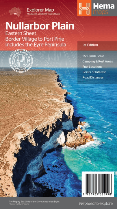
Landkaart Wegenkaart Explorer Map Nullarbor Plain - Eastern Map
Border Village to Port Pirie, including the Eyre Peninsula
Korte omschrijving
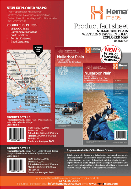
Explorer Map Nullarbor Plain - Eastern Map - Hema Productomschrijving: This map is part of Hema's new Nullarbor Plain Map Series (East and West) and covers Border Village to Port Pirie incl...

Specificaties
- Uitgever: Hema Maps
- ISBN-13: 9781925625998
- HOOFDCATEGORIEËN: Wegenkaart - Landkaart
- Activiteiten: Street/Road maps & city plans
- Regio: South Australia, Zuid Australië
- Land: Australië
- Schaal: 1:550000
- Editie: 1
- Taal: Engels
- Reeks/Serie: Explorer Map reeks, Hema maps, Nullarbor Plain Region, Australia
Volledige omschrijving
Explorer Map Nullarbor Plain - Eastern Map - Hema
Productomschrijving: This map is part of Hema's new Nullarbor Plain Map Series (East and West) and covers Border Village to Port Pirie including the Eyre Peninsula.
Truly one of the worlds great adventure drives, Australia's semi-arid Nullarbor Plain stretches some 1,256 kilometres (781 miles) via the Eyre Highway and links the cities of Adelaide and Perth (or vice versa depending on your direction). The length of this journey is so large we needed to stretch it over two maps; East from Port Pirie to Border Village in South Australia and the Western sheet from Border Village to Kalgoorlie.
While all the key sites and facilities along the Eyre Highway are listed this map allows you to broaden your horizon and consider some of the other attractions off the Highway, including; the various Nullarbor caves, iconic beaches across the Great Australian Bight and thousands of kilometres of 4WD tracks (including Googs Track), all field-checked by the Hema Map Patrol for superior accuracy.
This map combines Hema’s entire database of roads and 4WD tracks with touring points of interest and topographic information. Also included are camping & rest areas, fuel locations, accommodation, distances and history of the region.
Key Features:
• 4WD tracks (including Googs Track)
• Camping & rest areas
• Fuel Locations
• Road distances
• Accommodation
• Caves and Beaches
• History of the area
Gekoppelde artikelen
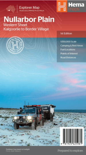
Landkaart Wegenkaart Explorer Map Nullarbor Plain - Western Map • 9781925625981
standaard versieExplorer Map Nullarbor Plain Western Map - Hema Productomschrijving: This map is part of Hema's new Nullarbor Plain Map Series and covers the area from Kalgoorlie to Border Village and its surrounds. Truly one of the worlds great adventure drives, Australia's semi-arid Nullarbor Plain stretches some 1,256 kilometres (781 miles) via the Eyre Highway and links the cities of Adelaide and…
Artikelen uit dezelfde regio

Landkaart Wegenkaart Australië Indigenous Journeys Map - Hema Map • 9781922668936
Wegenkaart Australië Indigenous Journeys Map - Hema Maps Productomschrijving: Australië Indigenous Journeys Map hema 1:5.5M Ontdek de zanglijnen van de oudste levende cultuur ter wereld Al meer dan 65.000 jaar bewandelen Aboriginals en Torres Strait Islanders - de traditionele eigenaars van Australië - het land, smeden handelsroutes, delen kennis en zorgen voor het land. De Indigenou…

Landkaart Wegenkaart South Australia state handy map - Hema • 9781865008707
Wegenkaart South Australia state handy map - Hema Productomschrijving: A map of South Australia (SA) that has camping areas, caravan parks, points of interest, rest areas and fuel marked on the map for touring throughout the state. Accompanying the mapping is an index of towns and localities and a distance chart.

Stadsplattegrond Adelaide City Streets & Suburbs - UBD Gregory's • 9780731933099
Stadskaart Adelaide City Streets & Suburbs - UBD Gregory's Productomschrijving: The latest edition of the popular Adelaide and surrounding suburbs map includes street level map coverage at a scale of 1:25 000 from Gepps Cross in the north, Blackwood in the south, Rosslyn Park in the east & West Beach in the west plus an index to suburbs. On the other side there is Adelaide suburban cov…

Landkaart Wegenkaart Zuid-Australië state map - Hema Maps • 9781865009865
Wegenkaart Zuid-Australië state map - Hema Productomschrijving: A map of South Australia (SA) for touring throughout the state that has camping and rest areas, 24-hour fuel and points of interest marked on the mapping. On the reverse are CBD, surrounding region and through road maps of Adelaide in addition to maps of Flinders Ranges National Park and the Barossa Valley. Also included are …

Reisgids Australië - een rondreis door het Zuiden - Edicola • 9789492920300
Reisgids, Australië, een rondreis door het Zuiden (9789492920300) Edicola Productomschrijving: Een letterlijke rondreis door het zuiden. Australië is groot, vergelijkbaar met Europa wat afstanden betreft. Deze subliem samengestelde reisgids, brengt u van Sydney, de hoofdstad van alles laat ons zeggen, tot Adelade richting het noorden, of omgekeerd kan uiteraard ook. Deze reisgids toont u w…