
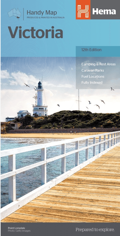
Landkaart Victoria state NSW - Hema Maps
For touring throughout the state of Victoria
Korte omschrijving
Wandelkaarten Victoria en New South Wales, Australië van Hema Maps. Ideaal voor tochten in Australië.
Wegenkaart Landkaart Victoria state - Hema Productomschrijving: A compact map of Victoria for touring throughout the state with a distance grid and index for planning and reference. Marked o...

Specificaties
- Uitgever: Hema Maps
- ISBN-13: 9781865009773
- HOOFDCATEGORIEËN: Wegenkaart - Landkaart
- Activiteiten: Street/Road maps & city plans, Toerisme
- Regio: New South Wales, Australië, Victoria
- Land: Australië
- Schaal: 1:850000
- Editie: 12
- Taal: Engels
- De Australische Regio's: New South Wales, Victoria
Volledige omschrijving
Wegenkaart Landkaart Victoria state - Hema
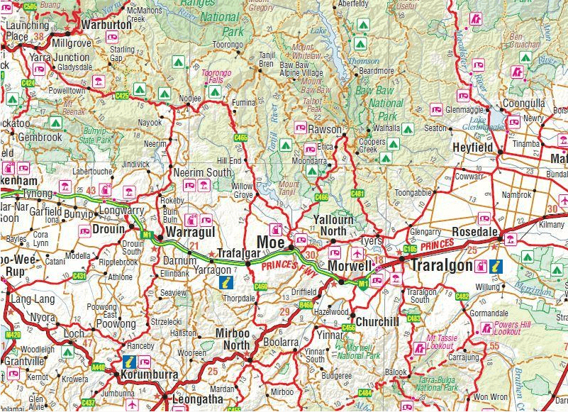
Productomschrijving: A compact map of Victoria for touring throughout the state with a distance grid and index for planning and reference. Marked on the mapping are highways, major and minor roads, points of interest, information centres, picnic areas, caravan parks and lookouts. Great for using in the car, Hema's Victoria Handy Map clearly shows highways, minor and secondary roads, national and state routes and fully-indexed cities, towns and localities. Detailed road distances are also shown.
The map splits the state in two, with half on one side of the map and half on the other. This results in a much smaller piece of paper which is far easier to manage in your car.
The map features:
Camping Areas
Rest Areas
24 Hour Fuel
Outback Fuel
Caravan Parks
National Parks
Fully Indexed
Points of Interest
Distance Grid
All of the state handy maps are double-sided and come in an easy-to-fold format.
Artikelen uit dezelfde regio

Landkaart Wegenkaart New South Wales state map - Hema Maps • 9781925625615
Wegenkaart New South Wales state map - Hema Productomschrijving: A state map of New South Wales (NSW) at a scale of 1:1,500,000. Marked on the map are national parks, points of interest, 24-hour fuel in addition to camping and rest areas. On the reverse side are CBD maps of Sydney and Canberra, as well as a Sydney regional map, a Sydney throughroads map, and maps of Blue Mountains Na…

Landkaart Wegenkaart 295 Port Stephens NSW - UBD Gregory's • 9780731931910
Wegenkaart Port Stephens New South Wales Productomschrijving: The latest edition of the Port Stephens touring map has been fully revised and updated and features: A regional touring map covering Port Stephens, Hawks Nest/Tea Gardens, Karuah, Lemon Tree Passage and Raymond Terrace. Maps and street index of Nelson Bay and surrounding suburbs. Maps of Hawks Nest/Tea Gardens, Karuah, Raym…

Landkaart Wegenkaart 382 Ballarat Grampians & Spa Country - UBD • 9780731932979
Wegenkaart Ballarat Grampians & Spa Country - Gregory's Productomschrijving: The latest edition of the Ballarat Grampians Spa Country Map has been fully revised and updated. Covers: Harcourt & Campbells Bridge in the north, Cressy in the south, Romsey in the east and Wartook and Dunkeld in the west. - A street level map and street index for Ballarat; - Street level maps of Arara…
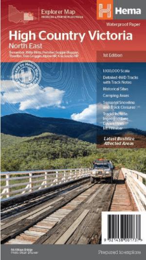
Landkaart Wegenkaart Victoria High Country Noordoost - Hema • 9321438001737
Wegenkaart Victoria High Country Noordoost - Hema Productomschrijving: This map is part of Hema's new Victorian High Country Map Series and covers the Northern Borderlands Area from Omeo to Jindabyne. Printed on durable waterproof paper, this map features Hema's iconic mapping and extensive points of interest. Featuring roads and 4WD tracks field-checked by the Hema Map Patrol for superio…
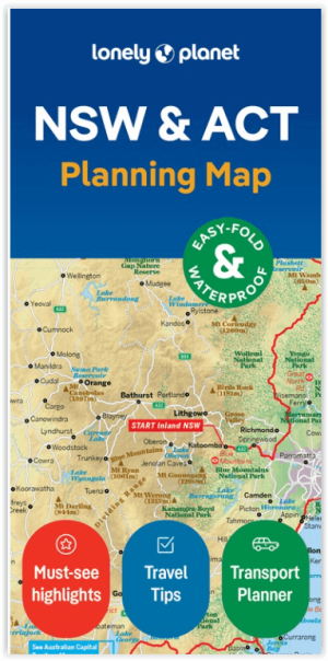
Wegenkaart Planning map New South Wales Australia - Lonely Planet • 9781788688482
Planning map New South Wales Australia - Lonely Planet Productomschrijving: From Lonely Planet: The world's number one travel guide publisher* Durable and waterproof, with a handy slipcase and an easy-fold format, Lonely Planet's New South Wales & the Australian Capital Territory Planning Map helps you explore with ease. Get more from your map and your trip with images and information…