

Landkaart Wegenkaart 289 Central Coast Suburban Streets - Gregory
Doyalson- Patonga- Budgewoi Peninsula- Box Head- Kariong

Korte omschrijving
Wegenkaart Central Coast Suburban Streets - Gregory's Productomschrijving: This conveniently sized fold out map features detailed street directory mapping of the Central Coast at a scale of...

Specificaties
- Uitgever: UBD Gregory's Universal Publishers
- ISBN-13: 9780731933334
- HOOFDCATEGORIEËN: Wegenkaart - Landkaart
- Activiteiten: Street/Road maps & city plans
- Regio: New South Wales, Australië
- Land: Australië
- Schaal: 1:25000
- Editie: 16
- Taal: Engels
- De Australische Regio's: New South Wales
Volledige omschrijving
Wegenkaart Central Coast Suburban Streets - Gregory's
Productomschrijving: This conveniently sized fold out map features detailed street directory mapping of the Central Coast at a scale of 1:25 000 with coverage from Doyalson in the north, Patonga in the south, along the coast from Budgewoi Peninsula to Box Head and Kariong in the west. Also included are a street index and index for suburbs and localities.
This is New South Wales!
Artikelen uit dezelfde regio
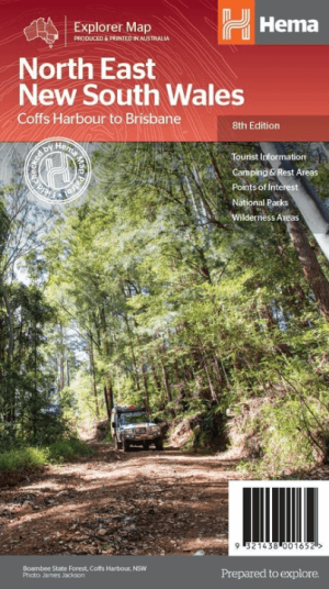
Landkaart Wegenkaart North East New South Wales - Hema Maps • 9321438001652
Wegenkaart North East, New South Wales - Hema Productomschrijving: A regional map of North East New South Wales (1:375,000) that is the perfect companion for touring through North East New South Wales (NSW). The map features information on the major touring routes through the region including the Summerland Way, Bruxner Highway, Waterfall Way and Gwydir Highway, as well as major tourist a…

Landkaart Wegenkaart 295 Port Stephens NSW - UBD Gregory's • 9780731931910
Wegenkaart Port Stephens New South Wales Productomschrijving: The latest edition of the Port Stephens touring map has been fully revised and updated and features: A regional touring map covering Port Stephens, Hawks Nest/Tea Gardens, Karuah, Lemon Tree Passage and Raymond Terrace. Maps and street index of Nelson Bay and surrounding suburbs. Maps of Hawks Nest/Tea Gardens, Karuah, Raym…
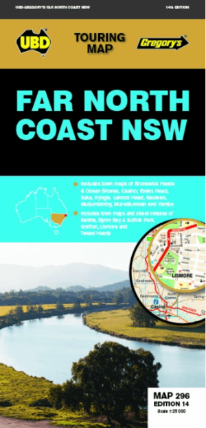
Landkaart Wegenkaart 296 Far North Coast NSW - UBD Gregory's • 9780731931996
Wegenkaart Far North Coast NSW - UBD Gregory's Productomschrijving: The latest edition of the Far North Coast NSW has been fully revised and updated and includes: Regional touring mapping covering Tweed Heads in the north, Woolgoolga in the south, Byron Bay in the east and Sandy Hill in the west. Maps and street index of Ballina, Byron Bay, Grafton, Lismore and Tweed Heads city centre…
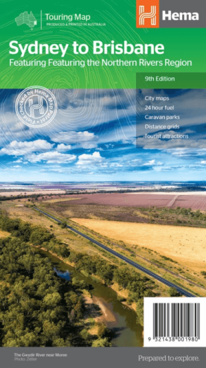
Landkaart Wegenkaart Sydney tot Brisbane - Hema Maps • 9321438001980
Wegenkaart Sydney tot Brisbane - Hema Productomschrijving: A city to city map designed for the journey from Sydney to Brisbane via the Pacific and New England Highways (1:1,000,000), with tourist information on towns and regions within the trip on the opposite side. Omvat: The Northern Rivers Region! • City maps • 24-hour fuel • Camping areas • Distance grids • Tourist att…

Landkaart Wegenkaart 299 Wollongong Suburban Streets NSW - UBD • 9780731932054
Wegenkaart Wollongong Suburban Streets NSW - UBD Productomschrijving: Street level mapping and street index at a scale of 1 : 25 000 from Helensburgh in the north to Dunmore in the south. Coverage included for Berry & Nowra, North Nowra & Bomaderry - Index to suburbs & localities - Overview map of Wollongong to Nowra at a scale of 1 : 685 700