

Landkaart Wegenkaart North East New South Wales - Hema Maps
Coffs Harbour to Brisbane


Korte omschrijving
Wegenkaart North East, New South Wales - Hema Productomschrijving: A regional map of North East New South Wales (1:375,000) that is the perfect companion for touring through North East New ...

Specificaties
- Uitgever: Hema Maps
- ISBN-13: 9321438001652
- HOOFDCATEGORIEËN: Wegenkaart - Landkaart
- Activiteiten: Street/Road maps & city plans
- Regio: New South Wales, Australië
- Land: Australië
- Schaal: 1:375000
- Editie: 8
- Taal: Engels
- De Australische Regio's: New South Wales
Volledige omschrijving
Wegenkaart North East, New South Wales - Hema
Productomschrijving: A regional map of North East New South Wales (1:375,000) that is the perfect companion for touring through North East New South Wales (NSW). The map features information on the major touring routes through the region including the Summerland Way, Bruxner Highway, Waterfall Way and Gwydir Highway, as well as major tourist attractions along both the Pacific Highway and the New England Highway. Also included are listed national parks within the region, contact information and events.
Omvat: Summerland Way, Bruxner Highway, Waterfall Way & Gwydir Highway.

Artikelen uit dezelfde regio

Landkaart Wegenkaart New South Wales handy map - Hema • 9781925625608
Wegenkaart New South Wales handy map - Hema Productomschrijving: A fully indexed state map of New South Wales (NSW) at a scale of 1:1,400,000. Marked on the map are national parks, camping areas, caravan parks, rest areas, points of interest and 24-hour fuel accompanied by a distance grid.
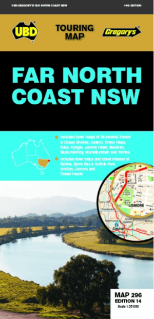
Landkaart Wegenkaart 296 Far North Coast NSW - UBD Gregory's • 9780731931996
Wegenkaart Far North Coast NSW - UBD Gregory's Productomschrijving: The latest edition of the Far North Coast NSW has been fully revised and updated and includes: Regional touring mapping covering Tweed Heads in the north, Woolgoolga in the south, Byron Bay in the east and Sandy Hill in the west. Maps and street index of Ballina, Byron Bay, Grafton, Lismore and Tweed Heads city centre…

Landkaart Wegenkaart 295 Port Stephens NSW - UBD Gregory's • 9780731931910
Wegenkaart Port Stephens New South Wales Productomschrijving: The latest edition of the Port Stephens touring map has been fully revised and updated and features: A regional touring map covering Port Stephens, Hawks Nest/Tea Gardens, Karuah, Lemon Tree Passage and Raymond Terrace. Maps and street index of Nelson Bay and surrounding suburbs. Maps of Hawks Nest/Tea Gardens, Karuah, Raym…

Landkaart Wegenkaart 299 Wollongong Suburban Streets NSW - UBD • 9780731932054
Wegenkaart Wollongong Suburban Streets NSW - UBD Productomschrijving: Street level mapping and street index at a scale of 1 : 25 000 from Helensburgh in the north to Dunmore in the south. Coverage included for Berry & Nowra, North Nowra & Bomaderry - Index to suburbs & localities - Overview map of Wollongong to Nowra at a scale of 1 : 685 700

Landkaart Wegenkaart 280 Newcastle Suburban Streets - UBD • 9780731931927
Wegenkaart Newcastle Suburban Streets - Gregory's Productomschrijving: The latest edition of the popular Newcastle Hunter Valley & surrounding region Map 280 features coverage at a scale of 1: 450 000 from Ardglen & North Haven in the north & Bateau Bay in the south and along the coast & Merriwa in the west plus an index to the towns noted on this map on one side. On the other side th…