
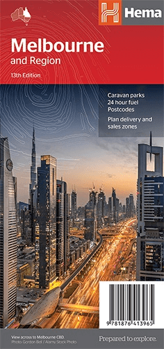
Stadskaart plattegrond Melbourne NSW & omgeving - Hema Maps
Greater Melbourne - Victoria - Yarra River - Port Phillip Bay
Korte omschrijving
Wandelkaarten New South Wales, Australië en Melbourne, Australië van Hema Maps. Ideaal voor tochten in Australië.
Stadskaart Melbourne & omgeving - Hema Productomschrijving: Melbourne CBD, City & Suburbs Map The Melbourne and Region map features a primary map of Greater Melbourne (1:115,000) that i...

Specificaties
- Uitgever: Hema Maps
- ISBN-13: 9781876413965
- HOOFDCATEGORIEËN: Stadskaart plattegrond
- Activiteiten: Street/Road maps & city plans, Toerisme
- Regio: Melbourne, Australië, New South Wales, Australië
- Land: Australië
- Schaal: 1:12500
- Editie: 13
- Taal: Engels
- De Australische Regio's: New South Wales
Volledige omschrijving
Stadskaart Melbourne & omgeving - Hema
Productomschrijving: Melbourne CBD, City & Suburbs Map
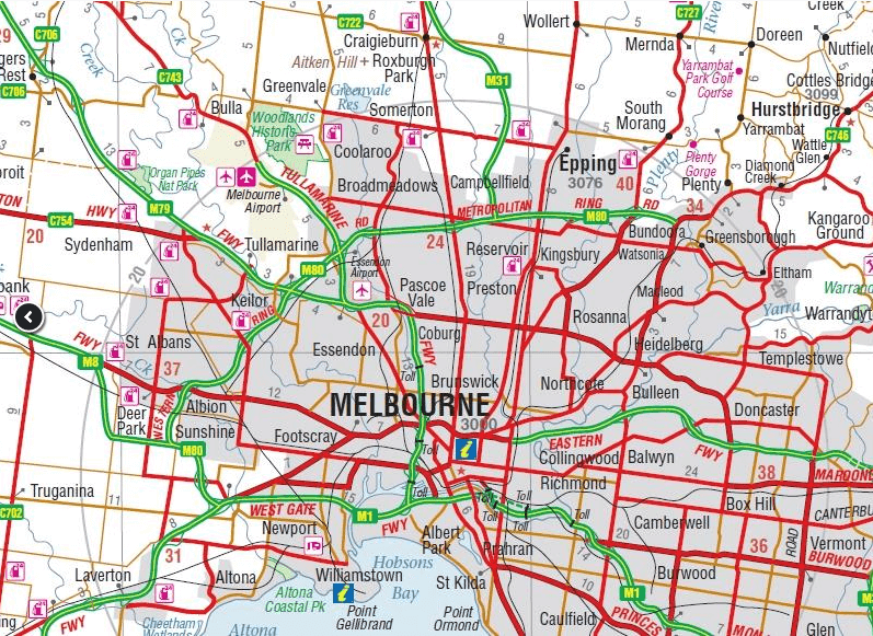
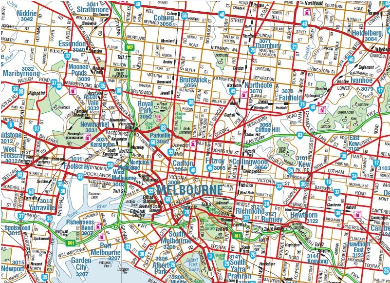
The Melbourne and Region map features a primary map of Greater Melbourne (1:115,000) that includes highways, major roads and local streets, as well as 24-hour fuel, parks and caravan parks. On the reverse is a Melbourne CBD map with accommodation, shopping and other places of interest pinpointed, along with train and tram network maps and a Melbourne Region map.
The cosmopolitan capital of Victoria, Melbourne is a city of distinct districts: each with its own particular appeal. For a different view of the city head to the observation deck at the Eureka Skydeck for 360° views. A cruise along the Yarra River provides yet another perspective. Set around Port Phillip Bay, the city can easily be explored on the many tram routes. Amid the hustle and bustle of the CBD are numerous cafes, restaurants, boutique fashion shops, theatres and galleries where visitors can easily while away the hours.
Browse through the exhibitions at the National Gallery of Victoria. Other highlights include the Melbourne Zoo and the Sea Life Melbourne Aquarium. Down at the St Kilda foreshore, talk a wander along the beach or sample some of the fish and chips.
If you are into sport, then you are in luck because major national and international sporting events are frequently held at venues including the Melbourne Cricket Ground, Etihad Stadium, Rod Laver Arena, Hisense Arena, Flemington Race Course and Visy Park. It’s also possible to tour the MCG or visit the National Sports Museum. Horse racing is another popular sport, and not just for the ‘big one’ – Melbourne Cup. The Australian Racing Museum and Hall of Fame has all you’d ever want to know about the history of racing. Take a step back in time at the Melbourne Museum, Polly Woodside and Gold Treasury Museum. The Scienceworks Museum and Planetarium is a must-visit too. Other fascinating insights into the city’s past can be gained at the Old Melbourne Gaol and Cook’s Cottage.
PRODUCT FEATURES:
• Highways, major roads and local streets
• Points of interest
• Accommodation
• Travel Information
• Parks
• Caravan Parks
• 24 Hour Fuel
• Tram lines
• Railway stations
• Suburbs
• Suburbs Index
• Shopping centres
• Theatres/Cinemas
• Sporting venues
• Tram and Train network maps
WHAT’S NEW IN THIS EDITION:
• New train and tram transit maps
• Updated POIs
• Updated road network
Artikelen uit dezelfde regio

Stadsplattegrond 362 Melbourne City Streets & Suburbs - UBD • 9780731933235
Wegenkaart Melbourne City Streets & Suburbs - UBD Productomschrijving: The latest edition of the Melbourne City streets and suburbs city map has been fully revised and updated. It includes Melbourne suburban coverage north to Sunbury, east to Healesville, south to Flinders and west to Melton plus suburban coverage for Geelong and the Bellarine Peninsula, Phillip Island plus a suburbs …

Landkaart Wegenkaart Explorer Map Mid North Coast, NSW - Hema • 9781922668226
Explorer Map Mid North Coast, New South Wales - Hema Productomschrijving: A regional map of the Mid North Coast of New South Wales (1:350,000) that ranges from Northern Newcastle, west to Mudgee, as far as Gunnedah in the North and East to Port Macquarie. Covers: Gunnedah, Tamworth, Mudgee, Port Macquarie, Maitland, Kempsey, Taree, and Forster. Also includes the following National Pa…

Landkaart Wegenkaart New South Wales handy map - Hema • 9781925625608
Wegenkaart New South Wales handy map - Hema Productomschrijving: A fully indexed state map of New South Wales (NSW) at a scale of 1:1,400,000. Marked on the map are national parks, camping areas, caravan parks, rest areas, points of interest and 24-hour fuel accompanied by a distance grid.
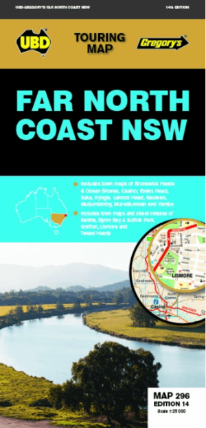
Landkaart Wegenkaart 296 Far North Coast NSW - UBD Gregory's • 9780731931996
Wegenkaart Far North Coast NSW - UBD Gregory's Productomschrijving: The latest edition of the Far North Coast NSW has been fully revised and updated and includes: Regional touring mapping covering Tweed Heads in the north, Woolgoolga in the south, Byron Bay in the east and Sandy Hill in the west. Maps and street index of Ballina, Byron Bay, Grafton, Lismore and Tweed Heads city centre…

Stadskaart Melbourne City map - Lonely Planet • 9781787017153
Melbourne City map - Lonely Planet Productomschrijving: Durable and waterproof, with a handy slipcase andan easy-fold format, Lonely Planet Melbourne City Map is your conveniently-sized passport to traveling with ease. Get more from your map and your trip with images and information about top city attractions, walking tour routes, transport maps, itinerary suggestions, extensive street an…