

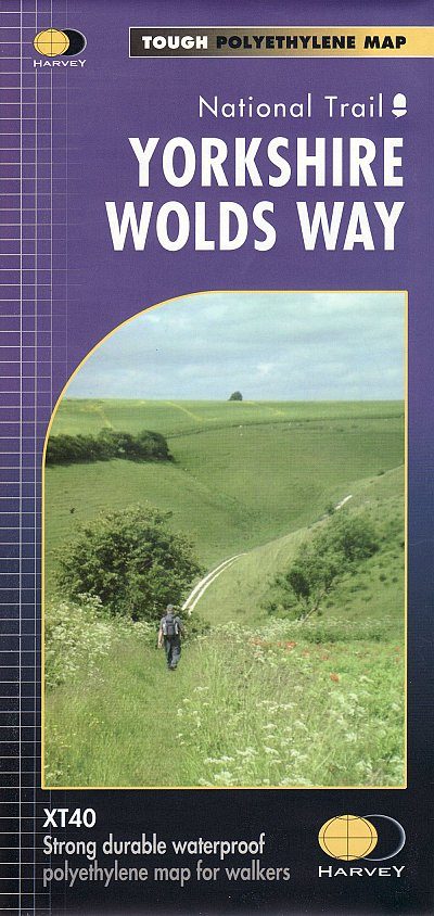
Wandelkaart XT40 Yorkshire Wolds Way Yorkshire - Harvey Maps
De route loopt voor 127 km- van Hessle naar Filey in Yorkshire
Korte omschrijving
Wandelkaarten Yorkshire, England van HARVEY MAPS. Ideaal voor tochten in England.
Wandelkaart XT40 - Yorkshire Wolds Way Yorkshire - Harvey Maps Productomschrijving: De Yorkshire Wolds Way, (127km) is een National Trail in Yorkshire, Engeland. De route loopt van Hessle na...

Specificaties
- Uitgever: HARVEY MAPS
- ISBN-13: 9781851375929
- HOOFDCATEGORIEËN: Wandelkaart
- Activiteiten: Wandelen, Hiking & Trekking
- Regio: Yorkshire, England
- Land: England
- Lange afstand wandelroutes: Yorkshire Wolds Way (127 km)
- Schaal: 1:40000
- Taal: Engels
- Reeks/Serie: National Trails, UK
- De Engelse Graafschappen: Yorkshire
Volledige omschrijving
Wandelkaart XT40 - Yorkshire Wolds Way Yorkshire - Harvey Maps
Productomschrijving: De Yorkshire Wolds Way, (127km) is een National Trail in Yorkshire, Engeland. De route loopt van Hessle naar Filey, rond de Yorkshire Wolds. Bij Filey Brigg verbindt hij met de Cleveland Way, een ander National Trail. In 2007 vierde de Yorkshire Wolds Way de 25ste verjaardag van de officiële opening die plaatsvond op 2 oktober 1982.
Gehele route op één kaart
De Yorkshire Wolds Way is een wandelroute van 127 km (79 mijl) in het krijtlandschap van de Yorkshire Wolds.
De National Trail loopt door enkele van de meest rustige platteland in Engeland. Van de dramatische landtong van Filey Brigg tot het machtige Humber-estuarium loopt de wandeling langs beboste hellingen en door serene, droge valleien, en klimt voorzichtig op de luchtige toppen van de glooiende heuvels waar je op een heldere dag voor altijd kunt zien.
De kaart is sterk, licht, duurzaam en 100% waterbestendig
Inclusief opengestelde wegen
Wegen duidelijk aangegeven
Locatie op kaart
Artikelen uit dezelfde regio

Wandelgids 50 walks in West Yorkshire - AA Publi. • 9780749583798
50 walks in West Yorkshire - AA Publishing Productomschrijving: West Yorkshire, een regio die de perfecte balans biedt tussen natuur en stedelijke charme, heeft veel te bieden voor wandelaars. De gids "50 Walks in West Yorkshire" neemt je mee langs schilderachtige routes door glooiende landschappen, historische locaties en levendige steden. Wat Kun Je Verwachten? Prachtige Natuur: …

Reisgids Walking the Wharfe - Bradt travel Guides • 9781804691106
Walking the Wharfe - Bradt travel Guides Productomschrijving: In een wereld van globetrottende ontdekkingsreizigers en recordbrekende reizen - waar hij zelf ook deel van uitmaakte - besloot Johno Ellison terug te keren naar zijn roots en de hele lengte van de rivier Wharfe te lopen, de waterweg in Yorkshire waar hij opgroeide. In zijn nieuwe boek voor Bradt, Walking the Wharfe, volgt Ellis…
Wandelkaart OL21 South Pennines - OS • 9780319242605
Wandelkaart South Pennines - Ordnance Survey Productomschrijving: Parts of the Peak District National Park, South Pennines, Brontë Way, Burnley Way, Calder / Aire Link, Calderdale Way, Colne Valley Circular Walk, Dales High Way, E2 European long distance Path, Irwell Sculpture trail, Kirklees Way, Meltham Way, Millenium Way, Oldhan Way & Crompton Circuit, Pendle Way, Pennine Bridleway, Pen…

Wandelgidse The Cleveland Way - Trailblazer • 9781912716494
The Cleveland Way - Trailblazer Productomschrijving: De Cleveland Way is een "National Trail" in het prachtige wilde landschap van het North York Moors National Park. Het loopt 107,4 mijl (127,9 km) Van Helmsley bij Thirsk rond de westelijke rand van het park om de kust bij Saltburn-by-the-Sea te bereiken. Vervolgens gaat de route langs de oostelijke rand van het park zuidwaarts langs de k…
Wandelgids Yorkshire Dales - 50 walks guide - AA Publishing • 9780749583309
Yorkshire Dales - 50 walks guide - AA Publishing Productomschrijving: Wandelen is een van de favoriete vrijetijdsbestedingen van Groot-Brittannië, en deze AA gids - 50 wandelingen in de Yorkshire Dales NP bevat een verscheidenheid aan uitgestippelde wandelingen van 3 tot 12 km, voor alle niveaus. Het boek bevat alle praktische details die u nodig hebt, vergezeld van boeiende achtergrondinf…