

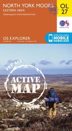
Wandelkaart OL27 North York Moors- Eastern area - OSI
Omvat het North York Moors National Park


Korte omschrijving
Wandelkaarten Yorkshire, England van Ordnance Survey. Ideaal voor tochten in England.
Wandelkaart North York Moors - Yorkshire England Omvat de: "Eastern area" Productbeschrijving: OS Explorer kaart OL27 omvat het North York Moors National Park, met inbegrip van de Clevel...

Specificaties
- Uitgever: Ordnance Survey
- ISBN-13: 9780319469453
- HOOFDCATEGORIEËN: Wandelkaart
- Activiteiten: Wandelen, Hiking & Trekking
- Regio: Yorkshire, England
- Land: England
- Waterafstotende kaart: Ordnance Survey ACTIVE Explorer Weatherproof Maps
- Nationale parken: Yorkshire Moors NP, England
- TOPO's & Stafkaarten: Topografisch wandelen
- Schaal: 1:25000
- Taal: Engels
- Reeks/Serie: Explorer ACTIVE Series OSI
- De Nationale Parken: North Yorkshire Moors National Park, England
- De Engelse Graafschappen: North Yorkshire
Volledige omschrijving
Wandelkaart North York Moors - Yorkshire England
Omvat de: "Eastern area"
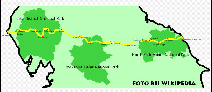
Productbeschrijving: OS Explorer kaart OL27 omvat het North York Moors National Park, met inbegrip van de Cleveland Hills en The Hambleton Hills. Ook zijn op deze kaart de Celeveland way National Trail & de Tabular Hills way, Cleveland Street, Esk Valley Walk en het noordelijke uiteinde van Ebor way beschreven. De OS Explorer kaart voor het North York Moors is beschikbaar in zowel de standaard papieren versie als de weerbestendige 'Actief' versie.
Kaart nummer OL27 is een all purpose kaart vol gepakt met informatie om u het gebied te helpen leren kennen. De kaarten bestrijken het land. Elke kaart heeft een oppervlakte van 40 km door 40 km (25 mijl door 25 mijl) en zoals andere kaarten van Ordnance Survey, National Grid-vierkanten worden verstrekt zodat elke functie een unieke referentienummer kan worden gegeven.
Productdiscription: OS Explorer sheet OL27 covers the North York Moors National Park, including the Cleveland Hills and The Hambleton Hills. Also on this map sheet are the Celeveland Way National Trail, Tabular Hills Walk, Cleveland Street, Esk Valley Walk and the northern end of Ebor Way. The OS Explorer map for North York Moors is available in both the standard paper version and weatherproof 'Active' version.
De samenstellende 9 kaarten set voor de Wainright's Coast-to-Coast Walk kunt bestellen met 10% korting op de combinatie van volgende ISBN nrs.
Omvat de kaarten: OL4, OL5, OL19, OL26, OL27, OL30, 302, 303 and 304
Graag doorgeven op service@bibliotrek.be met uw bestelling van de set, uw krijgt vervolgens de info om het bedrag over te schrijven. waarna u dan de facuur digitaal krijgt doorgemaild, en de kennisgeving van verzending die erop volgt.
Locatie op kaart
Gekoppelde artikelen
Wandelkaart OL27 North York Moors- Eastern area - OSI • 9780319469453
weatherproof versieWandelkaart North York Moors - Yorkshire England Omvat de: "Eastern area" Productbeschrijving: OS Explorer kaart OL27 omvat het North York Moors National Park, met inbegrip van de Cleveland Hills en The Hambleton Hills. Ook zijn op deze kaart de Celeveland way National Trail & de Tabular Hills way, Cleveland Street, Esk Valley Walk en het noordelijke uiteinde van Ebor way beschreven. D…
Artikelen uit dezelfde regio

Reisgids Go Slow North York Moors & Yorkshire Wolds - Bradt • 9781804690093
Reisgids North York Moors national park - Bradt Productomschrijving: Inwoner van Yorkshire, natuurliefhebber en reisschrijver Mike Bagshaw (Auteur) heeft deze nieuwe 3e van Bradt's North York Moors & Yorkshire Wolds, onderdeel van Bradt's bekroonde serie Go Slow travel gidsen over Britse regio's, grondig bijgewerkt. Het blijft de enige zelfstandige gids voor deze regio van contrasten. Wand…
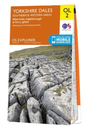
Wandelkaart OL02 Yorkshire Dales - South& Western areas - OS • 9780319263310
Wandelkaart OL2 Yorkshire Dales - South& Western areas - OS Productomschrijving: Yorkshire Dales Nationale Park - South& Western areas, Whernside, Ingleborough & Pen-y-ghent, The AONB Area's of Forest of Bowland & Nidderdale AONB. Yorkshire three peaks, The Devils Bridge at Kirkby Lonsdale, Leeds to Liverpool Canal at Skipton, The Pennine Way, Settle, and Old Town. Omvat: Whernside, I…

Wandelkaart North York Moors West XT40 - Harvey Maps • 9781851376223
Wandelkaart North York Moors West - Harvey Maps Productomschrijving: Omvat een groot gebied maar is praktisch en compact, zakformaat. Gedetailleerde kaart voor lopers en wandelaars van het westelijk gedeelte van het Nationaal Park North York Moors. Omvat: de populaire Hambleton Hills en Cleveland Hills. - Roseberry Topping, Sutton Bank en de White Horse. - De Lyke Wake Walk is aa…

Wandelkaart 298 Nidderdale AONB- Yorkshire - OSI • 9780319245507
Wandelkaart Nidderdale AONB - Yorkshire England Omvat ook: Fountains Abbey, Ripon & Pateley Bridge Productomschrijving: Kaart nummer 298 in de OS Explorer kaarten serie heeft een oppervlakte van North Yorkshire rond Nidderdale. De Nidderdale way en Ripon Rowel lopen door dit pittoreske gebied, die ook een deel van het Yorkshire Dales National Park heeft. Hoogtepunten van het gebied zij…
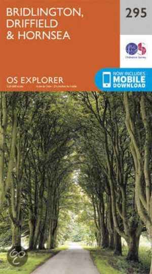
Wandelkaart 295 Bridlington- Driffield & Hornsea - OSI • 9780319245477
Wandelkaart Bridlington- Driffield & Hornsea - Yorkshire Productbeschrijving: 295 / Bridlington, Driffield & Hornsea, East Riding of Yorkshire, England - Van Hornsea langs de kust naar Bridlington en de binnenvaart tot Driffield. OS Explorer kaart 295 is de perfecte partner voor al uw outdoor avonturen. Het omvat ook delen van vier recreatieve paden: landtong way, Hornsea Rail Trail,…