

Reisgids Oxford & The Cotswolds pocket guide - Lonely Planet
Your passport to the most relevant & up-to-date advice


Korte omschrijving
Oxford & The Cotswolds pocket guide - Lonely Planet Product description: Lonely Planet's Pocket Oxford & the Cotswolds is your passport to the most relevant, up-to-date advice on what to see...

Specificaties
- Uitgever: Lonely Planet Publications
- ISBN-13: 9781787016934
- HOOFDCATEGORIEËN: Reisgids
- Activiteiten: Toerisme
- Auteur:: Catherine Le Nevez, Greg Ward
- Regio: Oxfordshire west England
- Land: England
- AONB - Area of Outstanding Beauty: Cotswolds AONB
- Editie: 1
- Taal: Engels
Volledige omschrijving
Oxford & The Cotswolds pocket guide - Lonely Planet
Product description: Lonely Planet's Pocket Oxford & the Cotswolds is your passport to the most relevant, up-to-date advice on what to see and skip, and what hidden discoveries await you. Wander the honey-toned streets of Oxford, follow in the footsteps of Betjeman and Wilde on a tour of Magdalen College and explore picture-perfect Cotswold villages - all with your trusted travel companion. Get to the heart of Oxford & the Cotswolds and begin your journey now!
Inside Lonely Planet's Pocket Oxford & the Cotswolds:
- Full-colour maps and images throughout
- Highlights and itineraries help you tailor your trip to your personal needs and interests
- Insider tips to save time and money and get around like a local, avoiding crowds and trouble spots
- Essential info at your fingertips - hours of operation, phone numbers, websites, transit tips, prices
- Honest reviews for all budgets - eating, sleeping, sightseeing, going out, shopping, hidden gems that most guidebooks miss
- Free, convenient pull-out map (included in print version)
- User-friendly layout with helpful icons, and organised by neighbourhood to help you pick the best spots to spend your time
Locatie op kaart
Overzichtskaarten

Area's of Outstanding Natural Beauty - AONB's UK
Area's of Outstanding Natural Beauty - AONB's UK

Producten op de overzichtskaart
Klik op een product om naar de detailpagina te gaan.
- Wandelgids - Guide to the Cotswolds AONB - AA
- Wandelkaart 24 - Chilterns AONB - AA
- Fietskaart- en Mtb kaart - The Cotswolds - Goldeneye
- Wandelgids - Cotswold classic walks guidebook - Goldeneye
- Wandelgids - Cotswold Classic Walks - Goldeneye
- Wandelgids - The Cotswold Way 30 classic routes - Cicerone
- Wandelgids - Kent walking guide - Cicerone
- Wandelgids - North Downs Way Nat. trail - Cicerone
- Wandelgids - Chilterns walking guide - Cicerone
- Wandelgids - Suffolk coast & Heaths walks - Cicerone
- Wandelgids - North Downs Way - Map Booklet - Cicerone
- Wandelgids - North Pennines AONB walking guide - Cicerone
- Wandelgids - Ridgeway National Trail - Cicerone
- Wandelgids - Forest of Bowland & Pendle - Cicerone
- Wandelgids - Hampshire's Test Way walking guide - Cicerone
- Wandelgids & Fietsgids - The Cotswold AONB - Cicerone
- Wandelgids - Walking on the Gower - Cicerone
- Wandelgids - North Wessex Downs - Cicerone Press
- Wandelgids - Walking on the North Wessex Downs - Cicerone
- Wandelgids - Silverdale & Arnside AONB - Cicerone
- Wandelgids - North Downs Way- 246 km - Trailblazer
- Wandelkaart OL2 - Yorkshire Dales- Southern & Western Areas - OSI
- Wandelkaart OL19 - Howgill Fells and Upper Eden Valley - OSI
- Wandelkaart OL21 - South Pennines - Yorkshire - OSI
- Wandelkaart OL31 - North Pennines- Teesdale & Weardale - OSI
- Wandelkaart OL40 - The Broads - OSI
- Wandelkaart OL41 - Forest of Bowland & Ribblesdale - OSI
- Wandelkaart OL45 - The Cotswolds AONB- Gloucestershire - OSI
- Wandelkaart 108 - Lower Tamer Valley & Plymouth- Cornwall- OSI
- Wandelkaart 115 - Exmouth & Sidmouth- Devon - OSI
- Wandelkaart 137 - Ashford- Kent downs AONB- England - OSI
- Wandelkaart 140 - Quantock Hills AONB- Somerset - OSI
- Wandelkaart 140 - Quantock Hills AONB & Bridgwater- Devon - OSI
- Wandelkaart 147 - Sevenoaks & Tonbridge- Kent - OSI
- Wandelkaart 164 - Gower AONB & Gwyr- South Wales - OSI
- Wandelkaart 164 - Gower AONB & Gwyr- Wales - OSI
- Wandelkaart 171 - Chiltern Hills West & Henley-on-Thames OSI
- Wandelkaart 171 - Chiltern Hills West AONB- Wycombe - OSI
- Wandelkaart 172 - Chiltern Hills East AONB- Wycombe - OSI
- Wandelkaart 181 - Chiltern Hills AONB North- England - OSI
- Wandelkaart 181 - Chiltern Hills North AONB- Wycombe - OSI
- Wandelkaart 190 - Malvern Hills & Bredon Hill - OSI
- Wandelkaart 190 - Malvern Hills AONB & Bredon Hill - OSI
- Wandelkaart 203 - Ludlow- Shropshire Hills AONB - OSI
- Wandelkaart 217 - Long Mynd & Wenlock Edge- Schropshire- OSI
- Wandelkaart 254 - Lleyn Peninsular East- North Wales - OSI
- Wandelkaart 261 - Boston- Lincolnshire AONB - OSI
- Wandelkaart 262 - Anglesey West- Wales AONB - OSI
- Wandelkaart 263 - Anglesey East AONB- Wales - OSI
- Wandelkaart 273 - Lincolnshire Wolds South AONB - OSI
- Wandelkaart 282 - Lincolnshire Wolds North AONB - OSI
- Wandelkaart 298 - Nidderdale AONB- Yorkshire - OSI
- Wandelkaart 298 - Nidderdale AONB North Yorkshire - OSI
- Wandelkaart 300 - Howardian Hills AONB - OSI
- Wandelkaart 300 - Howardian Hills AONB & Malton - OSI
- Wandelkaart - Mourne Mountains N. Ireland - Harvey maps
- Wandelkaart - Fietskaart Forest of Bowland - Harvey maps
- Wandelkaart XT40 - Anglesey Coastal Path N. Wales - Harvey Maps
- Wandelkaart XT40 - Pennine Way Noord - Harvey Maps
- Wandelkaart XT40 - Pennine Way Zuid - Harvey Maps
- Wandelgids Cotswold - Way Two-way trekking guide - Knife Edge
- Reisgids Oxford & the Cotswolds AONB - Edicola
- Reisgids Cotswolds England - Rough Guides
- Travelguide Oxford & The Cotswolds pocket guide - Lonely Planet
- Wandelgids - The Ridgeway National trail - Trailblazer
Artikelen uit dezelfde regio

Wandelkaart 191 Banbury- Bicester & Chipping Norton- OSI • 9780319243848
Wandelkaart Banbury- Bicester & Chipping Norton - Oxfordshire Omvat ook: Brackley Productomschrijving: Kaart nummer 191 in de OS Explorer kaarten reeks heeft betrekking op een gedeelte van de Cotswolds AONB, de Macmillan Way en Wychwood way recreative path. Hoogtepunten van het gebied zijn de steden van Banbury, Chipping Norton, Brackley Bicester, en het Oxford Canal Walk. De OS Explor…
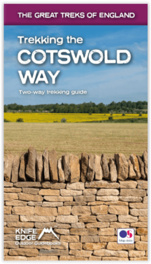
Wandelgids Cotswold - Way Two-way trekking guide - Knife Edge • 9781912933136
Cotswold - Way Two-way trekking guide - Knife Edge Productomschrijving: De Cotswold Way legt 102 mijl af door het sublieme landschap van de Cotswolds, een streek die het toonbeeld is van historisch Engeland. Onderweg gaat u over de top van de Cotswold Escarpment door een prachtig glooiend landschap en historische chocolade-doosdorpjes, gebouwd van prachtige honingkleurige stenen, die eeuwe…

Wandelkaart 171 Chiltern Hills West & Henley-on-Thames - OSI • 9780319470435
Wandelkaart Chiltern Hills West - Henley-on-Thames - Oxfordshire Omvat ook: Henley-on-Thames & Wallingford. Productbeschrijving: Kaart nummer 171 in de OS Explorer reeks omvat Henley-on-Thames, Wallingford, Purley-on-Thames, Barrow-in-Furness, Caversham. Hoogtepunten van het gebied zijn the Chilterns AONB en North Wessex Downs AONB, de Chiltern Way, Thames path, rivier de Theems en een…

Wandelkaart 170 Abingdon & Wantage - Oxfordshire - OSI • 9780319243633
Wandelkaart Abingdon & Wantage - Oxfordshire England Productbeschrijving: 170 - Kaart van Abingdon, Wantage & Vale of White Horse - Kaart nummer 170 in de OS Explorer reeks heeft betrekking op het Vale of White Horse en Uffington, North Wessex Downs AONB, het Gemeenschappelijke grote Westelijk bos en een klein deel van de Chiltern Hills AONB. Ook zijn de nederzettingen van Lechlade on…

Wandelkaart 191 Banbury Bicester & Chipping Norton- OSI • 9780319470633
Wandelkaart Banbury- Bicester & Chipping Norton England Omvat ook: Brackley. Productbeschrijving: Kaart nummer 191 in de OS Explorer kaarten reeks heeft betrekking op een gedeelte van de Cotswolds en de Macmillan Way en Wychwood way recreatieve paden. Hoogtepunten van het gebied zijn de steden van Banbury, Chipping Norton, Brackley en Bicester, en de Oxford Canal Walk. De OS Explorer k…