

Wandelgids - Hampshire's Test Way walking guide - Cicerone
Inkpen Beacon to the Eling Tide Mill near Southampton Water
Korte omschrijving
Wandelgidsen Hampshire, England en South East England van CICERONE Press. Ideaal voor tochten in United Kingdom, Great Britain en England.
Hampshire's Test Way walking guide - Cicerone Productomschrijving: Gloednieuwe wandelgids van de 71 km (44 mijl) Test Way in Hampshire van hoog op de krijtrotsen van Inkpen Beacon naar de El...

Specificaties
- Uitgever: CICERONE Press
- ISBN-13: 9781852849535
- HOOFDCATEGORIEËN: Wandelgids
- Activiteiten: Wandelen, Hiking & Trekking
- Auteur: Malcolm Leatherdale
- Regio: Hampshire, England, South East England
- Land: England, United Kingdom, Great Britain
- Lange afstand wandelroutes: Hampshire's Test Way, England (71 km)
- AONB - Area of Outstanding Beauty/National Landscape: North Wessex Downs AONB
- Schaal: 1:25000
- Editie: 1
- Taal: Engels
- De Engelse Graafschappen: Hampshire
Volledige omschrijving
Hampshire's Test Way walking guide - Cicerone
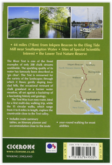
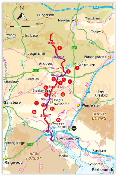
Productomschrijving: Gloednieuwe wandelgids van de 71 km (44 mijl) Test Way in Hampshire van hoog op de krijtrotsen van Inkpen Beacon naar de Eling Tide Mill bij Southampton Water. U volgt de prachtige, kristalheldere rivier de Test en komt langs pittoreske dorpjes en fascinerende historische plaatsen. Bevat ook 15 dagwandelingen om dit prachtige deel van pastoraal Engeland te verkennen.
Engelse omschrijving: Guidebook to walking the 71km (44 mile) Test Way in Hampshire from high on the chalk downs of Inkpen Beacon to the Eling Tide Mill near Southampton Water. Following the beautiful, crystal clear River Test, it passes picturesque villages and fascinating historic sites. Also includes 15 day walks to explore this lovely part of pastoral England.
Seasons:
All year
Centres:
Beginning at Inkpen Beacon, the Test Way passes close to or through St Mary Bourne, Whitchurch, Stockbridge, King's Somborne, Broughton, Mottisfont, Romsey and ends at Eling Totton.
Difficulty:
All abilities are catered for. Several of the walks and the first half of the Test Way are perhaps more of a challenge. The second half is fairly flat as are the majority of the walks. No special equipment required.
Must See:
Inkpen Beacon; Whitchurch Silk Mill; Chilbolton Common; Longstock Park Water Garden; Danebury Iron Age hill fort; Stockbridge Down; Mottisfont Abbey; Romsey Abbey, Romsey Signal Box - restored - formerly part of the dismantled 'Sprat and Winkle' railway; Broadlands House Romsey; Lower Test Nature Reserve; Eling Tide Mill Totton.
Overzichtskaarten

Area's of Outstanding Natural Beauty - AONB's UK
Area's of Outstanding Natural Beauty - AONB's UK

Producten op de overzichtskaart
Klik op een product om naar de detailpagina te gaan.
- Wandelgids - Guide to the Cotswolds AONB - AA
- Wandelkaart 24 - Chilterns AONB - AA
- Wandelgids - Cotswold classic walks guidebook - Goldeneye
- Wandelgids - Cotswold Classic Walks - Goldeneye
- Wandelgids - The Cotswold Way 30 classic routes - Cicerone
- Wandelgids - North Downs Way Nat. trail - Cicerone
- Wandelgids - Chilterns walking guide - Cicerone
- Wandelgids - Suffolk coast & Heaths walks - Cicerone
- Wandelgids - North Downs Way - Map Booklet - Cicerone
- Wandelgids - North Pennines AONB walking guide - Cicerone
- Wandelgids - Forest of Bowland & Pendle - Cicerone
- Wandelgids - Hampshire's Test Way walking guide - Cicerone
- Wandelgids & Fietsgids - The Cotswold AONB - Cicerone
- Wandelgids - North Wessex Downs - Cicerone Press
- Wandelgids - Walking on the North Wessex Downs - Cicerone
- Wandelgids - Silverdale & Arnside AONB - Cicerone
- Wandelkaart OL2 - Yorkshire Dales- Southern & Western Areas - OSI
- Wandelkaart OL19 - Howgill Fells and Upper Eden Valley - OSI
- Wandelkaart OL21 - South Pennines - Yorkshire - OSI
- Wandelkaart OL31 - North Pennines- Teesdale & Weardale - OSI
- Wandelkaart OL40 - The Broads - OSI
- Wandelkaart OL41 - Forest of Bowland & Ribblesdale - OSI
- Wandelkaart OL45 - The Cotswolds AONB- Gloucestershire - OSI
- Wandelkaart 108 - Lower Tamer Valley & Plymouth- Cornwall- OSI
- Wandelkaart 115 - Exmouth & Sidmouth- Devon - OSI
- Wandelkaart 137 - Ashford- Kent downs AONB- England - OSI
- Wandelkaart 140 - Quantock Hills AONB- Somerset - OSI
- Wandelkaart 140 - Quantock Hills AONB & Bridgwater- Devon - OSI
- Wandelkaart 147 - Sevenoaks & Tonbridge- Kent - OSI
- Wandelkaart 164 - Gower AONB & Gwyr- South Wales - OSI
- Wandelkaart 164 - Gower AONB & Gwyr- Wales - OSI
- Wandelkaart 171 - Chiltern Hills West & Henley-on-Thames OSI
- Wandelkaart 171 - Chiltern Hills West AONB- Wycombe - OSI
- Wandelkaart 172 - Chiltern Hills East AONB- Wycombe - OSI
- Wandelkaart 181 - Chiltern Hills AONB North- England - OSI
- Wandelkaart 181 - Chiltern Hills North AONB- Wycombe - OSI
- Wandelkaart 190 - Malvern Hills & Bredon Hill - OSI
- Wandelkaart 190 - Malvern Hills AONB & Bredon Hill - OSI
- Wandelkaart 203 - Ludlow- Shropshire Hills AONB - OSI
- Wandelkaart 217 - Long Mynd & Wenlock Edge- Schropshire- OSI
- Wandelkaart 254 - Lleyn Peninsular East- North Wales - OSI
- Wandelkaart 261 - Boston- Lincolnshire AONB - OSI
- Wandelkaart 262 - Anglesey West- Wales AONB - OSI
- Wandelkaart 263 - Anglesey East AONB- Wales - OSI
- Wandelkaart 273 - Lincolnshire Wolds South AONB - OSI
- Wandelkaart 282 - Lincolnshire Wolds North AONB - OSI
- Wandelkaart 298 - Nidderdale AONB- Yorkshire - OSI
- Wandelkaart 298 - Nidderdale AONB North Yorkshire - OSI
- Wandelkaart 300 - Howardian Hills AONB - OSI
- Wandelkaart 300 - Howardian Hills AONB & Malton - OSI
- Wandelkaart - Mourne Mountains N. Ireland - Harvey maps
- Wandelkaart - Fietskaart Forest of Bowland - Harvey maps
- Wandelkaart XT40 - Anglesey Coastal Path N. Wales - Harvey Maps
- Wandelkaart XT40 - Pennine Way Noord - Harvey Maps
- Wandelkaart XT40 - Pennine Way Zuid - Harvey Maps
- Wandelgids Cotswold - Way Two-way trekking guide - Knife Edge
- Reisgids Cotswolds England - Rough Guides
Artikelen uit dezelfde regio

Wandelkaart 191 Banbury Bicester & Chipping Norton- OSI • 9780319470633
Wandelkaart Banbury- Bicester & Chipping Norton England Omvat ook: Brackley. Productbeschrijving: Kaart nummer 191 in de OS Explorer kaarten reeks heeft betrekking op een gedeelte van de Cotswolds en de Macmillan Way en Wychwood way recreatieve paden. Hoogtepunten van het gebied zijn de steden van Banbury, Chipping Norton, Brackley en Bicester, en de Oxford Canal Walk. De OS Explorer k…
Wandelgids Isle of Wight walking guide - Cicerone • 9781786312563
Wandelgids Isle of Wight - Cicerone Productomschrijving: Guidebook to 33 walking routes on the beautiful Isle of Wight, from 4 to 18 miles long. The routes are suitable for all abilities and are accessible all year round. Includes a complete circuit of the island's spectacular coast as well as walks exploring forest trails and downland, and visiting the towns of Yarmouth, Cowes and Ventnor…

Wandelkaart 131 Romsey & Andover - Hampshire - OSI • 9780319243275
Wandelkaart Romsey- Andover & Test Valley - Hampshire England Omvat ook: Stockbridge & Ludgershall. Productbeschrijving: Kaart nummer 131 in de OS Explorer reeks heeft betrekking op het gebied van Oxenwood en Ashmansworth in het noorden tot Romsey en Redlynch in het zuiden. Hoogtepunten van het gebied zijn onder andere: Andover, Ludgershall, Stockbridge en de wandelingen van de Test Wa…
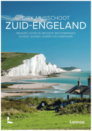
Reisgids Zuid-Engeland - Uitgeverij Lannoo • 9789059960978
Reisgids Zuid-Engeland - Lannoo Productomschrijving: Engelandkenner Dirk Musschoot laat je op een onovertroffen wijze kennismaken met de regio's Kent, East en West Sussex, Surrey, Hampshire en het eiland Wight, en de bestemmingen die je daar absoluut niet mag missen. Enkele voorbeelden: de optrekjes van Charles Darwin, Winston Churchill en Rudyard Kipling, de imposante kliffen van Beac…
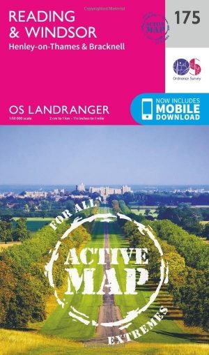
Wandelkaart 175 Reading & Windsor- S.E. England - OSI • 9780319474983
Wandelkaart Reading & Windsor - South East England Productbeschrijving: De OS Landranger kaarten reeks heeft betrekking op Groot-Brittannië met 204 gedetailleerde kaarten, perfect voor dagtochten en korte pauzes. Elke kaart bevat alle informatie die u nodig heeft om dit lokaal gebied te leren kennen en omvat plaatsen van belang, toeristische informatie, picknickplaatsen en campings, plus d…