

Wandelkaart OL45 - The Cotswolds AONB- Gloucestershire - OSI
Omvat een groot gebied van de Cotswolds AONB
Korte omschrijving
Wandelkaarten Gloucestershire, Egland en Oxfordshire west England van Ordnance Survey. Ideaal voor tochten in England.
Wandelkaart The Cotswolds AONB - Gloucestershire England Omvat ook: Burford, Chipping Campden, Cirencester & Stow-on-the-Wold Productbeschrijving: Kaart nummer OL45 in de OS Explorer ka...

Specificaties
- Uitgever: Ordnance Survey
- ISBN-13: 9780319469637
- HOOFDCATEGORIEËN: Wandelkaart
- Activiteiten: Wandelen, Hiking & Trekking
- Regio: Gloucestershire, Egland, Oxfordshire west England
- Land: England
- Waterafstotende kaart: Ordnance Survey ACTIVE Explorer Weatherproof Maps
- TOPO's & Stafkaarten: Topografisch wandelen
- AONB - Area of Outstanding Beauty/National Landscape: Cotswolds AONB
- Schaal: 1:25000
- Taal: Engels
- Reeks/Serie: Explorer ACTIVE Series OSI
Volledige omschrijving
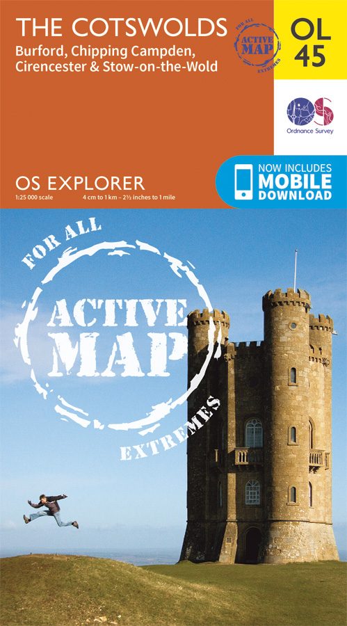
Wandelkaart The Cotswolds AONB - Gloucestershire England
Omvat ook: Burford, Chipping Campden, Cirencester & Stow-on-the-Wold
Productbeschrijving: Kaart nummer OL45 in de OS Explorer kaarten reeks heeft betrekking op een groot gebied van de Cotswolds AONB, inclusief Stow-on-the-Wold, Burford, Cirencester & Chipping Campden. Hoogtepunten van het gebied: de Cotswold hills, Wychwood community forest, en de Cotswold way. De OS Explorer kaart voor The Cotswolds is beschikbaar in zowel de standaard papieren versie als de weerbestendige 'Actief' versie
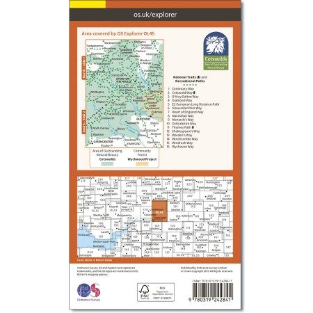
Kaart nummer OL45 is een all purpose kaart vol gepakt met informatie om u het gebied te helpen leren kennen. De kaarten bestrijken het land. Elke kaart heeft een oppervlakte van 40 km door 40 km (25 mijl door 25 mijl) en zoals andere kaarten van Ordnance Survey, National Grid-vierkanten worden verstrekt zodat elke functie een unieke referentienummer kan worden gegeven.
Productdiscription: Map sheet number OL45 in the OS Explorer series covers a large area of the Cotswolds AONB, including Stow-on-the-Wold, Burford, Cirencester and Chipping Campden. Highlights of the area include: the Cotswold Hills, Wychwood Community Forest, and the Cotswold Way. The OS Explorer map for The Cotswolds is available in both the standard paper version and weatherproof 'Active' version.
Locatie op kaart
Gekoppelde artikelen

Wandelkaart OL45 - The Cotswolds AONB- Gloucestershire - OSI • 9780319469637
weatherproof versieWandelkaart The Cotswolds AONB - Gloucestershire England Omvat ook: Burford, Chipping Campden, Cirencester & Stow-on-the-Wold Productbeschrijving: Kaart nummer OL45 in de OS Explorer kaarten reeks heeft betrekking op een groot gebied van de Cotswolds AONB, inclusief Stow-on-the-Wold, Burford, Cirencester & Chipping Campden. Hoogtepunten van het gebied: de Cotswold hills, Wychwood comm…
Overzichtskaarten

Area's of Outstanding Natural Beauty - AONB's UK
Area's of Outstanding Natural Beauty - AONB's UK

Producten op de overzichtskaart
Klik op een product om naar de detailpagina te gaan.
- Wandelgids - Guide to the Cotswolds AONB - AA
- Wandelkaart 24 - Chilterns AONB - AA
- Wandelgids - Cotswold classic walks guidebook - Goldeneye
- Wandelgids - Cotswold Classic Walks - Goldeneye
- Wandelgids - The Cotswold Way 30 classic routes - Cicerone
- Wandelgids - North Downs Way Nat. trail - Cicerone
- Wandelgids - Chilterns walking guide - Cicerone
- Wandelgids - Suffolk coast & Heaths walks - Cicerone
- Wandelgids - North Downs Way - Map Booklet - Cicerone
- Wandelgids - North Pennines AONB walking guide - Cicerone
- Wandelgids - Forest of Bowland & Pendle - Cicerone
- Wandelgids - Hampshire's Test Way walking guide - Cicerone
- Wandelgids & Fietsgids - The Cotswold AONB - Cicerone
- Wandelgids - North Wessex Downs - Cicerone Press
- Wandelgids - Walking on the North Wessex Downs - Cicerone
- Wandelgids - Silverdale & Arnside AONB - Cicerone
- Wandelkaart OL2 - Yorkshire Dales- Southern & Western Areas - OSI
- Wandelkaart OL19 - Howgill Fells and Upper Eden Valley - OSI
- Wandelkaart OL21 - South Pennines - Yorkshire - OSI
- Wandelkaart OL31 - North Pennines- Teesdale & Weardale - OSI
- Wandelkaart OL40 - The Broads - OSI
- Wandelkaart OL41 - Forest of Bowland & Ribblesdale - OSI
- Wandelkaart OL45 - The Cotswolds AONB- Gloucestershire - OSI
- Wandelkaart 108 - Lower Tamer Valley & Plymouth- Cornwall- OSI
- Wandelkaart 115 - Exmouth & Sidmouth- Devon - OSI
- Wandelkaart 137 - Ashford- Kent downs AONB- England - OSI
- Wandelkaart 140 - Quantock Hills AONB- Somerset - OSI
- Wandelkaart 140 - Quantock Hills AONB & Bridgwater- Devon - OSI
- Wandelkaart 147 - Sevenoaks & Tonbridge- Kent - OSI
- Wandelkaart 164 - Gower AONB & Gwyr- South Wales - OSI
- Wandelkaart 164 - Gower AONB & Gwyr- Wales - OSI
- Wandelkaart 171 - Chiltern Hills West & Henley-on-Thames OSI
- Wandelkaart 171 - Chiltern Hills West AONB- Wycombe - OSI
- Wandelkaart 172 - Chiltern Hills East AONB- Wycombe - OSI
- Wandelkaart 181 - Chiltern Hills AONB North- England - OSI
- Wandelkaart 181 - Chiltern Hills North AONB- Wycombe - OSI
- Wandelkaart 190 - Malvern Hills & Bredon Hill - OSI
- Wandelkaart 190 - Malvern Hills AONB & Bredon Hill - OSI
- Wandelkaart 203 - Ludlow- Shropshire Hills AONB - OSI
- Wandelkaart 217 - Long Mynd & Wenlock Edge- Schropshire- OSI
- Wandelkaart 254 - Lleyn Peninsular East- North Wales - OSI
- Wandelkaart 261 - Boston- Lincolnshire AONB - OSI
- Wandelkaart 262 - Anglesey West- Wales AONB - OSI
- Wandelkaart 263 - Anglesey East AONB- Wales - OSI
- Wandelkaart 273 - Lincolnshire Wolds South AONB - OSI
- Wandelkaart 282 - Lincolnshire Wolds North AONB - OSI
- Wandelkaart 298 - Nidderdale AONB- Yorkshire - OSI
- Wandelkaart 298 - Nidderdale AONB North Yorkshire - OSI
- Wandelkaart 300 - Howardian Hills AONB - OSI
- Wandelkaart 300 - Howardian Hills AONB & Malton - OSI
- Wandelkaart - Mourne Mountains N. Ireland - Harvey maps
- Wandelkaart - Fietskaart Forest of Bowland - Harvey maps
- Wandelkaart XT40 - Anglesey Coastal Path N. Wales - Harvey Maps
- Wandelkaart XT40 - Pennine Way Noord - Harvey Maps
- Wandelkaart XT40 - Pennine Way Zuid - Harvey Maps
- Wandelgids Cotswold - Way Two-way trekking guide - Knife Edge
- Reisgids Cotswolds England - Rough Guides
Artikelen uit dezelfde regio

Wandelgids 084 Pathfinder Berkshire- Buckinghamshire- Oxfordshire • 9780319092279
Wandelgids Berkshire- Buckinghamshire- Oxfordshire Productomschrijving: This all-new Pathfinder® Guide covering the ceremonial counties of Berkshire, Buckinghamshire and Oxfordshire features 28 outstanding circular walks across all three counties, offering more wonderful Pathfinder® routes in the south-central Midlands between the Cotswolds (PF 6 Cotswolds) and the Chilterns (PF 25 Thames…
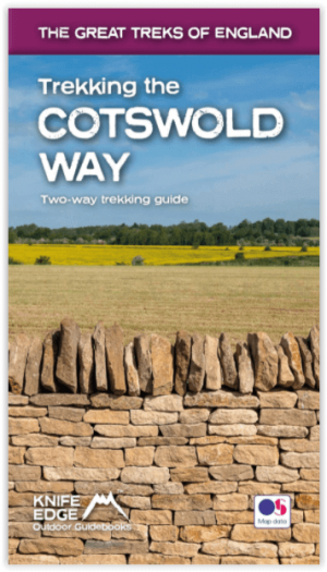
Wandelgids Cotswold - Way Two-way trekking guide - Knife Edge • 9781912933136
Cotswold - Way Two-way trekking guide - Knife Edge Productomschrijving: De Cotswold Way legt 102 mijl af door het sublieme landschap van de Cotswolds, een streek die het toonbeeld is van historisch Engeland. Onderweg gaat u over de top van de Cotswold Escarpment door een prachtig glooiend landschap en historische chocolade-doosdorpjes, gebouwd van prachtige honingkleurige stenen, die eeuwe…
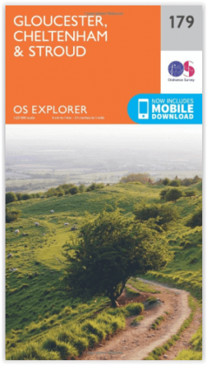
Wandelkaart 179 Gloucester- Cheltenham & Stroud - OSI • 9780319243725
Wandelkaart Gloucester- Cheltenham & Stroud - Gloucestershire Productbeschrijving: Gloucester & Cheltenham 179 / Gloucester, Cheltenham & Stroud, Gloucestershire, England - Kaart nummer 179 in de OS Explorer reeks heeft betrekking op de omgeving van Gloucester, Cheltenham, Stroud. Hoogtepunten van het gebied zijn onder meer: The Cotswolds AONB gebied van uitzonderlijke natuurlijke scho…

Wandelkaart 164 Oxford & Chipping Norton - OSI • 9780319474877
Wandelkaart Oxford- Chipping Norton & Bicester Productbeschrijving: Oxford is voorzien van een cultureel uitje als gevolg van het wereld beroemde hogescholen, rijke geschiedenis en familie dagjes uit. OS Landranger kaart 164 heeft betrekking op de 'stad van de droom torens' en het omliggende gebied. Neem een bootje langs de rivier Cherwell en de botanische tuinen of de Bodleian Library of …

Wandelgids Cotswolds - Heart of the Cotswolds - Rucksack Readers • 9781913817268
Wandelgids Cotswolds - Heart of the Cotswolds - Rucksack Productomschrijving: The Cotswolds AONB is quintessentially English, with its rich cultural history, medieval ‘wool’ churches and charming domestic architecture of stone, slate and thatch. The book offers three options for walking in the heart of this wonderful area: a 94-mile (151-km) grand tour starting from Cheltenham, and two sh…