

Wandelkaart 263 Anglesey East AONB- Wales - OSI
Heeft betrekking op het oosten van de Isle of Anglesey

Korte omschrijving
Wandelkaarten North Wales van Ordnance Survey. Ideaal voor tochten in Wales.
Wandelkaart Anglesey East - Wales 263 / Anglesey East, Wales - Kaart nummer 263 in de OS Explorer reeks heeft betrekking op het oosten van de Isle of Anglesey, Bangor, Beaumaris, Amlwch en M...

Specificaties
- Uitgever: Ordnance Survey
- ISBN-13: 9780319244609
- HOOFDCATEGORIEËN: Wandelkaart
- Activiteiten: Wandelen, Hiking & Trekking
- Regio: North Wales
- Land: Wales
- TOPO's & Stafkaarten: Topografisch wandelen
- AONB - Area of Outstanding Beauty/National Landscape: Isle of Anglesey AONB
- Schaal: 1:25000
- Taal: Engels
- Reeks/Serie: Explorer Series OS
Volledige omschrijving
Wandelkaart Anglesey East - Wales
263 / Anglesey East, Wales - Kaart nummer 263 in de OS Explorer reeks heeft betrekking op het oosten van de Isle of Anglesey, Bangor, Beaumaris, Amlwch en Menai Bridge. Hoogtepunten van het gebied zijn onder andere: Caernarfon, Menai Straight, Cefni Reservoir, Anglesey AONB, Puffin eiland, Ierse zee en Menai Strait kust.
263 / Anglesey East, Wales - Map sheet number 263 in the OS Explorer series covers the east of the Isle of Anglesey, Bangor, Beaumaris, Amlwch, and Menai Bridge. Highlights of the area include: Caernarfon, Menai Straight, Cefni Reservoir, Anglesey AONB, Puffin Island, Irish Sea and Menai Strait coast.
Locatie op kaart
Gekoppelde artikelen
Wandelkaart 263 Anglesey East AONB- Wales - OSI • 9780319244609
standaard versieWandelkaart Anglesey East - Wales 263 / Anglesey East, Wales - Kaart nummer 263 in de OS Explorer reeks heeft betrekking op het oosten van de Isle of Anglesey, Bangor, Beaumaris, Amlwch en Menai Bridge. Hoogtepunten van het gebied zijn onder andere: Caernarfon, Menai Straight, Cefni Reservoir, Anglesey AONB, Puffin eiland, Ierse zee en Menai Strait kust. 263 / Anglesey East, Wales - Ma…

Wandelkaart 263 Anglesey East- North Wales - OSI • 9780319471357
weatherproof versieWandelkaart Anglesey East, North Wales (9780319471357) OSI Omvat ook: Beaumaris, Amlwch & Menai Bridge. Productbeschrijving: Kaart nummer 263 in de OS Explorer kaarten reeks heeft betrekking op het oosten van de Isle of Anglesey, Bangor, Beaumaris, Amlwch en Menai Bridge. Hoogtepunten van het gebied zijn onder meer: Caernarfon, Menai Straight, Cefni Reservoir, Anglesey AONB, Puffin eil…
Overzichtskaarten

Area's of Outstanding Natural Beauty - AONB's UK
Area's of Outstanding Natural Beauty - AONB's UK

Producten op de overzichtskaart
Klik op een product om naar de detailpagina te gaan.
- Wandelgids - Guide to the Cotswolds AONB - AA
- Wandelkaart 24 - Chilterns AONB - AA
- Wandelgids - Cotswold classic walks guidebook - Goldeneye
- Wandelgids - Cotswold Classic Walks - Goldeneye
- Wandelgids - The Cotswold Way 30 classic routes - Cicerone
- Wandelgids - North Downs Way Nat. trail - Cicerone
- Wandelgids - Chilterns walking guide - Cicerone
- Wandelgids - Suffolk coast & Heaths walks - Cicerone
- Wandelgids - North Downs Way - Map Booklet - Cicerone
- Wandelgids - North Pennines AONB walking guide - Cicerone
- Wandelgids - Forest of Bowland & Pendle - Cicerone
- Wandelgids - Hampshire's Test Way walking guide - Cicerone
- Wandelgids & Fietsgids - The Cotswold AONB - Cicerone
- Wandelgids - North Wessex Downs - Cicerone Press
- Wandelgids - Walking on the North Wessex Downs - Cicerone
- Wandelgids - Silverdale & Arnside AONB - Cicerone
- Wandelkaart OL2 - Yorkshire Dales- Southern & Western Areas - OSI
- Wandelkaart OL19 - Howgill Fells and Upper Eden Valley - OSI
- Wandelkaart OL21 - South Pennines - Yorkshire - OSI
- Wandelkaart OL31 - North Pennines- Teesdale & Weardale - OSI
- Wandelkaart OL40 - The Broads - OSI
- Wandelkaart OL41 - Forest of Bowland & Ribblesdale - OSI
- Wandelkaart OL45 - The Cotswolds AONB- Gloucestershire - OSI
- Wandelkaart 108 - Lower Tamer Valley & Plymouth- Cornwall- OSI
- Wandelkaart 115 - Exmouth & Sidmouth- Devon - OSI
- Wandelkaart 137 - Ashford- Kent downs AONB- England - OSI
- Wandelkaart 140 - Quantock Hills AONB- Somerset - OSI
- Wandelkaart 140 - Quantock Hills AONB & Bridgwater- Devon - OSI
- Wandelkaart 147 - Sevenoaks & Tonbridge- Kent - OSI
- Wandelkaart 164 - Gower AONB & Gwyr- South Wales - OSI
- Wandelkaart 164 - Gower AONB & Gwyr- Wales - OSI
- Wandelkaart 171 - Chiltern Hills West & Henley-on-Thames OSI
- Wandelkaart 171 - Chiltern Hills West AONB- Wycombe - OSI
- Wandelkaart 172 - Chiltern Hills East AONB- Wycombe - OSI
- Wandelkaart 181 - Chiltern Hills AONB North- England - OSI
- Wandelkaart 181 - Chiltern Hills North AONB- Wycombe - OSI
- Wandelkaart 190 - Malvern Hills & Bredon Hill - OSI
- Wandelkaart 190 - Malvern Hills AONB & Bredon Hill - OSI
- Wandelkaart 203 - Ludlow- Shropshire Hills AONB - OSI
- Wandelkaart 217 - Long Mynd & Wenlock Edge- Schropshire- OSI
- Wandelkaart 254 - Lleyn Peninsular East- North Wales - OSI
- Wandelkaart 261 - Boston- Lincolnshire AONB - OSI
- Wandelkaart 262 - Anglesey West- Wales AONB - OSI
- Wandelkaart 263 - Anglesey East AONB- Wales - OSI
- Wandelkaart 273 - Lincolnshire Wolds South AONB - OSI
- Wandelkaart 282 - Lincolnshire Wolds North AONB - OSI
- Wandelkaart 298 - Nidderdale AONB- Yorkshire - OSI
- Wandelkaart 298 - Nidderdale AONB North Yorkshire - OSI
- Wandelkaart 300 - Howardian Hills AONB - OSI
- Wandelkaart 300 - Howardian Hills AONB & Malton - OSI
- Wandelkaart - Mourne Mountains N. Ireland - Harvey maps
- Wandelkaart - Fietskaart Forest of Bowland - Harvey maps
- Wandelkaart XT40 - Anglesey Coastal Path N. Wales - Harvey Maps
- Wandelkaart XT40 - Pennine Way Noord - Harvey Maps
- Wandelkaart XT40 - Pennine Way Zuid - Harvey Maps
- Wandelgids Cotswold - Way Two-way trekking guide - Knife Edge
- Reisgids Cotswolds England - Rough Guides

OSI Explorer & Explorer Active - Wales
OSI Explorer & Explorer Active - Wales

Producten op de overzichtskaart
Klik op een product om naar de detailpagina te gaan.
- Wandelkaart 151 Cardiff & Bridgend- Wales - OSI
- Wandelkaart 152 Newport & Pontypool- South Wales - OSI
- Wandelkaart 164 Gower AONB & Gwyr- South Wales - OSI
- Wandelkaart 165 Swansea & Abertawe- South Wales - OSI
- Wandelkaart 166 Rhondda & Merthyr Tydfil - OSI
- Wandelkaart 177 Carmarthen & Kidwelly- Wales - OSI
- Wandelkaart 178 Llanelli- Ammanford & Rhydaman - OSI
- Wandelkaart 185 Newcastle & Emly- Northumberland - OSI
- Wandelkaart 186 Llandeilo- Brechfa Forest- Wales - OSI
- Wandelkaart 187 Llandovery- South Wales - OSI
- Wandelkaart 188 Builth Wells & Llanfair-ym-Muallt - OSI
- Wandelkaart 189 Hereford & Ross-on-Wye- England - OSI
- Wandelkaart 198 Cardigan & New Quay- Wales - OSI
- Wandelkaart 199 Lampeter- Wales - OSI
- Wandelkaart 200 Llandrindod Wells & Elan Valley - OSI
- Wandelkaart 201 Knighton & Presteigne- Wales - OSI
- Wandelkaart 202 Leominster & Bromyard Hererfordshire - OSI
- Wandelkaart 203 Ludlow & Shropshire Hills AONB - OSI
- Wandelkaart 213 Aberystwyth & Cwm Rheidol - Wales - OSI
- Wandelkaart 214 Llanidloes- Newtown & Y Drenewydd - OSI
- Wandelkaart 215 Newtown & Machynlleth- Powys Wales - OSI
- Wandelkaart 216 Welshpool & Montgomery- Powys - OSI
- Wandelkaart 217 Long Mynd & Wenlock Edge - OSI
- Wandelkaart 239 Lake Vyrnwy & Efyrnwy- North Wales - OSI
- Wandelkaart 240 Oswestry & Croesoswallt- Shropshir - OSI
- Wandelkaart 241 Shrewsbury- shropshire England - OSI
- Wandelkaart 253 Lleyn Peninsula West Wales - OSI
- Wandelkaart 254 Lleyn Peninsula East- Wales - OSI
- Wandelkaart 255 Llangollen & Berwyn- West Wales - OSI
- Wandelkaart 256 Wrexham- Wrecsam & Llangollen - OSI
- Wandelkaart 257 Crewe & Nantwich & Cheshire East - OSI
- Wandelkaart 262 Anglesey West- Wales AONB - OSI
- Wandelkaart 263 Anglesey East AONB- Wales - OSI
- Wandelkaart 264 Vale of Clwyd & Dyffryn Clwyd - OSI
- Wandelkaart 265 Clwydian Range & Bryniau Clwyd - OSI
- Wandelkaart 266 Wirral- Chester & Caer- Merseyside - OSI
- Wandelkaart 267 Northwich & Delamere Forest - OSI
- Wandelkaart 275 Liverpool- South West England - OSI
- Wandelkaart OL012 Brecon Beacons Nat. Parc West & Central areas
- Wandelkaart OL013 Brecon Beacons National Parc East - OS
- Wandelkaart OL035 Pembrokeshire National Park North - OS
- Wandelkaart OL036 Pembrokeshire National Park South - OS
- Wandelkaart OL017 Snowdon- Conwy Valley & Dyffryn Conwy - OS
- Wandelkaart OL018 Harlech- Porthmadog & Y Bala - OS
- Wandelkaart OL023 Cadair Idris & Llyn Tegid - OS
Artikelen uit dezelfde regio

Wandelgids Snowdonia NP Wales - Cicerone • 9781852847678
Wandelgids Snowdonia NP Wales - Cicerone Productomschrijving: Gids naar 40 van Snowdonia's beste dagwandelingen, met de routes "Snowdon" en "Tryfan", met inbegrip van de Snowdon Horseshoe, Cadair Idris, Y Garn en The Rhinogs. De routes variëren van Grade 1 scrambles zoals wieg Goch of Bristly Ridge, tot riverside. Bevat details van een twee-daagse doorkruisen van alle 15 van Snowdonia …
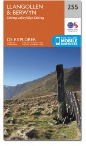
Wandelkaart 255 Llangollen & Berwyn - North Wales - OSI • 9780319471272
Wandelkaart Llangollen & Berwyn - Denbighshire Wales Omvat ook: Ceiriog Valley. Productbeschrijving: Kaart getal 255 in de OS Explorer reeks beslaat een gebied in Noord Wales in het oosten van Snowdonia National Park. Hoogtepunten van het gebied zijn onder andere: Offa's Dyke Path nationale trail, Upper Ceirirog Trail en Llwybr Maelor Way. De OS Explorer kaart voor Llangollen & Berwyn …
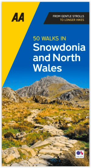
Wandelgids Snowdonia NP & North Wales - 50 walks guide - AA Publ. • 9780749583279
Snowdonia NP & North Wales - 50 walks guide - AA Publishing Productomschrijving: Wandelen is een van de favoriete vrijetijdsbestedingen van Groot-Brittannië en deze AA gids - 50 wandelingen in Snowdonia & Noord-Wales bevat een verscheidenheid aan uitgestippelde wandelingen van 3 tot 10 km, geschikt voor alle niveaus. Het boek bevat alle praktische details die u nodig heeft, vergezeld van f…

Wandelkaart 115 Snowdon & Yr Wyddfa - Snowdonia NP - OSI • 9780319262139
Wandelkaart 115 - Snowdon & Yr Wyddfa- Snowdonia NP Productbeschrijving: Kaart nummer 115 in de OS Landranger kaarten reeks, is de ideale kaart voor uw wandel-reizen en vakantie planning op het gebied van de Snowdon. Goed-gekend voor haar adembenemende landschappen, uitdagende wandelingen en beklimmingen, is Snowdon de perfecte plek voor alle liefhebbers van het buitenleven. Hoogtepunten v…

Wandelkaart 115 Snowdon & Caernarfon- Snowdonia NP - OSI • 9780319474389
Wandelkaart Snowdon & Caernarfon - Snowdonia NP - North Wales Productbeschrijving: Kaart blad nummer 115 in de OS Landranger kaarten reeks is de ideale kaart voor alle wandelreizen en vakantie planning rond het gebied van de Snowdon. Goed gekende regio voor haar adembenemende landschappen, uitdagende wandelingen en beklimmingen, Snowdon is dan ook de perfecte plek voor alle liefhebbers van…