

Wandelkaart 266 Wirral- Chester & Caer- Merseyside - OSI
Omvat de Mersey community Forest en recreatieve paden


Korte omschrijving
Wandelkaarten Merseyside, England van Ordnance Survey. Ideaal voor tochten in England.
Wandelkaart Wirral- Chester & Caer - Merseyside England Productbeschrijving: Kaart nummer 266 in de OS Explorer reeks heeft betrekking op het Wirral, in het noordwesten van Engeland in de bu...

Specificaties
- Uitgever: Ordnance Survey
- ISBN-13: 9780319244630
- HOOFDCATEGORIEËN: Wandelkaart
- Activiteiten: Wandelen, Hiking & Trekking
- Regio: Merseyside, England
- Land: England
- Regionale parken: Mersey Community Forest
- TOPO's & Stafkaarten: Topografisch wandelen
- Schaal: 1:25000
- Taal: Engels
- Reeks/Serie: Explorer Series OS
Volledige omschrijving
Wandelkaart Wirral- Chester & Caer - Merseyside England
Productbeschrijving: Kaart nummer 266 in de OS Explorer reeks heeft betrekking op het Wirral, in het noordwesten van Engeland in de buurt van Liverpool. De Mersey community Forest en recreatieve paden de North Cheshire Way, Canalside Trail en Wirral way worden getoont, samen met hoogtepunten zoals de steden Chester, Liverpool, samen met de steden Birkenhead, Bootle, Connah's Quay en Buckley. De OS Explorer kaart voor Wirral & Chester is beschikbaar in zowel de standaard papieren versie als de weerbestendige 'Actief' versie.
Productdiscription: Map sheet number 266 in the OS Explorer series covers The Wirral in the North West of England near Liverpool. The Mersey Community Forest and recreational paths the North Cheshire Way, Canalside Trail and Wirral Way are covered, along with highlights such as the cities of Chester and Liverpool, along with the towns of Birkenhead, Bootle, Connah's Quay and Buckley. The OS Explorer map for Wirral & Chester is available in both the standard paper version and weatherproof 'Active' version.
Locatie op kaart
Gekoppelde artikelen

Wandelkaart 266 Wirral- Chester & Caer- Merseyside - OSI • 9780319244630
standaard versieWandelkaart Wirral- Chester & Caer - Merseyside England Productbeschrijving: Kaart nummer 266 in de OS Explorer reeks heeft betrekking op het Wirral, in het noordwesten van Engeland in de buurt van Liverpool. De Mersey community Forest en recreatieve paden de North Cheshire Way, Canalside Trail en Wirral way worden getoont, samen met hoogtepunten zoals de steden Chester, Liverpool, samen m…

Wandelkaart 266 Wirral Chester & Caer Merseyside - OSI • 9780319471388
weatherproof versieWandelkaart Wirral- Chester & Caer - Merseyside England Productbeschrijving: Kaart nummer 266 in de OS Explorer kaarten reeks heeft betrekking op Wirral, in het noordwesten van Engeland in de buurt van Liverpool. De Mersey community Forest en recreatieve paden de North Cheshire Way, stijlkamers Trail en Wirral Way, vallen samen met hoogtepunten zoals de steden Chester, Liverpool, samen met…
Overzichtskaarten

OSI Explorer & Explorer Active - Wales
OSI Explorer & Explorer Active - Wales

Producten op de overzichtskaart
Klik op een product om naar de detailpagina te gaan.
- Wandelkaart 151 Cardiff & Bridgend- Wales - OSI
- Wandelkaart 152 Newport & Pontypool- South Wales - OSI
- Wandelkaart 164 Gower AONB & Gwyr- South Wales - OSI
- Wandelkaart 165 Swansea & Abertawe- South Wales - OSI
- Wandelkaart 166 Rhondda & Merthyr Tydfil - OSI
- Wandelkaart 177 Carmarthen & Kidwelly- Wales - OSI
- Wandelkaart 178 Llanelli- Ammanford & Rhydaman - OSI
- Wandelkaart 185 Newcastle & Emly- Northumberland - OSI
- Wandelkaart 186 Llandeilo- Brechfa Forest- Wales - OSI
- Wandelkaart 187 Llandovery- South Wales - OSI
- Wandelkaart 188 Builth Wells & Llanfair-ym-Muallt - OSI
- Wandelkaart 189 Hereford & Ross-on-Wye- England - OSI
- Wandelkaart 198 Cardigan & New Quay- Wales - OSI
- Wandelkaart 199 Lampeter- Wales - OSI
- Wandelkaart 200 Llandrindod Wells & Elan Valley - OSI
- Wandelkaart 201 Knighton & Presteigne- Wales - OSI
- Wandelkaart 202 Leominster & Bromyard Hererfordshire - OSI
- Wandelkaart 203 Ludlow & Shropshire Hills AONB - OSI
- Wandelkaart 213 Aberystwyth & Cwm Rheidol - Wales - OSI
- Wandelkaart 214 Llanidloes- Newtown & Y Drenewydd - OSI
- Wandelkaart 215 Newtown & Machynlleth- Powys Wales - OSI
- Wandelkaart 216 Welshpool & Montgomery- Powys - OSI
- Wandelkaart 217 Long Mynd & Wenlock Edge - OSI
- Wandelkaart 239 Lake Vyrnwy & Efyrnwy- North Wales - OSI
- Wandelkaart 240 Oswestry & Croesoswallt- Shropshir - OSI
- Wandelkaart 241 Shrewsbury- shropshire England - OSI
- Wandelkaart 253 Lleyn Peninsula West Wales - OSI
- Wandelkaart 254 Lleyn Peninsula East- Wales - OSI
- Wandelkaart 255 Llangollen & Berwyn- West Wales - OSI
- Wandelkaart 256 Wrexham- Wrecsam & Llangollen - OSI
- Wandelkaart 257 Crewe & Nantwich & Cheshire East - OSI
- Wandelkaart 262 Anglesey West- Wales AONB - OSI
- Wandelkaart 263 Anglesey East AONB- Wales - OSI
- Wandelkaart 264 Vale of Clwyd & Dyffryn Clwyd - OSI
- Wandelkaart 265 Clwydian Range & Bryniau Clwyd - OSI
- Wandelkaart 266 Wirral- Chester & Caer- Merseyside - OSI
- Wandelkaart 267 Northwich & Delamere Forest - OSI
- Wandelkaart 275 Liverpool- South West England - OSI
- Wandelkaart OL012 Brecon Beacons Nat. Parc West & Central areas
- Wandelkaart OL013 Brecon Beacons National Parc East - OS
- Wandelkaart OL035 Pembrokeshire National Park North - OS
- Wandelkaart OL036 Pembrokeshire National Park South - OS
- Wandelkaart OL017 Snowdon- Conwy Valley & Dyffryn Conwy - OS
- Wandelkaart OL018 Harlech- Porthmadog & Y Bala - OS
- Wandelkaart OL023 Cadair Idris & Llyn Tegid - OS
Artikelen uit dezelfde regio

Wandelkaart 108 Liverpool & Southport - England - OSI • 9780319474310
Wandelkaart Liverpool- Southport & Wigan - Merseyside England Productbeschrijving: De OS Landranger kaart 108 dekt Liverpool, en omvat Southport, Wigan, Chorley, Standish, Formby, Crosby, Rainford, Kirkby, St Helens, Prescot, Widness, Birkenhead en Runcorn. Liverpool is wereldwijd bekend voor zijn muziek, van de Beatles en Cilla Black naar Atomic Kitten, maar u kunt er ook de historische d…

Wandelkaart 275 Liverpool St Helens Widnes & Runcorn - OSI • 9780319471470
Wandelkaart Liverpool- St Helens - Widnes & Runcorn Omvat ook: St Helens, Widnes & Runcorn. Productbeschrijving: OS Explorer kaart 275 omvat Liverpool, St Helens, Widnes Runcorn, alsmede de rivier de Mersey. Hoogtepunten zijn onder andere de Trans Pennine Trail, Mersey Wayen de Liverpool run Line. De OS Explorer kaart voor Liverpool is beschikbaar in zowel de standaard papieren versie …

Wandelgids King Charles III England Coast Path Map Booklet • 9781786310415
King Charles III England Coast Path Map Booklet - Cicerone Productomschrijving: This map booklet to the Lancashire and Merseyside section of the England Coast Path contains detailed mapping for walking the route in either direction. With easy access at many points along the way, the Lancashire/Merseyside section can be enjoyed as a trek of around 12 days or in shorter sections. - Full…

Wandelgids King Charles III England Coast Path - Cicerone • 9781786310279
King Charles III England Coast Path - Cicerone Productomschrijving: A guidebook to walking the northwest section of the King Charles III England Coast Path between Gretna and Chester. Covering 590km (367 miles), this straightforward trail along the Cumbria, Lancashire and Merseyside coast takes around 1 month to hike. The route is described from north to south in 28 stages between 13 a…
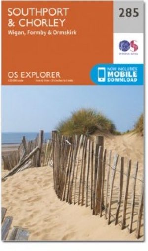
Wandelkaart 285 Southport & Chorley- Merseyside - OSI • 9780319471579
Wandelkaart Southport & Chorley - Merseyside England Omvat ook: Wigan, Formby & Ormskirk. Productbeschrijving: Kaart nummer 285 in de OS Explorer kaarten reeks is ideaal voor het ontdekken van het noordwesten van Engeland rond Southport en Chorley. Met het Red Rose Forest en de Mersey Forest opgenomen in het gebied van deze kaart, is er geen tekort aan plaatsen om te gaan verkennen. An…