

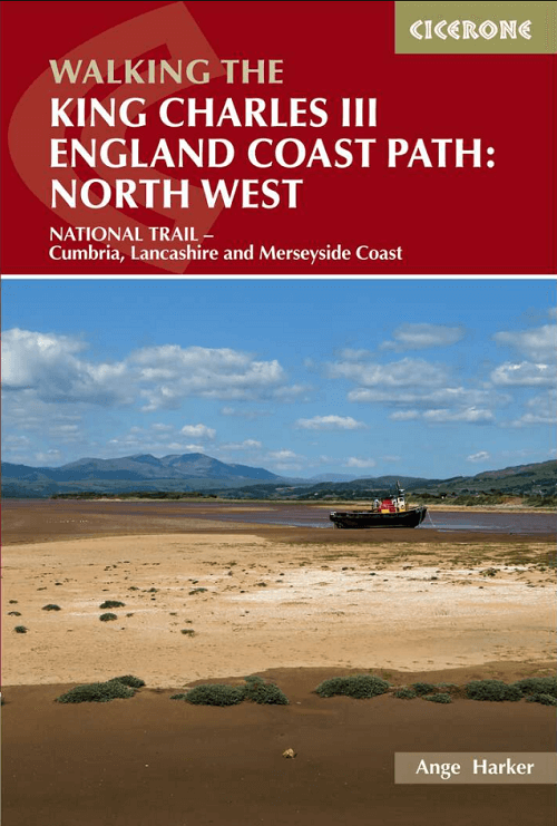
Wandelgids King Charles III England Coast Path - Cicerone
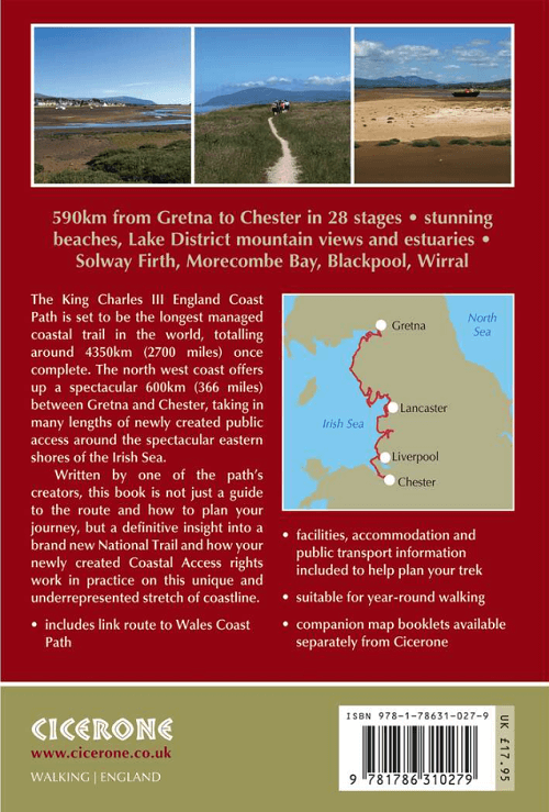
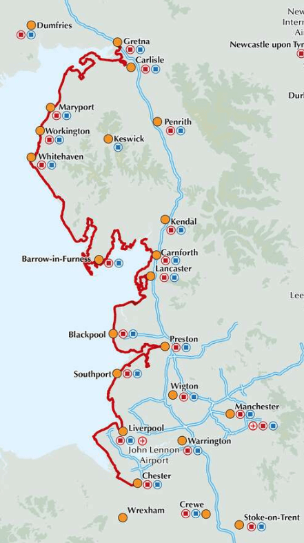
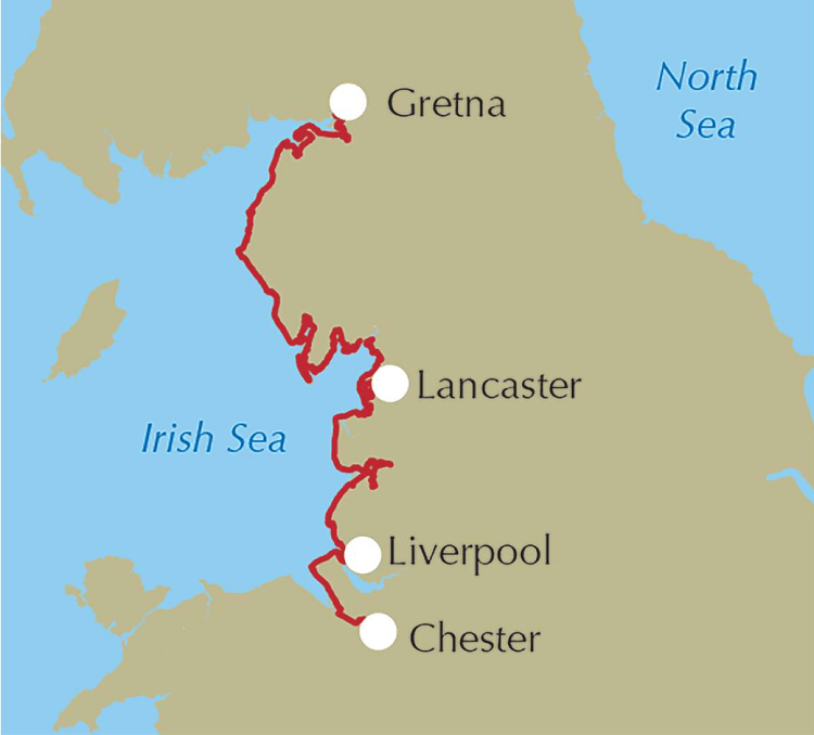
Between Gretna and Chester - 590km - 28 stages
Korte omschrijving
Wandelgidsen North West England, Cumbria & Lake District, England, Lanacshire, England en Merseyside, England van CICERONE Press. Ideaal voor tochten in England.
King Charles III England Coast Path - Cicerone Productomschrijving: A guidebook to walking the northwest section of the King Charles III England Coast Path between Gretna and Chester. Coveri...

Specificaties
- Uitgever: CICERONE Press
- ISBN-13: 9781786310279
- HOOFDCATEGORIEËN: Wandelgids
- Activiteiten: Wandelen, Hiking & Trekking
- Auteur: Ange Harker
- Regio: Cumbria & Lake District, England, Lanacshire, England, Merseyside, England, North West England
- Land: England
- Lange afstand wandelroutes: King Charles III England Coast Path (590 Km)
- Editie: 1
- Taal: Engels
- Reeks/Serie: National Trails, UK
- De Engelse Graafschappen: Cumberland (Cumbria), Lancashire
Volledige omschrijving
King Charles III England Coast Path - Cicerone
Productomschrijving: A guidebook to walking the northwest section of the King Charles III England Coast Path between Gretna and Chester. Covering 590km (367 miles), this straightforward trail along the Cumbria, Lancashire and Merseyside coast takes around 1 month to hike.
The route is described from north to south in 28 stages between 13 and 29km (8–18 miles) in length.
- Contains step-by-step description of the route alongside 1:50,000 OS maps
- Refreshment information given for each route stage
- Public transport by stage is listed for those wanting to break the trail into shorter sections
- Handy trek planner, route summary tables and accommodation listings help you plan your itinerary
- Accompanying map booklets containing OS 1:25,000 mapping and route line are also available.
Gekoppelde artikelen

Wandelgids King Charles III England Coast Path Map Booklet • 9781786310415
standaard versieKing Charles III England Coast Path Map Booklet - Cicerone Productomschrijving: This map booklet to the Lancashire and Merseyside section of the England Coast Path contains detailed mapping for walking the route in either direction. With easy access at many points along the way, the Lancashire/Merseyside section can be enjoyed as a trek of around 12 days or in shorter sections. - Full…

Wandelgids King Charles III England Coast Path Map Booklet • 9781786310293
standaard versieWandelgids King Charles III England Coast Path Map Booklet Productomschrijving: This map booklet to the Cumbrian section of the England Coast Path contains detailed mapping for walking the route in either direction. With easy access at many points along the way, the Cumbrian section can be enjoyed as a trek of around 15 days or in shorter sections. - Full route shown on 1:25,000 OS map…
Artikelen uit dezelfde regio
Wandelgids The Lake District - High Level & Fell Walks - Cicerone • 9781786312266
The Lake District - High Level & Fell Walks - Cicerone Productomschrijving: Deze gids omvat 30 wandelingen over de bergkammen en hoge toppen van het Engelse Lake District, het populairste nationale park van het Verenigd Koninkrijk. Deze gids, die enkele van de mooiste en hoogste berglandschappen van Engeland bereikt, leidt lezers naar klassieke hoefijzers en traditionele beklimmingen, maar…

Wandelkaart 287 West Pennine Moors & Blackburn - OSI • 9780319471593
Wandelkaart West Pennine Moors & Blackburn - North West Omvat ook: Blackburn, Darwen & Accrington. Productbeschrijving: Kaart nummer 287 in de OS Explorer kaarten reeks beslaat een gebied ten westen van de Pennines, met inbegrip van een deel van de Forest of Bowland. Hoogtepunten van het gebied zijn onder andere: Witton Weavers Way, Rossendale Way en Ribble Way, samen met de steden van…
Wandelkaart 296 Lancaster- Morecambe & Fleetwood - OSI • 9780319471685
Wandelkaart Lancaster- Morecambe & Fleetwood - Lancaster Productbeschrijving: Kaart nummer 296 dekt Lancaster, Morecambe en Fleetwood. Hoogtepunten zijn Heysham, Lancaster Castle en Knott End-on-Sea. Omvat ook Overton en Middleton. De OS Explorer kaart voor Lancaster, Morecambe & Fleetwood is beschikbaar in zowel de standaard papieren versie als de weerbestendige 'Actief' versie. Produ…

Wandelgids Mountain Walks Helvellyn - Vertebrate Publ. • 9781839812521
Mountain Walks Helvellyn - Vertebrate Publ. Productomschrijving: 15 routes to enjoy on and around Helvellyn Mountain Walks Helvellyn by Tina Codling is a guide to walking routes to the summit of Helvellyn in the Lake District National Park. Alongside the summit routes, there are also lower-level alternatives for mixed weather or shorter days and those new to mountain walking. Amon…

Wandelkaart Fietskaart Forest of Bowland - Harvey maps • 9781851374731
Wandelkaart - Fietskaart Forest of Bowland - Harvey maps Productomschrijving: Deze kaart van de Forest of Bowland is 2-in-1. Aan de ene kant is een wandelkaart; aan de andere een kaart geschikt voor fietsers. De Forest of Bowland heeft veel te bieden voor wandelaars, ruiters en fietsers, en deze praktische kaart zal u helpen om dit prachtige deel van Engeland te verkennen. De wandelaar…