

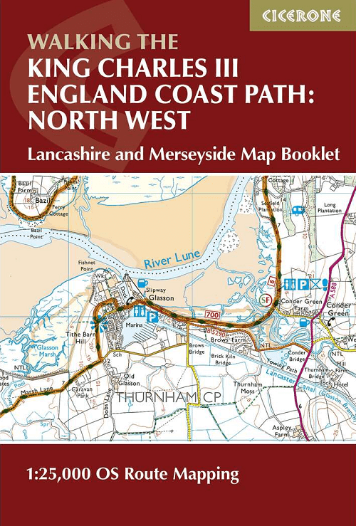
Wandelgids King Charles III England Coast Path Map Booklet
Lancashire and Merseyside - Arnside to Chester
Korte omschrijving
Wandelgidsen Lanacshire, England en Merseyside, England van CICERONE Press. Ideaal voor tochten in England.
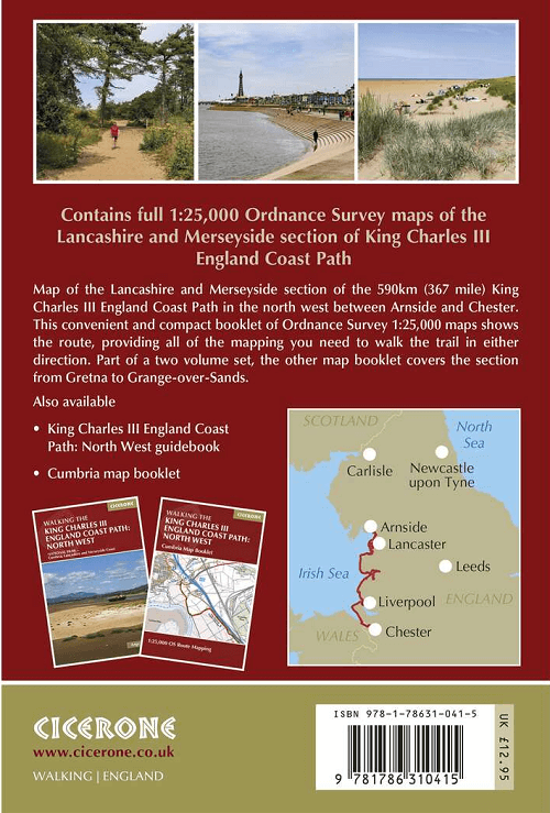
King Charles III England Coast Path Map Booklet - Cicerone Productomschrijving: This map booklet to the Lancashire and Merseyside section of the England Coast Path contains detailed mapping...

Specificaties
- Uitgever: CICERONE Press
- ISBN-13: 9781786310415
- HOOFDCATEGORIEËN: Wandelgids
- Activiteiten: Wandelen, Hiking & Trekking
- Auteur: Ange Harker
- Regio: Lanacshire, England, Merseyside, England
- Land: England
- Lange afstand wandelroutes: King Charles III England Coast Path (590 Km)
- TOPO's & Stafkaarten: Topografisch wandelen
- Editie: 1
- Taal: Engels
- Reeks/Serie: National Trails, UK
- De Engelse Graafschappen: Lancashire
Volledige omschrijving
King Charles III England Coast Path Map Booklet - Cicerone
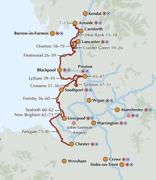
Productomschrijving: This map booklet to the Lancashire and Merseyside section of the England Coast Path contains detailed mapping for walking the route in either direction. With easy access at many points along the way, the Lancashire/Merseyside section can be enjoyed as a trek of around 12 days or in shorter sections.
- Full route shown on 1:25,000 OS maps
- Map booklet can be used to walk the path in either direction
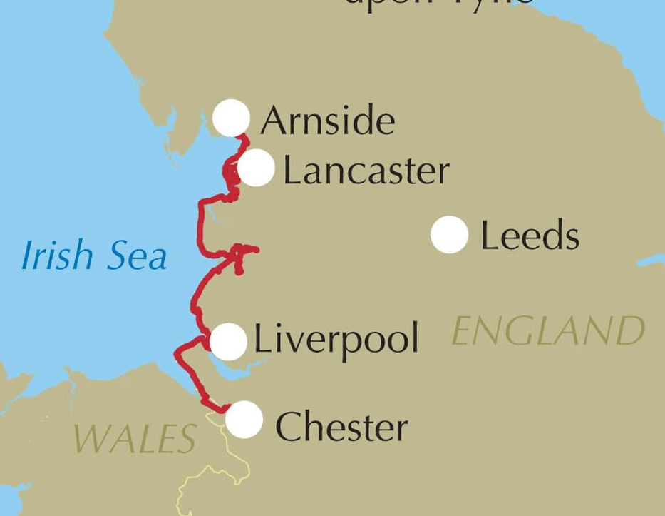
- Covers the England Coast Path from Arnside to Chester
- Conveniently sized for slipping into a jacket pocket or top of a rucksack
- An accompanying Cicerone guidebook - Walking the England Coast Path: North West - is available separately.
Gekoppelde artikelen

Wandelgids King Charles III England Coast Path - Cicerone • 9781786310279
standaard versieKing Charles III England Coast Path - Cicerone Productomschrijving: A guidebook to walking the northwest section of the King Charles III England Coast Path between Gretna and Chester. Covering 590km (367 miles), this straightforward trail along the Cumbria, Lancashire and Merseyside coast takes around 1 month to hike. The route is described from north to south in 28 stages between 13 a…

Wandelgids King Charles III England Coast Path Map Booklet • 9781786310293
standaard versieWandelgids King Charles III England Coast Path Map Booklet Productomschrijving: This map booklet to the Cumbrian section of the England Coast Path contains detailed mapping for walking the route in either direction. With easy access at many points along the way, the Cumbrian section can be enjoyed as a trek of around 15 days or in shorter sections. - Full route shown on 1:25,000 OS map…
Artikelen uit dezelfde regio
Reisgids Liverpool Secret - Jonglez Publishing • 9782361953249
Travelguide Liverpool Secret - Jonglez Publishing Productinformation: Let Secret Liverpool guide you around the unusual and unfamiliar. Step off the beaten track with this fascinating Liverpool guide book and let our local experts show you the well-hidden treasures of an amazing city. Ideal for local inhabitants and curious travellers alike. The places included in our guides are unusual an…

Wandelkaart 108 Liverpool- Merseyside England - OSI • 9780319262061
Wandelkaart Liverpool- Merseyside England - OSI Productbeschrijving: De OS Landranger kaart 108 omvat Liverpool alsook Southport, Wigan, Chorley, Standish, Formby, Crosby, Rainford, Kirkby, St Helens, Prescot, Widness, Birkenhead en Runcorn. De OS Landranger kaarten reeks heeft betrekking op Groot-Brittannië met 204 gedetailleerde kaarten, perfect voor dagtochten en korte pauzes. Elke kaar…

Fietsgids Lancashire cycleway - Cicerone • 9781852848491
Fietsgids Lancashire cycleway - Cicerone Productomschrijving: Lancashire is een graafschap in de Engelse regio North West England Detail uitgever: Comprising two distinct loops that intersect at Whalley in the Ribble Valley, the 425km (265 mile) Lancashire Cycleway showcases the idyllic scenery of England's historic Red Rose County. The Northern Loop contrasts the quiet lanes and peac…

Wandelkaart 206 Edge Hill & Fenny Compton - OSI • 9780319243992
Wandelkaart Edge Hill & Fanny Compton - Warwickshire Productbeschrijving: Badby, Kineton & Middle Tysoe. 206 / Edge Hill & Fenny Compton, Warwickshire, England - Kaart nummer 206 in de OS Explorer kaart reeks is ideaal voor het ontdekken van het noordelijke deel van de Cotswolds. Dit gebied van uitzonderlijke natuurlijke schoonheid AONB kan worden bezocht dmv het aflopen van de Centen…

Wandelkaart XT25 Forest of Bowland Lancashire England - Harvey • 9781851377206
Wandelkaart Forest of Bowland Lancashire - Harvey Maps Productomschrijving: Meer dan een kaart - een essentieel deel van je uitrusting. Deze nieuwe generatie HARVEY Superwalker kaarten is ontworpen om de meest praktische outdoor navigatietool te zijn. - De ideale kaart om het Forest of Bowland National Landscape te verkennen - Omvat Settle, Gisburn Forest en de Trough of Bowland - …