

Wandelgids 019 Pathfinder guides Dumfries & Galloway - OS
Solway Firth - Firth of Clyde - Mull of Galloway - Rascarrel Bay


Korte omschrijving
Wandelgidsen Dumfries & Galloway, Schotland van Ordnance Survey. Ideaal voor tochten in Schotland.
Wandelgids Dumfries & Galloway Schotland - OS Productomschrijving: Dumfries and Galloway form the South-west of Scotland, a broad wedge of land jutting out into the Irish Sea between the So...

Specificaties
- Uitgever: Ordnance Survey
- ISBN-13: 9780319091180
- HOOFDCATEGORIEËN: Wandelgids
- Activiteiten: Wandelen, Hiking & Trekking
- Regio: Dumfries & Galloway, Schotland
- Land: Schotland
- Taal: Engels
- Reeks/Serie: Outstanding Circular Walks, Pathfinder Series, OS
Volledige omschrijving
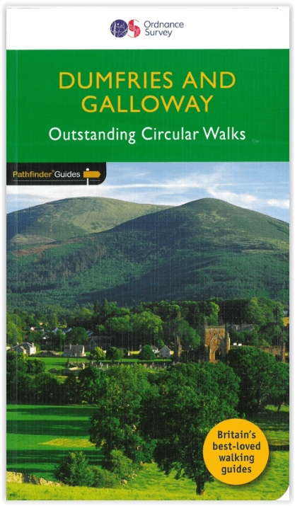
Wandelgids Dumfries & Galloway Schotland - OS
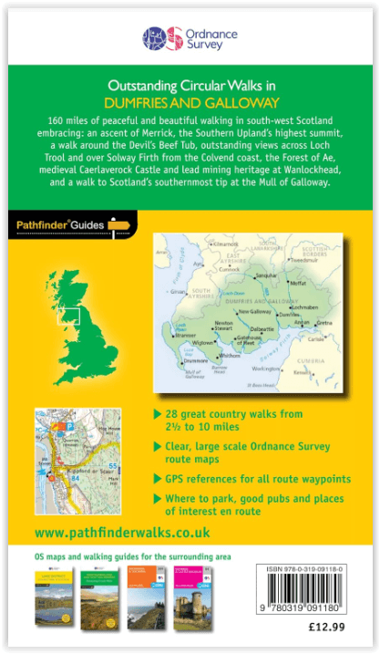
Productomschrijving: Dumfries and Galloway form the South-west of Scotland, a broad wedge of land jutting out into the Irish Sea between the Solway Firth and the Firth of Clyde. The area is also part of Scotland's border country a peaceful, unspoilt region that possesses a mild climate, a great variety of scenery and a rich historic legacy.
The mountains of Dumfries and Galloway offer plenty of remote and challenging walking, with over 40 peaks that exceed 2000 feet. Also featured are clifftop walks around the Mull of Galloway and Rascarrel Bay, a route around the Solway Marshes, and Gretna Green destination for romantic elopements for 200 years.

Overzichtskaarten

Overzicht Pathfinder guides - OS
Overzicht Pathfinder guides - OS

Producten op de overzichtskaart
Klik op een product om naar de detailpagina te gaan.
- Wandelgids 001 Pathfinder guides South Devon & Dartmoor NP - OS
- Wandelgids 003 Pathfinder guides Isle of Skye - OS
- Wandelgids 004 Pathfinder guides Cairngorms NP - OS
- Wandelgids 005 Pathfinder guides Cornwall England - OS
- Wandelgids 006 Pathfinder guides Cotswolds AONB - OS
- Wandelgids 007 Pathfinder guides Fort William & Glen Coe - OS
- Wandelgids 008 Pathfinder guides Kent - OS
- Wandelgids 009 Pathfinder guides Exmoor NP & the Quantocks - OS
- Wandelgids 010 Pathfinder guides Snowdonia NP Wales - OS
- Wandelgids 011 Pathfinder guides Dorset England - OS
- Wandelgids 012 Pathfinder New Forest & South Downs NP Hampshire
- Wandelgids 015 Pathfinder guides Yorkshire Dales NP - OS
- Wandelgids 018 Pathfinder guides Brecon Beacons Wales - OS
- Wandelgids 019 Pathfinder guides Dumfries & Galloway - OS
- Wandelgids 020 Pathfinder guides Sherwood Forest - OS
- Wandelgids 022 Pathfinder guides More Lake District - OS
- Wandelgids 023 Pathfinder guides Loch Lomond, Trossachs NP - OS
- Wandelgids 025 Pathfinder guides Thames Valley & Chilterns - OS
- Wandelgids 026 Pathfinder guides Dartmoor National Park - OS
- Wandelgids 027 Pathfinder Perthshire "big county" Angus & Five OS
- Wandelgids 028 Pathfinder guides North York Moors NP - OS
- Wandelgids 029 Pathfinder guides Wye Valley AONB & Forrest of Dean
- Wandelgids 030 Pathfinder guides Loch Ness & Iverness - OS
- Wandelgids 031 Pathfinder guides Oban, Mull & Kintyre - OS
- Wandelgids 034 Pathfinder guides Pembrokeshire Wales - OS
- Wandelgids 035 Pathfinder guides Northumberland- Scottish Borders
- Wandelgids 039 Pathfinder Durham, North Pennines & Tyne & Wear OS
- Wandelgids 041 Pathfinder guides Central Wales - OS
- Wandelgids 042 Pathfinder guides Cheshire England - OS
- Wandelgids 044 Pathfinder guides Essex England - OS
- Wandelgids 045 Pathfinder guides Norfolk - OS
- Wandelgids 046 Pathfinder guides Aberdeen & Royal Deeside - OS
- Wandelgids 047 Pathfinder Edinburgh, Pentlands & Lothians - OS
- Wandelgids 048 Pathfinder guides Suffolk East England - OS
- Wandelgids 049 Pathfinder guides Vale of York East England - OS
- Wandelgids 050 Pathfinder guides Lincolnshire & the Wolds - OS
- Wandelgids 051 Pathfinder guides Cambridgeshire & The Fens - OS
- Wandelgids 053 Pathfinder guides Lancashire NW En England - OS
- Wandelgids 054 Pathfinder guides Hertfordshire & Bedfordshire- OS
- Wandelgids 055 Pathfinder guides Gower, Swansea & Cardiff - OS
- Wandelgids 060 Pathfinder guides Lake District NP - OS
- Wandelgids 063 Pathfinder guides Peak District England - OS
- Wandelgids 064 Pathfinder guides South Pennines - OS
- Wandelgids 065 Pathfinder guides Surrey England - OS
- Wandelgids 066 Pathfinder guides West Sussex & South Downs - OS
- Wandelgids 067 Pathfinder guides South Downs NP & East Sussex- OS
- Wandelgids 068 Pathfinder guides Devon North & Mid - OS
- Wandelgids 069 Pathfinder guides South West England Coastal walks
- Wandelgids 071 Pathfinder guides High Fells of Lakeland - OS
- Wandelgids 073 Pathfinder guides More Peak District - OS
Artikelen uit dezelfde regio

Wandelkaart Galloway Hills XT40 ultra - Harvey Maps • 9781851377282
Wandelkaart Galloway Hills - Harvey Maps Productomschrijving: De Galloway Hills zijn een reeks heuvels in de Schotse regio Dumfries and Galloway. Ze liggen in het zuidwesten van Galloway. De Galloway Hills bestaan uit de bergen Merrick, Criffel & Cairnsmore of Fleet.

Wandelgids Dumfries and Galloway short walks - Cicerone • 9781786311726
Dumfries and Galloway short walks - Cicerone Productomschrijving: Ronald Turnbull heeft 15 van de beste korte wandelingen rond Dumfries and Galloway voor je uitgezocht. Onze gids is voorzien van goed leesbare Ordnance Survey-kaarten en duidelijke routebeschrijvingen, perfect als je voor het eerst gaat wandelen of iets zoekt waar je met het hele gezin van kunt genieten. We hebben inform…
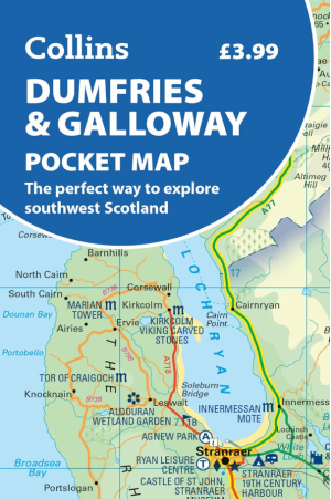
Landkaart Wegenkaart Pocket map Dumfries & Galloway - Harper • 9780008780449
Wegenkaart Pocket map Dumfries & Galloway - Harper Collins Productomschrijving: Dumfries & Galloway Pocket Map: The perfect way to explore southwest Scotland Map Handy little full colour map of Dumfries & Galloway.

Wandelkaart 321 Nithsdale & Dumfries & Thornhill - OSI • 9780319245736
Wandelkaart Nithsdale & Dumfries - Thornhill Dumfries Omvat ook: Thornhill Productomschrijving: OS Explorer kaart 321 omvat Dumfries te Thornhill. Het gebied staat bekend als Nithsdale, want het is de vallei van de rivier de Nith. De indrukwekkende Drumlanrig Castle is het hele jaar geopend, of er zijn wandelpaden over het Nithsdale gebied. De OS Explorer kaart voor Nithsdale & Dumfrie…

Reisgids Go Slow Dumfries & Galloway - Bradt travel guides • 9781804692721
Reisgids Dumfries & Galloway - Bradt Productomschrijving: Written by Southern Scotland experts, this new, thoroughly updated third edition of Bradt's Dumfries & Galloway (Slow Travel) remains the only full-blown guide to this beguiling southwest corner of Scotland. The region is covered in depth, from Eskdale in the east to Scotland's southern tip at the Mull of Galloway, via Annandal…