

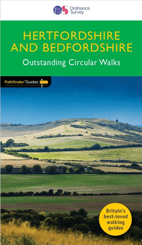
Wandelgids 054 Pathfinder guides Hertfordshire & Bedfordshire- OS
Greensand Ridge Walk - Icknield Way Path - Ouse Valley Way...


Korte omschrijving
Wandelgidsen Hertfordshire East England en Bedfordshire, England van Ordnance Survey. Ideaal voor tochten in England.
Wandelgids Hertfordshire & Bedfordshire - OS Productomschrijving: This walkers guide contains 28 outstanding circular walks in Hertfordshire and Bedfordshire ranging from 5.5km to 15km. Eac...

Specificaties
- Uitgever: Ordnance Survey
- ISBN-13: 9780319090077
- HOOFDCATEGORIEËN: Wandelgids
- Activiteiten: Wandelen, Hiking & Trekking
- Auteur: Deborah King
- Regio: Bedfordshire, England, Hertfordshire East England
- Land: England
- Taal: Engels
- Reeks/Serie: Outstanding Circular Walks, Pathfinder Series, OS
- De Engelse Graafschappen: Bedfordshire, Herefordshire
Volledige omschrijving
Wandelgids Hertfordshire & Bedfordshire - OS
Productomschrijving: This walkers guide contains 28 outstanding circular walks in Hertfordshire and Bedfordshire ranging from 5.5km to 15km. Each route has easy-to-follow route descriptions, clear Ordnance Survey route maps, GPS waypoints, where to park, good pubs and places of interest en route. All of the routes have been researched and written by expert outdoor writer Deborah King and showcase beautiful photography of scenes from the walks
While often overlooked by walkers, the area they does have fine walking country, with a diverse of terrain, gentle hilly regions, pleasant woodlands, attractive riverside landscapes and an impressive collection of pretty villages. Routes include explorations along the Greensand Ridge Walk, the Icknield Way Path, the Ouse Valley Way, the Lea Valley Walk, as well as the Grand Union Canal Walk, the Bunyan Trail and a part of the Chilterns Way.
Pathfinder Guides are Britain’s best-loved walking guides. Printed with weather-resistant covers featuring durable rounded corners, they are the perfect companion for country walking throughout Britain. With over 90 titles in the series, and well in excess of 2000 routes to choose from, a wealth of walks is available throughout England, Scotland and Wales.

Overzichtskaarten

Overzicht Pathfinder guides - OS
Overzicht Pathfinder guides - OS

Producten op de overzichtskaart
Klik op een product om naar de detailpagina te gaan.
- Wandelgids 001 Pathfinder guides South Devon & Dartmoor NP - OS
- Wandelgids 003 Pathfinder guides Isle of Skye - OS
- Wandelgids 004 Pathfinder guides Cairngorms NP - OS
- Wandelgids 005 Pathfinder guides Cornwall England - OS
- Wandelgids 006 Pathfinder guides Cotswolds AONB - OS
- Wandelgids 007 Pathfinder guides Fort William & Glen Coe - OS
- Wandelgids 008 Pathfinder guides Kent - OS
- Wandelgids 009 Pathfinder guides Exmoor NP & the Quantocks - OS
- Wandelgids 010 Pathfinder guides Snowdonia NP Wales - OS
- Wandelgids 011 Pathfinder guides Dorset England - OS
- Wandelgids 012 Pathfinder New Forest & South Downs NP Hampshire
- Wandelgids 015 Pathfinder guides Yorkshire Dales NP - OS
- Wandelgids 018 Pathfinder guides Brecon Beacons Wales - OS
- Wandelgids 019 Pathfinder guides Dumfries & Galloway - OS
- Wandelgids 020 Pathfinder guides Sherwood Forest - OS
- Wandelgids 022 Pathfinder guides More Lake District - OS
- Wandelgids 023 Pathfinder guides Loch Lomond, Trossachs NP - OS
- Wandelgids 025 Pathfinder guides Thames Valley & Chilterns - OS
- Wandelgids 026 Pathfinder guides Dartmoor National Park - OS
- Wandelgids 027 Pathfinder Perthshire "big county" Angus & Five OS
- Wandelgids 028 Pathfinder guides North York Moors NP - OS
- Wandelgids 029 Pathfinder guides Wye Valley AONB & Forrest of Dean
- Wandelgids 030 Pathfinder guides Loch Ness & Iverness - OS
- Wandelgids 031 Pathfinder guides Oban, Mull & Kintyre - OS
- Wandelgids 034 Pathfinder guides Pembrokeshire Wales - OS
- Wandelgids 035 Pathfinder guides Northumberland- Scottish Borders
- Wandelgids 039 Pathfinder Durham, North Pennines & Tyne & Wear OS
- Wandelgids 041 Pathfinder guides Central Wales - OS
- Wandelgids 042 Pathfinder guides Cheshire England - OS
- Wandelgids 044 Pathfinder guides Essex England - OS
- Wandelgids 045 Pathfinder guides Norfolk - OS
- Wandelgids 046 Pathfinder guides Aberdeen & Royal Deeside - OS
- Wandelgids 047 Pathfinder Edinburgh, Pentlands & Lothians - OS
- Wandelgids 048 Pathfinder guides Suffolk East England - OS
- Wandelgids 049 Pathfinder guides Vale of York East England - OS
- Wandelgids 050 Pathfinder guides Lincolnshire & the Wolds - OS
- Wandelgids 051 Pathfinder guides Cambridgeshire & The Fens - OS
- Wandelgids 053 Pathfinder guides Lancashire NW En England - OS
- Wandelgids 054 Pathfinder guides Hertfordshire & Bedfordshire- OS
- Wandelgids 055 Pathfinder guides Gower, Swansea & Cardiff - OS
- Wandelgids 060 Pathfinder guides Lake District NP - OS
- Wandelgids 063 Pathfinder guides Peak District England - OS
- Wandelgids 064 Pathfinder guides South Pennines - OS
- Wandelgids 065 Pathfinder guides Surrey England - OS
- Wandelgids 066 Pathfinder guides West Sussex & South Downs - OS
- Wandelgids 067 Pathfinder guides South Downs NP & East Sussex- OS
- Wandelgids 068 Pathfinder guides Devon North & Mid - OS
- Wandelgids 069 Pathfinder guides South West England Coastal walks
- Wandelgids 071 Pathfinder guides High Fells of Lakeland - OS
- Wandelgids 073 Pathfinder guides More Peak District - OS
Artikelen uit dezelfde regio

Wandelkaart 171 - Chiltern Hills West & Henley-on-Thames OSI • 9780319470435
Wandelkaart Chiltern Hills West - Henley-on-Thames - Oxfordshire Omvat ook: Henley-on-Thames & Wallingford. Productbeschrijving: Kaart nummer 171 in de OS Explorer reeks omvat Henley-on-Thames, Wallingford, Purley-on-Thames, Barrow-in-Furness, Caversham. Hoogtepunten van het gebied zijn the Chilterns AONB en North Wessex Downs AONB, de Chiltern Way, Thames path, rivier de Theems en een…

Wandelkaart 172 Chiltern Hills East AONB- Oxfordshire- OSI • 9780319470442
Wandelkaart Chiltern Hills East AONB - Oxfordshire England Omvat ook: High Wycombe, Maidenhead & Rickmansworth. Productbeschrijving: Kaart nummer 172 in de OS Explorer kaarten reeks omvat High Wycombe, Maidenhead, Rickmansworth, Gerrards Cross, Northwood, Slough, Uxbridge, Hillingdon, Amersham, Chorleywood, Ruislip en Marlow, de oostelijke Chiltern Hills AONB en het pad van de Thames. …

Wandelkaart 182 St-Albans & Hatfield- Hertfordshire - OSI • 9780319243756
Wandelkaart St-Albans & Hatfield - Hertfordshire E. England Omvat ook: Hemel Hempstead & Welwyn Garden City. Productbeschrijving: Omvat de Hemel Hempstead, St. Albans, Hatfield en Welwyn Garden City, deze kaart beschikt ook over delen van beide The Chilterns AONB gebied van uitzonderlijke natuurlijke schoonheid en Watling Chase community forest. De OS Explorer kaart van St Albans & Hat…

Wandelkaart 153 Bedford- Huntingdon & St-Neots- England - OSI • 9780319262511
Wandelkaart Bedford- Huntingdon & St-Neots - England Productbeschrijving: De oude steden van Bedford, Huntingdon en St Neots liggen allemaal aan de oevers van de Great Ouse - en verschijnen op kaart OS Landranger 153. De belangrijkste bezienswaardigheden van Bedford omvatten St Paul's Church en Bedford Park. Huntingdon, als geboorteplaats van Oliver Cromwell, is een historische stad St Neo…

Wandelkaart 166 Luton- Hertford & Hitchin- Bedfordshire - OSI • 9780319474891
Wandelkaart 166 - Luton- Hertford & Hitchin- Bedfordshire Productbeschrijving: Het platteland van Hertfordshire gedekt door OS Landranger kaart 166 trekt wandel- en fietsroute enthusiastellingen aan, en voor een goede reden. Er zijn vele wandel- of fietstroutes zoals de Cole Green way alngs de oude spoorweg van Hertford aan de unieke Welwyn Garden City. De OS Landranger kaarten reeks h…