

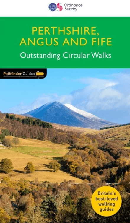
Wandelgids 027 Pathfinder Perthshire "big county" Angus & Five OS
Dunsinane Hill & Macbeth's castle - Sidlaw Hills in Strathmore
Korte omschrijving
Wandelgidsen Speyside, Schotland en Highlands, Schotland van Ordnance Survey. Ideaal voor tochten in Schotland.
Wandelgids Perthshire, Angus & Five - OS Productomschrijving: Each of the Jarrold Pathfinder titles features 28 circular routes, all tried and tested by seasoned walkers. The routes range f...

Specificaties
- Uitgever: Ordnance Survey
- ISBN-13: 9780319091289
- HOOFDCATEGORIEËN: Wandelgids
- Activiteiten: Wandelen, Hiking & Trekking
- Regio: Highlands, Schotland, Speyside, Schotland
- Land: Schotland
- Taal: Engels
- Reeks/Serie: Outstanding Circular Walks, Pathfinder Series, OS
- Iconische Bergketens van Europa: De Schotse Highlands
Volledige omschrijving
Wandelgids Perthshire, Angus & Five - OS
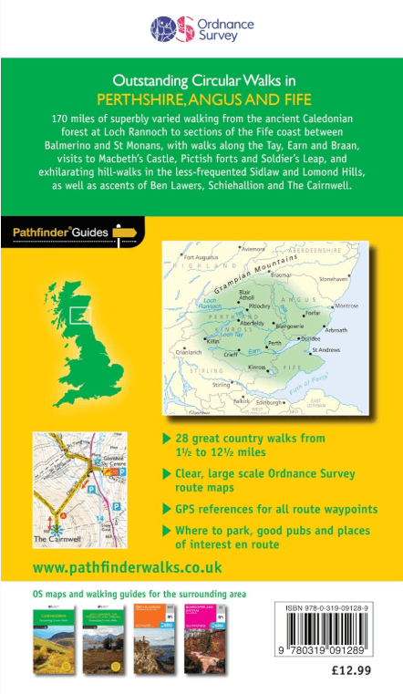
Productomschrijving: Each of the Jarrold Pathfinder titles features 28 circular routes, all tried and tested by seasoned walkers. The routes range from extended strolls to exhilarating hikes, so there is something for everyone.
They also contain:
- Ordnance Survey mapping;
- Background details of each area;
- Details of refreshment stops and parking;
- Walking safety advice; and
- Information about walkers and the law
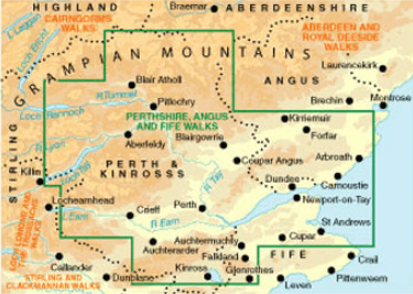
Approaching the eastern part of central Scotland, where the Grampians dominate the horizon, it appears at first glance to be mountain country. In fact much of the area is low-lying, with flat woodland and agricultural land bordered by gentle, rounded hills and an attractive North Sea coastline. Perthshire has enough lochs to vie with Cumbria's Lake District. Dunsinane Hill and the site of Macbeth's castle can be seen on the Sidlaw Hills in Strathmore, Angus, and there are also coastal walks around the Fife peninsula, with its waterfront villages, sheltered harbours and sandy beaches.
Overzichtskaarten

Overzicht Pathfinder guides - OS
Overzicht Pathfinder guides - OS

Producten op de overzichtskaart
Klik op een product om naar de detailpagina te gaan.
- Wandelgids 001 Pathfinder guides South Devon & Dartmoor NP - OS
- Wandelgids 003 Pathfinder guides Isle of Skye - OS
- Wandelgids 004 Pathfinder guides Cairngorms NP - OS
- Wandelgids 005 Pathfinder guides Cornwall England - OS
- Wandelgids 006 Pathfinder guides Cotswolds AONB - OS
- Wandelgids 007 Pathfinder guides Fort William & Glen Coe - OS
- Wandelgids 008 Pathfinder guides Kent - OS
- Wandelgids 009 Pathfinder guides Exmoor NP & the Quantocks - OS
- Wandelgids 010 Pathfinder guides Snowdonia NP Wales - OS
- Wandelgids 011 Pathfinder guides Dorset England - OS
- Wandelgids 012 Pathfinder New Forest & South Downs NP Hampshire
- Wandelgids 015 Pathfinder guides Yorkshire Dales NP - OS
- Wandelgids 018 Pathfinder guides Brecon Beacons Wales - OS
- Wandelgids 019 Pathfinder guides Dumfries & Galloway - OS
- Wandelgids 020 Pathfinder guides Sherwood Forest - OS
- Wandelgids 022 Pathfinder guides More Lake District - OS
- Wandelgids 023 Pathfinder guides Loch Lomond, Trossachs NP - OS
- Wandelgids 025 Pathfinder guides Thames Valley & Chilterns - OS
- Wandelgids 026 Pathfinder guides Dartmoor National Park - OS
- Wandelgids 027 Pathfinder Perthshire "big county" Angus & Five OS
- Wandelgids 028 Pathfinder guides North York Moors NP - OS
- Wandelgids 029 Pathfinder guides Wye Valley AONB & Forrest of Dean
- Wandelgids 030 Pathfinder guides Loch Ness & Iverness - OS
- Wandelgids 031 Pathfinder guides Oban, Mull & Kintyre - OS
- Wandelgids 034 Pathfinder guides Pembrokeshire Wales - OS
- Wandelgids 035 Pathfinder guides Northumberland- Scottish Borders
- Wandelgids 039 Pathfinder Durham, North Pennines & Tyne & Wear OS
- Wandelgids 041 Pathfinder guides Central Wales - OS
- Wandelgids 042 Pathfinder guides Cheshire England - OS
- Wandelgids 044 Pathfinder guides Essex England - OS
- Wandelgids 045 Pathfinder guides Norfolk - OS
- Wandelgids 046 Pathfinder guides Aberdeen & Royal Deeside - OS
- Wandelgids 047 Pathfinder Edinburgh, Pentlands & Lothians - OS
- Wandelgids 048 Pathfinder guides Suffolk East England - OS
- Wandelgids 049 Pathfinder guides Vale of York East England - OS
- Wandelgids 050 Pathfinder guides Lincolnshire & the Wolds - OS
- Wandelgids 051 Pathfinder guides Cambridgeshire & The Fens - OS
- Wandelgids 053 Pathfinder guides Lancashire NW En England - OS
- Wandelgids 054 Pathfinder guides Hertfordshire & Bedfordshire- OS
- Wandelgids 055 Pathfinder guides Gower, Swansea & Cardiff - OS
- Wandelgids 060 Pathfinder guides Lake District NP - OS
- Wandelgids 063 Pathfinder guides Peak District England - OS
- Wandelgids 064 Pathfinder guides South Pennines - OS
- Wandelgids 065 Pathfinder guides Surrey England - OS
- Wandelgids 066 Pathfinder guides West Sussex & South Downs - OS
- Wandelgids 067 Pathfinder guides South Downs NP & East Sussex- OS
- Wandelgids 068 Pathfinder guides Devon North & Mid - OS
- Wandelgids 069 Pathfinder guides South West England Coastal walks
- Wandelgids 071 Pathfinder guides High Fells of Lakeland - OS
- Wandelgids 073 Pathfinder guides More Peak District - OS
Artikelen uit dezelfde regio
Wandelkaart 356 Kintyre South- Highlands-Schotland - OSI • 9780319246078
Wandelkaart Kintyre South - Highlands Schotland 356 / Kintyre South, Highlands, Schotland. Kaart nummer 356 is een all purpose, avontuurlijke watervaste kaart vol gepakt met informatie om u het gebied te helpen leren kennen. De 204 Landranger-kaarten bestrijken het land. Elke kaart heeft een oppervlakte van 40 km door 40 km (25 mijl door 25 mijl) en zoals andere kaarten van Ordnance Su…

Wandelkaart OL46 Trossachs- Callander & Aberfoyle - OSI • 9780319469644
Wandelkaart Trossachs- Callander & Aberfoyle - Highland's Omvat ook: Callander, Aberfoyle & Lochearnhead Balquhidder & Strathyre. Productbeschrijving: Omvat initieel een gebied in het noordoosten van de Loch Lomond and The Trossachs National Park, omvat deze kaart Ben Tulaichean, Ben More, Stob Binnein, Stuc a'Chroin en Ben Vorlich. Deze kaart vervangt de vorige OS Explorer kaart 365 v…
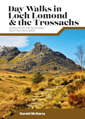
Wandelgids Day Walks in Loch Lomond & the Trossachs NP • 9781839810718
Day Walks in Loch Lomond & the Trossachs - Vertebrate Productomschrijving: 20 routes in the southern Scottish Highlands Day Walks in Loch Lomond & the Trossachs National Park features 20 day-length routes suitable for hillwalkers of all abilities. Researched and written by experienced local walker Gerald McGarry, the walks explore the highlights of the Loch Lomond & The Trossachs N…
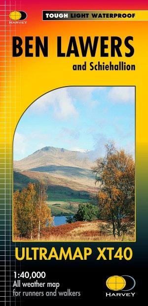
Wandelkaart XT40 Ben Lawers Highlands - Harvey Ultramaps • 9781851375783
Wandelkaart XT40 - Ben Lawers Highlands - Harvey Ultramaps productomschrijving: Ben Lawers, in het Schotse district Perthshire, is de naam van een bergmassief ten noorden van Loch Tay en van de hoogste top, centraal gelegen in de 12 km lange richel die alle bergen verbindt. Ben Lawers is te bereiken via wandelpaden over lange, met gras begroeide hellingen die vertrekken aan de weg die ten …
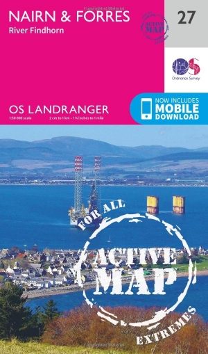
Wandelkaart 27 Nairn & Forres- Highland's Schotland - OSI • 9780319473504
Wandelkaart Nairn & Forres - Highland's Schotland Productbeschrijving: OS Landranger kaart 27 toont Moray Firth, net ten oosten van Inverness. De kust stad van Nairn is een populaire vakantiebestemming, of neem de Moray Coastal Trail langs Forres aan Findhorn. De OS Landranger kaarten reeks heeft betrekking op Groot-Brittannië met 204 gedetailleerde kaarten, perfect voor dagtochten en kort…