

Wandelgids 020 Pathfinder guides Sherwood Forest - OS
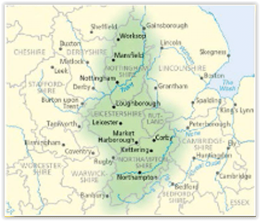
East Midlands


Korte omschrijving
Wandelgidsen East Midlands, England en Nottinghamshire, Engeland van Ordnance Survey. Ideaal voor tochten in England.
Wandelgids Sherwood Forest - OS Productomschrijving: With 28 circular, graded walks all tried and tested by seasoned walkers, this guidebook for the Sherwood Forest & the East Midlands walks...

Specificaties
- Uitgever: Ordnance Survey
- ISBN-13: 9780319091098
- HOOFDCATEGORIEËN: Wandelgids
- Activiteiten: Wandelen, Hiking & Trekking
- Regio: East Midlands, England, Nottinghamshire, Engeland
- Land: England
- Regionale parken: Sherwood Forest, Nottinghamshire England
- Taal: Engels
- Reeks/Serie: Outstanding Circular Walks, Pathfinder Series, OS
- De Engelse Graafschappen: Nottinghamshire
Volledige omschrijving
Wandelgids Sherwood Forest - OS
Productomschrijving: With 28 circular, graded walks all tried and tested by seasoned walkers, this guidebook for the Sherwood Forest & the East Midlands walks guidebook is ideal for holidaymakers and locals alike.
Sherwood Forest lies in Nottinghamshire England.
Overzichtskaarten

Overzicht Pathfinder guides - OS
Overzicht Pathfinder guides - OS

Producten op de overzichtskaart
Klik op een product om naar de detailpagina te gaan.
- Wandelgids 001 Pathfinder guides South Devon & Dartmoor NP - OS
- Wandelgids 003 Pathfinder guides Isle of Skye - OS
- Wandelgids 004 Pathfinder guides Cairngorms NP - OS
- Wandelgids 005 Pathfinder guides Cornwall England - OS
- Wandelgids 006 Pathfinder guides Cotswolds AONB - OS
- Wandelgids 007 Pathfinder guides Fort William & Glen Coe - OS
- Wandelgids 008 Pathfinder guides Kent - OS
- Wandelgids 009 Pathfinder guides Exmoor NP & the Quantocks - OS
- Wandelgids 010 Pathfinder guides Snowdonia NP Wales - OS
- Wandelgids 011 Pathfinder guides Dorset England - OS
- Wandelgids 012 Pathfinder New Forest & South Downs NP Hampshire
- Wandelgids 015 Pathfinder guides Yorkshire Dales NP - OS
- Wandelgids 018 Pathfinder guides Brecon Beacons Wales - OS
- Wandelgids 019 Pathfinder guides Dumfries & Galloway - OS
- Wandelgids 020 Pathfinder guides Sherwood Forest - OS
- Wandelgids 022 Pathfinder guides More Lake District - OS
- Wandelgids 023 Pathfinder guides Loch Lomond, Trossachs NP - OS
- Wandelgids 025 Pathfinder guides Thames Valley & Chilterns - OS
- Wandelgids 026 Pathfinder guides Dartmoor National Park - OS
- Wandelgids 027 Pathfinder Perthshire "big county" Angus & Five OS
- Wandelgids 028 Pathfinder guides North York Moors NP - OS
- Wandelgids 029 Pathfinder guides Wye Valley AONB & Forrest of Dean
- Wandelgids 030 Pathfinder guides Loch Ness & Iverness - OS
- Wandelgids 031 Pathfinder guides Oban, Mull & Kintyre - OS
- Wandelgids 034 Pathfinder guides Pembrokeshire Wales - OS
- Wandelgids 035 Pathfinder guides Northumberland- Scottish Borders
- Wandelgids 039 Pathfinder Durham, North Pennines & Tyne & Wear OS
- Wandelgids 041 Pathfinder guides Central Wales - OS
- Wandelgids 042 Pathfinder guides Cheshire England - OS
- Wandelgids 044 Pathfinder guides Essex England - OS
- Wandelgids 045 Pathfinder guides Norfolk - OS
- Wandelgids 046 Pathfinder guides Aberdeen & Royal Deeside - OS
- Wandelgids 047 Pathfinder Edinburgh, Pentlands & Lothians - OS
- Wandelgids 048 Pathfinder guides Suffolk East England - OS
- Wandelgids 049 Pathfinder guides Vale of York East England - OS
- Wandelgids 050 Pathfinder guides Lincolnshire & the Wolds - OS
- Wandelgids 051 Pathfinder guides Cambridgeshire & The Fens - OS
- Wandelgids 053 Pathfinder guides Lancashire NW En England - OS
- Wandelgids 054 Pathfinder guides Hertfordshire & Bedfordshire- OS
- Wandelgids 055 Pathfinder guides Gower, Swansea & Cardiff - OS
- Wandelgids 060 Pathfinder guides Lake District NP - OS
- Wandelgids 063 Pathfinder guides Peak District England - OS
- Wandelgids 064 Pathfinder guides South Pennines - OS
- Wandelgids 065 Pathfinder guides Surrey England - OS
- Wandelgids 066 Pathfinder guides West Sussex & South Downs - OS
- Wandelgids 067 Pathfinder guides South Downs NP & East Sussex- OS
- Wandelgids 068 Pathfinder guides Devon North & Mid - OS
- Wandelgids 069 Pathfinder guides South West England Coastal walks
- Wandelgids 071 Pathfinder guides High Fells of Lakeland - OS
- Wandelgids 073 Pathfinder guides More Peak District - OS
Artikelen uit dezelfde regio

Wandelkaart 140 Leicester- Coventry & Rugby - OSI • 9780319262382
Wandelkaart Leicester- Coventry & Rugby - England Productbeschrijving: Deze kaart van Leicester omvat ook Hinckley, Nuneaton, Coventry, Rugby, Bedworth, Atherstone, Thornton, Lutterworth, Welford, Wigston & onderdeel van de E2 Europese Long Distance pad. De OS Landranger kaarten reeks heeft betrekking op Groot-Brittannië met 204 gedetailleerde kaarten, perfect voor dagtochten en korte pauz…

Wandelkaart 233 Leicester & Hinckley England - OSI • 9780319244265
Wandelkaart Leicester & Hinckley - England Productbeschrijving: OS Explorer kaart 233 dekt Hinckley, Leicester en de omliggende steden en dorpen. Naast de Leicestershire ronde en Midshires way bevat dit gebied talrijke toutes voor wandelen, fietsen en paardrijden. De OS Explorer kaart voor Leicester & Hinckley is beschikbaar in zowel de standaard papieren versie als weerbestendige 'Actie…

Wandelkaart 272 Lincoln- East Midlands England - OSI • 9780319471449
Wandelkaart Lincoln - East Midlands England Omvat ook: Sleaford, Metheringham & Navenby. Productbeschrijving: Kaart nummer 272 omvat Lincoln en Sleaford. Hoogtepunten zijn Lincoln kasteel en de rivier Witham. Omvat ook Metheringham, Navenby en Noord Hykeham. De OS Explorer kaart voor Lincoln is beschikbaar in zowel de standaard papieren versie als de weerbestendige 'Actief' versie. …

Wandelkaart 259 Derby- Derbyshire - England - OSI • 9780319471319
Wandelkaart Derby - Derbyshire Easte Midland's England Omvat ook: Uttoxeter, Ashbourne & Cheadle. Productbeschrijving: Kaart nummer 259 in de OS Explorer reeks omvat Ashbourne, Uttoxeter, Cheadle en Derby in het Peak District National Park. Hoogtepunten van het gebied zijn onder andere: rivier Dove, rivier Churnet en de lange afstand wandelpaden zoals Centenary way, Derwent Valley road…

Wandelgids Derbyshire walking guide - Cicerone • 9781852846336
Wandelgids - Derbyshire walking guide - Cicerone Productomschrijving: Een handige gids die 60 circulaire dagwandelingen beschrijft, variërend van eenvoudig tot matig, in termen van moeilijkheden en terrein, die geschikt zijn voor het hele gezin. Derbyshire beschikt over een interessante geschiedenis die ook door middel van deze routes onderzocht kan worden, en elk thema rond een specifieke…