

Wandelgids 009 Pathfinder guides Exmoor NP & the Quantocks - OS
Vale of Porlock- Bristol Channel coast- North Hill- Minehead


Korte omschrijving
Wandelgidsen Somerset South West England en Devon, England van Ordnance Survey. Ideaal voor tochten in England.
Wandelgids Exmoor National Park & the Quantocks - OS Productomschrijving: Exmoor National Park comprises 265 square miles, of which about two-thirds lie in west Somerset and the remaining th...

Specificaties
- Uitgever: Ordnance Survey
- ISBN-13: 9780319090114
- HOOFDCATEGORIEËN: Wandelgids
- Activiteiten: Wandelen, Hiking & Trekking
- Auteur: Sue Viccars
- Regio: Devon, England, Somerset South West England
- Land: England
- Nationale parken: Exmoor NP, Devon England
- Taal: Engels
- Reeks/Serie: Outstanding Circular Walks, Pathfinder Series, OS
- De Nationale Parken: Exmoor Nationaal Park, Devon England
- De Engelse Graafschappen: Devon, Somerset
Volledige omschrijving
Wandelgids Exmoor National Park & the Quantocks - OS
Productomschrijving: Exmoor National Park comprises 265 square miles, of which about two-thirds lie in west Somerset and the remaining third in north Devon. This walking guidebook contains 28 circular, graded walks in Exmoor, all tried and tested by seasoned walkers. The routes range from extended strolls to longer hikes, so there is something for everyone.
The routes range from three to eleven miles in length and each is also rated for difficulty. Each walk includes a detailed description, an OS map, GPS waypoints and notes of key features and things to see. Routes include the Bristol Channel coast, stretching in a dramatic series of cliffs interrupted only by the Vale of Porlock, from North Hill above Minehead in the east to Little Hangman above Combe Martin in the west.
Pathfinder Guides are Britain’s best-loved walking guides. Printed with weather-resistant covers featuring durable rounded corners, they are the perfect companion for country walking throughout Britain.

Overzichtskaarten

Overzicht Pathfinder guides - OS
Overzicht Pathfinder guides - OS

Producten op de overzichtskaart
Klik op een product om naar de detailpagina te gaan.
- Wandelgids 001 Pathfinder guides South Devon & Dartmoor NP - OS
- Wandelgids 003 Pathfinder guides Isle of Skye - OS
- Wandelgids 004 Pathfinder guides Cairngorms NP - OS
- Wandelgids 005 Pathfinder guides Cornwall England - OS
- Wandelgids 006 Pathfinder guides Cotswolds AONB - OS
- Wandelgids 007 Pathfinder guides Fort William & Glen Coe - OS
- Wandelgids 008 Pathfinder guides Kent - OS
- Wandelgids 009 Pathfinder guides Exmoor NP & the Quantocks - OS
- Wandelgids 010 Pathfinder guides Snowdonia NP Wales - OS
- Wandelgids 011 Pathfinder guides Dorset England - OS
- Wandelgids 012 Pathfinder New Forest & South Downs NP Hampshire
- Wandelgids 015 Pathfinder guides Yorkshire Dales NP - OS
- Wandelgids 018 Pathfinder guides Brecon Beacons Wales - OS
- Wandelgids 019 Pathfinder guides Dumfries & Galloway - OS
- Wandelgids 020 Pathfinder guides Sherwood Forest - OS
- Wandelgids 022 Pathfinder guides More Lake District - OS
- Wandelgids 023 Pathfinder guides Loch Lomond, Trossachs NP - OS
- Wandelgids 025 Pathfinder guides Thames Valley & Chilterns - OS
- Wandelgids 026 Pathfinder guides Dartmoor National Park - OS
- Wandelgids 027 Pathfinder Perthshire "big county" Angus & Five OS
- Wandelgids 028 Pathfinder guides North York Moors NP - OS
- Wandelgids 029 Pathfinder guides Wye Valley AONB & Forrest of Dean
- Wandelgids 030 Pathfinder guides Loch Ness & Iverness - OS
- Wandelgids 031 Pathfinder guides Oban, Mull & Kintyre - OS
- Wandelgids 034 Pathfinder guides Pembrokeshire Wales - OS
- Wandelgids 035 Pathfinder guides Northumberland- Scottish Borders
- Wandelgids 039 Pathfinder Durham, North Pennines & Tyne & Wear OS
- Wandelgids 041 Pathfinder guides Central Wales - OS
- Wandelgids 042 Pathfinder guides Cheshire England - OS
- Wandelgids 044 Pathfinder guides Essex England - OS
- Wandelgids 045 Pathfinder guides Norfolk - OS
- Wandelgids 046 Pathfinder guides Aberdeen & Royal Deeside - OS
- Wandelgids 047 Pathfinder Edinburgh, Pentlands & Lothians - OS
- Wandelgids 048 Pathfinder guides Suffolk East England - OS
- Wandelgids 049 Pathfinder guides Vale of York East England - OS
- Wandelgids 050 Pathfinder guides Lincolnshire & the Wolds - OS
- Wandelgids 051 Pathfinder guides Cambridgeshire & The Fens - OS
- Wandelgids 053 Pathfinder guides Lancashire NW En England - OS
- Wandelgids 054 Pathfinder guides Hertfordshire & Bedfordshire- OS
- Wandelgids 055 Pathfinder guides Gower, Swansea & Cardiff - OS
- Wandelgids 060 Pathfinder guides Lake District NP - OS
- Wandelgids 063 Pathfinder guides Peak District England - OS
- Wandelgids 064 Pathfinder guides South Pennines - OS
- Wandelgids 065 Pathfinder guides Surrey England - OS
- Wandelgids 066 Pathfinder guides West Sussex & South Downs - OS
- Wandelgids 067 Pathfinder guides South Downs NP & East Sussex- OS
- Wandelgids 068 Pathfinder guides Devon North & Mid - OS
- Wandelgids 069 Pathfinder guides South West England Coastal walks
- Wandelgids 071 Pathfinder guides High Fells of Lakeland - OS
- Wandelgids 073 Pathfinder guides More Peak District - OS
Artikelen uit dezelfde regio
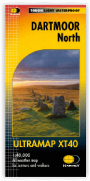
Wandelkaart XT40 Ultra - Dartmoor NP Noord - Harvey Maps • 9781851376322
Wandelkaart XT40 Ultra - Dartmoor NP Noord - Harvey Maps Productomschrijving: Omvat een groot gebied, maar de kaart is wel zeer praktisch en compact en in zakformaat - De kaart omvat gedetailleerde informatie voor lopers en wandelaars van het noordelijk deel van Dartmoor National Park. Omvat eveneens Dartmoor's bekende Tors waaronder Haytor Rocks, Yes Tor & High Willhays. Archaeologisc…

Wandelkaart Dartmoor National Park - Harvey maps • 9781851374649
Wandelkaart Dartmoor National Park - Harvey maps Productomschrijving: Deze Harvey kaart heeft de gehele Dartmoor op één kaart en wordt afgedrukt in samenwerking met de British Council van het alpinisme. Het omvat ook een geologische kaart van het gebied speciaal ontworpen door de British Geological Survey, klimcrags zijn ook gemarkeerd op de kaart. De kaart heeft ook tips over het gebruik …
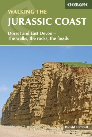
Wandelgids Walking the Jurassic Coast - Cicerone • 9781852847418
Wandelgids - Walking the Jurassic Coast - Cicerone Discover the Jurassic Coast of Devon and Dorset with a Cicerone guide. Productomschrijving: Deze gids bevat 30 wandelingen naar de Jurassic Coast van Devon en Dorset. Dekking van de kust tussen Exmouth en Bournemouth, deze prachtige routes variëren van 3 tot 16 mijl (5 tot 24km). De gids verkent en geeft uitleg over de spectaculaire ge…
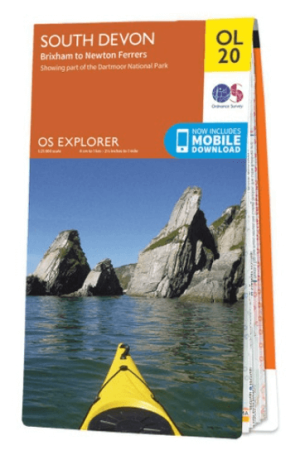
Wandelkaart OL20 South Devon & Dartmoor NP - OS • 9780319242599
Wandelkaart South Devon - OS Productomschrijving: South Devon, Dartmoor National Park and parts of the South West Coast Path SWCP, South Devon AONB and Tamar Valley AONB. Omvat: Brixham to Newton Ferrers, Avon Estuary Walk, Co-operative Way, Dart Valley Trail, E9 European Long Distanse Path, Erme-Plym Trail, Greenway Walk, John Musgrave Heritage Trail, Plymouth Cross-City Link, South …

Reisgids Time Out Devon & Cornwall - Crimson Pub. • 9781846702433
Reisgids - Time Out Devon & Cornwall - Crimson Pub. Productomschrijving: Devon en Cornwall zijn uniek, glorieus mooi en rijk aan geschiedenis en dieren in het wild. Ze bieden alles van traditionele vissersdorpen en zandstranden tot wandelingen in de wildernis en kastelen. Accommodaties variëren van campings en huisjes tot boerderijen en boetiekhotels. Of het nu gaat om gezinsvriendelijke o…