

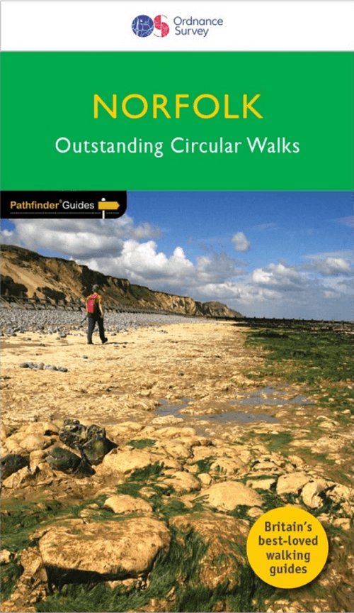
Wandelgids 045 Pathfinder guides Norfolk - OS
The Broads AONB- Oxburgh Hall- Boudicca's- Peddars Way
Korte omschrijving
Wandelgidsen East England van Ordnance Survey. Ideaal voor tochten in England.
Wandelgids Norfolk East England - OS Productomschrijving: These 28 circular, graded walks around Norfolk are all tried and tested by seasoned walkers. The routes range from extended strolls...

Specificaties
- Uitgever: Ordnance Survey
- ISBN-13: 9780319090152
- HOOFDCATEGORIEËN: Wandelgids
- Activiteiten: Wandelen, Hiking & Trekking
- Auteur: Dennis Kelsal
- Regio: East England
- Land: England
- Taal: Engels
- Reeks/Serie: Outstanding Circular Walks, Pathfinder Series, OS
- De Engelse Graafschappen: Norfolk
Volledige omschrijving
Wandelgids Norfolk East England - OS
Productomschrijving: These 28 circular, graded walks around Norfolk are all tried and tested by seasoned walkers. The routes range from extended strolls of four miles to exhilarating hikes of eleven, so there is something for everyone.
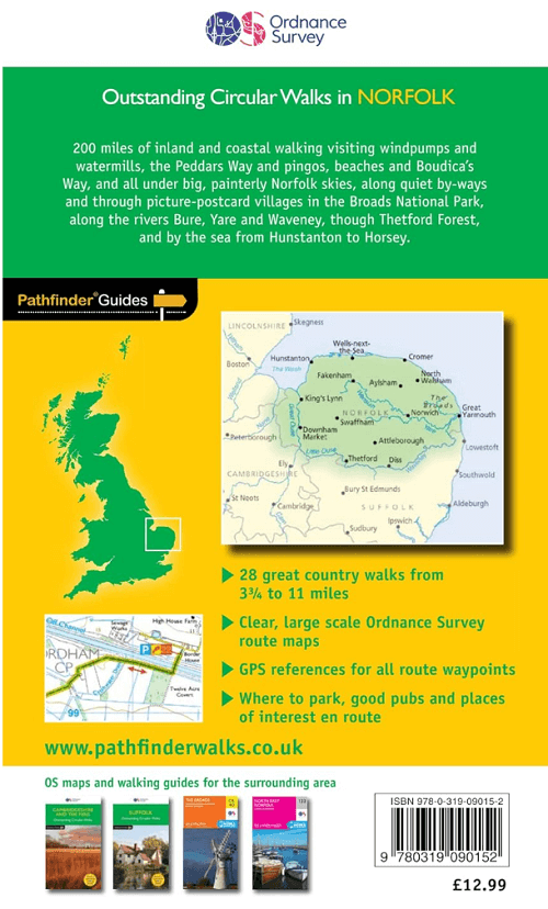
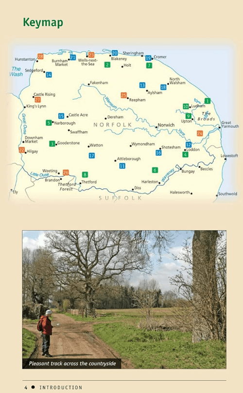
Each route includes information on parking and local amenities, detailed route description, a large-scale OS map and notes on the landscape and key features to keep an eye out for. They are also rated for difficulty and approximate time so you can quickly choose a route to suit your needs, Highlights of the area include the stunning coastal scenery in the north of the county, the unique inland waterways of the Broads AONB to the east and the remote beauty of the vast fenlands to the west. Walking routes include the historic highlights of Castle Rising and Oxburgh Hall, ancient routes such as Boudicca's and the Peddars Way and stunning seascapes at Overstrand and Wells-next-the Sea.
Pathfinder Guides are Britain’s best-loved walking guides. Printed with weather-resistant covers featuring durable rounded corners, they are the perfect companion for country walking throughout Britain.
Walks in this book:
- Horsey
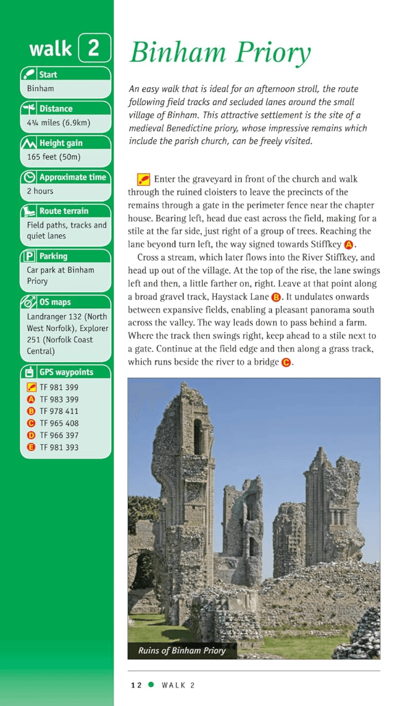
- Binham Priory
- Oxborough and Gooderstone
- Hales Green from Loddon
- Marham Fen and the Nar Valley Way
- Tyrrel's Wood and Shelton
- Felbrigg Park and Metton
- Langmere and the Devil's Punchbowl
- River Bure and Upton Marshes
- How Hill and Ludham
- The Buckenhams
- Hardley Cross
- Blickling and the River Bure
- Peddars Way Fring and Sedgeford
- Castle Acre and West Acre
- Boudca's Way Shotesham & Saxlingham Nethergate
- Thompson Common and the Pingos
- Westwick Woods and the Weaver's Way
- West Runton and Beacons Hill
- Wiveton Downs and Cley next the Sea
- The Burnhams
- Denver Sluice a three rivers walk
- Wells-next-the-Sea, Warham, and Wighton
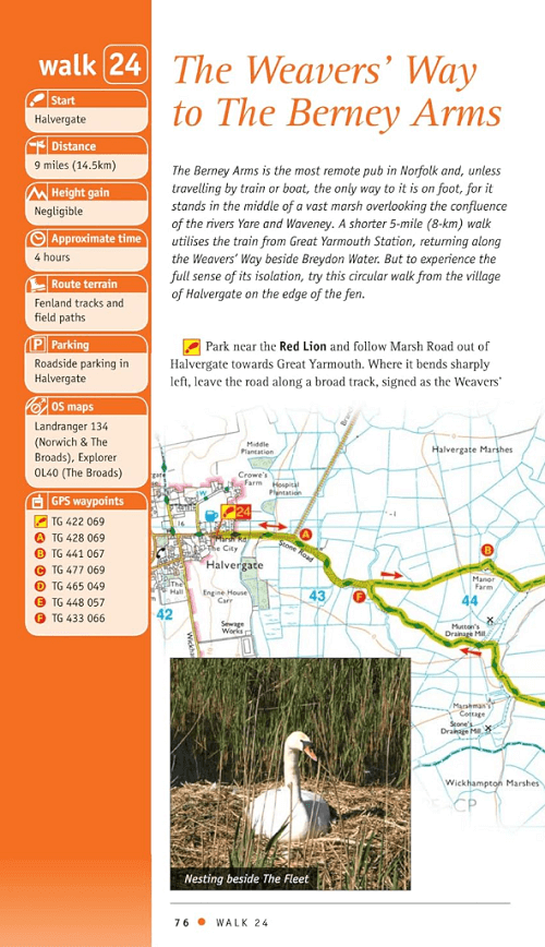
- The Weaver's Way to The Berney Arms
- Reepham, Marriott's Way, and Salle
- Weeting Castle and Grime's Graves
- Castle Rising and Roydon Common
- Ringstead Downs and the Norfolk Coast
Overzichtskaarten

Overzicht Pathfinder guides - OS
Overzicht Pathfinder guides - OS

Producten op de overzichtskaart
Klik op een product om naar de detailpagina te gaan.
- Wandelgids 001 Pathfinder guides South Devon & Dartmoor NP - OS
- Wandelgids 003 Pathfinder guides Isle of Skye - OS
- Wandelgids 004 Pathfinder guides Cairngorms NP - OS
- Wandelgids 005 Pathfinder guides Cornwall England - OS
- Wandelgids 006 Pathfinder guides Cotswolds AONB - OS
- Wandelgids 007 Pathfinder guides Fort William & Glen Coe - OS
- Wandelgids 008 Pathfinder guides Kent - OS
- Wandelgids 009 Pathfinder guides Exmoor NP & the Quantocks - OS
- Wandelgids 010 Pathfinder guides Snowdonia NP Wales - OS
- Wandelgids 011 Pathfinder guides Dorset England - OS
- Wandelgids 012 Pathfinder New Forest & South Downs NP Hampshire
- Wandelgids 015 Pathfinder guides Yorkshire Dales NP - OS
- Wandelgids 018 Pathfinder guides Brecon Beacons Wales - OS
- Wandelgids 019 Pathfinder guides Dumfries & Galloway - OS
- Wandelgids 020 Pathfinder guides Sherwood Forest - OS
- Wandelgids 022 Pathfinder guides More Lake District - OS
- Wandelgids 023 Pathfinder guides Loch Lomond, Trossachs NP - OS
- Wandelgids 025 Pathfinder guides Thames Valley & Chilterns - OS
- Wandelgids 026 Pathfinder guides Dartmoor National Park - OS
- Wandelgids 027 Pathfinder Perthshire "big county" Angus & Five OS
- Wandelgids 028 Pathfinder guides North York Moors NP - OS
- Wandelgids 029 Pathfinder guides Wye Valley AONB & Forrest of Dean
- Wandelgids 030 Pathfinder guides Loch Ness & Iverness - OS
- Wandelgids 031 Pathfinder guides Oban, Mull & Kintyre - OS
- Wandelgids 034 Pathfinder guides Pembrokeshire Wales - OS
- Wandelgids 035 Pathfinder guides Northumberland- Scottish Borders
- Wandelgids 039 Pathfinder Durham, North Pennines & Tyne & Wear OS
- Wandelgids 041 Pathfinder guides Central Wales - OS
- Wandelgids 042 Pathfinder guides Cheshire England - OS
- Wandelgids 044 Pathfinder guides Essex England - OS
- Wandelgids 045 Pathfinder guides Norfolk - OS
- Wandelgids 046 Pathfinder guides Aberdeen & Royal Deeside - OS
- Wandelgids 047 Pathfinder Edinburgh, Pentlands & Lothians - OS
- Wandelgids 048 Pathfinder guides Suffolk East England - OS
- Wandelgids 049 Pathfinder guides Vale of York East England - OS
- Wandelgids 050 Pathfinder guides Lincolnshire & the Wolds - OS
- Wandelgids 051 Pathfinder guides Cambridgeshire & The Fens - OS
- Wandelgids 053 Pathfinder guides Lancashire NW En England - OS
- Wandelgids 054 Pathfinder guides Hertfordshire & Bedfordshire- OS
- Wandelgids 055 Pathfinder guides Gower, Swansea & Cardiff - OS
- Wandelgids 060 Pathfinder guides Lake District NP - OS
- Wandelgids 063 Pathfinder guides Peak District England - OS
- Wandelgids 064 Pathfinder guides South Pennines - OS
- Wandelgids 065 Pathfinder guides Surrey England - OS
- Wandelgids 066 Pathfinder guides West Sussex & South Downs - OS
- Wandelgids 067 Pathfinder guides South Downs NP & East Sussex- OS
- Wandelgids 068 Pathfinder guides Devon North & Mid - OS
- Wandelgids 069 Pathfinder guides South West England Coastal walks
- Wandelgids 071 Pathfinder guides High Fells of Lakeland - OS
- Wandelgids 073 Pathfinder guides More Peak District - OS
Artikelen uit dezelfde regio

Wandelkaart 208 Bedford & St Neots- Sandy - OSI • 9780319470800
Wandelkaart Bedford & St Neots- Sandy- Bedfordshire Omvat ook: Sandy & Biggleswade. Productbeschrijving: OS Explorer kaart 208 toont de steden van Bedford, St Neots, Sandy en Biggleswade. Andere hoogtepunten zijn de Forest van Marston Vale, de Greensand Ridge Walk, John Bunyan trail en de Ouse Valley way. De OS Explorer kaart voor Bedford & St Neots is beschikbaar in zowel de standaard…

Wandelkaart 175 Southend-on-Sea & Basildon - OSI • 9780319470473
Wandelkaart Southend-on-Sea & Basildon - East England Omvat ook: Brentwood & Billericay. Productbeschrijving: Beroemd om haar pier, ligt Southend-on-Sea aan de zuidoostelijke hoek van deze kaart waarin Canvety Island, Basildon, Brentwood en Billericay. Onderdeel vormen van de Thames Chase community forest en Hannigfield Resevoir zijn ook van toepassing. De OS Explorer kaart voor Southe…
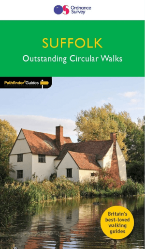
Wandelgids 048 Pathfinder guides Suffolk East England - OS • 9780319090381
Wandelgids Suffolk - OS Proiductomschrijving: This walkers guide has 28 circular, graded walks in Suffolk, all tested by seasoned walkers. The routes range from extended strolls to exhilarating hikes, from under three to over ten miles, so there is something for everyone. Each walk includes a detailed, turn by turn description, an extract of the large-scale OS map, photos and notes identi…
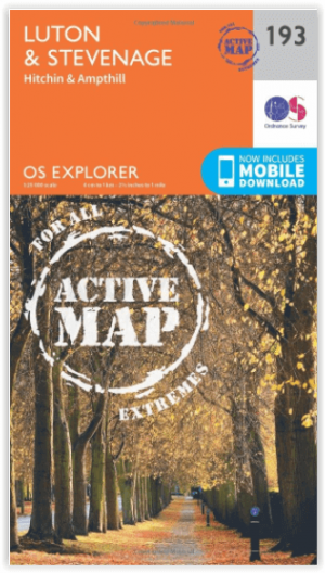
Wandelkaart 193 Luton & Stevenage & Hitchin - OSI • 9780319470657
Wandelkaart Luton & Stevenage - Hitchin & Ampthill E. England Productbeschrijving: Kaart nummer 193 in de OS Explorer kaarten reeks omvat The Chilterns AONB, een Area of Outstanding Natural Beauty AONB. De Chiltern Way, Icknield Way Trail en John Bunyan Trail zijn enkele van de wandelingen in dit gebied die gaan langs de steden van Luton, Stevenage, Hitchin en Ampthill. De OS Explorer kaar…