

Wandelkaart 175 Southend-on-Sea & Basildon - OSI
De Thames Chase community forest en Hannigfield Resevoir

Korte omschrijving
Wandelkaarten East England van Ordnance Survey. Ideaal voor tochten in England.
Wandelkaart Southend-on-Sea & Basildon - East England Omvat ook: Brentwood & Billericay. Productbeschrijving: Beroemd om haar pier, ligt Southend-on-Sea aan de zuidoostelijke hoek van de...

Specificaties
- Uitgever: Ordnance Survey
- ISBN-13: 9780319470473
- HOOFDCATEGORIEËN: Wandelkaart
- Activiteiten: Wandelen, Hiking & Trekking
- Regio: East England
- Land: England
- Waterafstotende kaart: Ordnance Survey ACTIVE Explorer Weatherproof Maps
- TOPO's & Stafkaarten: Topografisch wandelen
- Schaal: 1:25000
- Taal: Engels
- Reeks/Serie: Explorer ACTIVE Series OSI
Volledige omschrijving
Wandelkaart Southend-on-Sea & Basildon - East England
Omvat ook: Brentwood & Billericay.
Productbeschrijving: Beroemd om haar pier, ligt Southend-on-Sea aan de zuidoostelijke hoek van deze kaart waarin Canvety Island, Basildon, Brentwood en Billericay. Onderdeel vormen van de Thames Chase community forest en Hannigfield Resevoir zijn ook van toepassing. De OS Explorer kaart voor Southend-on-Sea & Basildon is beschikbaar in zowel de standaard papieren versie als de weerbestendige 'Actief' versie.
Productdiscription: Famous for its pier, Southend-on-Sea sits at the south east corner of this map that includes Canvety Island, Basildon, Brentwood and Billericay. Part of the Thames Chase community forest and Hannigfield Resevoir are also featured. The OS Explorer map for Southend-on-Sea & Basildon is available in both the standard paper version and weatherproof 'Active' version.
Locatie op kaart
Gekoppelde artikelen

Wandelkaart 175 Southend-on-Sea & Basildon Essex - OSI • 9780319243688
standaard versieWandelkaart Southend-on-Sea & Basildon - Essex England Omvat ook: Brentwood & Billericay Productomschrijving: Beroemd om haar pier, Southend-on-Sea ligt aan de zuidoostelijke hoek van deze kaart waarin Canvey Island, Basildon, Brentwood en Billericay aanwezig zijn. Onderdeel van de Thames Chase community forest en Hanningfield Reservoir worden ook getoont. De OS Explorer kaart voor Sou…

Wandelkaart 175 Southend-on-Sea & Basildon - OSI • 9780319470473
weatherproof versieWandelkaart Southend-on-Sea & Basildon - East England Omvat ook: Brentwood & Billericay. Productbeschrijving: Beroemd om haar pier, ligt Southend-on-Sea aan de zuidoostelijke hoek van deze kaart waarin Canvety Island, Basildon, Brentwood en Billericay. Onderdeel vormen van de Thames Chase community forest en Hannigfield Resevoir zijn ook van toepassing. De OS Explorer kaart voor Southe…
Artikelen uit dezelfde regio

Wandelkaart 193 Luton & Stevenage & Hitchin - OSI • 9780319470657
Wandelkaart Luton & Stevenage - Hitchin & Ampthill E. England Productbeschrijving: Kaart nummer 193 in de OS Explorer kaarten reeks omvat The Chilterns AONB, een Area of Outstanding Natural Beauty AONB. De Chiltern Way, Icknield Way Trail en John Bunyan Trail zijn enkele van de wandelingen in dit gebied die gaan langs de steden van Luton, Stevenage, Hitchin en Ampthill. De OS Explorer kaar…

Wandelgids 045 Pathfinder guides Norfolk - OS • 9780319090152
Wandelgids Norfolk East England - OS Productomschrijving: These 28 circular, graded walks around Norfolk are all tried and tested by seasoned walkers. The routes range from extended strolls of four miles to exhilarating hikes of eleven, so there is something for everyone. Each route includes information on parking and local amenities, detailed route description, a large-scale OS map a…

Wandelkaart 208 Bedford & St Neots- Sandy - OSI • 9780319470800
Wandelkaart Bedford & St Neots- Sandy- Bedfordshire Omvat ook: Sandy & Biggleswade. Productbeschrijving: OS Explorer kaart 208 toont de steden van Bedford, St Neots, Sandy en Biggleswade. Andere hoogtepunten zijn de Forest van Marston Vale, de Greensand Ridge Walk, John Bunyan trail en de Ouse Valley way. De OS Explorer kaart voor Bedford & St Neots is beschikbaar in zowel de standaard…
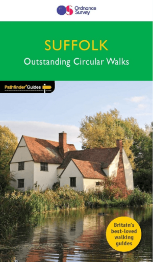
Wandelgids 048 Pathfinder guides Suffolk East England - OS • 9780319090381
Wandelgids Suffolk - OS Proiductomschrijving: This walkers guide has 28 circular, graded walks in Suffolk, all tested by seasoned walkers. The routes range from extended strolls to exhilarating hikes, from under three to over ten miles, so there is something for everyone. Each walk includes a detailed, turn by turn description, an extract of the large-scale OS map, photos and notes identi…