

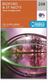
Wandelkaart 208 Bedford & St Neots- Sandy - OSI
Omvat de Forest van Marston Vale & de Greensand Ridge Walk
Korte omschrijving
Wandelkaarten Bedfordshire, England en East England van Ordnance Survey. Ideaal voor tochten in England.
Wandelkaart Bedford & St Neots- Sandy- Bedfordshire Omvat ook: Sandy & Biggleswade. Productbeschrijving: OS Explorer kaart 208 toont de steden van Bedford, St Neots, Sandy en Biggleswade...

Specificaties
- Uitgever: Ordnance Survey
- ISBN-13: 9780319470800
- HOOFDCATEGORIEËN: Wandelkaart
- Activiteiten: Wandelen, Hiking & Trekking
- Regio: Bedfordshire, England, East England
- Land: England
- Waterafstotende kaart: Ordnance Survey ACTIVE Explorer Weatherproof Maps
- TOPO's & Stafkaarten: Topografisch wandelen
- Schaal: 1:25000
- Taal: Engels
- Reeks/Serie: Explorer ACTIVE Series OSI
Volledige omschrijving
Wandelkaart Bedford & St Neots- Sandy- Bedfordshire
Omvat ook: Sandy & Biggleswade.
Productbeschrijving: OS Explorer kaart 208 toont de steden van Bedford, St Neots, Sandy en Biggleswade. Andere hoogtepunten zijn de Forest van Marston Vale, de Greensand Ridge Walk, John Bunyan trail en de Ouse Valley way. De OS Explorer kaart voor Bedford & St Neots is beschikbaar in zowel de standaard papieren versie als de weerbestendige 'Actief' versie.
Productdiscription: OS Explorer map sheet 208 shows the towns of Bedford, St Neots, Sandy and Biggleswade. Other highlights include the Forest of Marston Vale, the Greensand Ridge Walk, John Bunyan Trial, and the Ouse Valley Way. The OS Explorer map for Bedford & St Neots is available in both the standard paper version and weatherproof 'Active' version.
Locatie op kaart
Gekoppelde artikelen

Wandelkaart 208 Bedford & St Neots- Bedforeshire - OSI • 9780319244012
standaard versieWandelkaart Bedford & St Neots- Bedforeshire - England Productbeschrijving: Sandy & Biggleswade. 208 / Bedford & St Neots, Bedforeshire, England - OS Explorer kaart 208 toont de steden van Bedford, St Neots, Sandy en Biggleswade. Andere hoogtepunten zijn de Forest van Marston Vale, de Greensand Ridge Walk, John Bunyan proces en de Ouse Valley Way. De OS Explorer kaart voor Bedford & S…

Wandelkaart 208 Bedford & St Neots- Sandy - OSI • 9780319470800
weatherproof versieWandelkaart Bedford & St Neots- Sandy- Bedfordshire Omvat ook: Sandy & Biggleswade. Productbeschrijving: OS Explorer kaart 208 toont de steden van Bedford, St Neots, Sandy en Biggleswade. Andere hoogtepunten zijn de Forest van Marston Vale, de Greensand Ridge Walk, John Bunyan trail en de Ouse Valley way. De OS Explorer kaart voor Bedford & St Neots is beschikbaar in zowel de standaard…
Artikelen uit dezelfde regio

Wandelgids 054 Pathfinder guides Hertfordshire & Bedfordshire- OS • 9780319090077
Wandelgids Hertfordshire & Bedfordshire - OS Productomschrijving: This walkers guide contains 28 outstanding circular walks in Hertfordshire and Bedfordshire ranging from 5.5km to 15km. Each route has easy-to-follow route descriptions, clear Ordnance Survey route maps, GPS waypoints, where to park, good pubs and places of interest en route. All of the routes have been researched and writt…
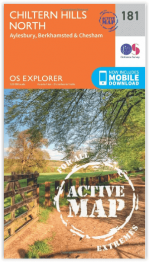
Wandelkaart 181 - Chiltern Hills AONB North- England - OSI • 9780319470534
Wandelkaart Chiltern Hills AONB North - Oxfordshire Omvat ook: Aylesbury, Berkhamsted & Chesham. Productbeschrijving: Kaart nummer 181 in de OS Explorer reeks omvat Aylesbury, Wendover, Berkhamstead, Chesham, Princes Risborough en Tring. Hoogtepunten van het gebied zijn The Chiltern Hills, rivier Thame, The Chilterns AONB, Aylesbury Ring, de Ridgeway en de Chiltern way. De OS Explorer …

Wandelkaart 193 Luton & Stevenage- Bedfordshire - OSI • 9780319243862
Wandelkaart Luton & Stevenage - Bedfordshire England Omvat ook: Hitchin & Ampthill Productomschrijving: Kaart nummer 193 in de OS Explorer kaarten reeks omvat The Chilterns AONB. De Chiltern way, Icknield way Trail en John Bunyan Trail zijn maar enkele van de wandelingen in dit gebied die gaan langs de steden van Luton, Stevenage, Hitchin en Ampthill. De OS Explorer kaart voor Luton & …

Wandelgids 045 Pathfinder guides Norfolk - OS • 9780319090152
Wandelgids Norfolk East England - OS Productomschrijving: These 28 circular, graded walks around Norfolk are all tried and tested by seasoned walkers. The routes range from extended strolls of four miles to exhilarating hikes of eleven, so there is something for everyone. Each route includes information on parking and local amenities, detailed route description, a large-scale OS map a…

Wandelkaart 172 Chiltern Hills East AONB- Oxfordshire- OSI • 9780319470442
Wandelkaart Chiltern Hills East AONB - Oxfordshire England Omvat ook: High Wycombe, Maidenhead & Rickmansworth. Productbeschrijving: Kaart nummer 172 in de OS Explorer kaarten reeks omvat High Wycombe, Maidenhead, Rickmansworth, Gerrards Cross, Northwood, Slough, Uxbridge, Hillingdon, Amersham, Chorleywood, Ruislip en Marlow, de oostelijke Chiltern Hills AONB en het pad van de Thames. …