

Wandelkaart 208 Bedford & St Neots- Bedforeshire - OSI
Omvat de Forest van Marston Vale & de Greensand Ridge Walk
Korte omschrijving
Wandelkaarten Bedfordshire, England van Ordnance Survey. Ideaal voor tochten in England.
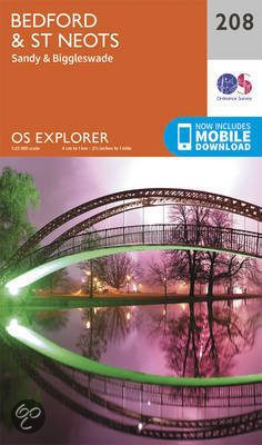
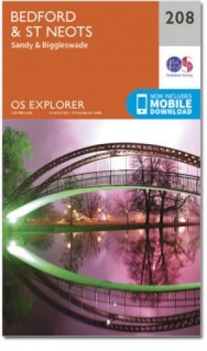
Wandelkaart Bedford & St Neots- Bedforeshire - England Productbeschrijving: Sandy & Biggleswade. 208 / Bedford & St Neots, Bedforeshire, England - OS Explorer kaart 208 toont de steden ...

Specificaties
- Uitgever: Ordnance Survey
- ISBN-13: 9780319244012
- HOOFDCATEGORIEËN: Wandelkaart
- Activiteiten: Wandelen, Hiking & Trekking
- Regio: Bedfordshire, England
- Land: England
- TOPO's & Stafkaarten: Topografisch wandelen
- Schaal: 1:25000
- Taal: Engels
- Reeks/Serie: Explorer Series OS
Volledige omschrijving
Wandelkaart Bedford & St Neots- Bedforeshire - England
Productbeschrijving: Sandy & Biggleswade.
208 / Bedford & St Neots, Bedforeshire, England - OS Explorer kaart 208 toont de steden van Bedford, St Neots, Sandy en Biggleswade. Andere hoogtepunten zijn de Forest van Marston Vale, de Greensand Ridge Walk, John Bunyan proces en de Ouse Valley Way. De OS Explorer kaart voor Bedford & St Neots is beschikbaar in zowel de standaard papieren versie als de weerbestendige 'Actief' versie.
208 / Bedford & St Neots, Bedforeshire, England - OS Explorer map sheet 208 shows the towns of Bedford, St Neots, Sandy and Biggleswade. Other highlights include the Forest of Marston Vale, the Greensand Ridge Walk, John Bunyan Trial, and the Ouse Valley Way. The OS Explorer map for Bedford & St Neots is available in both the standard paper version and weatherproof 'Active' version.
Locatie op kaart
Gekoppelde artikelen

Wandelkaart 208 Bedford & St Neots- Bedforeshire - OSI • 9780319244012
standaard versieWandelkaart Bedford & St Neots- Bedforeshire - England Productbeschrijving: Sandy & Biggleswade. 208 / Bedford & St Neots, Bedforeshire, England - OS Explorer kaart 208 toont de steden van Bedford, St Neots, Sandy en Biggleswade. Andere hoogtepunten zijn de Forest van Marston Vale, de Greensand Ridge Walk, John Bunyan proces en de Ouse Valley Way. De OS Explorer kaart voor Bedford & S…
Wandelkaart 208 Bedford & St Neots- Sandy - OSI • 9780319470800
weatherproof versieWandelkaart Bedford & St Neots- Sandy- Bedfordshire Omvat ook: Sandy & Biggleswade. Productbeschrijving: OS Explorer kaart 208 toont de steden van Bedford, St Neots, Sandy en Biggleswade. Andere hoogtepunten zijn de Forest van Marston Vale, de Greensand Ridge Walk, John Bunyan trail en de Ouse Valley way. De OS Explorer kaart voor Bedford & St Neots is beschikbaar in zowel de standaard…
Overzichtskaarten

OSI Explorer & Explorer Active - Midden Engeland - Midlands
OSI Explorer & Explorer Active - Midden Engeland - Midlands

Producten op de overzichtskaart
Klik op een product om naar de detailpagina te gaan.
- Wandelkaart 180 Oxford- England - OSI
- Wandelkaart 181 Chiltern Hills North AONB- Wycombe - OSI
- Wandelkaart 182 St-Albans & Hatfield- Hertfordshire - OSI
- Wandelkaart 189 Hereford & Ross-on-Wye- England - OSI
- Wandelkaart 190 Malvern Hills AONB & Bredon Hill - OSI
- Wandelkaart 191 Banbury- Bicester & Chipping Norton- OSI
- Wandelkaart 192 Buckingham & Milton Keynes - OSI
- Wandelkaart 193 Luton & Stevenage- Bedfordshire - OSI
- Wandelkaart 194 Hertford & Bishop's Stortford - OSI
- Wandelkaart 202 Leominster & Bromyard Hererfordshire - OSI
- Wandelkaart 203 Ludlow & Shropshire Hills AONB - OSI
- Wandelkaart 204 Worcester & Droitwich Spa - OSI
- Wandelkaart 205 Stratford-upon-Avon & Evesham - OSI
- Wandelkaart 206 Edge Hill & Fenny Compton - OSI
- Wandelkaart 207 Newport Pagnell & Northampton - OSI
- Wandelkaart 208 Bedford & St Neots- Bedforeshire - OSI
- Wandelkaart 209 Cambridge - England - OSI
- Wandelkaart 217 Long Mynd & Wenlock Edge - OSI
- Wandelkaart 218 Kidderminster & Wyre Forest - OSI
- Wandelkaart 219 Wolverhampton & Dudley - OSI
- Wandelkaart 220 Birmingham- West Midlands - OSI
- Wandelkaart 221 Coventry & Warwickshire - OSI
- Wandelkaart 222 Rugby & Daventry- Warwickshire - OSI
- Wandelkaart 223 Northampton & Market Harborough - OSI
- Wandelkaart 224 Corby- Kettering & Wellingborough - OSI
- Wandelkaart 225 Huntingdon & St Ives - OSI
- Wandelkaart 227 Peterborough- Cambridgeshire England - OSI
- Wandelkaart 228 March- Ely- Chatteris & Littleport - OSI
- Wandelkaart 232 Nuneaton & Tamworth- Warwickshire - OSI
- Wandelkaart 233 Leicester & Hinckley England - OSI
- Wandelkaart 234 Rutland Water & Stamford- Oakham - OSI
- Wandelkaart 235 Wisbech & Peterborough North - OSI
- Wandelkaart 241 Shrewsbury- shropshire England - OSI
- Wandelkaart 242 Telford- Ironbridge & the Wrekin - OSI
- Wandelkaart 243 Market Drayton- Schropshire - OSI
- Wandelkaart 244 Cannock Chase & Chasewater- Severn - OSI
- Wandelkaart 245 National Forest- Burton-upon-Trent - OSI
- Wandelkaart 245 National Forest - OSI
- Wandelkaart 246 Loughborough- Leicestershire England - OSI
- Wandelkaart 247 Grantham- Lincolnshire - OSI
- Wandelkaart 248 Bourne & Heckington- lincolnshire - OSI
- Wandelkaart 249 Spalding & Holbeach- Lincolnshire - OSI
- Wandelkaart 257 Crewe & Nantwich & Cheshire East - OSI
- Wandelkaart 258 Stoke-on-Trent & Newcastle-under-Lyme- OSI
- Wandelkaart 259 Derby & Utoxeter- Derbyshire - OSI
- Wandelkaart 260 Nottingham & Vale of Belvoir - OSI
- Wandelkaart 261 Boston & Lincolnshire- England - OSI
- Wandelkaart 267 Northwich & Delamere Forest - OSI
- Wandelkaart 268 Wilmslow- Macclesfield & Congleton - OSI
- Wandelkaart 269 Chesterfield & Alfreton- Derbyshire- OSI
- Wandelkaart 270 Sherwood Forest- Nottinghamshire - OSI
- Wandelkaart 271 Newark-on-Trent- Nottinghampshire - OSI
- Wandelkaart 272 Lincoln- England - OSI
- Wandelkaart 273 Lincolnshire Wolds South- England - OSI
- Wandelkaart 274 Skegness- Alford & Spilsby - OSI
- Wandelkaart 275 Liverpool- South West England - OSI
- Wandelkaart 276 Bolton- Wigan & Warrington- Machester - OSI
- Wandelkaart 277 Manchester & Salford - OSI
- Wandelkaart 278 Sheffield & Barnsley- South Yorkshire - OSI
- Wandelkaart 279 Doncaster- South Yorkshire - OSI
- Wandelkaart 280 Isle of Axholme- Lincolnshire - OSI
- Wandelkaart 281 Ancholme Valley- Lincolnshire - OSI
- Wandelkaart 282 Lincolnshire Wolds North- England - OSI
- Wandelkaart 283 Louth & Mablethorpe- Lincolnshire - OSI
- Wandelkaart 284 Grimsby- Cleethorpes & Immingham - OSI
- Wandelkaart OL01 Peak District NP & Dark Peak area - OS
- Wandelkaart OL13 Brecon Beacons National Parc East - OS
- Wandelkaart OL24 Peak District & White Peak area - OS
- Wandelkaart OL40 The Broads National Park - OS

OSI Explorer & Explorer Active - Zuid Oost England - Kent & London
OSI Explorer & Explorer Active - Zuid Oost England - Kent & London

Producten op de overzichtskaart
Klik op een product om naar de detailpagina te gaan.
- Wandelkaart OL03 Meon Valley Portsmouth - OS
- Wandelkaart OL08 Chichester- South Harting & Selsey - OS
- Wandelkaart OL10 Arundel- Pulborough & Worthing - OS
- Wandelkaart OL11 Brighton- Hove & South Downs NP - OS
- Wandelkaart OL22 New Forest National Park - OS
- Wandelkaart OL25 Eastbourne & Beachy Head - OS
- Wandelkaart OL32 Winchester, New Alresford & East Meon - OS
- Wandelkaart OL29 Isle of Wight & Cowes - OSI
- Wandelkaart OL29 Isle of Wight South East England - OS
- Wandelkaart OL33 Haslemere & Petersfield - OS
- Wandelkaart OL33 Haslemere & Petersfield - OS
- Wandelkaart OL45 The Cotswolds AONB - OS
- Wandelkaart 118 Shaftesbury & Cranbourne Chase - OSI
- Wandelkaart 124 Hastings & Bexhill East Sussex - OSI
- Wandelkaart 124 Hastings & Bexhill East Sussex - OSI
- Wandelkaart 125 Romney Marsh Rye & Winchelsea - OSI
- Wandelkaart 130 Salisburry & Stonehenge- Wiltshire - OSI
- Wandelkaart 131 Romsey & Andover - Hampshire - OSI
- Wandelkaart 135 Ashdown Forest - East Sussex - OSI
- Wandelkaart 136 High Weald Royal Tunbridge Wells - OSI
- Wandelkaart 137 Ashford, Kent England - OSI
- Wandelkaart 138 Dover Folkstone & Hythe Kent - OSI
- Wandelkaart 144 Basingstoke - Alton & Whitchurch - OSI
- Wandelkaart 145 Guildford & Farnham- Surrey - OSI
- Wandelkaart 146 Dorking- Box Hill & Reigate- Surrey - OSI
- Wandelkaart 147 Sevenoaks & Tonbridge- Kent - OSI
- Wandelkaart 148 Maidstone & Medway Towns Kent - OSI
- Wandelkaart 149 Sittingbourne & Faversham- Kent - OSI
- Wandelkaart 150 Canterbury & Isle of Thanet- Kent - OSI
- Wandelkaart 157 Marlborough & Savernake Forest - OSI
- Wandelkaart 158 Newbury & Hungerford- Berkshire - OSI
- Wandelkaart 159 Reading- S.E. England - OSI
- Wandelkaart 160 Windsor- Weybridge & Bracknell - OSI
- Wandelkaart 161 London South - OSI
- Wandelkaart 162 Greenwich & Gravesend - OSI
- Wandelkaart 163 Gravesend & Rochester - OSI
- Wandelkaart 169 Cirencester & Swindon - England - OSI
- Wandelkaart 170 Abingdon & Wantage - Oxfordshire - OSI
- Wandelkaart 171 Chiltern Hills West AONB - Wycombe - OSI
- Wandelkaart 172 Chiltern Hills East AONB - Wycombe - OSI
- Wandelkaart 173 London North- England - OSI
- Wandelkaart 174 Epping Forest & Lee Valley- Essex - OSI
- Wandelkaart 175 Southend-on-Sea & Basildon Essex - OSI
- Wandelkaart 176 Blackwater Estuary- Essex- England - OSI
- Wandelkaart 180 Oxford- England - OSI
- Wandelkaart 181 Chiltern Hills North AONB- Wycombe - OSI
- Wandelkaart 182 St-Albans & Hatfield- Hertfordshire - OSI
- Wandelkaart 183 Chelmsford & the Rodings- Essex - OSI
- Wandelkaart 191 Banbury- Bicester & Chipping Norton- OSI
- Wandelkaart 192 Buckingham & Milton Keynes - OSI
- Wandelkaart 193 Luton & Stevenage- Bedfordshire - OSI
- Wandelkaart 194 Dorchester & Weymouth Dorset - OSI
- Wandelkaart 195 Braintree & Saffron Walden Essex - OSI
- Wandelkaart 196 Sudbury Hadleigh & Dedham Vale - OSI
- Wandelkaart 197 Ipswich Felixstowe & Harwich - OSI
- Wandelkaart 205 Stratford-upon-Avon & Evesham - OSI
- Wandelkaart 206 Edge Hill & Fenny Compton - OSI
- Wandelkaart 207 Newport Pagnell & Northampton - OSI
- Wandelkaart 208 Bedford & St Neots- Bedforeshire - OSI
- Wandelkaart 209 Cambridge - England - OSI
- Wandelkaart 210 Newmarket- Haverhill & Barrow - OSI
Artikelen uit dezelfde regio

Wandelkaart 172 Chiltern Hills East AONB- Oxfordshire- OSI • 9780319470442
Wandelkaart Chiltern Hills East AONB - Oxfordshire England Omvat ook: High Wycombe, Maidenhead & Rickmansworth. Productbeschrijving: Kaart nummer 172 in de OS Explorer kaarten reeks omvat High Wycombe, Maidenhead, Rickmansworth, Gerrards Cross, Northwood, Slough, Uxbridge, Hillingdon, Amersham, Chorleywood, Ruislip en Marlow, de oostelijke Chiltern Hills AONB en het pad van de Thames. …

Wandelgids 054 Pathfinder guides Hertfordshire & Bedfordshire- OS • 9780319090077
Wandelgids Hertfordshire & Bedfordshire - OS Productomschrijving: This walkers guide contains 28 outstanding circular walks in Hertfordshire and Bedfordshire ranging from 5.5km to 15km. Each route has easy-to-follow route descriptions, clear Ordnance Survey route maps, GPS waypoints, where to park, good pubs and places of interest en route. All of the routes have been researched and writt…
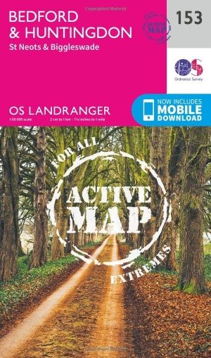
Wandelkaart 153 Bedford & Huntingdon- England - OSI • 9780319474761
Wandelkaart Bedford & Huntingdon - Bedfordshire England Productbeschrijving: De oude steden van Bedford, Huntingdon en St Neots liggen allemaal aan de oevers van de Great Ouse - die op deze OS Landranger 153 kaart verschijnen. De belangrijkste bezienswaardigheden van Bedford omvatten St Paul's Church en Bedford Park. Huntingdon, als geboorteplaats van Oliver Cromwell is een historische sta…

Wandelkaart 166 Luton- Hertford & Hitchin- Bedfordshire - OSI • 9780319474891
Wandelkaart 166 - Luton- Hertford & Hitchin- Bedfordshire Productbeschrijving: Het platteland van Hertfordshire gedekt door OS Landranger kaart 166 trekt wandel- en fietsroute enthusiastellingen aan, en voor een goede reden. Er zijn vele wandel- of fietstroutes zoals de Cole Green way alngs de oude spoorweg van Hertford aan de unieke Welwyn Garden City. De OS Landranger kaarten reeks h…

Wandelgids Lea Valley walk - Cicerone Press • 9781786312877
Wandelgids Lea Valley walk - Cicerone Productomschrijving: Guidebook to the Lea Valley Walk, a 53 mile path from Luton to the Thames. The walk traces the River Lea from Leagrave, near Luton to East India Dock opposite Greenwich where it joins the Thames Path. Features an alternative finish at Limehouse and an optional tour of the Olympic Park. Split into 9 stages, the walk is suitable for …