

Wandelkaart OL29 Isle of Wight & Cowes - OSI
Also including Newport & Ryde


Korte omschrijving
Wandelkaarten Isle of White, Engeland van Ordnance Survey. Ideaal voor tochten in England.
Wandelkaart Isle of Wight & Cowes England Productomschrijving: Kaart nummer OL29 in de OS Explorer-kaartserie is de perfecte kaart voor uw dagje uit en vakanties op het Isle of Wight. Een id...

Specificaties
- Uitgever: Ordnance Survey
- ISBN-13: 9780319475638
- HOOFDCATEGORIEËN: Wandelkaart
- Activiteiten: Wandelen, Hiking & Trekking
- Regio: Isle of White, Engeland
- Land: England
- Waterafstotende kaart: Ordnance Survey ACTIVE Explorer Weatherproof Maps
- TOPO's & Stafkaarten: Topografisch wandelen
- Schaal: 1:25000
- Taal: Engels
- Reeks/Serie: Explorer ACTIVE Series OSI
- Grote Eilanden: Isle of White, Ierse zee
Volledige omschrijving
Wandelkaart Isle of Wight & Cowes England
Productomschrijving: Kaart nummer OL29 in de OS Explorer-kaartserie is de perfecte kaart voor uw dagje uit en vakanties op het Isle of Wight. Een ideale bestemming voor strandliefhebbers, wandelaars, surfers en mountainbikers, het Isle of Wight herbergt vele attracties. Hoogtepunten van het gebied zijn onder meer: The Needles, Ventnor, Blackgang Chine, Sandown, Newport en Osborne House.
Engelse omschrijving: Map sheet number OL29 in the OS Explorer map series is the perfect map for your days out and holidays on the Isle of Wight. An ideal destination for beach lovers, walkers, surfers and mountain bikers, the Isle of Wight is home to many attractions. Highlights of the area include: The Needles, Ventnor, Blackgang Chine,Sandown, Newport and Osborne House.

Locatie op kaart
Overzichtskaarten

OSI Explorer & Explorer Active - Zuid Oost England - Kent & London
OSI Explorer & Explorer Active - Zuid Oost England - Kent & London

Producten op de overzichtskaart
Klik op een product om naar de detailpagina te gaan.
- Wandelkaart OL03 Meon Valley Portsmouth - OS
- Wandelkaart OL08 Chichester- South Harting & Selsey - OS
- Wandelkaart OL10 Arundel- Pulborough & Worthing - OS
- Wandelkaart OL11 Brighton- Hove & South Downs NP - OS
- Wandelkaart OL22 New Forest National Park - OS
- Wandelkaart OL25 Eastbourne & Beachy Head - OS
- Wandelkaart OL32 Winchester, New Alresford & East Meon - OS
- Wandelkaart OL29 Isle of Wight & Cowes - OSI
- Wandelkaart OL29 Isle of Wight South East England - OS
- Wandelkaart OL33 Haslemere & Petersfield - OS
- Wandelkaart OL33 Haslemere & Petersfield - OS
- Wandelkaart OL45 The Cotswolds AONB - OS
- Wandelkaart 118 Shaftesbury & Cranbourne Chase - OSI
- Wandelkaart 124 Hastings & Bexhill East Sussex - OSI
- Wandelkaart 124 Hastings & Bexhill East Sussex - OSI
- Wandelkaart 125 Romney Marsh Rye & Winchelsea - OSI
- Wandelkaart 130 Salisburry & Stonehenge- Wiltshire - OSI
- Wandelkaart 131 Romsey & Andover - Hampshire - OSI
- Wandelkaart 135 Ashdown Forest - East Sussex - OSI
- Wandelkaart 136 High Weald Royal Tunbridge Wells - OSI
- Wandelkaart 137 Ashford, Kent England - OSI
- Wandelkaart 138 Dover Folkstone & Hythe Kent - OSI
- Wandelkaart 144 Basingstoke - Alton & Whitchurch - OSI
- Wandelkaart 145 Guildford & Farnham- Surrey - OSI
- Wandelkaart 146 Dorking- Box Hill & Reigate- Surrey - OSI
- Wandelkaart 147 Sevenoaks & Tonbridge- Kent - OSI
- Wandelkaart 148 Maidstone & Medway Towns Kent - OSI
- Wandelkaart 149 Sittingbourne & Faversham- Kent - OSI
- Wandelkaart 150 Canterbury & Isle of Thanet- Kent - OSI
- Wandelkaart 157 Marlborough & Savernake Forest - OSI
- Wandelkaart 158 Newbury & Hungerford- Berkshire - OSI
- Wandelkaart 159 Reading- S.E. England - OSI
- Wandelkaart 160 Windsor- Weybridge & Bracknell - OSI
- Wandelkaart 161 London South - OSI
- Wandelkaart 162 Greenwich & Gravesend - OSI
- Wandelkaart 163 Gravesend & Rochester - OSI
- Wandelkaart 169 Cirencester & Swindon - England - OSI
- Wandelkaart 170 Abingdon & Wantage - Oxfordshire - OSI
- Wandelkaart 171 Chiltern Hills West AONB - Wycombe - OSI
- Wandelkaart 172 Chiltern Hills East AONB - Wycombe - OSI
- Wandelkaart 173 London North- England - OSI
- Wandelkaart 174 Epping Forest & Lee Valley- Essex - OSI
- Wandelkaart 175 Southend-on-Sea & Basildon Essex - OSI
- Wandelkaart 176 Blackwater Estuary- Essex- England - OSI
- Wandelkaart 180 Oxford- England - OSI
- Wandelkaart 181 Chiltern Hills North AONB- Wycombe - OSI
- Wandelkaart 182 St-Albans & Hatfield- Hertfordshire - OSI
- Wandelkaart 183 Chelmsford & the Rodings- Essex - OSI
- Wandelkaart 191 Banbury- Bicester & Chipping Norton- OSI
- Wandelkaart 192 Buckingham & Milton Keynes - OSI
- Wandelkaart 193 Luton & Stevenage- Bedfordshire - OSI
- Wandelkaart 194 Dorchester & Weymouth Dorset - OSI
- Wandelkaart 195 Braintree & Saffron Walden Essex - OSI
- Wandelkaart 196 Sudbury Hadleigh & Dedham Vale - OSI
- Wandelkaart 197 Ipswich Felixstowe & Harwich - OSI
- Wandelkaart 205 Stratford-upon-Avon & Evesham - OSI
- Wandelkaart 206 Edge Hill & Fenny Compton - OSI
- Wandelkaart 207 Newport Pagnell & Northampton - OSI
- Wandelkaart 208 Bedford & St Neots- Bedforeshire - OSI
- Wandelkaart 209 Cambridge - England - OSI
- Wandelkaart 210 Newmarket- Haverhill & Barrow - OSI
Artikelen uit dezelfde regio
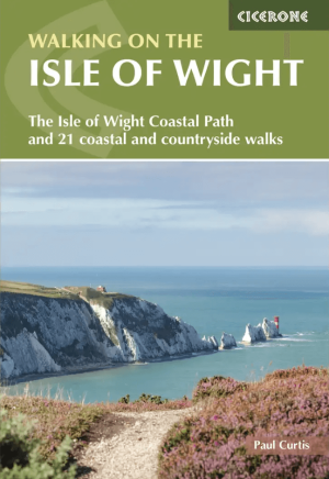
Wandelgids Isle of Wight walking guide - Cicerone • 9781786312563
Wandelgids Isle of Wight - Cicerone Productomschrijving: Guidebook to 33 walking routes on the beautiful Isle of Wight, from 4 to 18 miles long. The routes are suitable for all abilities and are accessible all year round. Includes a complete circuit of the island's spectacular coast as well as walks exploring forest trails and downland, and visiting the towns of Yarmouth, Cowes and Ventnor…
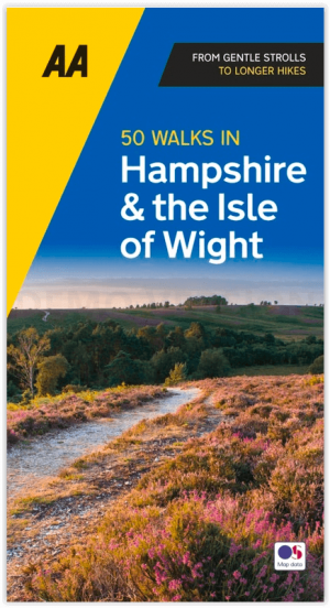
Wandelgids Hampshire & Isle of Wight - 50 walks - AA Publishing • 9780749583248
Wandelgids Hampshire & Isle of Wight - AA Productomschrijving: De Isle of White is bekend voor zijn natuur in open zee, daarenboven bevat dit eiland zijn eigen AONB, of Area of Outstanding Natural Beauty, of bij ons gekend als gebied van uitmuntend natuurschoon. Engelse omschrijving: Walking is one of Britain's favourite leisure activities, and AA 50 Walks in Hampshire & Isle of Wight …

Wandelkaart 196 The Solent & Isle of Wight - OSI • 9780319262948
Wandelkaart The Solent & Isle of Wight England Productbeschrijving: Kaart nummer 196 in de OS Landranger kaarten reeks is de ideale kaart om te gebruiken bij het plannen van dagexcusies of vakantie in de Solent en The Isle of Wight. Het gebied is beroemd om zijn kust-wandelingen en het New Forest Nationaal park. Hoogtepunten van het gebied zijn onder andere: Lyndhurst, Southampton, Calshot…

Wandelkaart 196 The Solent & Isle of Wight - OSI • 9780319475195
Wandelkaart The Solent & the Isle of Wight - England Productbeschrijving: Kaart nummer 196 in de OS Landranger kaarten reeks, is de ideale kaart om te gebruiken bij het plannen van daguitstapjes of vakantie in de Solent en The Isle of Wight. Het gebied is beroemd om zijn zeilen, kust-wandelingen en het New Forest Nationaal park. Hoogtepunten van het gebied zijn onder andere: Lyndhurst, Sou…

Reisgids Slow Travel Isle of Wight - Bradt Travel guides • 9781804693421
Reisgids Isle of Wight - Bradt Travel guides Productomschrijving: This brand new guide to the Isle of Wight forms part of Bradt’s top-selling, award-winning series of Slow travel guides to UK regions. Written by expert author and journalist Mark Rowe, who has visited the island over 30 times since first spending childhood holidays there, it is the perfect companion to help you get the mos…