

Wandelkaart 144 Basingstoke - Alton & Whitchurch - OSI
Omvat Hampshire- Whitchurch tot Odiham en Alton

Korte omschrijving
Wandelkaarten Hampshire, England van Ordnance Survey. Ideaal voor tochten in England.
Wandelkaart Basingstoke- Alton & Whitchurch - Hampshire England Productbeschrijving: Alton & Whitchurch Odiham, Overton & Hook. 144 / Basingstoke, Alton & Whitchurch - Hampshire, Englan...

Specificaties
- Uitgever: Ordnance Survey
- ISBN-13: 9780319243374
- HOOFDCATEGORIEËN: Wandelkaart
- Activiteiten: Wandelen, Hiking & Trekking
- Regio: Hampshire, England
- Land: England
- Waterafstotende kaart: Ordnance Survey ACTIVE Explorer Weatherproof Maps
- TOPO's & Stafkaarten: Topografisch wandelen
- Schaal: 1:25000
- Taal: Engels
- Reeks/Serie: Explorer Series OS
Volledige omschrijving
Wandelkaart Basingstoke- Alton & Whitchurch - Hampshire England
Productbeschrijving: Alton & Whitchurch Odiham, Overton & Hook.
144 / Basingstoke, Alton & Whitchurch - Hampshire, England - Kaart nummerl 144 in de OS Explorer reeks heeft betrekking op een gebied in het noorden van Hampshire, van Whitchurch in het westen tot Odiham en Alton in het Oosten, rond in de stad van Basingstoke. De Wayfarer's kruist de North Wessex Downs, een gebied van uitzonderlijke natuurlijke schoonheid AONB. Andere hoogtepunten: Overton en haak, samen met de recreatieve paden van St Swithun's manier, de manier waarop drie kastelen en Test manier.
144 / Basingstoke, Alton & Whitchurch - Hampshire, England - Map sheet number 144 in the OS Explorer series covers an area in the north of Hampshire, from Whitchurch in the west to Odiham and Alton in the east, taking in the town of Basingstoke. The Wayfarer's Walk crosses the North Wessex Downs, an area of Outstanding Natural Beauty AONB. Other highlights: Overton and Hook, along with the recreational paths of St Swithun's Way, Three Castles Way and Test Way.
Locatie op kaart
Gekoppelde artikelen

Wandelkaart 144 Basingstoke - Alton & Whitchurch - OSI • 9780319243374
standaard versieWandelkaart Basingstoke- Alton & Whitchurch - Hampshire England Productbeschrijving: Alton & Whitchurch Odiham, Overton & Hook. 144 / Basingstoke, Alton & Whitchurch - Hampshire, England - Kaart nummerl 144 in de OS Explorer reeks heeft betrekking op een gebied in het noorden van Hampshire, van Whitchurch in het westen tot Odiham en Alton in het Oosten, rond in de stad van Basingstoke…

Wandelkaart 144 Basingstoke Alton & Whitchurch- Hampshire • 9780319470169
weatherproof versieWandelkaart Basingstoke- Alton & Whitchurch - Hampshire England Omvat ook: Odiham, Overton & Hook. Productbeschrijving: Kaart nummer 144 in de OS Explorer kaarten reeks heeft betrekking op een gebied in het noorden van Hampshire, van Whitchurch in het westen tot Odiham en Alton in het Oosten, en betrekken de stad van Basingstoke. De Wayfarer's walk kruist de North Wessex Downs, een geb…
Overzichtskaarten

OSI Explorer & Explorer Active - Zuid England
OSI Explorer & Explorer Active - Zuid England

Producten op de overzichtskaart
Klik op een product om naar de detailpagina te gaan.
- Wandelkaart 117 Cerne Abbas & Bere Regis - Dorset - OSI
- Wandelkaart 118 Shaftesbury & Cranbourne Chase - OSI
- Wandelkaart 129 Yeovil & Sherborne - Somerset - OSI
- Wandelkaart 130 Salisburry & Stonehenge- Wiltshire - OSI
- Wandelkaart 131 Romsey & Andover - Hampshire - OSI
- Wandelkaart 135 Ashdown Forest - East Sussex - OSI
- Wandelkaart 141 Cheddar Gorge & Mendip Hills - OSI
- Wandelkaart 142 Shepton Mallet & Mendip Hills - OSI
- Wandelkaart 143 Warminster & Trowbridge - Wiltshire - OSI
- Wandelkaart 144 Basingstoke - Alton & Whitchurch - OSI
- Wandelkaart 145 Guildford & Farnham- Surrey - OSI
- Wandelkaart 146 Dorking- Box Hill & Reigate- Surrey - OSI
- Wandelkaart 147 Sevenoaks & Tonbridge- Kent - OSI
- Wandelkaart 154 Bristol West & Portishead- Bristol - OSI
- Wandelkaart 155 Bristol & Bath & Bristol Area - OSI
- Wandelkaart 156 Chippenham & Bradford-on-Avon - OSI
- Wandelkaart 157 Marlborough & Savernake Forest - OSI
- Wandelkaart 158 Newbury & Hungerford- Berkshire - OSI
- Wandelkaart 159 Reading- S.E. England - OSI
- Wandelkaart 160 Windsor- Weybridge & Bracknell - OSI
- Wandelkaart 161 London South - OSI
- Wandelkaart 162 Greenwich & Gravesend - OSI
- Wandelkaart 167 Thornbury- Dursley & Yate - England- OSI
- Wandelkaart 168 Stroud- Tetbury & Malmesbury - OSI
- Wandelkaart 169 Cirencester & Swindon - England - OSI
- Wandelkaart 170 Abingdon & Wantage - Oxfordshire - OSI
- Wandelkaart 171 Chiltern Hills West AONB - Wycombe - OSI
- Wandelkaart 172 Chiltern Hills East AONB - Wycombe - OSI
- Wandelkaart 173 London North- England - OSI
- Wandelkaart 174 Epping Forest & Lee Valley- Essex - OSI
- Wandelkaart 179 Gloucester- Cheltenham & Stroud - OSI
- Wandelkaart 180 Oxford- England - OSI
- Wandelkaart 181 Chiltern Hills North AONB- Wycombe - OSI
- Wandelkaart 182 St-Albans & Hatfield- Hertfordshire - OSI
- Wandelkaart OL03 Meon Valley Portsmouth - OS
- Wandelkaart OL08 Chichester- South Harting & Selsey - OS
- Wandelkaart OL10 Arundel- Pulborough & Worthing - OS
- Wandelkaart OL11 Brighton- Hove & South Downs NP - OS
- Wandelkaart OL22 New Forest National Park - OS
- Wandelkaart OL25 Eastbourne & Beachy Head - OS
- Wandelkaart OL29 Isle of Wight South East England - OS
- Wandelkaart OL32 Winchester, New Alresford & East Meon - OS
- Wandelkaart OL33 Haslemere & Petersfield - OS
- Wandelkaart OL34 Crawley & Horsham - Ordnance Survey

OSI Explorer & Explorer Active - Zuid Oost England - Kent & London
OSI Explorer & Explorer Active - Zuid Oost England - Kent & London

Producten op de overzichtskaart
Klik op een product om naar de detailpagina te gaan.
- Wandelkaart OL03 Meon Valley Portsmouth - OS
- Wandelkaart OL08 Chichester- South Harting & Selsey - OS
- Wandelkaart OL10 Arundel- Pulborough & Worthing - OS
- Wandelkaart OL11 Brighton- Hove & South Downs NP - OS
- Wandelkaart OL22 New Forest National Park - OS
- Wandelkaart OL25 Eastbourne & Beachy Head - OS
- Wandelkaart OL32 Winchester, New Alresford & East Meon - OS
- Wandelkaart OL29 Isle of Wight & Cowes - OSI
- Wandelkaart OL29 Isle of Wight South East England - OS
- Wandelkaart OL33 Haslemere & Petersfield - OS
- Wandelkaart OL33 Haslemere & Petersfield - OS
- Wandelkaart OL45 The Cotswolds AONB - OS
- Wandelkaart 118 Shaftesbury & Cranbourne Chase - OSI
- Wandelkaart 124 Hastings & Bexhill East Sussex - OSI
- Wandelkaart 124 Hastings & Bexhill East Sussex - OSI
- Wandelkaart 125 Romney Marsh Rye & Winchelsea - OSI
- Wandelkaart 130 Salisburry & Stonehenge- Wiltshire - OSI
- Wandelkaart 131 Romsey & Andover - Hampshire - OSI
- Wandelkaart 135 Ashdown Forest - East Sussex - OSI
- Wandelkaart 136 High Weald Royal Tunbridge Wells - OSI
- Wandelkaart 137 Ashford, Kent England - OSI
- Wandelkaart 138 Dover Folkstone & Hythe Kent - OSI
- Wandelkaart 144 Basingstoke - Alton & Whitchurch - OSI
- Wandelkaart 145 Guildford & Farnham- Surrey - OSI
- Wandelkaart 146 Dorking- Box Hill & Reigate- Surrey - OSI
- Wandelkaart 147 Sevenoaks & Tonbridge- Kent - OSI
- Wandelkaart 148 Maidstone & Medway Towns Kent - OSI
- Wandelkaart 149 Sittingbourne & Faversham- Kent - OSI
- Wandelkaart 150 Canterbury & Isle of Thanet- Kent - OSI
- Wandelkaart 157 Marlborough & Savernake Forest - OSI
- Wandelkaart 158 Newbury & Hungerford- Berkshire - OSI
- Wandelkaart 159 Reading- S.E. England - OSI
- Wandelkaart 160 Windsor- Weybridge & Bracknell - OSI
- Wandelkaart 161 London South - OSI
- Wandelkaart 162 Greenwich & Gravesend - OSI
- Wandelkaart 163 Gravesend & Rochester - OSI
- Wandelkaart 169 Cirencester & Swindon - England - OSI
- Wandelkaart 170 Abingdon & Wantage - Oxfordshire - OSI
- Wandelkaart 171 Chiltern Hills West AONB - Wycombe - OSI
- Wandelkaart 172 Chiltern Hills East AONB - Wycombe - OSI
- Wandelkaart 173 London North- England - OSI
- Wandelkaart 174 Epping Forest & Lee Valley- Essex - OSI
- Wandelkaart 175 Southend-on-Sea & Basildon Essex - OSI
- Wandelkaart 176 Blackwater Estuary- Essex- England - OSI
- Wandelkaart 180 Oxford- England - OSI
- Wandelkaart 181 Chiltern Hills North AONB- Wycombe - OSI
- Wandelkaart 182 St-Albans & Hatfield- Hertfordshire - OSI
- Wandelkaart 183 Chelmsford & the Rodings- Essex - OSI
- Wandelkaart 191 Banbury- Bicester & Chipping Norton- OSI
- Wandelkaart 192 Buckingham & Milton Keynes - OSI
- Wandelkaart 193 Luton & Stevenage- Bedfordshire - OSI
- Wandelkaart 194 Dorchester & Weymouth Dorset - OSI
- Wandelkaart 195 Braintree & Saffron Walden Essex - OSI
- Wandelkaart 196 Sudbury Hadleigh & Dedham Vale - OSI
- Wandelkaart 197 Ipswich Felixstowe & Harwich - OSI
- Wandelkaart 205 Stratford-upon-Avon & Evesham - OSI
- Wandelkaart 206 Edge Hill & Fenny Compton - OSI
- Wandelkaart 207 Newport Pagnell & Northampton - OSI
- Wandelkaart 208 Bedford & St Neots- Bedforeshire - OSI
- Wandelkaart 209 Cambridge - England - OSI
- Wandelkaart 210 Newmarket- Haverhill & Barrow - OSI
Artikelen uit dezelfde regio

Reisgids Zuid-Engeland - Uitgeverij Lannoo • 9789059960978
Reisgids Zuid-Engeland - Lannoo Productomschrijving: Engelandkenner Dirk Musschoot laat je op een onovertroffen wijze kennismaken met de regio's Kent, East en West Sussex, Surrey, Hampshire en het eiland Wight, en de bestemmingen die je daar absoluut niet mag missen. Enkele voorbeelden: de optrekjes van Charles Darwin, Winston Churchill en Rudyard Kipling, de imposante kliffen van Beac…
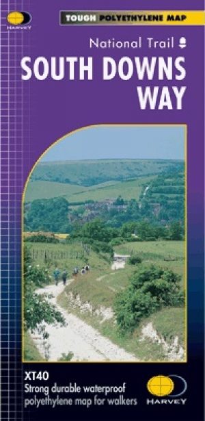
Wandelkaart South Downs Way - Harvey maps • 9781851374779
Wandelkaart South Downs Way - Harvey maps Productomschrijving: Toont de gehele route op één plan, 162km (101 mijl) tussen Winchester en Eastbourne. Geschikt voor wandelaars, fietsers en ruiters met alternatieve routes duidelijk aangetoond. Informatie over het vinden van accommodatie, camping en voedsel. Routebeschrijving naar de start van de trail. Nieuwe generatie HARVEY Superwalker,…

Wandelkaart 131 Romsey- Andover & Test Valley- Hampshire • 9780319470060
Wandelkaart Romsey- Andover & Test Valley - Hampshire England Omvat ook: Stockbridge & Ludgershall Productbeschrijving: Kaart nummer 131 in de OS Explorer kaarten reeks heeft betrekking op het gebied van Oxenwood en Ashmansworth in het noorden tot Romsey en Redlynch in het zuiden. Hoogtepunten van het gebied zijn onder andere: Andover, Ludgershall, Stockbridge en de wandelingen van de …

Wandelgids Winchester short walks - Cicerone • 9781786311641
Winchester short walks - Cicerone Productomschrijving: Malcolm Leatherdale heeft 15 van de beste korte wandelingen rond Winchester en centraal Hampshire voor je uitgezocht. Onze gids is voorzien van goed leesbare Ordnance Survey-kaarten en duidelijke routebeschrijvingen, perfect als je voor het eerst gaat wandelen of iets zoekt waar je met het hele gezin van kunt genieten. We hebben in…

Reisgids Go Slow New Forest National Park - Bradt guides • 9781804690482
Reisgids New Forest National Park - Bradt guides Productomschrijving: Deze nieuwe, grondig bijgewerkte en uitgebreide tweede editie van Bradt's New Forest - onderdeel van de bekroonde 'Slow travel' serie van gidsen over Britse regio's - richt zich op dit vredige, betoverende gebied in Hampshire. Wandelaars, fietsers, natuurliefhebbers, gezinnen en fijnproevers komen allemaal aan hun trekke…