

Wandelkaart 179 Gloucester- Cheltenham & Stroud - OSI
Omvat de omgeving van Gloucester & Cheltenham
Korte omschrijving
Wandelkaarten Gloucestershire, Egland van Ordnance Survey. Ideaal voor tochten in England.
Wandelkaart Gloucester- Cheltenham & Stroud - Gloucestershire Productbeschrijving: Gloucester & Cheltenham 179 / Gloucester, Cheltenham & Stroud, Gloucestershire, England - Kaart nummer ...

Specificaties
- Uitgever: Ordnance Survey
- ISBN-13: 9780319243725
- HOOFDCATEGORIEËN: Wandelkaart
- Activiteiten: Wandelen, Hiking & Trekking
- Regio: Gloucestershire, Egland
- Land: England
- TOPO's & Stafkaarten: Topografisch wandelen
- Schaal: 1:25000
- Taal: Engels
- Reeks/Serie: Explorer Series OS
Volledige omschrijving
Wandelkaart Gloucester- Cheltenham & Stroud - Gloucestershire
Productbeschrijving: Gloucester & Cheltenham
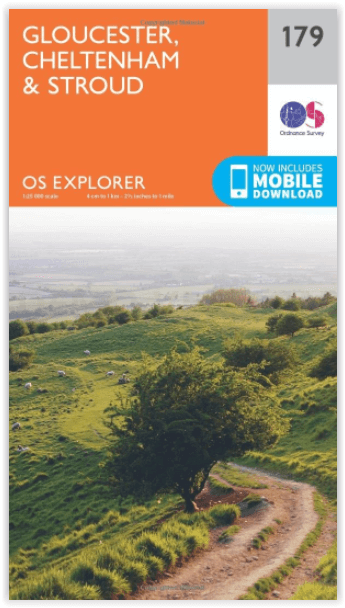
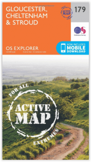
179 / Gloucester, Cheltenham & Stroud, Gloucestershire, England - Kaart nummer 179 in de OS Explorer reeks heeft betrekking op de omgeving van Gloucester, Cheltenham, Stroud. Hoogtepunten van het gebied zijn onder meer: The Cotswolds AONB gebied van uitzonderlijke natuurlijke schoonheid AONB Vale van Gloucester, rivier de Severn en de wijze van de Cotswolds. De OS Explorer kaart voor Gloucester, Cheltenham & Stroud is beschikbaar in zowel de standaard papieren versie als de weerbestendige 'Actief' versie.
179 / Gloucester, Cheltenham & Stroud, Gloucestershire, England - Map sheet number 179 in the OS Explorer series covers the area around Gloucester, Cheltenham, Stroud. Highlights of the area include: Cotswolds Area of Outstanding Natural Beauty AONB, Vale of Gloucester, River Severn and the Cotswolds Way. The OS Explorer map for Gloucester, Cheltenham & Stroud is available in both the standard paper version and weatherproof 'Active' version.
.png)
Locatie op kaart
Gekoppelde artikelen

Wandelkaart 179 Gloucester- Cheltenham & Stroud - OSI • 9780319243725
standaard versieWandelkaart Gloucester- Cheltenham & Stroud - Gloucestershire Productbeschrijving: Gloucester & Cheltenham 179 / Gloucester, Cheltenham & Stroud, Gloucestershire, England - Kaart nummer 179 in de OS Explorer reeks heeft betrekking op de omgeving van Gloucester, Cheltenham, Stroud. Hoogtepunten van het gebied zijn onder meer: The Cotswolds AONB gebied van uitzonderlijke natuurlijke scho…
Wandelkaart 179 Gloucester- Cheltenham & Stroud - OSI • 9780319470510
weatherproof versieWandelkaart Gloucester- Cheltenham & Stroud - S.W. England Productbeschrijving: Kaart nummer 179 in de OS Explorer reeks heeft betrekking op de omgeving van Gloucester, Cheltenham, Stroud. Hoogtepunten van het gebied zijn onder andere: Cotswolds AONB gebied van uitzonderlijke natuurlijke schoonheid AONB, Vale van Gloucester, rivier de Severn en de Cotswolds way. De OS Explorer kaart voor G…
Overzichtskaarten

OSI Explorer & Explorer Active - Z.W. England Devon - Cornwall
OSI Explorer & Explorer Active - Z.W. England Devon - Cornwall

Producten op de overzichtskaart
Klik op een product om naar de detailpagina te gaan.
- Wandelkaart 102 Land's End - OSI
- Wandelkaart 102 Land's End - OSI
- Wandelkaart 103 The Lizard- Cornwall England - OSI
- Wandelkaart 103 The Lizard- Cornwall England - OSI
- Wandelkaart 104 Redruth & St Agnes- Cornwall - OSI
- Wandelkaart 104 Redruth & St Agnes- Cornwall - OSI
- Wandelkaart 105 Falmouth & Mevagissey - Cornawall - OSI
- Wandelkaart 106 Newquay & Padstow - Cornwall - OSI
- Wandelkaart 107 St-Austell & Liskeard- Cornwall - OSI
- Wandelkaart 108 Lower Tamar Valley & Plymouth - OSI
- Wandelkaart 109 Bodmin Moor- Cornwal - OSI
- Wandelkaart 111 Bude- Boscastle & Tintagel- Devon - OSI
- Wandelkaart 112 Launceston & Holsworthy- Devon - OSI
- Wandelkaart 113 Okehampton- Devon England - OSI
- Wandelkaart 113 Okehampton- Devon England - OSI
- Wandelkaart 114 Exeter & Exe Valley- Devon - OSI
- Wandelkaart 114 Exeter & Exe Valley- Devon - OSI
- Wandelkaart 115 Exmouth & Sidmouth- Devon - OSI
- Wandelkaart 115 Exmouth & Sidmouth- Devon - OSI
- Wandelkaart 116 Lyme regis & Bridport- Devon - OSI
- Wandelkaart 116 Lyme Regis & Bridport- Dorset - OSI
- Wandelkaart 117 Cerne Abbas & Bere Regis - Dorset - OSI
- Wandelkaart 117 Cerne Abbas & Bere Regis - Dorset - OSI
- Wandelkaart OL15 Purbeck- South Dorset & Poole - OSI
- Wandelkaart 118 Shaftesbury & Cranbourne Chase - OSI
- Wandelkaart 118 Shaftesbury & Cranbourne Chase - OSI
- Wandelkaart 129 Yeovil & Sherborne- Somerset - OSI
- Wandelkaart 129 Yeovil & Sherborne- Somerset - OSI
- Wandelkaart 140 Quantock Hills AONB & Bridgwater- Devon - OSI
- Wandelkaart 140 Quantock Hills AONB- Somerset - OSI
- Wandelkaart 141 Cheddar Gorge & Mendip Hills - OSI
- Wandelkaart 141 Shepton Mallet & Mendip Hills East - OSI
- Wandelkaart 142 Shepton Mallet & Mendip Hills - OSI
- Wandelkaart 142 Shepton Mallet & Mendip Hills - OSI
- Wandelkaart 143 Warminster & Trowbridge- Wiltshire - OSI
- Wandelkaart 143 Warminster & Trowbridge- Wiltshire - OSI
- Wandelkaart 130 Salisburry & Stonehenge- Wiltshire - OSI
- Wandelkaart 130 Salisburry & Stonehenge- Wiltshire - OSI
- Wandelkaart 131 Romsey- Andover & Test Valley- Hampshire
- Wandelkaart 131 Romsey & Andover - Hampshire - OSI
- Wandelkaart 153 Weston-super-Mare & Bleadon Hill - OSI
- Wandelkaart 153 Weston-Super-Mare & Bleadon Hill - OSI
- Wandelkaart 154 Bristol West & Portishead- Bristol - OSI
- Wandelkaart 154 Bristol West & Portishead- Bristol area
- Wandelkaart 155 Bristol & Bath Keynsham & Marshfield - OSI
- Wandelkaart 155 Bristol & Bath- Bristol Area - OSI
- Wandelkaart 156 Chippenham & Bradford-on-Avon - OSI
- Wandelkaart 156 Chippenham & Bradford-on-Avon- Wiltshire - OSI
- Wandelkaart 157 Marlborough & Savernake Forest - OSI
- Wandelkaart 157 Marlborough & Savernake Forest - OSI
- Wandelkaart 158 Newbury & Hungerford- Berkshire - OSI
- Wandelkaart 158 Newbury & Hungerford- West Berkshire - OSI
- Wandelkaart 167 Thornbury- Dursley & Yate - England- OSI
- Wandelkaart 167 Thornbury- Dursley & Yate - England- OSI
- Wandelkaart 168 Stroud- Tetbury & Malmesbury - OSI
- Wandelkaart 168 Stroud- Tetbury & Malmesbury - OSI
- Wandelkaart 169 Cirencester & Swindon - England - OSI
- Wandelkaart 169 Cirencester & Swindon - England - OSI
- Wandelkaart 170 Abingdon & Wantage - Oxfordshire - OSI
- Wandelkaart 170 Abingdon- Wantage & Vale - OSI
- Wandelkaart 179 Gloucester- Cheltenham & Stroud - OSI
- Wandelkaart 205 Stratford-upon-Avon & Evesham - OSI
- Wandelkaart 205 Stratford-upon-Avon & Evesham - OSI
- Wandelkaart 206 Edge Hill & Fenny Compton - OSI
- Wandelkaart 206 Edge Hill & Fenny Compton - OSI
- Wandelkaart OL09 Exmoor NP Devon England - OS
- Wandelkaart OL15 Purbeck & South Dorset - OS
- Wandelkaart OL20 South Devon & Dartmoor NP - OS
- Wandelkaart OL22 New Forest National Park - OS
- Wandelkaart OL28 Dartmoor National Park - OS
- Wandelkaart OL45 The Cotswolds AONB - OS

OSI Explorer & Explorer Active - Zuid England
OSI Explorer & Explorer Active - Zuid England

Producten op de overzichtskaart
Klik op een product om naar de detailpagina te gaan.
- Wandelkaart 117 Cerne Abbas & Bere Regis - Dorset - OSI
- Wandelkaart 118 Shaftesbury & Cranbourne Chase - OSI
- Wandelkaart 129 Yeovil & Sherborne - Somerset - OSI
- Wandelkaart 130 Salisburry & Stonehenge- Wiltshire - OSI
- Wandelkaart 131 Romsey & Andover - Hampshire - OSI
- Wandelkaart 135 Ashdown Forest - East Sussex - OSI
- Wandelkaart 141 Cheddar Gorge & Mendip Hills - OSI
- Wandelkaart 142 Shepton Mallet & Mendip Hills - OSI
- Wandelkaart 143 Warminster & Trowbridge - Wiltshire - OSI
- Wandelkaart 144 Basingstoke - Alton & Whitchurch - OSI
- Wandelkaart 145 Guildford & Farnham- Surrey - OSI
- Wandelkaart 146 Dorking- Box Hill & Reigate- Surrey - OSI
- Wandelkaart 147 Sevenoaks & Tonbridge- Kent - OSI
- Wandelkaart 154 Bristol West & Portishead- Bristol - OSI
- Wandelkaart 155 Bristol & Bath & Bristol Area - OSI
- Wandelkaart 156 Chippenham & Bradford-on-Avon - OSI
- Wandelkaart 157 Marlborough & Savernake Forest - OSI
- Wandelkaart 158 Newbury & Hungerford- Berkshire - OSI
- Wandelkaart 159 Reading- S.E. England - OSI
- Wandelkaart 160 Windsor- Weybridge & Bracknell - OSI
- Wandelkaart 161 London South - OSI
- Wandelkaart 162 Greenwich & Gravesend - OSI
- Wandelkaart 167 Thornbury- Dursley & Yate - England- OSI
- Wandelkaart 168 Stroud- Tetbury & Malmesbury - OSI
- Wandelkaart 169 Cirencester & Swindon - England - OSI
- Wandelkaart 170 Abingdon & Wantage - Oxfordshire - OSI
- Wandelkaart 171 Chiltern Hills West AONB - Wycombe - OSI
- Wandelkaart 172 Chiltern Hills East AONB - Wycombe - OSI
- Wandelkaart 173 London North- England - OSI
- Wandelkaart 174 Epping Forest & Lee Valley- Essex - OSI
- Wandelkaart 179 Gloucester- Cheltenham & Stroud - OSI
- Wandelkaart 180 Oxford- England - OSI
- Wandelkaart 181 Chiltern Hills North AONB- Wycombe - OSI
- Wandelkaart 182 St-Albans & Hatfield- Hertfordshire - OSI
- Wandelkaart OL03 Meon Valley Portsmouth - OS
- Wandelkaart OL08 Chichester- South Harting & Selsey - OS
- Wandelkaart OL10 Arundel- Pulborough & Worthing - OS
- Wandelkaart OL11 Brighton- Hove & South Downs NP - OS
- Wandelkaart OL22 New Forest National Park - OS
- Wandelkaart OL25 Eastbourne & Beachy Head - OS
- Wandelkaart OL29 Isle of Wight South East England - OS
- Wandelkaart OL32 Winchester, New Alresford & East Meon - OS
- Wandelkaart OL33 Haslemere & Petersfield - OS
- Wandelkaart OL34 Crawley & Horsham - Ordnance Survey
Artikelen uit dezelfde regio

Wandelgids 50 walks in Gloucestershire - AA Publishing • 9780749583729
50 walks in Gloucestershire - AA Publishing Productomschrijving: Gloucestershire, gelegen in het schilderachtige hart van Engeland, biedt een rijke verscheidenheid aan wandelroutes die zowel natuurliefhebbers als geschiedenisfanaten aanspreken. Met 50 wandelingen verspreid door de glooiende heuvels van de Cotswolds, diepe bossen van het Forest of Dean en langs historische bezienswaardighed…

Wandelgids - The Cotswold Way 30 classic routes - Cicerone • 9781852848330
Wandelgids - The Cotswold Way 30 classic routes - Cicerone Productomschrijving: Deze gids beschrijft 30 circulaire wandelingen in de Cotswolds AONB van Zuid-Engeland. De gegradeerde routes zijn 4 tot 15 km lang, en omvat heuvel forten, lange kruiwagens en steencirkels, pittoreske dorpjes en delen van de Cotswold way National Trail als circulaire wandeling om te bezoeken. Bevat informatie o…

Wandelkaart 168 Stroud- Tetbury & Malmesbury - OSI • 9780319243619
Wandelkaart Stroud- Tetbury & Malmesbury - Gloucestershire Omvat ook: De Cotswolds AONB- the Cotswold Way & The Monarch Way Productbeschrijving: Kaart nummer 168 in de OS Explorer kaarten reeks omvat Stroud, Tetbury, Malmesbury en Nailsworth. Hoogtepunten van het gebied zijn onder andere: de Cotswolds AONB, Cotswold Way, Monarch Way en the Thames Path. De OS Explorer kaart voor Stroud,…

Wandelkaartv OL14 Wye Valley, Forest of Dean & Dyfryn Gwy - OS • 9780319263839
Wandelkaartv Wye Valley, Forest of Dean & Dyfryn Gwy - OS Productomschrijving: Parts of Offa's Dyke Path, on the border of England & Wales. Omvat: Wye Valley, Forest of Dean & Dyfryn Gwy, Wye Valley AONB, Daffodil Way, Gloucestershire Way, Herefordshire Way, Jubilee Way, Offa's Dyke Path, Severn Way, Thames & Severn Way, Three Coastal Walk, Wales Coast Path, Wye Valley Walk & Wysis Way…

Wandelkaart 167 Thornbury- Dursley & Yate - England- OSI • 9780319470398
Wandelkaart Thornbury- Dursley & Yate - Gloucestershire Omvat ook: Berkeley & Wotton-under-Edge. Productbeschrijving: Kaart nummer 167 in de OS Explorer-reeks omvat het gebied ten noorden van Bristol langs de rivier de Severn tussen Engeland en Wales. Hoogtepunten van het gebied zijn ondermeer: Forest of Avon, de Cotswolds en de Wye Valley, met inbegrip van de Cotswold Way Offa's Dyke …