

Wandelkaart 157 Marlborough & Savernake Forest - OSI
Omvat de North Wessex Downs & Savernake Forest

Korte omschrijving
Wandelkaarten Wiltshire, West England van Ordnance Survey. Ideaal voor tochten in England.
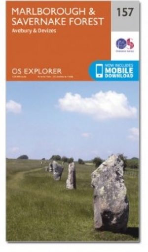
Wandelkaart Marlborough & Savernake Forest - Wiltshire Omvat ook: Avebury & Devizes. Productbeschrijving: Kaart nummer 157 in de OS Explorer kaarten reeks omvat Marlborough, Avebury en D...

Specificaties
- Uitgever: Ordnance Survey
- ISBN-13: 9780319470299
- HOOFDCATEGORIEËN: Wandelkaart
- Activiteiten: Wandelen, Hiking & Trekking
- Regio: Wiltshire, West England
- Land: England
- Waterafstotende kaart: Ordnance Survey ACTIVE Explorer Weatherproof Maps
- TOPO's & Stafkaarten: Topografisch wandelen
- Schaal: 1:25000
- Taal: Engels
- Reeks/Serie: Explorer ACTIVE Series OSI
Volledige omschrijving
Wandelkaart Marlborough & Savernake Forest - Wiltshire
Omvat ook: Avebury & Devizes.
Productbeschrijving: Kaart nummer 157 in de OS Explorer kaarten reeks omvat Marlborough, Avebury en Devizes in Wiltshire. Hoogtepunten van het gebied zijn onder andere: een deel van de Great Western Community Forest, North Wessex Downs AONB, Savernake Forest, Avebury Rings, Wessex Ridgeway, The Ridgeway, de White Horse en Tan Hill Trail. De OS Explorer kaart voor Marlborough & Savernake Forest is beschikbaar in zowel de standaard papieren versie als de weerbestendige 'Actief' versie.
Productdiscription: Map sheet number 157 in the OS Explorer series covers Marlborough, Avebury and Devizes in Wiltshire. Highlights of the area include: part of the Great Western Community Forest, North Wessex Downs, Savernake Forest, Avebury Rings, Wessex Ridgeway, The Ridgeway, the White Horse and Tan Hill Trail. The OS Explorer map for Marlborough & Savernake Forest is available in both the standard paper version and weatherproof 'Active' version.
Locatie op kaart
Gekoppelde artikelen

Wandelkaart 157 Marlborough & Savernake Forest - OSI • 9780319243503
standaard versieWandelkaart Marlborough - North Wessex Downs AONB Omvat ook: Avebury & Devizes Productomschrijving: Kaart nummer 157 in de OS Explorer kaarten reeks omvat Marlborough, Avebury en Devizes in Wiltshire. Hoogtepunten van het gebied zijn onder andere: een deel van het grote bos voor van de Western North Wessex Downs AONB, Savernake Forest, Avebury Rings, Wessex Ridgeway, The Ridgeway, de W…
Wandelkaart 157 Marlborough & Savernake Forest - OSI • 9780319470299
weatherproof versieWandelkaart Marlborough & Savernake Forest - Wiltshire Omvat ook: Avebury & Devizes. Productbeschrijving: Kaart nummer 157 in de OS Explorer kaarten reeks omvat Marlborough, Avebury en Devizes in Wiltshire. Hoogtepunten van het gebied zijn onder andere: een deel van de Great Western Community Forest, North Wessex Downs AONB, Savernake Forest, Avebury Rings, Wessex Ridgeway, The Ridgewa…
Overzichtskaarten

OSI Explorer & Explorer Active - Z.W. England Devon - Cornwall
OSI Explorer & Explorer Active - Z.W. England Devon - Cornwall

Producten op de overzichtskaart
Klik op een product om naar de detailpagina te gaan.
- Wandelkaart 102 Land's End - OSI
- Wandelkaart 102 Land's End - OSI
- Wandelkaart 103 The Lizard- Cornwall England - OSI
- Wandelkaart 103 The Lizard- Cornwall England - OSI
- Wandelkaart 104 Redruth & St Agnes- Cornwall - OSI
- Wandelkaart 104 Redruth & St Agnes- Cornwall - OSI
- Wandelkaart 105 Falmouth & Mevagissey - Cornawall - OSI
- Wandelkaart 106 Newquay & Padstow - Cornwall - OSI
- Wandelkaart 107 St-Austell & Liskeard- Cornwall - OSI
- Wandelkaart 108 Lower Tamar Valley & Plymouth - OSI
- Wandelkaart 109 Bodmin Moor- Cornwal - OSI
- Wandelkaart 111 Bude- Boscastle & Tintagel- Devon - OSI
- Wandelkaart 112 Launceston & Holsworthy- Devon - OSI
- Wandelkaart 113 Okehampton- Devon England - OSI
- Wandelkaart 113 Okehampton- Devon England - OSI
- Wandelkaart 114 Exeter & Exe Valley- Devon - OSI
- Wandelkaart 114 Exeter & Exe Valley- Devon - OSI
- Wandelkaart 115 Exmouth & Sidmouth- Devon - OSI
- Wandelkaart 115 Exmouth & Sidmouth- Devon - OSI
- Wandelkaart 116 Lyme regis & Bridport- Devon - OSI
- Wandelkaart 116 Lyme Regis & Bridport- Dorset - OSI
- Wandelkaart 117 Cerne Abbas & Bere Regis - Dorset - OSI
- Wandelkaart 117 Cerne Abbas & Bere Regis - Dorset - OSI
- Wandelkaart OL15 Purbeck- South Dorset & Poole - OSI
- Wandelkaart 118 Shaftesbury & Cranbourne Chase - OSI
- Wandelkaart 118 Shaftesbury & Cranbourne Chase - OSI
- Wandelkaart 129 Yeovil & Sherborne- Somerset - OSI
- Wandelkaart 129 Yeovil & Sherborne- Somerset - OSI
- Wandelkaart 140 Quantock Hills AONB & Bridgwater- Devon - OSI
- Wandelkaart 140 Quantock Hills AONB- Somerset - OSI
- Wandelkaart 141 Cheddar Gorge & Mendip Hills - OSI
- Wandelkaart 141 Shepton Mallet & Mendip Hills East - OSI
- Wandelkaart 142 Shepton Mallet & Mendip Hills - OSI
- Wandelkaart 142 Shepton Mallet & Mendip Hills - OSI
- Wandelkaart 143 Warminster & Trowbridge- Wiltshire - OSI
- Wandelkaart 143 Warminster & Trowbridge- Wiltshire - OSI
- Wandelkaart 130 Salisburry & Stonehenge- Wiltshire - OSI
- Wandelkaart 130 Salisburry & Stonehenge- Wiltshire - OSI
- Wandelkaart 131 Romsey- Andover & Test Valley- Hampshire
- Wandelkaart 131 Romsey & Andover - Hampshire - OSI
- Wandelkaart 153 Weston-super-Mare & Bleadon Hill - OSI
- Wandelkaart 153 Weston-Super-Mare & Bleadon Hill - OSI
- Wandelkaart 154 Bristol West & Portishead- Bristol - OSI
- Wandelkaart 154 Bristol West & Portishead- Bristol area
- Wandelkaart 155 Bristol & Bath Keynsham & Marshfield - OSI
- Wandelkaart 155 Bristol & Bath- Bristol Area - OSI
- Wandelkaart 156 Chippenham & Bradford-on-Avon - OSI
- Wandelkaart 156 Chippenham & Bradford-on-Avon- Wiltshire - OSI
- Wandelkaart 157 Marlborough & Savernake Forest - OSI
- Wandelkaart 157 Marlborough & Savernake Forest - OSI
- Wandelkaart 158 Newbury & Hungerford- Berkshire - OSI
- Wandelkaart 158 Newbury & Hungerford- West Berkshire - OSI
- Wandelkaart 167 Thornbury- Dursley & Yate - England- OSI
- Wandelkaart 167 Thornbury- Dursley & Yate - England- OSI
- Wandelkaart 168 Stroud- Tetbury & Malmesbury - OSI
- Wandelkaart 168 Stroud- Tetbury & Malmesbury - OSI
- Wandelkaart 169 Cirencester & Swindon - England - OSI
- Wandelkaart 169 Cirencester & Swindon - England - OSI
- Wandelkaart 170 Abingdon & Wantage - Oxfordshire - OSI
- Wandelkaart 170 Abingdon- Wantage & Vale - OSI
- Wandelkaart 179 Gloucester- Cheltenham & Stroud - OSI
- Wandelkaart 205 Stratford-upon-Avon & Evesham - OSI
- Wandelkaart 205 Stratford-upon-Avon & Evesham - OSI
- Wandelkaart 206 Edge Hill & Fenny Compton - OSI
- Wandelkaart 206 Edge Hill & Fenny Compton - OSI
- Wandelkaart OL09 Exmoor NP Devon England - OS
- Wandelkaart OL15 Purbeck & South Dorset - OS
- Wandelkaart OL20 South Devon & Dartmoor NP - OS
- Wandelkaart OL22 New Forest National Park - OS
- Wandelkaart OL28 Dartmoor National Park - OS
- Wandelkaart OL45 The Cotswolds AONB - OS
Artikelen uit dezelfde regio
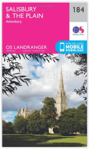
Wandelkaart 184 Salisbury & The Plain- Wiltshire England - OSI • 9780319262825
Wandelkaart Salisbury & The Plain - Wiltshire England Productbeschrijving: Kaart nummer 184 in de OS Landranger kaarten reeks, is ideaal voor het plannen van uitstapjes in- en rond het gebied van Salisbury. Grote open ruimten zijn in overvloed in dit gebied, zodat bezoekers van het gebied zullen genieten van spectaculaire uitzichten. Hoogtepunten van het gebied zijn onder andere: Stoneheng…
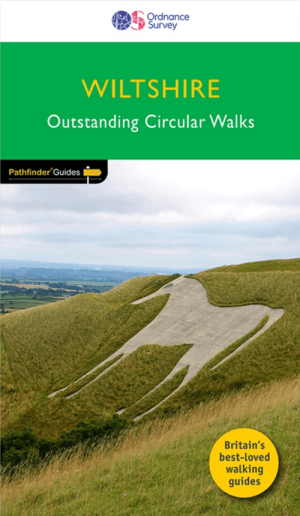
Wandelgids 077 Pathfinder guides Wiltshire - OS • 9780319092002
Wandelgids Wiltshire - OS Productomschrijving: Walking among the expansive landscapes and fascinating prehistoric sites of Wiltshire has never been easier or more rewarding. Discover rolling chalk downs, stone circles, white horses and millennia of English history with these 28 walks through gorgeous Wiltshire, graded by length and difficulty. Featured Wiltshire walks include: - S…

Wandelgids The Kennet and Avon Canal walk - Cicerone • 9781786312303
The Kennet and Avon Canal walk - Cicerone Productomschrijving: Wandelgids langs het Kennet & Avon kanaal. De 151 Km lange route van Reading naar Bristol is verdeeld in 7 etappes van redelijk gemakkelijke wandelingen en omvat het UNESCO werelderfgoed Bath en de drijvende haven van Bristol. Er zijn ook 20 rondwandelingen opgenomen, variërend van 4¼ tot 9 mijl, waarbij de beste delen van het …

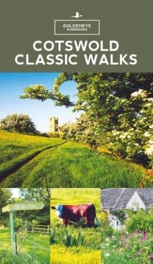
Wandelgids - Cotswold Classic Walks - Goldeneye • 9781859652916
Cotswold Classic Walks - Goldeneye Productomschrijving: Met 25 rondwandelingen helpt dit boek u een uitvalsbasis te vinden om de auto te ontvluchten en te genieten van een weekend vol frisse lucht en beweging.... Sommige wandelingen bieden verschillende routemogelijkheden en links naar andere wandelingen. Hoe beslist u welke wandeling u gaat doen? - Waar zijn de mooiste uitzichten? - W…
Wandelgids - Cotswold classic walks guidebook - Goldeneye • 9781859652602
Wandelgids Cotswold classic walks guidebook Productomschrijving: In eerste instantie is dit wat de engelsen noemen een AONB, een "Area of Outstanding Natural Beauty" die in deze versie verspreidt word over verschillende regio's aangezien zijn grote. Deze plaats van subliem natuurschoon, ligt deel is, Somerset, deels in wawickshire, deels in Wiltshire, deels in Oxfordshire en is de meest be…