

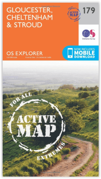
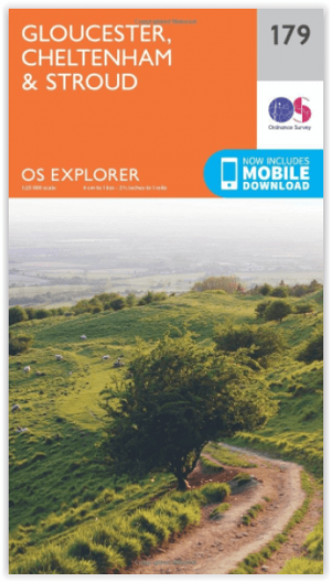
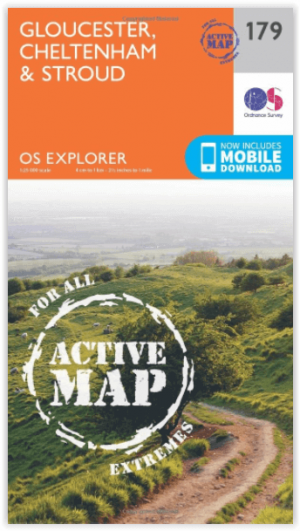
Wandelkaart 179 Gloucester- Cheltenham & Stroud - OSI
Cotswolds AONB- Vale van Gloucester & de Cotswolds way

Korte omschrijving
Wandelkaarten Gloucestershire, Egland van Ordnance Survey. Ideaal voor tochten in England.
Wandelkaart Gloucester- Cheltenham & Stroud - S.W. England Productbeschrijving: Kaart nummer 179 in de OS Explorer reeks heeft betrekking op de omgeving van Gloucester, Cheltenham, Stroud. H...

Specificaties
- Uitgever: Ordnance Survey
- ISBN-13: 9780319470510
- HOOFDCATEGORIEËN: Wandelkaart
- Activiteiten: Wandelen, Hiking & Trekking
- Regio: Gloucestershire, Egland
- Land: England
- Waterafstotende kaart: Ordnance Survey ACTIVE Explorer Weatherproof Maps
- TOPO's & Stafkaarten: Topografisch wandelen
- AONB - Area of Outstanding Beauty/National Landscape: Cotswolds AONB
- Schaal: 1:25000
- Taal: Engels
- Reeks/Serie: Explorer ACTIVE Series OSI
Volledige omschrijving
Wandelkaart Gloucester- Cheltenham & Stroud - S.W. England
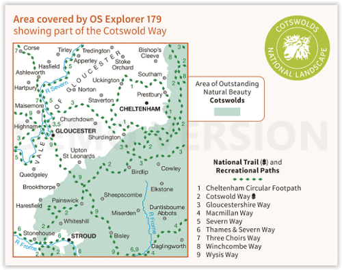
Productbeschrijving: Kaart nummer 179 in de OS Explorer reeks heeft betrekking op de omgeving van Gloucester, Cheltenham, Stroud. Hoogtepunten van het gebied zijn onder andere: Cotswolds AONB gebied van uitzonderlijke natuurlijke schoonheid AONB, Vale van Gloucester, rivier de Severn en de Cotswolds way. De OS Explorer kaart voor Gloucester, Cheltenham & Stroud is beschikbaar in zowel de standaard papieren versie als de weerbestendige 'Actief' versie.
Productdiscription: Map sheet number 179 in the OS Explorer series covers the area around Gloucester, Cheltenham, Stroud. Highlights of the area include: Cotswolds Area of Outstanding Natural Beauty AONB, Vale of Gloucester, River Severn and the Cotswolds Way. The OS Explorer map for Gloucester, Cheltenham & Stroud is available in both the standard paper version and weatherproof 'Active' version.
Locatie op kaart
Gekoppelde artikelen
Wandelkaart 179 Gloucester- Cheltenham & Stroud - OSI • 9780319243725
standaard versieWandelkaart Gloucester- Cheltenham & Stroud - Gloucestershire Productbeschrijving: Gloucester & Cheltenham 179 / Gloucester, Cheltenham & Stroud, Gloucestershire, England - Kaart nummer 179 in de OS Explorer reeks heeft betrekking op de omgeving van Gloucester, Cheltenham, Stroud. Hoogtepunten van het gebied zijn onder meer: The Cotswolds AONB gebied van uitzonderlijke natuurlijke scho…
Wandelkaart 179 Gloucester- Cheltenham & Stroud - OSI • 9780319470510
weatherproof versieWandelkaart Gloucester- Cheltenham & Stroud - S.W. England Productbeschrijving: Kaart nummer 179 in de OS Explorer reeks heeft betrekking op de omgeving van Gloucester, Cheltenham, Stroud. Hoogtepunten van het gebied zijn onder andere: Cotswolds AONB gebied van uitzonderlijke natuurlijke schoonheid AONB, Vale van Gloucester, rivier de Severn en de Cotswolds way. De OS Explorer kaart voor G…
Artikelen uit dezelfde regio

Cotswolds Mountain Biking - Vertebrate Publ. • 9781906148140
Cotswolds AONB Mountain Biking - Vertebrate Productomschrijving: 20 Classic Rides - Cotwolds Mountain Biking by Tom Fenton features 20 classic MTB routes in the Cotswold Hills across the counties of Gloucestershire and Oxfordshire, and extending into parts of Wiltshire, Somerset, Worcestershire and Warwickshire. With Ordnance Survey mapping and easy-to-follow directions. The Cotswold H…

Wandelkaart 167 Thornbury- Dursley & Yate - England- OSI • 9780319243602
Wandelkaart Thornbury- Dursley & Yate - Gloucestershire Omvat ook: Berkeley & Wotton-under-Edge Productomschrijving: Kaart nummer 167 in de OS Explorer kaarten reeks omvat het gebied ten noorden van Bristol langs de rivier de Severn tussen Engeland en Wales. Hoogtepunten van het gebied: forest of Avon, de Cotswolds en de Wye Valley, met inbegrip van de Cotswold way, Offa's Dyke Path en…

Wandelgids 029 Pathfinder guides Wye Valley AONB & Forrest of Dean • 9780319090442
Wandelgids Wye Valley AONB & Forrest of Dean -OS Productomschrijving: The Wye Valley and Forest of Dean Pathfinder guidebook contains 28 circular walks for all abilities. Walks are from 4km to 17km long, and each route includes a difficulty rating, route directions, an extract of the Ordnance Survey map and notes and photos of key features to look for. All of them have been created and te…

Wandelkaart OL45 - The Cotswolds AONB- Gloucestershire - OSI • 9780319469637
Wandelkaart The Cotswolds AONB - Gloucestershire England Omvat ook: Burford, Chipping Campden, Cirencester & Stow-on-the-Wold Productbeschrijving: Kaart nummer OL45 in de OS Explorer kaarten reeks heeft betrekking op een groot gebied van de Cotswolds AONB, inclusief Stow-on-the-Wold, Burford, Cirencester & Chipping Campden. Hoogtepunten van het gebied: de Cotswold hills, Wychwood comm…

Wandelgids - The Cotswold Way 30 classic routes - Cicerone • 9781852848330
Wandelgids - The Cotswold Way 30 classic routes - Cicerone Productomschrijving: Deze gids beschrijft 30 circulaire wandelingen in de Cotswolds AONB van Zuid-Engeland. De gegradeerde routes zijn 4 tot 15 km lang, en omvat heuvel forten, lange kruiwagens en steencirkels, pittoreske dorpjes en delen van de Cotswold way National Trail als circulaire wandeling om te bezoeken. Bevat informatie o…