

Wandelkaart 102 Land's End - OSI
Penzance - Land's End - Mousehole - Cape Cornwall


Korte omschrijving
Wandelkaarten Cornwall, England van Ordnance Survey. Ideaal voor tochten in England.
Wandelkaart 102 Explorer Land's End - OSI Productomschrijving: Kaart nummer 102 in de OS Explorer kaartenserie is de perfecte kaart voor het ontdekken van het beroemde gebied rond Land's End...

Specificaties
- Uitgever: Ordnance Survey
- ISBN-13: 9780319263648
- HOOFDCATEGORIEËN: Wandelkaart
- Activiteiten: Wandelen, Hiking & Trekking
- Regio: Cornwall, England
- Land: England
- TOPO's & Stafkaarten: Topografisch wandelen
- AONB - Area of Outstanding Beauty/National Landscape: Cornwall, AONB
- Schaal: 1:25000
- Taal: Engels
- Reeks/Serie: Explorer Series OS
Volledige omschrijving
Wandelkaart 102 Explorer Land's End - OSI
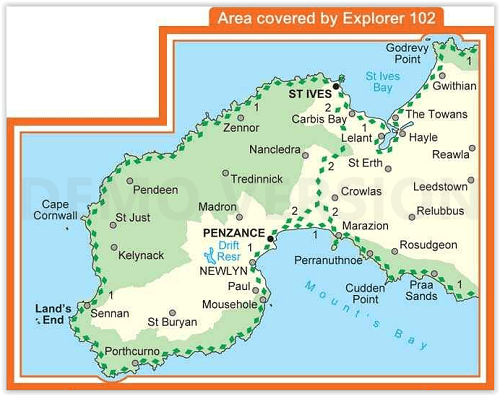
Productomschrijving: Kaart nummer 102 in de OS Explorer kaartenserie is de perfecte kaart voor het ontdekken van het beroemde gebied rond Land's End, Penzance en St Ives. Het gebied staat bekend als het meest extreem zuidwestelijke punt van Groot-Brittannië. Hoogtepunten zijn: Penzance, Land's End, Mousehole, en Cape Cornwall.
Inclusief mobiele downloadBij deze kaart ontvangt u een code voor gebruik op uw iOS- of Android-smartphone of -tablet. Meer informatie vindt u bij Veelgestelde vragen over mobiel downloaden.
National trails & recreational paths: Sout West Coast Path & St Michael's Way.
Engelse omschrijving: Map sheet number 102 in the OS Explorer map series is the perfect map for discovering the famous area around Land's End, Penzance and St Ives. The area is well known as the most extreme south westerly point in Britain. Highlights include: Penzance, Land's End, Mousehole, and Cape Cornwall.

Locatie op kaart
Overzichtskaarten

OSI Explorer & Explorer Active - Z.W. England Devon - Cornwall
OSI Explorer & Explorer Active - Z.W. England Devon - Cornwall

Producten op de overzichtskaart
Klik op een product om naar de detailpagina te gaan.
- Wandelkaart 102 Land's End - OSI
- Wandelkaart 102 Land's End - OSI
- Wandelkaart 103 The Lizard- Cornwall England - OSI
- Wandelkaart 103 The Lizard- Cornwall England - OSI
- Wandelkaart 104 Redruth & St Agnes- Cornwall - OSI
- Wandelkaart 104 Redruth & St Agnes- Cornwall - OSI
- Wandelkaart 105 Falmouth & Mevagissey - Cornawall - OSI
- Wandelkaart 106 Newquay & Padstow - Cornwall - OSI
- Wandelkaart 107 St-Austell & Liskeard- Cornwall - OSI
- Wandelkaart 108 Lower Tamar Valley & Plymouth - OSI
- Wandelkaart 109 Bodmin Moor- Cornwal - OSI
- Wandelkaart 111 Bude- Boscastle & Tintagel- Devon - OSI
- Wandelkaart 112 Launceston & Holsworthy- Devon - OSI
- Wandelkaart 113 Okehampton- Devon England - OSI
- Wandelkaart 113 Okehampton- Devon England - OSI
- Wandelkaart 114 Exeter & Exe Valley- Devon - OSI
- Wandelkaart 114 Exeter & Exe Valley- Devon - OSI
- Wandelkaart 115 Exmouth & Sidmouth- Devon - OSI
- Wandelkaart 115 Exmouth & Sidmouth- Devon - OSI
- Wandelkaart 116 Lyme regis & Bridport- Devon - OSI
- Wandelkaart 116 Lyme Regis & Bridport- Dorset - OSI
- Wandelkaart 117 Cerne Abbas & Bere Regis - Dorset - OSI
- Wandelkaart 117 Cerne Abbas & Bere Regis - Dorset - OSI
- Wandelkaart OL15 Purbeck- South Dorset & Poole - OSI
- Wandelkaart 118 Shaftesbury & Cranbourne Chase - OSI
- Wandelkaart 118 Shaftesbury & Cranbourne Chase - OSI
- Wandelkaart 129 Yeovil & Sherborne- Somerset - OSI
- Wandelkaart 129 Yeovil & Sherborne- Somerset - OSI
- Wandelkaart 140 Quantock Hills AONB & Bridgwater- Devon - OSI
- Wandelkaart 140 Quantock Hills AONB- Somerset - OSI
- Wandelkaart 141 Cheddar Gorge & Mendip Hills - OSI
- Wandelkaart 141 Shepton Mallet & Mendip Hills East - OSI
- Wandelkaart 142 Shepton Mallet & Mendip Hills - OSI
- Wandelkaart 142 Shepton Mallet & Mendip Hills - OSI
- Wandelkaart 143 Warminster & Trowbridge- Wiltshire - OSI
- Wandelkaart 143 Warminster & Trowbridge- Wiltshire - OSI
- Wandelkaart 130 Salisburry & Stonehenge- Wiltshire - OSI
- Wandelkaart 130 Salisburry & Stonehenge- Wiltshire - OSI
- Wandelkaart 131 Romsey- Andover & Test Valley- Hampshire
- Wandelkaart 131 Romsey & Andover - Hampshire - OSI
- Wandelkaart 153 Weston-super-Mare & Bleadon Hill - OSI
- Wandelkaart 153 Weston-Super-Mare & Bleadon Hill - OSI
- Wandelkaart 154 Bristol West & Portishead- Bristol - OSI
- Wandelkaart 154 Bristol West & Portishead- Bristol area
- Wandelkaart 155 Bristol & Bath Keynsham & Marshfield - OSI
- Wandelkaart 155 Bristol & Bath- Bristol Area - OSI
- Wandelkaart 156 Chippenham & Bradford-on-Avon - OSI
- Wandelkaart 156 Chippenham & Bradford-on-Avon- Wiltshire - OSI
- Wandelkaart 157 Marlborough & Savernake Forest - OSI
- Wandelkaart 157 Marlborough & Savernake Forest - OSI
- Wandelkaart 158 Newbury & Hungerford- Berkshire - OSI
- Wandelkaart 158 Newbury & Hungerford- West Berkshire - OSI
- Wandelkaart 167 Thornbury- Dursley & Yate - England- OSI
- Wandelkaart 167 Thornbury- Dursley & Yate - England- OSI
- Wandelkaart 168 Stroud- Tetbury & Malmesbury - OSI
- Wandelkaart 168 Stroud- Tetbury & Malmesbury - OSI
- Wandelkaart 169 Cirencester & Swindon - England - OSI
- Wandelkaart 169 Cirencester & Swindon - England - OSI
- Wandelkaart 170 Abingdon & Wantage - Oxfordshire - OSI
- Wandelkaart 170 Abingdon- Wantage & Vale - OSI
- Wandelkaart 179 Gloucester- Cheltenham & Stroud - OSI
- Wandelkaart 205 Stratford-upon-Avon & Evesham - OSI
- Wandelkaart 205 Stratford-upon-Avon & Evesham - OSI
- Wandelkaart 206 Edge Hill & Fenny Compton - OSI
- Wandelkaart 206 Edge Hill & Fenny Compton - OSI
- Wandelkaart OL09 Exmoor NP Devon England - OS
- Wandelkaart OL15 Purbeck & South Dorset - OS
- Wandelkaart OL20 South Devon & Dartmoor NP - OS
- Wandelkaart OL22 New Forest National Park - OS
- Wandelkaart OL28 Dartmoor National Park - OS
- Wandelkaart OL45 The Cotswolds AONB - OS
Artikelen uit dezelfde regio
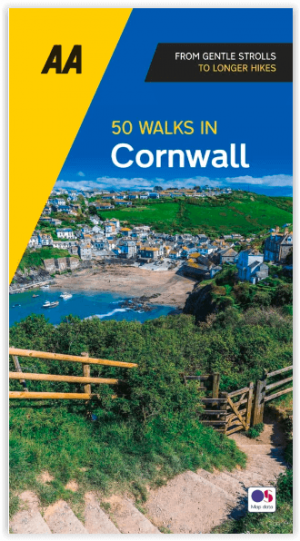
Wandelgids 50 walks in Cornwall - AA Publishing • 9780749583217
50 walks in Cornwall - AA Publishing. Productomschrijving: Wandelen is één van de favoriete vrijetijdsbestedingen van Groot-Brittannië en AA 50 Walks in Cornwall bevat een verscheidenheid aan uitgestippelde wandelingen van 2 tot 10 mijl, geschikt voor alle niveaus. Het boek bevat alle praktische details die u nodig heeft, vergezeld van fascinerende achtergrondinformatie over de geschiedeni…
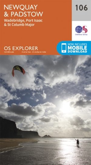
Wandelkaart 106 Newquay & Padstow - Cornwall - OSI • 9780319243084
Wandelkaart Newquay & Padstow - Cornwall - OSI Omvat ook: Wadebridge, Port Isaac & St Columb Major Productbeschrijving: Kaart nummer 106 in de OS Explorer kaarten reeks is de ideale kaart voor iedereen die de Cornish kuststeden van Newquay en Padstow wil bezoeken. Het gebied is beroemd onder vakantiegangers en word bezocht door wandelaars, surfers en mensen die willen proeven van de ge…

Reisgids Devon & Cornwall - Rough Guides • 9780241270325
Reisgids Devon & Cornwall - Rough Guides Productomschrijving: The Rough Guide to Devon and Cornwall is the perfect companion to your trip to this captivating peninsula, introducing you to the charms of gentle, pastoral Devon and wild, craggy Cornwall. Both counties will tempt you outside to enjoy their mild climate, with everything from hikes over Dartmoor and surfing off Newquay to puffi…

Stadsplattegrond Cornwall pocket map - Harper Collins • 9780008719159
Stadskaart Cornwall pocket map - Harper Collins Productomschrjving: This handy little full color map of Cornwall is an excellent value and very detailed for its size. Key features include clear mapping at a scale of 8.7 miles to 1 inch; National Tourist Routes showing the best routes through the most scenic areas; Top 100 places of interest; and Park and Ride locations. An ideal companion…
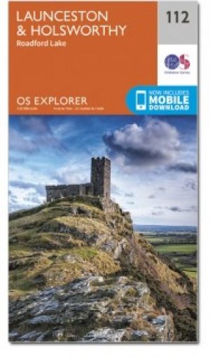
Wandelkaart 112 Launceston & Holsworthy- Devon - OSI • 9780319469927
Wandelkaart Launceston & Holsworthy - Cornwall England - OSI Productbeschrijving: Kaart nummer 112 omvat Holsworthy en Launceston. Hoogtepunten zijn Dartmoor National Park, Tamar Valley en Roadford Lake. Omvat ook Sheepwash, Milton Abbot, Lifton en Chapmans Well. De OS Explorer kaart voor Launceston & Holsworthy is beschikbaar in zowel de standaard papieren versie als de weerbestendige 'Ac…