

Wandelkaart 168 Stroud- Tetbury & Malmesbury - OSI
De Cotswolds AONB- the Cotswold Way & Monarch Way

Korte omschrijving
Wandelkaarten Gloucestershire, Egland van Ordnance Survey. Ideaal voor tochten in England.
Wandelkaart Stroud- Tetbury & Malmesbury - England Productbeschrijving: Kaart nummer 168 in de OS Explorer kaarten reeks omvat Stroud, Tetbury, Malmesbury en Nailsworth. Hoogtepunten van het...

Specificaties
- Uitgever: Ordnance Survey
- ISBN-13: 9780319470404
- HOOFDCATEGORIEËN: Wandelkaart
- Activiteiten: Wandelen, Hiking & Trekking
- Regio: Gloucestershire, Egland
- Land: England
- Waterafstotende kaart: Ordnance Survey ACTIVE Explorer Weatherproof Maps
- TOPO's & Stafkaarten: Topografisch wandelen
- AONB - Area of Outstanding Beauty/National Landscape: Cotswolds AONB
- Schaal: 1:25000
- Taal: Engels
- Reeks/Serie: Explorer ACTIVE Series OSI
Volledige omschrijving
Wandelkaart Stroud- Tetbury & Malmesbury - England
Productbeschrijving: Kaart nummer 168 in de OS Explorer kaarten reeks omvat Stroud, Tetbury, Malmesbury en Nailsworth. Hoogtepunten van het gebied zijn onder meer: Cotswolds AONB, Cotswold Way, Monarch Way en de Thames Path. De OS Explorer kaart voor Stroud, Tetbury & Malmesbury is beschikbaar in zowel de standaard papieren versie als de weerbestendige 'Actief' versie.
Productdiscription: Map sheet number 168 in the OS Explorer series covers Stroud, Tetbury, Malmesbury, and Nailsworth. Highlights of the area include: Cotswolds AONB, Cotswold Way, Monarch's Way and Thames Path. The OS Explorer map for Stroud, Tetbury & Malmesbury is available in both the standard paper version and weatherproof 'Active' version.
Locatie op kaart
Gekoppelde artikelen

Wandelkaart 168 Stroud- Tetbury & Malmesbury - OSI • 9780319243619
standaard versieWandelkaart Stroud- Tetbury & Malmesbury - Gloucestershire Omvat ook: De Cotswolds AONB- the Cotswold Way & The Monarch Way Productbeschrijving: Kaart nummer 168 in de OS Explorer kaarten reeks omvat Stroud, Tetbury, Malmesbury en Nailsworth. Hoogtepunten van het gebied zijn onder andere: de Cotswolds AONB, Cotswold Way, Monarch Way en the Thames Path. De OS Explorer kaart voor Stroud,…

Wandelkaart 168 Stroud- Tetbury & Malmesbury - OSI • 9780319470404
weatherproof versieWandelkaart Stroud- Tetbury & Malmesbury - England Productbeschrijving: Kaart nummer 168 in de OS Explorer kaarten reeks omvat Stroud, Tetbury, Malmesbury en Nailsworth. Hoogtepunten van het gebied zijn onder meer: Cotswolds AONB, Cotswold Way, Monarch Way en de Thames Path. De OS Explorer kaart voor Stroud, Tetbury & Malmesbury is beschikbaar in zowel de standaard papieren versie als de w…
Overzichtskaarten

OSI Explorer & Explorer Active - Z.W. England Devon - Cornwall
OSI Explorer & Explorer Active - Z.W. England Devon - Cornwall

Producten op de overzichtskaart
Klik op een product om naar de detailpagina te gaan.
- Wandelkaart 102 Land's End - OSI
- Wandelkaart 102 Land's End - OSI
- Wandelkaart 103 The Lizard- Cornwall England - OSI
- Wandelkaart 103 The Lizard- Cornwall England - OSI
- Wandelkaart 104 Redruth & St Agnes- Cornwall - OSI
- Wandelkaart 104 Redruth & St Agnes- Cornwall - OSI
- Wandelkaart 105 Falmouth & Mevagissey - Cornawall - OSI
- Wandelkaart 106 Newquay & Padstow - Cornwall - OSI
- Wandelkaart 107 St-Austell & Liskeard- Cornwall - OSI
- Wandelkaart 108 Lower Tamar Valley & Plymouth - OSI
- Wandelkaart 109 Bodmin Moor- Cornwal - OSI
- Wandelkaart 111 Bude- Boscastle & Tintagel- Devon - OSI
- Wandelkaart 112 Launceston & Holsworthy- Devon - OSI
- Wandelkaart 113 Okehampton- Devon England - OSI
- Wandelkaart 113 Okehampton- Devon England - OSI
- Wandelkaart 114 Exeter & Exe Valley- Devon - OSI
- Wandelkaart 114 Exeter & Exe Valley- Devon - OSI
- Wandelkaart 115 Exmouth & Sidmouth- Devon - OSI
- Wandelkaart 115 Exmouth & Sidmouth- Devon - OSI
- Wandelkaart 116 Lyme regis & Bridport- Devon - OSI
- Wandelkaart 116 Lyme Regis & Bridport- Dorset - OSI
- Wandelkaart 117 Cerne Abbas & Bere Regis - Dorset - OSI
- Wandelkaart 117 Cerne Abbas & Bere Regis - Dorset - OSI
- Wandelkaart OL15 Purbeck- South Dorset & Poole - OSI
- Wandelkaart 118 Shaftesbury & Cranbourne Chase - OSI
- Wandelkaart 118 Shaftesbury & Cranbourne Chase - OSI
- Wandelkaart 129 Yeovil & Sherborne- Somerset - OSI
- Wandelkaart 129 Yeovil & Sherborne- Somerset - OSI
- Wandelkaart 140 Quantock Hills AONB & Bridgwater- Devon - OSI
- Wandelkaart 140 Quantock Hills AONB- Somerset - OSI
- Wandelkaart 141 Cheddar Gorge & Mendip Hills - OSI
- Wandelkaart 141 Shepton Mallet & Mendip Hills East - OSI
- Wandelkaart 142 Shepton Mallet & Mendip Hills - OSI
- Wandelkaart 142 Shepton Mallet & Mendip Hills - OSI
- Wandelkaart 143 Warminster & Trowbridge- Wiltshire - OSI
- Wandelkaart 143 Warminster & Trowbridge- Wiltshire - OSI
- Wandelkaart 130 Salisburry & Stonehenge- Wiltshire - OSI
- Wandelkaart 130 Salisburry & Stonehenge- Wiltshire - OSI
- Wandelkaart 131 Romsey- Andover & Test Valley- Hampshire
- Wandelkaart 131 Romsey & Andover - Hampshire - OSI
- Wandelkaart 153 Weston-super-Mare & Bleadon Hill - OSI
- Wandelkaart 153 Weston-Super-Mare & Bleadon Hill - OSI
- Wandelkaart 154 Bristol West & Portishead- Bristol - OSI
- Wandelkaart 154 Bristol West & Portishead- Bristol area
- Wandelkaart 155 Bristol & Bath Keynsham & Marshfield - OSI
- Wandelkaart 155 Bristol & Bath- Bristol Area - OSI
- Wandelkaart 156 Chippenham & Bradford-on-Avon - OSI
- Wandelkaart 156 Chippenham & Bradford-on-Avon- Wiltshire - OSI
- Wandelkaart 157 Marlborough & Savernake Forest - OSI
- Wandelkaart 157 Marlborough & Savernake Forest - OSI
- Wandelkaart 158 Newbury & Hungerford- Berkshire - OSI
- Wandelkaart 158 Newbury & Hungerford- West Berkshire - OSI
- Wandelkaart 167 Thornbury- Dursley & Yate - England- OSI
- Wandelkaart 167 Thornbury- Dursley & Yate - England- OSI
- Wandelkaart 168 Stroud- Tetbury & Malmesbury - OSI
- Wandelkaart 168 Stroud- Tetbury & Malmesbury - OSI
- Wandelkaart 169 Cirencester & Swindon - England - OSI
- Wandelkaart 169 Cirencester & Swindon - England - OSI
- Wandelkaart 170 Abingdon & Wantage - Oxfordshire - OSI
- Wandelkaart 170 Abingdon- Wantage & Vale - OSI
- Wandelkaart 179 Gloucester- Cheltenham & Stroud - OSI
- Wandelkaart 205 Stratford-upon-Avon & Evesham - OSI
- Wandelkaart 205 Stratford-upon-Avon & Evesham - OSI
- Wandelkaart 206 Edge Hill & Fenny Compton - OSI
- Wandelkaart 206 Edge Hill & Fenny Compton - OSI
- Wandelkaart OL09 Exmoor NP Devon England - OS
- Wandelkaart OL15 Purbeck & South Dorset - OS
- Wandelkaart OL20 South Devon & Dartmoor NP - OS
- Wandelkaart OL22 New Forest National Park - OS
- Wandelkaart OL28 Dartmoor National Park - OS
- Wandelkaart OL45 The Cotswolds AONB - OS
Artikelen uit dezelfde regio

Wandelkaart XT Malvern Hills AONB England - Harvey map • 9781851376056
Wandelkaart - Malvern Hills AONB England - Harvey map Productomschrijving: Deze Mavern Hills zijn een samenstelling van heuvels in de Engelse counties, Worcestershire, Herefordshire, en een klein deel van Gloucestershire, en domineren de volledige regio rond deze counties van het district van Alvern Hills. Het hoogst gelegen punt van deze regio biedt een panorama van de Severn vallei met d…
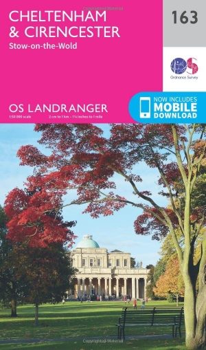
Wandelkaart 163 Cheltenham & Cirencester- England - OSI • 9780319262610
Wandelkaart Cheltenham & Cirencester - England Productbeschrijving: De Cotswold way, de Thames path, en de Europese lange afstand pad, snijden hier beiden doorheen, de OS Landranger kaart 163, bied hier een fantastische locatie om te wandelen en het landschap op te nemen. Cheltenham, het Cultuurcentrum vernoemd naar de Cotswolds, is een historische stad, met winkels en evenementen. In de b…

Wandelkaart OL45 - The Cotswolds AONB- Gloucestershire - OSI • 9780319469637
Wandelkaart The Cotswolds AONB - Gloucestershire England Omvat ook: Burford, Chipping Campden, Cirencester & Stow-on-the-Wold Productbeschrijving: Kaart nummer OL45 in de OS Explorer kaarten reeks heeft betrekking op een groot gebied van de Cotswolds AONB, inclusief Stow-on-the-Wold, Burford, Cirencester & Chipping Campden. Hoogtepunten van het gebied: de Cotswold hills, Wychwood comm…
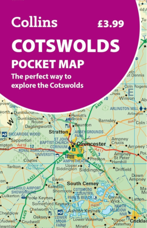
Landkaart Wegenkaart Pocket map Cotswolds AONB - Harper-Collins • 9780008780395
Wegenkaart Pocket map Cotswolds AONB - Harper Productomschrijving: De Collins Cotswolds Pocket Map is een compacte toeristische wegenkaart voor het verkennen van de Cotswolds AONB en het omliggende deel van Zuid-Centraal-Engeland. Het kaartgebied strekt zich uit van Worcester in het noorden tot Trowbridge in het zuiden, en van Cinderford in het westen tot Oxford in het oosten. Daarmee bes…

Wandelgids Cotswolds AONB 50 walks guide - AA Publishing • 9780749583224
Cotswolds AONB - 50 walks guide - AA Publishing Productomschrijving: Wandelen is een van de favoriete vrijetijdsbestedingen van Groot-Brittannië. AA 50 Walks in the Cotswolds bevat een verscheidenheid aan uitgestippelde wandelingen van 3 tot 12 km, geschikt voor alle niveaus. Het boek bevat alle praktische details die u nodig hebt, vergezeld van boeiende achtergrondinformatie over de gesch…