

Wandelkaart 141 Cheddar Gorge & Mendip Hills - OSI
Omvat de westelijke heuvels van Mendip- Cheddar & Wells

Korte omschrijving
Wandelkaarten Devon, England van Ordnance Survey. Ideaal voor tochten in England.
Wandelkaart Cheddar Gorge & Mendip Hills West - Devon - OSI Productbeschrijving: Wells & Glastonbury 141 / Cheddar Gorge & Mendip Hills West, Devon, England - Kaart nummer 141 in de OS ...

Specificaties
- Uitgever: Ordnance Survey
- ISBN-13: 9780319243343
- HOOFDCATEGORIEËN: Wandelkaart
- Activiteiten: Wandelen, Hiking & Trekking
- Regio: Devon, England
- Land: England
- Waterafstotende kaart: Ordnance Survey ACTIVE Explorer Weatherproof Maps
- TOPO's & Stafkaarten: Topografisch wandelen
- Schaal: 1:25000
- Taal: Engels
- Reeks/Serie: Explorer Series OS
Volledige omschrijving
Wandelkaart Cheddar Gorge & Mendip Hills West - Devon - OSI
Productbeschrijving: Wells & Glastonbury
141 / Cheddar Gorge & Mendip Hills West, Devon, England - Kaart nummer 141 in de OS Explorer reeks heeft betrekking op de westelijke heuvels van Mendip, Cheddar, Wells, Street en Glastonbury. Hoogtepunten van het gebied zijn onder andere: Cheddar Gorge, Wookey Hole, Glastonbury Tor, Blagdon, de Chew Valley meren, en de rivieren Axe, Brue & Cary. De OS Explorer kaart voor Cheddar Gorge & Mendip West Hills is beschikbaar in zowel de standaard papieren versie als de weerbestendige 'Actief' versie.
141 / Cheddar Gorge & Mendip Hills West, Devon, England - Map sheet number 141 in the OS Explorer series covers the western Mendip Hills, Cheddar, Wells, Street and Glastonbury. Highlights of the area include: Cheddar Gorge, Wookey Hole, Glastonbury Tor, Blagdon and Chew Valley lakes, and the rivers Axe, Brue and Cary. The OS Explorer map for Cheddar Gorge & Mendip Hills West is available in both the standard paper version and weatherproof 'Active' version.
Locatie op kaart
Overzichtskaarten

OSI Explorer & Explorer Active - Z.W. England Devon - Cornwall
OSI Explorer & Explorer Active - Z.W. England Devon - Cornwall

Producten op de overzichtskaart
Klik op een product om naar de detailpagina te gaan.
- Wandelkaart 102 Land's End - OSI
- Wandelkaart 102 Land's End - OSI
- Wandelkaart 103 The Lizard- Cornwall England - OSI
- Wandelkaart 103 The Lizard- Cornwall England - OSI
- Wandelkaart 104 Redruth & St Agnes- Cornwall - OSI
- Wandelkaart 104 Redruth & St Agnes- Cornwall - OSI
- Wandelkaart 105 Falmouth & Mevagissey - Cornawall - OSI
- Wandelkaart 106 Newquay & Padstow - Cornwall - OSI
- Wandelkaart 107 St-Austell & Liskeard- Cornwall - OSI
- Wandelkaart 108 Lower Tamar Valley & Plymouth - OSI
- Wandelkaart 109 Bodmin Moor- Cornwal - OSI
- Wandelkaart 111 Bude- Boscastle & Tintagel- Devon - OSI
- Wandelkaart 112 Launceston & Holsworthy- Devon - OSI
- Wandelkaart 113 Okehampton- Devon England - OSI
- Wandelkaart 113 Okehampton- Devon England - OSI
- Wandelkaart 114 Exeter & Exe Valley- Devon - OSI
- Wandelkaart 114 Exeter & Exe Valley- Devon - OSI
- Wandelkaart 115 Exmouth & Sidmouth- Devon - OSI
- Wandelkaart 115 Exmouth & Sidmouth- Devon - OSI
- Wandelkaart 116 Lyme regis & Bridport- Devon - OSI
- Wandelkaart 116 Lyme Regis & Bridport- Dorset - OSI
- Wandelkaart 117 Cerne Abbas & Bere Regis - Dorset - OSI
- Wandelkaart 117 Cerne Abbas & Bere Regis - Dorset - OSI
- Wandelkaart OL15 Purbeck- South Dorset & Poole - OSI
- Wandelkaart 118 Shaftesbury & Cranbourne Chase - OSI
- Wandelkaart 118 Shaftesbury & Cranbourne Chase - OSI
- Wandelkaart 129 Yeovil & Sherborne- Somerset - OSI
- Wandelkaart 129 Yeovil & Sherborne- Somerset - OSI
- Wandelkaart 140 Quantock Hills AONB & Bridgwater- Devon - OSI
- Wandelkaart 140 Quantock Hills AONB- Somerset - OSI
- Wandelkaart 141 Cheddar Gorge & Mendip Hills - OSI
- Wandelkaart 141 Shepton Mallet & Mendip Hills East - OSI
- Wandelkaart 142 Shepton Mallet & Mendip Hills - OSI
- Wandelkaart 142 Shepton Mallet & Mendip Hills - OSI
- Wandelkaart 143 Warminster & Trowbridge- Wiltshire - OSI
- Wandelkaart 143 Warminster & Trowbridge- Wiltshire - OSI
- Wandelkaart 130 Salisburry & Stonehenge- Wiltshire - OSI
- Wandelkaart 130 Salisburry & Stonehenge- Wiltshire - OSI
- Wandelkaart 131 Romsey- Andover & Test Valley- Hampshire
- Wandelkaart 131 Romsey & Andover - Hampshire - OSI
- Wandelkaart 153 Weston-super-Mare & Bleadon Hill - OSI
- Wandelkaart 153 Weston-Super-Mare & Bleadon Hill - OSI
- Wandelkaart 154 Bristol West & Portishead- Bristol - OSI
- Wandelkaart 154 Bristol West & Portishead- Bristol area
- Wandelkaart 155 Bristol & Bath Keynsham & Marshfield - OSI
- Wandelkaart 155 Bristol & Bath- Bristol Area - OSI
- Wandelkaart 156 Chippenham & Bradford-on-Avon - OSI
- Wandelkaart 156 Chippenham & Bradford-on-Avon- Wiltshire - OSI
- Wandelkaart 157 Marlborough & Savernake Forest - OSI
- Wandelkaart 157 Marlborough & Savernake Forest - OSI
- Wandelkaart 158 Newbury & Hungerford- Berkshire - OSI
- Wandelkaart 158 Newbury & Hungerford- West Berkshire - OSI
- Wandelkaart 167 Thornbury- Dursley & Yate - England- OSI
- Wandelkaart 167 Thornbury- Dursley & Yate - England- OSI
- Wandelkaart 168 Stroud- Tetbury & Malmesbury - OSI
- Wandelkaart 168 Stroud- Tetbury & Malmesbury - OSI
- Wandelkaart 169 Cirencester & Swindon - England - OSI
- Wandelkaart 169 Cirencester & Swindon - England - OSI
- Wandelkaart 170 Abingdon & Wantage - Oxfordshire - OSI
- Wandelkaart 170 Abingdon- Wantage & Vale - OSI
- Wandelkaart 179 Gloucester- Cheltenham & Stroud - OSI
- Wandelkaart 205 Stratford-upon-Avon & Evesham - OSI
- Wandelkaart 205 Stratford-upon-Avon & Evesham - OSI
- Wandelkaart 206 Edge Hill & Fenny Compton - OSI
- Wandelkaart 206 Edge Hill & Fenny Compton - OSI
- Wandelkaart OL09 Exmoor NP Devon England - OS
- Wandelkaart OL15 Purbeck & South Dorset - OS
- Wandelkaart OL20 South Devon & Dartmoor NP - OS
- Wandelkaart OL22 New Forest National Park - OS
- Wandelkaart OL28 Dartmoor National Park - OS
- Wandelkaart OL45 The Cotswolds AONB - OS

OSI Explorer & Explorer Active - Zuid England
OSI Explorer & Explorer Active - Zuid England

Producten op de overzichtskaart
Klik op een product om naar de detailpagina te gaan.
- Wandelkaart 117 Cerne Abbas & Bere Regis - Dorset - OSI
- Wandelkaart 118 Shaftesbury & Cranbourne Chase - OSI
- Wandelkaart 129 Yeovil & Sherborne - Somerset - OSI
- Wandelkaart 130 Salisburry & Stonehenge- Wiltshire - OSI
- Wandelkaart 131 Romsey & Andover - Hampshire - OSI
- Wandelkaart 135 Ashdown Forest - East Sussex - OSI
- Wandelkaart 141 Cheddar Gorge & Mendip Hills - OSI
- Wandelkaart 142 Shepton Mallet & Mendip Hills - OSI
- Wandelkaart 143 Warminster & Trowbridge - Wiltshire - OSI
- Wandelkaart 144 Basingstoke - Alton & Whitchurch - OSI
- Wandelkaart 145 Guildford & Farnham- Surrey - OSI
- Wandelkaart 146 Dorking- Box Hill & Reigate- Surrey - OSI
- Wandelkaart 147 Sevenoaks & Tonbridge- Kent - OSI
- Wandelkaart 154 Bristol West & Portishead- Bristol - OSI
- Wandelkaart 155 Bristol & Bath & Bristol Area - OSI
- Wandelkaart 156 Chippenham & Bradford-on-Avon - OSI
- Wandelkaart 157 Marlborough & Savernake Forest - OSI
- Wandelkaart 158 Newbury & Hungerford- Berkshire - OSI
- Wandelkaart 159 Reading- S.E. England - OSI
- Wandelkaart 160 Windsor- Weybridge & Bracknell - OSI
- Wandelkaart 161 London South - OSI
- Wandelkaart 162 Greenwich & Gravesend - OSI
- Wandelkaart 167 Thornbury- Dursley & Yate - England- OSI
- Wandelkaart 168 Stroud- Tetbury & Malmesbury - OSI
- Wandelkaart 169 Cirencester & Swindon - England - OSI
- Wandelkaart 170 Abingdon & Wantage - Oxfordshire - OSI
- Wandelkaart 171 Chiltern Hills West AONB - Wycombe - OSI
- Wandelkaart 172 Chiltern Hills East AONB - Wycombe - OSI
- Wandelkaart 173 London North- England - OSI
- Wandelkaart 174 Epping Forest & Lee Valley- Essex - OSI
- Wandelkaart 179 Gloucester- Cheltenham & Stroud - OSI
- Wandelkaart 180 Oxford- England - OSI
- Wandelkaart 181 Chiltern Hills North AONB- Wycombe - OSI
- Wandelkaart 182 St-Albans & Hatfield- Hertfordshire - OSI
- Wandelkaart OL03 Meon Valley Portsmouth - OS
- Wandelkaart OL08 Chichester- South Harting & Selsey - OS
- Wandelkaart OL10 Arundel- Pulborough & Worthing - OS
- Wandelkaart OL11 Brighton- Hove & South Downs NP - OS
- Wandelkaart OL22 New Forest National Park - OS
- Wandelkaart OL25 Eastbourne & Beachy Head - OS
- Wandelkaart OL29 Isle of Wight South East England - OS
- Wandelkaart OL32 Winchester, New Alresford & East Meon - OS
- Wandelkaart OL33 Haslemere & Petersfield - OS
- Wandelkaart OL34 Crawley & Horsham - Ordnance Survey
Artikelen uit dezelfde regio

Wandelkaart 114 Exeter & Exe Valley- Devon - OSI • 9780319469941
Wandelkaart Exeter & The Exe Valley - Devon England - OSI Productbeschrijving: Kaart nummer 114 in de OS Explorer reeks heeft betrekking op de Exeter vallei ten noorden van de stad van Exeter in Devon. Onderdelen van Exmoor en Dartmoor nationale parken zijn opgenomen in de kaart, samen met de Exe Valley way en Two Moors Way. Andere hoogtepunten van het gebied zijn Crediton, Tiverton Tivert…

Wandelkaart South West Coast Path 3 - Harvey Maps • 9781851376834
South West Coast Path - Harvey Maps Productomschrijving: Het South West Coast path is een dikke 1014 km lang en omvat het volledige South-West-England met daarin Devon & Corwall. Het pad is een National trail en behoort tot de langste routes van Engeland. De route start in Minehead in Somerset en loopt de volledige kust af tot in Poole in Dorset. OPGELET: deze kaart omvat het laatste deel …

Mountainbike kaart Exmoor NP & Quantocks Hills AONB - Goldeneye • 9781859652855
MTB map Exmoor NP & Quantocks Hills AONB - Goldeneye Productomschrijving: Herewith, 10 of the best off-road touring routes to Exmoor, North Devon and The Quantock Hills AONB which include Public Rights of Way; bridlepaths & quiet lanes. These routes have also been checked out and approved by the Exmoor National Park Authority. The routes are graded: easy, moderate and more strenuous al…

Wandelgids DEEL 1 Coast Path Exmoor & North Devon - Trailblazer • 9781912716241
Wandelgids DEEL 1 - Exmoor & North Devon Coast Path Productomschrijving: Exmoor & North Devon kustpad (South-West Coast Path Deel 1) Minehead naar Bude. Deze gids omvat het eerste deel van het South West Coast Path, van Minehead naar Bude (124,5 mijl). Deze spectaculaire 10- tot 12-daagse route loopt door het Exmoor National Park langs de hoogste kustlijn van Engeland (meer dan 800…
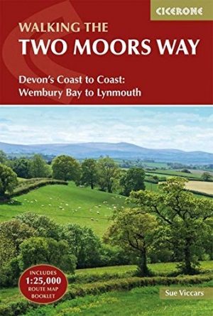
Wandelgids The Two Moors Way - Cicerone • 9781852849917
Wandelgids, The Two Moors Way (9781852849917) Cicerone Press Productomschrijving: De oorspronkelijke Two Moors Way beslaat 153 km van Ivybridge aan de zuidelijke grens van Dartmoor National Park naar Lynmouth aan de kust van Noord-Devon in Exmoor National Park. Als u een Coast to Coast-wandeling wilt maken, kunt u beginnen bij Wembury aan de kust van Zuid-Devon en de Erme-Plym-route volgen…