

Wandelkaart OL11 Brighton & Hove - Ordnance Survey
Lewes &- Burgess Hil - Portslade - Shoreham by Sea & Peacehaven

Korte omschrijving
Wandelkaarten Sussex, England van Ordnance Survey. Ideaal voor tochten in England.
Wandelkaart Brighton & Hove - Ordnance Survey Productomschrijving: Kaart nummer OL11 in de OS Explorer kaartenserie is ideaal voor wie op zoek is naar avontuur in de omgeving van Brighton e...

Specificaties
- Uitgever: Ordnance Survey
- ISBN-13: 9780319475751
- HOOFDCATEGORIEËN: Wandelkaart
- Activiteiten: Wandelen, Hiking & Trekking
- Regio: Sussex, England
- Land: England
- Waterafstotende kaart: Ordnance Survey ACTIVE Explorer Weatherproof Maps
- TOPO's & Stafkaarten: Topografisch wandelen
- AONB - Area of Outstanding Beauty/National Landscape: Sussex Downs AONB
- Schaal: 1:25000
- Taal: Engels
- Reeks/Serie: Explorer ACTIVE Series OSI
Volledige omschrijving
Wandelkaart Brighton & Hove - Ordnance Survey
Productomschrijving: Kaart nummer OL11 in de OS Explorer kaartenserie is ideaal voor wie op zoek is naar avontuur in de omgeving van Brighton en Hove. De kust kan te voet worden verkend, waarbij u onderweg de bezienswaardigheden en geluiden van Brighton, Hove, Portslade, Shoreham by Sea, Peacehaven en Newhaven kunt bekijken. Het platteland in dit gebied biedt wandelaars glooiende Sussex Downs, mooie dorpjes en tal van prachtige landschappen om te bewonderen, evenals delen van de South Downs Way. Deze kaart vervangt het vorige Explorer blad 122 voor dit gebied.
Inclusief mobiele downloadBij deze kaart ontvangt u een code voor gebruik op uw iOS of Android smartphone of tablet. Meer informatie vindt u bij Veelgestelde vragen over mobiel downloaden.
Engelse omschrijving: Map sheet number OL11 in the OS Explorer map series is ideal for those seeking adventure in the Brighton and Hove area. The coast can be explored by foot taking in the sights and sounds of Brighton, Hove, Portslade, Shoreham by Sea, Peacehaven and Newhaven on the way. The countryside in this area offers walkers rolling Sussex Downs, pretty villages and plenty of stunning scenery to admire, as well as parts of the South Downs Way. This map replaces the previous Explorer sheet 122 for this area.
Includes mobile downloadWith this map you will receive a code for use on your iOS or Android smartphone or tablet. Find our more at Mobile Download FAQ.

Locatie op kaart
Artikelen uit dezelfde regio

Fietsgids Cycling in Sussex - Vertebrate Publ. • 9781906148072
Cycling in Sussex - Vertebrate Productomschrijving: Off-road trails & quiet lanes Cycling in Sussex by Deirdre Huston and Marina Bullivant covers 20 rides, between 4km and 28km, exploring one of the most beautiful counties in the UK. It also includes instructions and features original maps, route profiles, and local area information. Written by local family cyclists, Deirdre Husto…
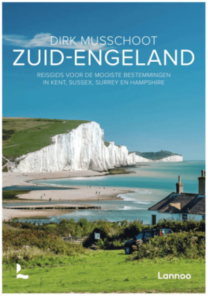
Reisgids Zuid-Engeland - Uitgeverij Lannoo • 9789059960978
Reisgids Zuid-Engeland - Lannoo Productomschrijving: Engelandkenner Dirk Musschoot laat je op een onovertroffen wijze kennismaken met de regio's Kent, East en West Sussex, Surrey, Hampshire en het eiland Wight, en de bestemmingen die je daar absoluut niet mag missen. Enkele voorbeelden: de optrekjes van Charles Darwin, Winston Churchill en Rudyard Kipling, de imposante kliffen van Beac…
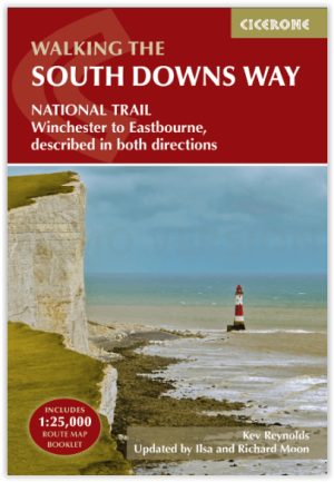
Wandelgids The South Downs Way - Cicerone • 9781786311610
The South Downs Way - Cicerone Productomschrijving: Wandelgids over de South Downs Way National Trail, een route van 100 mijl (160 km) tussen Winchester en Eastbourne door het South Downs National Park, beschreven in beide richtingen over 12 etappes. Gemakkelijke wandelingen over oude en historische paden, langs beboste gebieden, prachtige rivierdalen en mooie dorpjes. Met 1:25K OS kaarten…
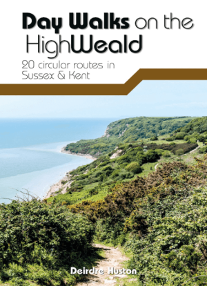
Wandelgids Day Walks on the High Weald AONB - Vertebrate Publ. • 9781911342854
Day Walks on the High Weald AONB - Vertebrate Productomschrijving: 20 circular routes in Sussex & Kent Day Walks on the High Weald features 20 circular routes between 6.5 and 13.9 miles (10.5km and 22.4km) in length, spread across this AONB- Area of Outstanding Natural Beauty in the south-east of England. Local author Deirdre Huston has compiled her favourite walks in the region, whic…
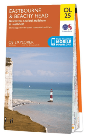
Wandelkaart OL25 Eastbourne & Beachy Head - OS • 9780319242643
Wandelkaart Eastbourne & Beachy Head - OS Productomschrijving: Eastbourne & Beachy Head Omvat: Newhaven, Seaford, Hailsham & Heathfield, Uckfield, the High Weald AONB, South Downs National Park, South Downs Way, Cuckmere Haven, River Cucksmereand the 1066 Country Walk. Ontdek de OL-serie van Ordnance Survey: De OL-serie (Outdoor Leisure) van Ordnance Survey is dé referentie voor …