

Reisgids Dorset, Hampshire & Isle of Wight - Rough Guides
Ports of Portsmouth and Southhampton

Korte omschrijving
Reisgidsen South East England en Sussex, England van Rough Guides. Ideaal voor tochten in England.
Reisgids Dorset, Hampshire & Isle of Wight Productomschrijving: From sweeping beaches to medieval forests, country pubs to seaside hotels, The Rough Guide to Dorset, Hampshire & the Isle of ...

Specificaties
- Uitgever: Rough Guides
- ISBN-13: 9781835290170
- HOOFDCATEGORIEËN: Reisgids
- Activiteiten: Toerisme
- Regio: South East England, Sussex, England
- Land: England
- Nationale parken: South Downs NP, Sussex Egland
- Editie: 5
- Taal: Engels
- Reeks/Serie: Rough Guides Main, Rough Guides Mini
- Grote Eilanden: Isle of White, Ierse zee
- De Engelse Graafschappen: Dorset, Hampshire
Volledige omschrijving
Reisgids Dorset, Hampshire & Isle of Wight
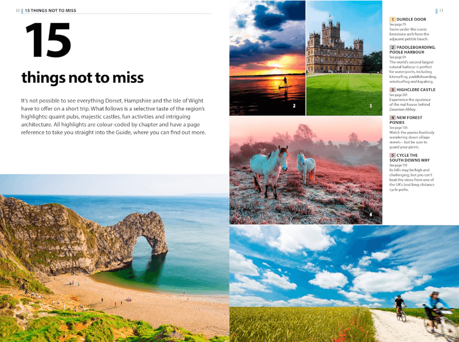
Productomschrijving: From sweeping beaches to medieval forests, country pubs to seaside hotels, The Rough Guide to Dorset, Hampshire & the Isle of Wight is the ultimate guide to this stunning part of England. Our expert authors show you all the region’s highlights and let you in on the secret spots locals love, with the fully updated listings shown on clear, full-colour maps. Alongside this you’ll find gorgeous photography, fascinating historical background and vital practical information – everything from how to get around on public transport to when the best festivals are held.
Discover the region’s Jurassic geology, prehistoric sites, chocolate-box villages and literary landmarks, all in Rough Guides’ trademark tell-it-like-it-is style.
Whether you’re interested in historic manors or wildlife walks, coastal cycle rides or farm-fresh food, The Rough Guide to Dorset, Hampshire & the Isle of Wight will help you make the most of your time in this beautiful region.

Artikelen uit dezelfde regio

Mountainbikegids South Downs - 26 off road routes - Cicerone • 9781852846459
Mountainbikegids South Downs - 26 off road routes - Cicerone Productomschrijving: Een gids voor berg (MTB) fietsroutes op de South Downs van Hampshire en Sussex, tussen Winchester, Brighton en Eastbourne. De 26 routes beschreven in dit boek nemen deel aan achtbanen, toegewijde bos singletrack en grote afdalingen. Ritten worden gequoteerd voor alle vaardigheden met informatie over plaatseli…
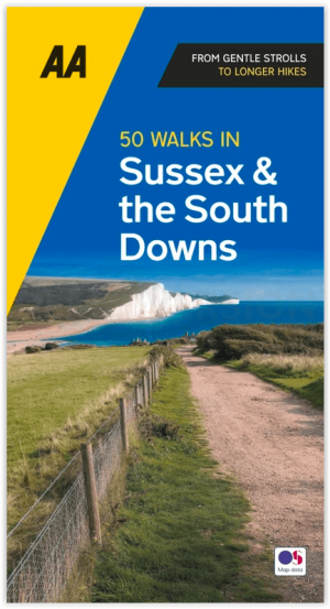
Wandelgids Sussex & the South Downs AONB - 50 walks - AA Publ. • 9780749583293
Wandelgids Sussex & the South Downs AONB - AA Publishing Productomschrijving: Wandelen is een van de favoriete vrijetijdsbestedingen in Groot-Brittannië en AA 50 Walks in Sussex bevat een verscheidenheid aan uitgestippelde wandelingen van twee tot tien mijl, geschikt voor alle niveaus. Het boek bevat alle praktische details die u nodig hebt, vergezeld van boeiende achtergrondinformatie ove…

Wandelkaart OL11 Brighton- Hove & South Downs NP - OS • 9780319263891
Wandelkaart Brighton- Hove & South Downs NP - OS Productomschrijving: Parts of The South Downs National Park - Lewes - Burgess Hill. Omvat: Brighton, Hove, Portslade, Shoreham by Sea, Peacehaven and Newhaven on the way, the rolling Sussex Downs & parts of the South Downs Way. Ontdek de OL-serie van Ordnance Survey: De OL-serie (Outdoor Leisure) van Ordnance Survey is dé referenti…
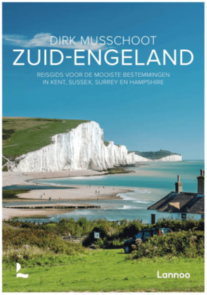
Reisgids Zuid-Engeland - Uitgeverij Lannoo • 9789059960978
Reisgids Zuid-Engeland - Lannoo Productomschrijving: Engelandkenner Dirk Musschoot laat je op een onovertroffen wijze kennismaken met de regio's Kent, East en West Sussex, Surrey, Hampshire en het eiland Wight, en de bestemmingen die je daar absoluut niet mag missen. Enkele voorbeelden: de optrekjes van Charles Darwin, Winston Churchill en Rudyard Kipling, de imposante kliffen van Beac…

Wandelgids 094 Pathfinder guides The Isle of Wight - OS • 9780319092989
Wandelgids The Isle of Wight - OS Productomschrijving: The ISle of White is an island of the Coast of England, Het eiland wordt van Engeland gescheiden door de zeestraat de Solent. Aan de overkant ligt Southampton.