

Wandelgids Sussex & the South Downs AONB - 50 walks - AA Publ.
South Downs AONB - Area of Outstanding Natural Beauty

Korte omschrijving
Wandelgidsen Sussex, England van AA Publishing. Ideaal voor tochten in England.
Wandelgids Sussex & the South Downs AONB - AA Publishing Productomschrijving: Wandelen is een van de favoriete vrijetijdsbestedingen in Groot-Brittannië en AA 50 Walks in Sussex bevat een ve...

Specificaties
- Uitgever: AA Publishing
- ISBN-13: 9780749583293
- HOOFDCATEGORIEËN: Wandelgids
- Activiteiten: Wandelen, Hiking & Trekking
- Regio: Sussex, England
- Land: England
- AONB - Area of Outstanding Beauty/National Landscape: The South Downs, Sussex AONB
- Taal: Engels
- De Nationale Parken: South Downs National Park, England
- De Engelse Graafschappen: East Sussex, West Sussex
Volledige omschrijving
Wandelgids Sussex & the South Downs AONB - AA Publishing
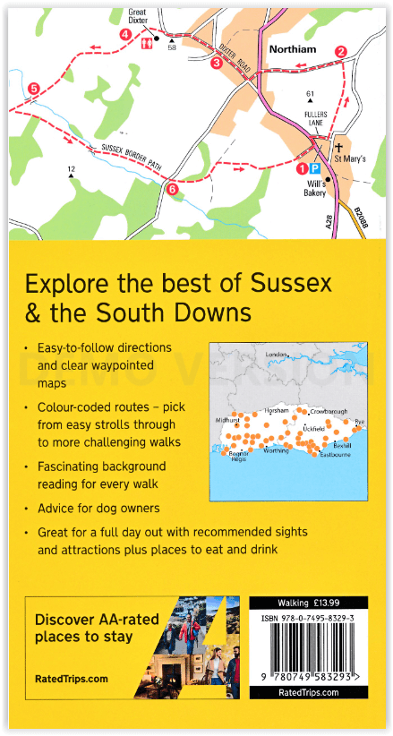
Productomschrijving: Wandelen is een van de favoriete vrijetijdsbestedingen in Groot-Brittannië en AA 50 Walks in Sussex bevat een verscheidenheid aan uitgestippelde wandelingen van twee tot tien mijl, geschikt voor alle niveaus. Het boek bevat alle praktische details die u nodig hebt, vergezeld van boeiende achtergrondinformatie over de geschiedenis en de natuur van Sussex en duidelijke kaarten in full colour voor gebruiksgemak. Elke route is met kleur gecodeerd naar moeilijkheidsgraad.
Alle wandelingen zijn geannoteerd met lokale bezienswaardigheden en plaatsen om te stoppen voor een verfrissing. Elke wandeling is voorzien van een samenvatting van afstand, tijd, helling, moeilijkheidsgraad, type ondergrond en toegang, landschap, hondvriendelijkheid, parkeergelegenheid en openbare toiletten.
Engelse omschrijving: Walking is one of Britain's favourite leisure activities, and AA 50 Walks in Sussex features a variety of mapped walks of two to ten miles, to suit all abilities. The book features all the practical detail you need, accompanied by fascinating background reading on the history and wildlife of Sussex, and clear full colour mapping for ease of use. Every route has been colour coded according to difficulty.
All walks are annotated with local points of interest and places to stop for refreshments. Every walk is given a summary of distance, time, gradient, level of difficulty, type of surface and access, landscape, dog friendliness, parking and public toilets.

Artikelen uit dezelfde regio
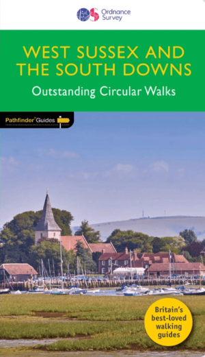
Wandelgids 066 Pathfinder guides West Sussex & South Downs - OS • 9780319091746
Wandelgids West Sussex & South Downs AONB - OS Productomschrijving: Containing 28 circular, graded walks that have all been created and tested by experienced walkers, this walking guidebook is ideal for both visitors and locals. The routes range from extended strolls to exhilarating hikes, so there is something for everyone. Each route includes a detailed description, the Ordnance Survey …
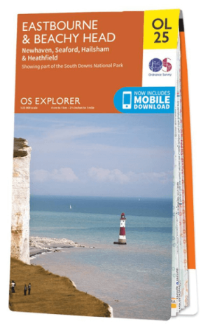
Wandelkaart OL25 Eastbourne & Beachy Head - OS • 9780319242643
Wandelkaart Eastbourne & Beachy Head - OS Productomschrijving: Eastbourne & Beachy Head Omvat: Newhaven, Seaford, Hailsham & Heathfield, Uckfield, the High Weald AONB, South Downs National Park, South Downs Way, Cuckmere Haven, River Cucksmereand the 1066 Country Walk. Ontdek de OL-serie van Ordnance Survey: De OL-serie (Outdoor Leisure) van Ordnance Survey is dé referentie voor …

Reisgids Dorset, Hampshire & Isle of Wight - Rough Guides • 9781835290170
Reisgids Dorset, Hampshire & Isle of Wight Productomschrijving: From sweeping beaches to medieval forests, country pubs to seaside hotels, The Rough Guide to Dorset, Hampshire & the Isle of Wight is the ultimate guide to this stunning part of England. Our expert authors show you all the region’s highlights and let you in on the secret spots locals love, with the fully updated listings show…

Wandelgids Sussex Walks - Vertebrate Publ. • 9781906148683
Wandelgids Sussex Walks - Vertebrate Productomschrijving: 20 walks exploring the Weald and the South Downs Natioal Park. Sussex Walks is a collection of 20 circular walks, between 3.5 and 12 miles (5km and 19km) in length that explore the length and breadth of the county of Sussex. Written by local author Deirdre Huston, the walks feature Ordnance Survey 1:25,000 maps, easy-to-follow …

Wandelgids South Downs Way Map Booklet - Cicerone • 9781786311658
The South Downs Way, Map Booklet - Cicerone The guidebook INCLUDES a copy of this map booklet. Productomschrijving: Kaart van de 100 mijl (160 km) lange South Downs Way National Trail, tussen Eastbourne en Winchester. Dit boekje is bijgesloten bij de Cicerone gids voor het pad en toont de volledige route op OS 1:25.000 kaarten. De wandeling duurt meestal een week en is geschikt voor de…